Farndale
Historical and geographical information
|
Return to the Home Page of the Farndale Family
Website |
The story of one family’s journey through two
thousand years of British History |
The 83 family lines into which the family is divided.
Meet the whole family and how the wider family is related |
Members of the historical family ordered by date of
birth |
Links to other pages with historical research and
related material |
The story of the Bakers of Highfields, the Chapmans,
and other related families |
Introduction
Dates are in red.
Hyperlinks to other
pages are in dark blue.
Headlines of the
history of the Farndale are in brown.
References and
citations are in turquoise.
Contextual
history is in purple.
This webpage about
the valley of Farndale has the following section headings:
· The Farndales who
lived in Farndale
· The Geography of
Farndale
· Farndale, an
Overview
· Kirkbymoorside
· Farndale before the
Norman Conquest
· The Feudal Era and
Farndale
· Farndale since 1500
· Farndale Timeline
· The Farndale Hunt
· Wordsworth’s
Farndale
· A photographic journey
of Farndale
The Farndales who lived in
Farndale
Our early
ancestors were the inhabitants of Farndale
by about 1230. We know of some of those who lived in Farndale in medieval times
(see FAR00001
and FAR00002).
We know a little of the forest of Farndale (FAR00003
and FAR00004). Edmund
the hermit was of course not our ancestors and indeed until the mid thirteenth century, the area was forested hunting grounds,
with grants given to monks as a source of timber, and with little evidence of
habitation. But there is evidence in the mid thirteenth century of a campaign
of cutting back the land for cultivation and renting it to villeins. It is the
poor peasant folk of Farndale who are probably our earliest ancestors - perhaps
William the Smith of Farndale, 1240 (FAR00009),
John the Shepherd of Farndale, 1250 (FAR00010),
Roger milne (miller) of Farndale, 1265 (FAR00013A)
and Simon the miller of Farndale, 1282 (FAR00021)
were our early ancestors living in Farndale.
Over time, folk started
to adopt names which described them by place or occupation. Examples are
Nicholas de Farndale, the first personal name linked to Farndale (see FAR000006
and Farndale 1), Peter de
Farndale (see FAR000008
and Farndale 2), Gilbert de
Farndale (FAR00018
and Farndale 3), and Simon de
Farndale (FAR00021
and Farndale 4). So our ancestors started to called
themselves de Farndale, and in time just used the Farndale name. That process signalled
the start of a spread of our ancestors out of Farndale to the surrounding
lands. At that time, such movements were no doubt as bold and significant as
later emigrations to Australia, Canada and New Zealand. We
know for instance that De Johanne de Farndale, 1275 (FAR00014) moved
further afield to Egton.
In this
genealogical exploration of the Farndale family, we are therefore most interested
in Farndale the place before about 1400. After that, those who chose to define
themselves as ‘of Farndale’ were those who had moved on to live in other
places. By the fifteenth century there were no members of the family still
living in Farndale, and none have returned.
Nevertheless an exploration
of the earliest history of Farndale the place is integral to the family story.
It is our beginnings. It is the cradle of the Farndale family. It is where it
all started.
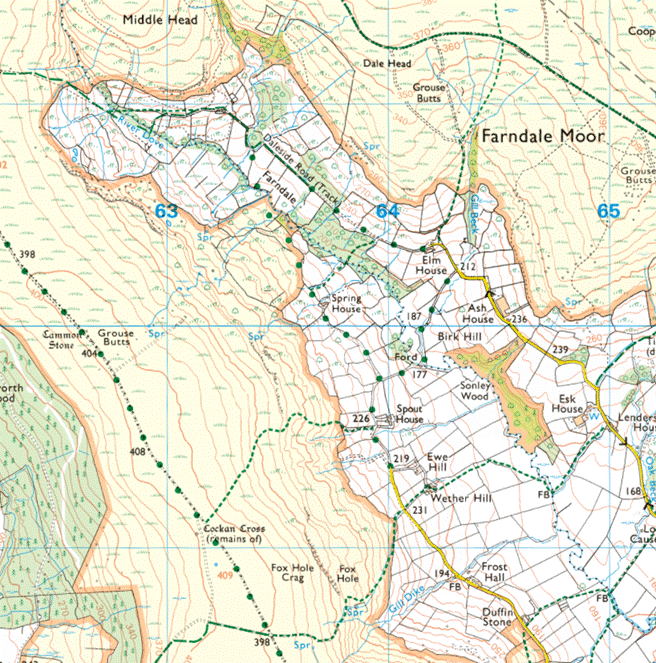
The Geography of Farndale

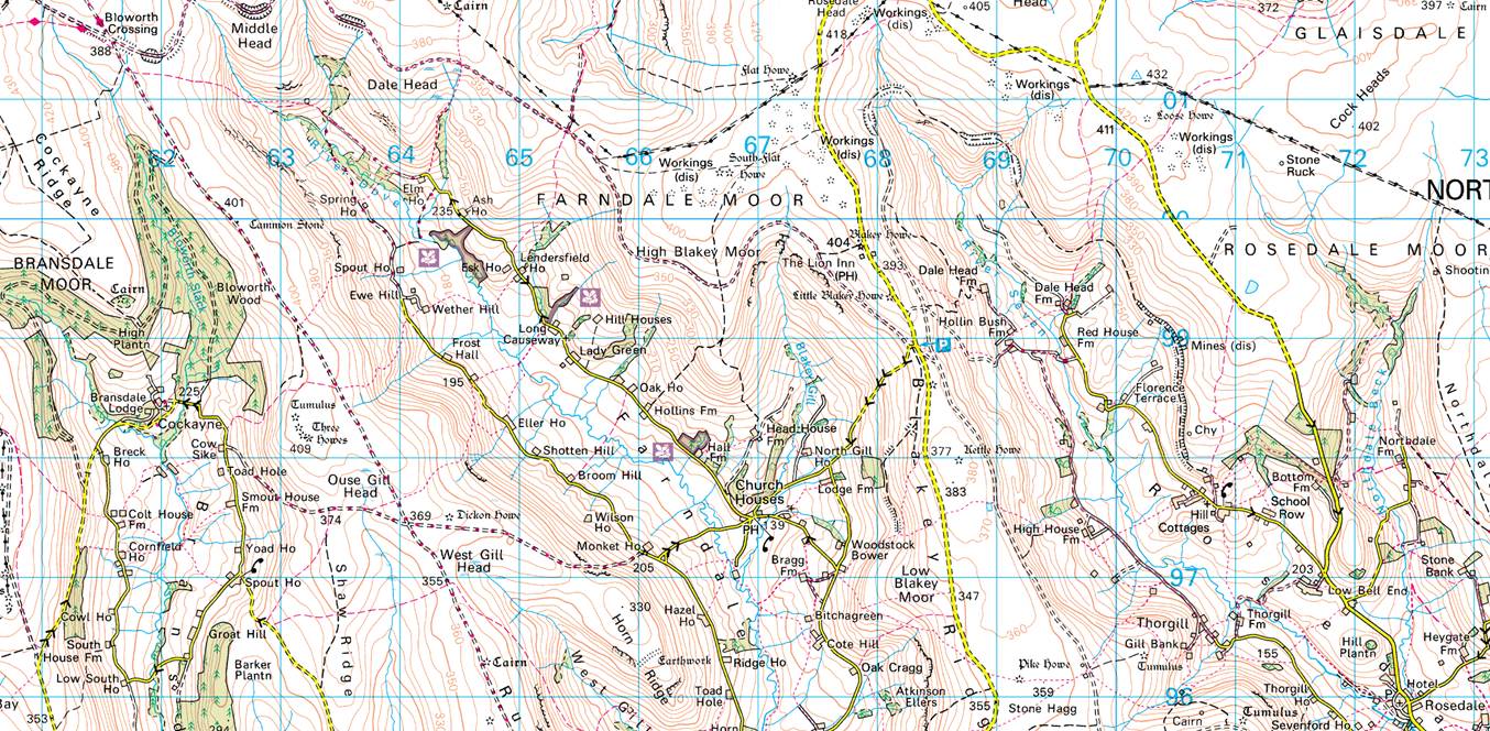
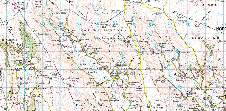
Farndale location
Farndale 2023

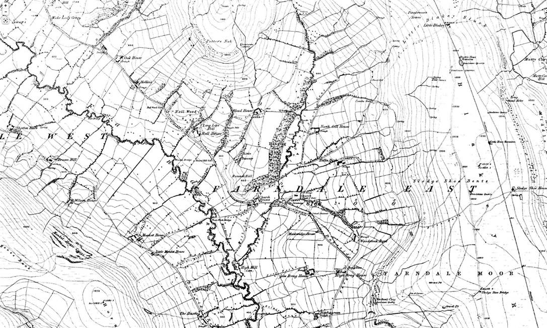

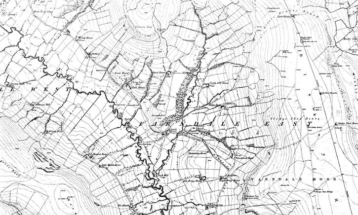
Farndale 1857
Farndale,
an Overview
Farndale
is a valley located in the North York Moors National Park in North Yorkshire.
The nearest town is Kirkbymoorside located five miles to the south. Pickering
is thirteen miles to the south-east and Helmsley twelve miles to the south-west.
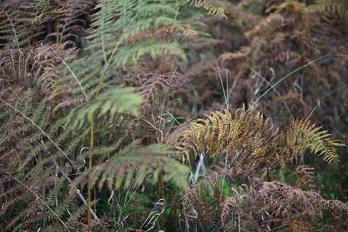
Farndale was first recorded as Farnedale, and means
Fern Valley. It has sometimes been interpreted as a derivation of the Gaelic
word fearna meaning alder, since the alder
tree is still common in the dale. Farndale’s river, the Dove, probably
originates in the Celtic word dubo, the black
or shady stream. High up on the west side of the valley is a large boulder,
known as the Duffin Stone. This stone might identify one of the two original
forest clearings, named Duvaneesthaut in the Rievaulx
Abbey charter of 1154.
Farndale
is surrounded by some of the wildest moorland in England, and
is sandwiched between Bransdale and Rosedale. To the north-east sits Blakey
Ridge at over 400 m above sea level, and to the north-west, Cockayne Ridge
reaching up to 454 m above sea level is one of the highest points of the North
York Moors. Around the north of Farndale, between Bloworth
Crossing and Blakey is the track bed of the old Rosedale Ironstone Railway (Rosedale
Branch) which forms part of two Long Distance Footpaths these being
Wainwright's Coast to Coast Walk and The Lyke Wake Walk.
Farndale is a scattered agricultural community
with traditional Yorkshire dry stone walls. The valley is popular with walkers
due to its famous wild daffodils, which can be seen around Easter time all
along the banks of the River Dove. To protect the daffodils the majority of
Farndale north of Lowna was created a Local Nature
Reserve in 1955.
Farndale is home to two hamlets. Church Houses is
at the top of the valley and Low Mill further down. Low Mill is at the heart of
the daffodil walking routes.
Pre History
Neolithic
microlith sites have been found on the moors at Bransdale and Farndale
including flint and stone chippings and basic tools. The area between the heads
of Farndale and Westerdale is one of the richest series of flint sites in Britain.
Large collections have been made at Cammon Stone, near Ash House, and at Blakey
Howe. Petit
tranchet microliths or arrowheads, have been found at the Farndale
sites.
Sander van
der Leeuw has identified the real significance of the evolution of
neolithic tool making in expressing the new cognitive ability of the human brain.
The simplest early tools had natural points and edges. Our Palaeolithic
ancestors then learned to create a sharp edge, by flaking off part of the stone
by hitting it against another surface. They then started to create tools with
multiple flaked edges. By 20,000 YPB on a global scale, with
the new technology spreading more recently in places like the moors, they
mastered tool making in three dimensions, by removing flakes at specific angles
to create sharpened points, involving the intersection of three planes. Early
stone tool making found its ultimate expression in the Levallois Technique,
which involved a mental reasoning and understanding of multiple stages in
making a tool. This ability emerged from the increased cranial capacity of the
human brain from about two million years ago, which in turn expressed a new
uniquely human ability for planning and long term thinking.
Van der Leeuw found advances in stone knapping
techniques reflected a step change in the human mind.
In other words these very
earliest expressions of human activity on the edge of Farndale, are
representative of a global evolution of humans into thinking, reasoning and forward thinking people.
There are also barrows
on the high ground around Farndale. Blakey Howe is a round barrow which
includes buried and earthwork remains of a prehistoric burial mound, also known
as Cockpit Hill, topped by an eighteenth century boundary stone. It is located
eighty metres from the Lion Inn. It survives in an area which was later
extensively worked for coal, an activity which has left behind several spoil
heaps along the ridge. Referred to as Blakenhow
in a Charter of Gisborough Priory in 1200, the round barrow sits on a natural rise
on the spine of Blakey Ridge and has line of sight to other prominently located
barrows in the area. Constructed of earth with some stone, it is just over
twenty metres in diameter and stands two metres high with an ancient excavation
hollow six metres in diameter and up to one and a half metres deep. This hollow
is thought to have been later used for staging cockfights, explaining the
barrow's alternative name.
On the rim of this hollow, on the southern side, there
is a one and a half metre high boundary stone which tapers towards its top. On
its west face it is inscribed with the initials TD above four more
weathered characters. This is a reference to Thomas Duncombe who owned the
Duncombe Estate west of Helmsley in the early eighteenth century. It is
possible that this stone is a redressed and reset prehistoric standing stone.
Near
Ouse Gill Head on Rudland Ridge at the Three Howes (SE 63209 98210), flint
tools had been found by the gamekeepers over a number of
years. In September 1973 Raymond Hayes and others excavated the area. His small
excavation yielded over 800 flints from an area of 3.50 x 3.0m. The site was
interpreted as a temporary camping site in a forest clearing, probably being
occupied by hunters following red deer or other game.
About
a kilometre to the north is the Cammon Stone (SE 62611 99966)(from
cam maen or bank stone), a prehistoric
standing stone that sits just beside the main track. The stone is about a metre
and a half tall and leans towards the west. The southern views from the stone
look down along Bransdale, the axis of the stone is also aligned in this
direction, which is probably no coincidence. There are a
number of faded letters carved onto the western face of the stone.
Antiquarians had speculated as to whether these letters were Phoenician in
origin, but they are actually Hebrew and spell out the
word halleluiah. They are thought to be the work of the Reverend W Strickland, Vicar
of Ingleby. Strickland is thought to be responsible for carving a number of inscriptions in this area. There is a second
stone, a large flat slab. No one knows whether this slab ever stood upright.
The
Duffin Stone is a massive boulder that has tumbled down from the escarpment
side and is embedded into the verge of the narrow lane. The stone bears the
scars of contact with many vehicles.
Raymond
Hayes reported on flint arrowheads and an urn at Stony Rigg (NZ 62999 02823) on
Farndale slope (Yorkshire Archaeological Journal Vol. 41, page 574
and page 581).
He noted that Professor G. W. Dimbleby took samples of peat at White Gill,
half a mile north-east of this site and proved beyond doubt that forest
conditions prevailed when the microliths were made and that, at Burton Howes, 2
miles west, the forest was still thick in the Bronze Age (G W
Dimbleby, The Ancient Forest of Blackamoor, Antiquity, Volume
35/138,
June 1961, pages
123 to 129). Another proof of forest conditions on this ridge is the discovery
by Messrs. Rowland Close, W. Thornley and the writer, of horn cases of bos longifrons - the Celtic
shorthorn. These were found in the peat of Stony Rigg. Four were found in the
area. Mr. Don. Bramwell of Bakewell, Derbyshire, who identified three of the
horns, said that they belonged to creatures of the forest clearings, eating
leaves as well as grass. Horn-cores of the same size have been found in the
Ryedale Windypits and they belong
to the Beaker period c. 1750 B.C. It seems possible therefore that the arrow
heads were originally lost in forest undergrowth.
These sites are all on the high moorland ground which
surrounds Farndale. So it seems likely that early
habitation from Neolithic through the Bronze and Iron ages was on the high
ground overlooking an impenetrable wooded valley. There is no reason to suppose
that the valley itself was a place of settlement, even on a small scale.
Roman
One day in the second or third century CE, a Roman soldier dropped his arm purse,
close to a prehistoric cairn, above and overlooking Farndale. It was later
found in 1849 and is currently to be seen displayed in the British Museum. When
the Roman legionary looked over Farndale it remained a wild forested place.
As it was found above Farndale, it doesn’t
evidence Roman activity within the dale, but it does suggest patrolling across high
moorland tracks, overlooking the dale.
Close to the entrance to Farndale, but to its
south, between Hutton-le-Hole and Spaunton and
Lastingham, Roman
remains suggest that Romano British people were living in a clearing
between tracts of forest and moorland, on a site which may have been occupied
in Neolithic through to Iron Age periods. The site was discovered in 1962 when pot
sherds were found. There was evidence of a domestic hearth or oven and animals bones of ox, pig, horse, goat and red deer.
There were some similarities to finds at a villa at Langton. These
were likely to have been smallholder farmers producing for themselves, but
subject to Roman tax levies in corn or hides. A larger farmstead was
found nearby, which included primitive hypocausts. In all there were four
isolated farms. These were probably small families of native Britons in touch
with Roman culture, but whose daily life probably varied little, if at
all, from that of their early Celtic ancestors.
The nearby Roman military fortification
at Cawthorn was
built for practice rather than for operational military use and there were
certainly military routes which passed over the moors.
Raymond Hayes reported on the find of a
Romano-British glass bangle at Stony Rigg (NZ636032) in 1967 (Yorkshire Archaeological Journal, Volume 42, page 125).
He wrote that this find and the occurrence of beehive querns in Westerdale and
Danby (see also Raymond Hayes on querns in Ryedale Historian, 1974, Volume 7, page 22) point
to occupation, trading, and travellers in the dales and on the high moors. We
are already coming to accept intensive Romano-British occupation on the
limestone hills, therefore it is unlikely the dales remained uninhabited, for
recent work in Kildale and Eskdale shows otherwise.
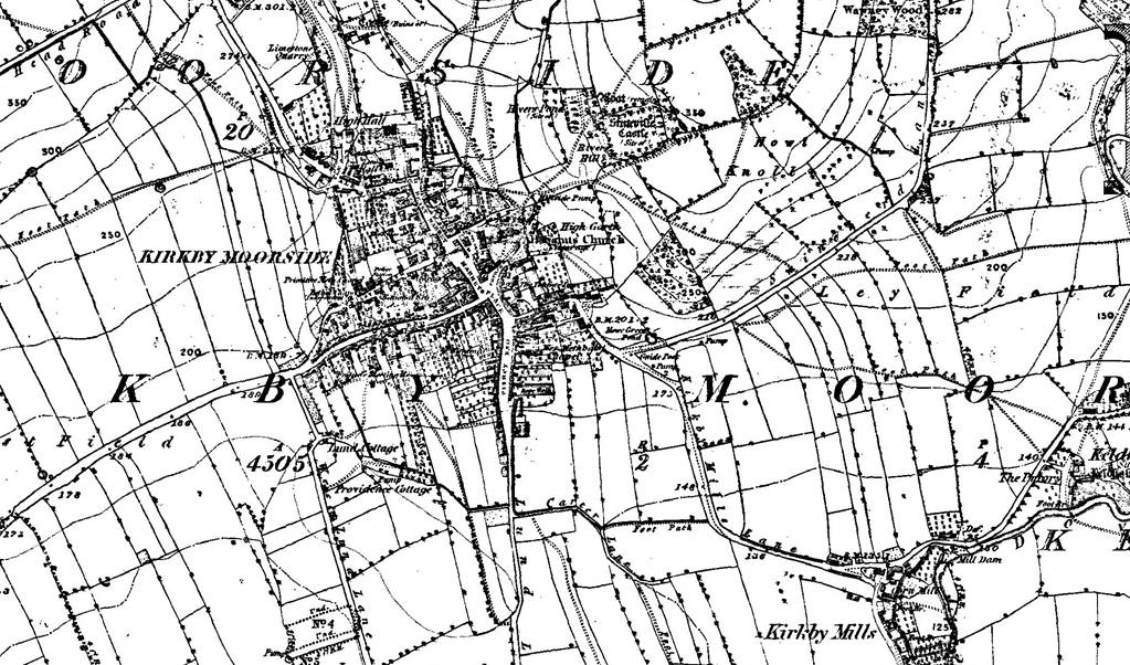
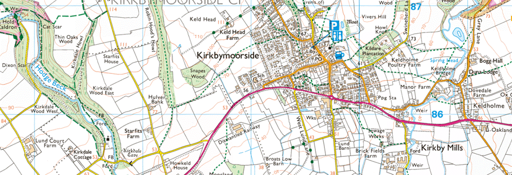
Kirkbymoorside
Kirkbymoorside lies only 25 miles north of York.
The name Kirkbymoorside suggests one of the key
reasons for the settlement’s establishment, that being the shelter offered by the
southern slopes of the moors into which the town nestles. Our prehistoric
ancestors left behind flint and stone axes, and traces of their Celtic language
in the street names of Tinley Garth (garden) and Howe End (a ’howe’ being a
burial mound). Anglo-Saxon and Viking artefacts include a silver coin dating
from around 790, found within the grounds of the parish church of All Saints.
There is some disagreement over the spelling of the
village: the alternative is Kirbymoorside, which is how
the railway companies spelt the name on the station, as how it is traditionally
pronounced). Signposts read "Kirkbymoorside". "Kirk" means
church and "-by" is the Viking word for settlement, so that the name
translates as "settlement with a church by the moorside",
or as Ekwall argues, Moorside is "Moresheved"
which means "top of the moor".[5] A valley near the town is known as
Kirkdale.
Kirkbymoorside is noted as Chirchebi in the Domesday
Book of 1086. With William the Conqueror came the ’Harrying of the North’;
Saxon landowners gave way to his supporters and in Kirkbymoorside Torbrant was replaced by Hugh Fitzbaldric and then Robert
de Stuteville. The Stuteville family built a moated wooden castle on Vivers Hill behind the church with commanding views of the
town and beyond. The town grew in importance and prospered under the Wake
family to whom it passed in the 13th Century and in 1254 the Wednesday Market, which
still thrives today, was established along with an annual fair.
Torbrand, the Anglo-Saxon owner, was "evicted" by
the Conqueror, and his home and lands given to Robert D'Estoteville or
Stuteville, a Norman who had accompanied the Conqueror to England. The family
rose high in the royal favour, and figured largely in
the annals of Norman England. The De Mowbrays appear to have become possessed,
in some way or other, of a portion of the lordship, and Henry I. deprived both Roger
de Mowbray and Roger de Stuteville of their lands here for rebellion, and
bestowed them on Nigel de Albini, who married the heiress of the Mowbrays, and
assumed that name. Shortly afterwards a dispute arose between the families as
to the right of possession, and the king (Henry II.) restored the barony of Kirbymoorside to the Stutevilles. It remained with this
family till Joan, the daughter and heiress of Nicholas Estoteville, conveyed it
in marriage to Hugh de Wake.
The Norman baron Robert de Stuteville built a wooden
moated castle on Vivers Hill.
It has served as a trading hub at least since 1254,
when it became a market town.
The estate passed to the Wake family in the 13th
century, who brought prosperity to the town. However, it was badly hit by the
Black Death of the mid-14th century, after which the wooden castle lay in
ruins. In the 14th century the Black Death hit Kirkbymoorside and soon the wooden
castle was in decay and a loss of order within the town followed.
Prosperity returned after 1408, when the Neville
family took over, although little remains of the fortified manor they built to
the north of the town. The Nevilles remained Catholic and took part in the
Rising of the North of 1569.
Farndale Before the Norman Conquest
According to Bede, the Angles came from Ageln in the Jutland peninsula of Denmark.
Archaeological evidence is sparse for the earliest phase of their settlement in
this area.
After the Angles were converted to
Christianity, they left more substantial evidence. Christianity came to
Yorkshire not through the establishment route from Rome via Canterbury, but
from the north and ultimately from the west. Monasteries were established on
sites resembling Lindisfarne, which offered qualities of remoteness but also
access to settlements. Lindisfarne as well as sites such as Iona in Scotland,
were near to navigational routes which were then primarily by sea.
Whitby was founded by Aidan himself and Hilda was its most famous abbess. Another cell
was later established in Forge Valley near Scarborough. The founding of an
early monastery at Lastingham is vividly described by Bede. Closer to Farndale,
the little church of St Gregory at Kirkdale near Kirbymoorside
is secluded, lying across the narrow valley.
This part of Yorkshire saw two Viking
settlements, both fairly peaceful, with no evidence of
armed conquest except for the taking of York, the political centre and market
of the area. York fell to the Danes in 867. The extent and range of settlement
isn’t clear. In the early tenth century came a second wave of Scandinavian
speakers, with Norwegian tongues into northern Yorkshire from Cumberland.
The place names of the pre Norman countryside provide glimpses of pastures,
valleys, marshes, farms. The sculpture and churches in the tenth and eleventh centuries
hint at a growth of population around the edges of the moorland and on the
lowlands and the coast. Monuments suggest a framework of parishes along the
tabular hills stretching into the low ground.
Northwards from
the Wolds, the windswept moors of Hambleton and Cleveland remain as they have
been throughout pre-historic times, a refuge of broken peoples, a home of lost
cultural causes. Bede described the area as ‘vel
bestiae commorari vel hommines bestialiter
vivere conserverant.’ (‘a land fit only for
wild beasts, and men who live like wild beasts.’). Although there are many
pre-historic remains on the North Yorkshire moors, the wooded valleys were very
remote and isolated. The Romans built roads around it and the Vikings skirted
it also. When the Romans left and the Saxons and Vikings arrived, some people
did move into the dales and left their burial mounds and crosses across the
moors. Thus the people who today come from the ‘dales
on the moors’ of North Yorkshire have remained a particular folk for several
hundred years and developed very special characteristics. In many respects they
remain to this day a unique Yorkshire Tribe. (Early
man in North East Yorkshire, 1930 p 219-20 by F Elgee)
When
Cedd established the early Celtic monastery at Lastingham in 653 CE, only a few
miles south from the entrance to Farndale, he deliberately chose a place at the
edge of civilisation. The Venerable Bede when he recorded the event a century later
described the area where Farndale lay, vel bestiae commorari vel hommines bestialiter
vivere conserverant, ‘a land fit only for wild
beasts, and men who live like wild beasts.’ These early monks must have gazed
across the wild Spaunton Moor in the direction of the
wooded valley that would become Farndale, and felt
they had reached a place at the end of the world.
Within
the porch of the Saxon Church of St Gregory at Kirkdale, about a mile west of Kirkbymoorside,
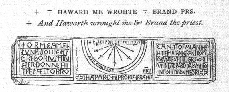
above the entrance door is housed a Saxon sundial. It bears the inscription “Orm
the son of Gamel acquired St Gregory’s Church when it was completely ruined and
collapsed, and he had it built anew from the ground to Christ and to St Gregory
in the days of King Edward and in the days of Earl Tostig”. The inscription
refers to Edward the Confessor and to Tostig, the son of Earl Godwin of Wessex
and brother of Harold II, the last Anglo Saxon King of England. Tostig was the
Earl of Northumbria between 1055 and 1065. It was therefore during that last
peaceful decade, immediately before the Norman conquest, that Orm, son of Gamel
rebuilt St Gregory’s Church.
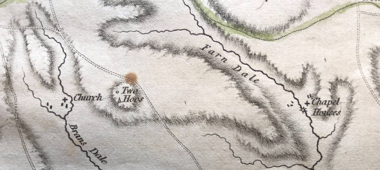
Orm was prominent in Northumbria in the middle years
of the eleventh century. He married into the leading aristocratic clan of the
region. His wife Aethelthryth was the daughter of Ealdred, Earl of Northumbria
in the mid eleventh century. His brother in law was Siward,
Earl of Northumbria until 1055, famous for his exploits against Macbeth, the
King of Scots. Orm’s name suggests that he was of Scandinavian descent, but by
his lifetime, he was very much a Christian, and a part of the Saxon world.
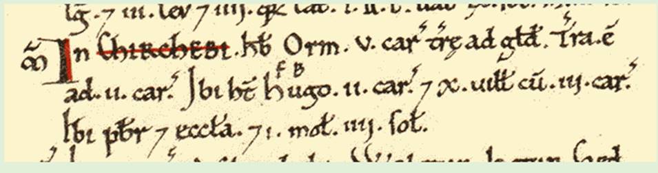
Chirchebi is known to us today as Kirkbymoorside. The Domesday Book
recorded that Chirchebi comprised five carucates of land. A carucate was
a medieval land unit based on the land which eight oxen could till in a year. So
presumably this area of land described the five carucates of cultivated land
around Kirkdale. Before the Conquest, civilised Chirchebi was in the
possession of Orm and it comprised ten villagers, one priest, two ploughlands,
two lord’s plough teams, three men’s plough teams, a mill and a church.
However this area of civilisation was part of a much wider
wild estate which Chirchebi formed, which was said to be twelve leagues
(about 42 miles) long by the time of the Normans.
Earl Waltef who had a manor and 5 carucates at Fadmoor which comprised three ploughlands.
So whilst there was a small community of folk living at
Kirkdale, within this wider estate, the bulk of the estate was deep forest,
stretching up through the dales towards the highlands of the North York Moors.
This forest was probably largely impenetrable, and certainly not settled. It
may have been used for hunting. Centuries before, the Venerable Bede had described
this region as ‘a land fit only for wild beasts, and men who live like wild beasts’.
Within
this uninhabited woodland, there lay a forested valley, which was then unknown,
but which was nestling quietly in those woods, the place which in time would
become the cradle of the modern Farndale family. The land which was to become
Farndale was little more than a possession, and a place which the owner himself
did not likely know, and which after the Conquest, would continue to be
possessed, transferred, perhaps sometimes hunted within, for another two
centuries.
The Feudal Era and Farndale
Medieval
Farndale and East Bransdale
By
1086 the ownership of Chirchebu had passed to
Hugh, son of Baldric. Count Robert of Mortain held Fadmoor and it was waste. Later it fell into the
hands of Hugh son of Baldric before passing first to
Roger de Mowbray and later to William and then Nicholas de Stuteville in 1200.
(Domesday
Book and Victoria County History of Yorkshire).
From the
Essay New Settlements in the North Yorkshire Moors, 1086 to 1340 by
Barry Harrison, in Medieval Rural Settlement in North East
England, Architectural and Archaeological Society of Durham and
Northumberland, Research Report No 2, Edited by BE Vyner, 1990:
The
North Yorks Moors was an appropriate area for the study of medieval
agriculture, since it appears to have been largely empty of settlements in
1086.The only developed manor in the moorlands proper was in the Esk Valley where a 12 carucate holding was located at
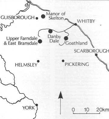
Danby,
The estate passed to the Stuteville family in 1086,
when Hugh died. The Stutevilles were deprived of it in 1106 when it was granted
to Nigel d’Aubigny, one of Henry I’s ‘new men’.
On his death in 1129 his widow Gundreda
administered the estate on behalf of her under age
son, Roger de Mowbray. It was she who granted the whole of Welburn and Skiplam
together with the western side of Bramsdale to Rievaulx Abbey who developed the
whole area as a series of granges and cotes, including Colt House and Stirk
House in Brandsale. It was only to be expected that
the monks would seek to extend their properties into the Mowbray territory further
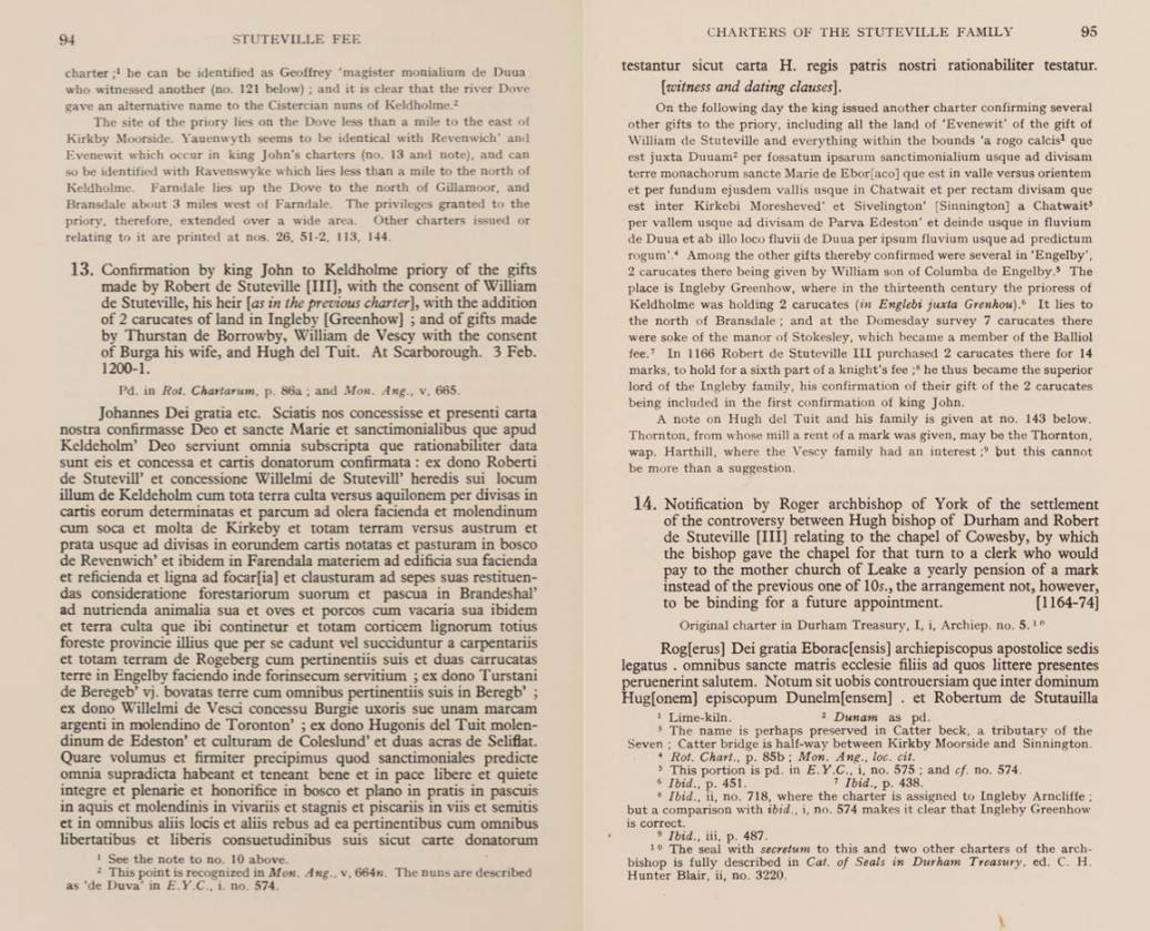
east. Therefore, at some time before 1155, Roger granted to the monks a wood in Farndale called Midelhoved (the “Middle Heads”)
(Ordnance Survey Grid NZ 628018) and another wood called Duvanesthuart,
probably in the area of Duffin Stone Farm (Ordnance Survey NZ 645988), at the north western end of the Dale, together with common pasture
rights and permission to take building timber and wood ‘for those who stay
there’. Duvanesthuart embodies an Irish-Norse personal
name, but there is nothing to suggest that it was a functioning settlement by
the mid twelfth century. The whole area was regarded as a private forest of the
Mowbrays – the grant was made ‘saving Roger’s wild beasts’ (ie
reserving Roger’s right to hunt), and it seems to have anticipated that the
monks would want to build a new dwelling there probably for use as a grange or
cote.
The House Mowbray
Sir Roger de Mowbray (1120 to 1188) was an Anglo-Norman
nobleman. He had substantial English landholdings. A supporter of King Stephen,
with whom he was captured at Lincoln in 1141, he rebelled against Henry II. He
made multiple religious foundations in Yorkshire. He took part in the Second
Crusade and later returned to the Holy Land, where he was captured and died in
1187. Roger was the son of Nigel d'Aubigny by his
second wife, Gundreda de Gournay. On his father's
death in 1129 he became a ward of the crown. Based at Thirsk with his mother,
on reaching his majority in 1138, he took title to the lands awarded to his
father by Henry I both in Normandy including Montbray,
from which he would adopt his surname, as well as the substantial holdings in
Yorkshire and around Melton. Roger supported the Revolt of 1173–74 against
Henry II and fought with his sons, Nigel and Robert, but they were defeated at Kinardferry, Kirkby Malzeard and
Thirsk. Roger left for the Holy Land again in 1186, but encountered further misfortune
being captured at the Battle of Hattin in 1187. His ransom was met by the
Templars, but he died soon after and, according to some accounts, was buried at
Tyre in Palestine. There is, however, some controversy surrounding his death
and burial and final resting-place.
And so, in 1154, we are introduced to Farndale the place for the
first time in the Chartulary of Rievaulx Abbey when
Gundreda, on behalf of her guardian, gave land to the
abbey.
“Gundreda, wife of Nigel de
Albaneius, greetings to all the sons of St. Ecclesiff.
Know that I have given and … confirmed, with the consent of my son, Eogeri de Moubrai, God and St.
Marise Eievallis and the brothers there. . . for the
soul of my husband Nigel de Albaneius, and for the safety of the soul of my
son, Roger de Molbrai, and of his wife, and of their children, and for the soul
of my father and mother, and of all my ancestors, whatever I had in my
possession of cultivated land in Skipenum, and, where
the cultivated land falls towards the north, whatever is in my fief and that of
my son, Roger de Moubrai, in the forest and the plain, and the pastures and the
wastins, according to the divisions between Wellebruna and Wimbeltun, and as
divided from Wellebruna they tend to Thurkilesti, and so towards Cliveland,
namely Locum and Locumeslehit, and Wibbehahge and Langeran, and Brannesdala, and Middelhoved,
as they are divided between Wellebruna and Faddemor, and so towards Cliveland.”
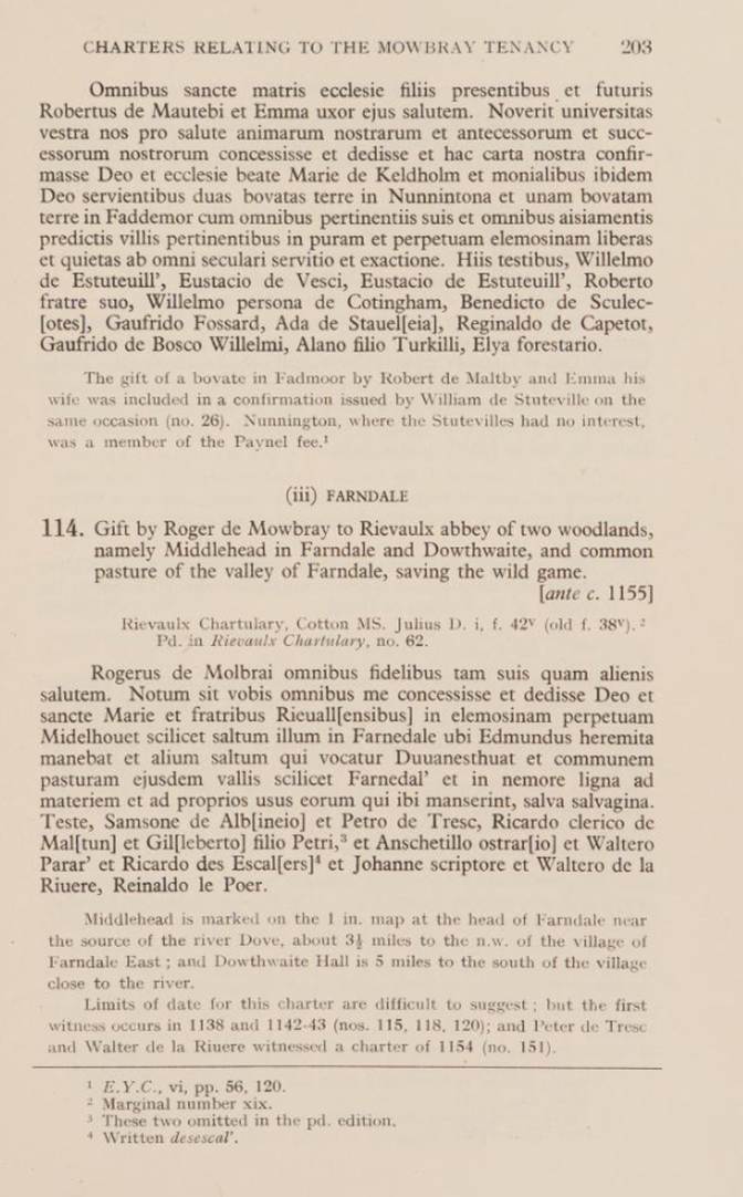
Roger of Molbrai, to all the
faithful, both his own and strangers. Let it be known that I have granted . . to the Rievallis
brothers, in perpetual alms, Midelhovet - scil. that
meadow in Farnedale where Edmund the Hermit dwelt,
and another meadow called Duvanesthuat, and the
common pasture of the same valley - scil., Farnedale: and in the forest wood for material, and for the
own uses of those who remained there, save the salvage. Witness Samson de Alb[aneia];
and Peter of Tresc; and Anschetillo
Ostrario; and Walter Parar; and Eicardo de Sescal [or ? Desescal.]; and John the Scribe; and Walter de la Eiviere; [and] Eiinaldo le Poer.
And so, as we first lay our historical goggles onto
Farndale the place in 1154, we appear to enter a Lord of the Rings
World, with a dash of Game of Thrones. The House Mowbray (a competitor to
the House Stuteville) has given to the monks, who live in their exquisite Elven
home at Rievaulx, a
place called Midelhovet, where Edmund the Hermit used to dwell, and another
called Duvanesthuat, together with the common pasture
within the valley of Farndale.
Rievaulx, in its Elven valley, taken by the website
author in 2016
Midelhovet is almost certainly the area in Farndale
known today as Middle Head and Duvanesthuat is
probably the place where the Duffin Stone lies today.
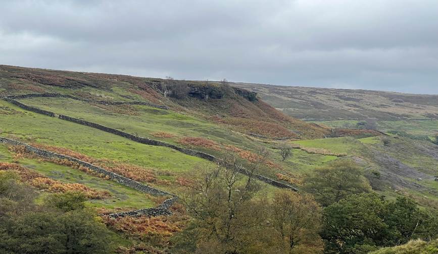
The northwestern end of Farndale showing Middle Head
and the Duffin Stone. The
area of Middle Head in 2021
We are also introduced to the first individual who
roamed the lands of Farndale, who used to live at Midelhovet some years prior
to 1154. Edmund the hermit of Farndale was a legendary figure who lived in a
cave in the North York Moors in the 12th century. He was said to be a holy man who
performed miracles and healed the sick. He was also reputed to have been a
descendant of King Alfred the Great and a cousin of King Stephen. I don’t
suppose he was our ancestor, since he was a hermit, but this is our first
introduction to a character roaming the place.
So by this time, the dale had become known as Farndale.
The name Farndale seems to
come from the Celtic ‘farn, or fearn’
meaning ‘fern’ and the Norwegian ‘dalr’,
meaning ‘dale;’ and so was the ‘dale where the ferns grew.’ There are historical
accounts which have suggested that the first people to settle in Farndale were
bands of mixed Celtic and Scandinavian stock and that it was they who began to
clear areas in which to build and grow crops. I still need to review the
historical evidence to see if there is evidence of such. We have no records of
them until the 13th Century. Until I see evidence otherwise, I think that
Farndale was likely uninhabited forest until the twelfth century, but this
needs more work to check the archaeological record of Farndale.
Of course whilst Farndale is today dominated by moorland bracken and ferns,
ferns are naturally a woodland plant, so it must have been the ferns of the
forested Farndale which gave rise to its name. Perhaps it was Edmund who must
have known the valley intricately, who first chose its name.

Unfortunately
for the monks of Rievaulx, the Stutevilles came back into favour with the accession
of Henry II and Roger de Mowbray was compelled to hand back Kirbymoorside,
along with many others fees. The Stutevilles favoured
the Benedictine monks of St Mary’s Abbey, York and their own small house of
nuns was founded at Keldholme near Kirbymoorside.
(Ordnance Survey NZ 710863).
The
House Stuteville
The
Stuteville came to the region after the Norman Conquest in 1066. The Stuteville
family lived in Cumberland. Their name, however, is a reference to Estouteville-en-Caux, Normandy, the family's place of
residence prior to the Norman Conquest of England in 1066. The surname
Stuteville was first found in Cumberland where they held a family seat as Lords
of the Manor and Barons of Lydesdale Castle on the
western borders of England and Scotland. This ancient family were derived d'Estouteville-en-Caux in Normandy where the family held
the Castle Ambriers and Robert d'Estouteville
was Governor of the Castle 11 years prior to the Battle of Hastings, in 1055, and
defended it against the Count of Anjou.
Robert
III de Stuteville (who died in 1186) was an English baron and justiciar. He was
son of Robert II de Stuteville (from Estouteville in
Normandy), one of the northern barons who commanded the English at the battle
of the Standard in August 1138. His grandfather, Robert Grundebeof, had
supported Robert of Normandy at the battle of Tinchebray
in 1106, where he was taken captive and kept in prison for the rest of his
life.
Robert
III de Stuteville was witness to a charter of Henry II of England on 8 January
1158 at Newcastle-on-Tyne. He was a justice itinerant in the counties of
Cumberland and Northumberland in 1170–1171, and High Sheriff of Yorkshire from
Easter 1170 to Easter 1175. The king's Knaresborough Castle and Appleby Castle
were in his custody in April 1174, when they were captured by David of
Scotland, Earl of Huntingdon. Stuteville, with his brothers and sons, was
active in support of the king during the war of 1174, and he took a prominent
part in the capture of William the Lion at Alnwick on 13 July (Rog. Hov. ii.
60). He was one of the witnesses to the Spanish award on 16 March 1177, and
from 1174 to 1181 was constantly in attendance on the king, both in England and
abroad. He seems to have died in the early part of 1186.
He
claimed the barony, which had been forfeited by his grandfather, from Roger de
Mowbray, who by way of compromise gave him Kirby Moorside. He is the
probable founder of the nunneries of Keldholme and Rosedale, Yorkshire, and was
a benefactor of Rievaulx Abbey.
Rievaulx
Abbey was unable to sustain its claim to the Farndale property and a little
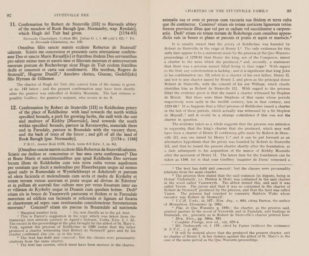
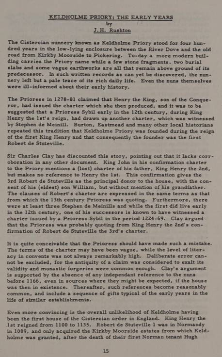
before 1166, Robert de Stuteville granted Keldholme Priory timber and wood in
Farndale together with a vaccary, pasture and cultivated land in East
Bransdale.
This
implies that there was some earlier settlement in the area, but not very much.
The Keldholme property in Bransdale, which could still be identified in a
survey of 1610, never amounted to more than 40 or 50 acres at Cockayne at the
head of the valley.
The
next mention of Farndale, also Farendale, Farendal, Farnedale
in the thirteenth century, is found at the beginning of the 13th century (Cal.
Rot. Chart. 1199–1216 (Rec. Com.), 86). It formed part of the fee of
the lords of Kirkbymoorside, of which manor it was parcel.
For
an extent in 1281–2 see Yorks. Inq. (Yorks. Arch. Soc.), i,
249.
Robert
de Stuteville had given the nuns of Keldholme the right of getting wood for
burning and building in Farndale, (Cal. Rot. Chart. 1199–1216 (Rec.
Com.), 86) and in or about 1209 the Abbot of St. Mary's obtained from King
John rights in the forest of Farndale which the king had recovered from
Nicholas de Stuteville. (Pipe R. 11 John, m. 11) The abbot and Nicholas
came to an agreement concerning common of wood and pasture here, this being
renewed in 1233. (Feet of F. Yorks. 17 Hen. III, no. 14).
At about
the same time Robert gave to St Mary’s Abbey, who held the nearby manor of
Spaunton, as much timber and wood as they required together with pasture and
pannage of pigs in Farndale. The contemporaneous documents suggest that
Farndale was regarded primarily as a resource for timber and pasture in the mid
twelfth century, with little evidence of settlement.
In
the mid thirteenth century, Lady Joan de Stuteville successfully prosecuted the
Abbot of St Mary’s York, for exceeding his rights taking wood from Farndale by actually assarting 100 acres of land. Only a few years
later, the Inquisition Post Mortem taken
after Joan’s death in 1276 reveals settlement on a grand scale.
Joan
de Stuteville, heiress of Cottingham (incl. the honors
of Liddel and Rosedale), also known as "Joan de Wake", was born in
1216, the daughter of Nicholas II de Stuteville.
Only
a few years later, the Inquisition Post Mortem
taken
after Joan’s death in 1276, reveals settlement on a grand scale. In Farndale,
bond tenants holding by acres and paying a standard rent of 1-0d for each acre
produced £27-5-0d, presumably for 545 acres. In East Bransdale, bondmen
held another 141 acres paying a standard rent of 6d per acre, but they are said
to hold ‘by cultures’. The significance of these terms
is explained in the IPM of Joan’s Son, Baldwin Wake, taken only six years later
in 1282, where the bondmen are said to hold their land ‘not by the bovate of
land, but by more or less’. Thus standard bovate
holdings, usually in the lowlands and in some of the older settled moorland
villas, have been dispensed with in favour of holdings of varied size rented by
the acre.
Many
lords ran other lesser manor courts and enjoyed the fines from any breach of
the local customs that they enforced. The Kirkby Moorside tenants of the
Stutevilles and the Wakes were taxed annually at Michaelmas, gave ‘merchet’ for
their daughters, paid ‘gersumes’ and gave the Lord
every tenth pig. (The History of Ryedale, John Rushton, 2003, page 104).
marchet was a historical fine paid by a tenant to their lord
in medieval England, typically upon the marriage of the tenant's daughter. It
was a form of payment related to feudal obligations and land ownership.
gærsume was a sum paid by a tenant to a landlord on the entry
of a lease.
The
1282 extent shows a considerable increase over that of 1276, but this probably
means nothing more than that a new and up-to-date survey was used as the basis
for the later document. The Farndale rents now amounted £ 38-8-8d together with
a nut-rent and a few boon works and if the rate of 1s 0d per acre still
applied, this would give a total acreage held in bondage of no less than 768
acres. In Bransdale rents were up to £4-14-3d which would give us about 188
acres at the old rent of 6d per acre. For the first time the number of bondmen are given - 25 in East Bransdale and 90 in Farndale.
Assarting
is the act of clearing forested lands for use in agriculture or other purposes.
In English land law, it was illegal to assart any
part of a royal forest without permission. This was the greatest trespass that
could be committed in a forest, being more than a waste: while waste of the
forest involves felling trees and shrubs, which can regrow, assarting involves
completely uprooting all trees—the total extirpation of the forested area. The
term assart was also used for a parcel of land
assarted. Assart rents were those paid to the British
Crown for the forest lands assarted. The etymology is from the French word essarter meaning to remove or grub out woodland. In
northern England this is referred to as ridding.
In
the Middle Ages, the land cleared was usually common land but after assarting,
the space became privately used. The process took several forms. Usually it was done by one farmer who hacked out a clearing
from the woodland, leaving a hedged field. However, sometimes groups of
individuals or even entire villages did the work and
the results were divided into strips and shared among tenant farmers. Monastic
communities, particularly the Cistercians, sometimes assarted, as well as local
lords. The cleared land often leaves behind an assart
hedge, which often contains a high number of woodland trees such as small leafed lime or wild service and contains trees that
rarely colonise planted hedges, such as hazel.
Assarting
has existed since Mesolithic times and often it relieved population pressures.
During the 13th century, assarting was very active, but
decreased with environmental and economic challenges in the 14th century. The
Black Death in the late 1340s depopulated the countryside and many formerly
assarted areas returned to woodland.
Assarting
was described by landscape historian Richard Muir as typically being "like
bites from an apple" as it was usually done on a small scale
but large areas were sometimes cleared. Occasionally, people specialized in
assarting and acquired the surname or family name of 'Sart'.
Field
names in Britain sometimes retain their origin in assarting or colonisation by
their names such as: 'Stocks'; 'Stubbings'; 'Stubs'; 'Assart';
'Sart'; 'Ridding'; 'Royd'; 'Brake'; 'Breach'; or
'Hay'.
The sheer scale is impressive enough, but there are features which
point to a planned campaign of settlement. It is difficult to imagine
how men of villain status, compelled to pay rents of 1s 0d per acre for minute
holdings of marginal land, could also have managed to undertake their own
assarting. It seems more likely that the land had been reclaimed in advance of
letting, as at Goathland, by the Lord’s agents, while the standard rents
suggest a single campaign on a large scale rather than piece meal assaulting. A number of key questions cannot be answered from the sources we have
used so far. It is not clear whether settlement of the two Dales completed by
1282.
The Lay Subsidy Assessments of 1301 give
us a brief glimpse of the settlement pattern, listing numerous contributors
bearing the names of the farms which are still to be found in Farndale, such as
Wakelevedy (‘Wake Lady Green’), Westgille (“West
Gill”), Monkegate (Monket
House) and Ellershaye (“Eller House”), and which are scattered
all round the dale.
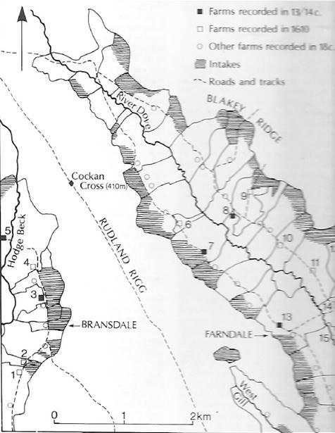
Medieval
settlement in upper Farndale and east Bransdale – the numbered farms are those
which still bear names mentioned in the sources up to 1610.
The 1570 document described 71 tenements in Farndale,
40 on the east side and 31 on the west, together with two mills and a few
cottages paying altogether just over £54 in rent.
As the
thirteenth century Inquisitions Post Mortem make
clear, the size of farms was never uniform. Some farms must have fallen out of
cultivation in the later middle ages and may have been
combined with others, thus effecting a considerable reduction in the overall
number of tenements. Even so, there was still remarkably little differentiation
among the peasantry as late as 1610. Farms of 10 to 15 acres producing rents of
about as many shillings were still very common. Only five tenants paid over £20
0d rent and only two paid more than £25 0d.
Farndale since 1500
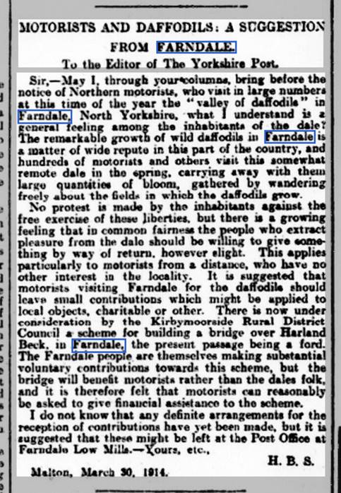
Kirkbymoorside,
1857
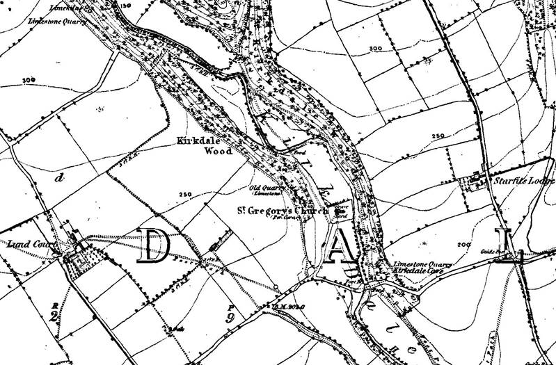
Kirkdale, 1857
1857
The Victoria
County History – Yorkshire, A History of the County of York North Riding:
Volume 1 Parishes: Kirkby Moorside, 1914:
Kirkby
Moorside is a parish covering about 13,700 acres, chiefly of moorland. It is
practically enclosed between two streams, the Dove and the Hodge Beck its
tributary, which, flowing down through Farndale and Bransdale
respectively, unite to the south of the town of Kirkby Moorside. The ground is
thus well watered and fertile, on a subsoil of inferior oolite with Upper and
Lower Lias in the dales. There are brick and tile
works at Kirkby Moorside and Cockayne, and jet, coal and limestone have been
worked in Bransdale and Farndale. About half the total area is in
cultivation, the chief crops raised being oats and barley. …
The
townships of Bransdale Eastside and Farndale Low
Quarter have only a few houses scattered here and there among the hills.
These with Bransdale Westside from Kirkdale parish and the rest of Farndale
from Lastingham were in 1873 formed into the modern parish of
Bransdale-cum-Farndale. In the extreme north of Bransdale, between two branches
of the Hodge Beck, is the little hamlet of Cockayne, with an old chapel of ease
and a hall used by the Earl of Feversham as a shooting-lodge.
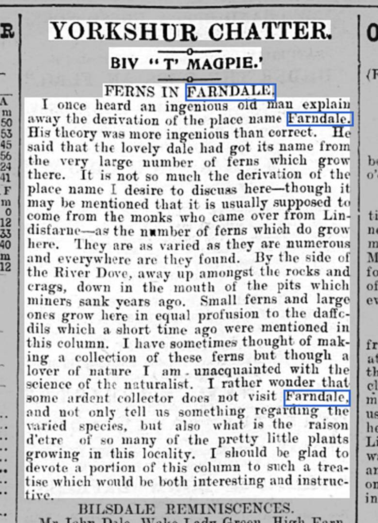
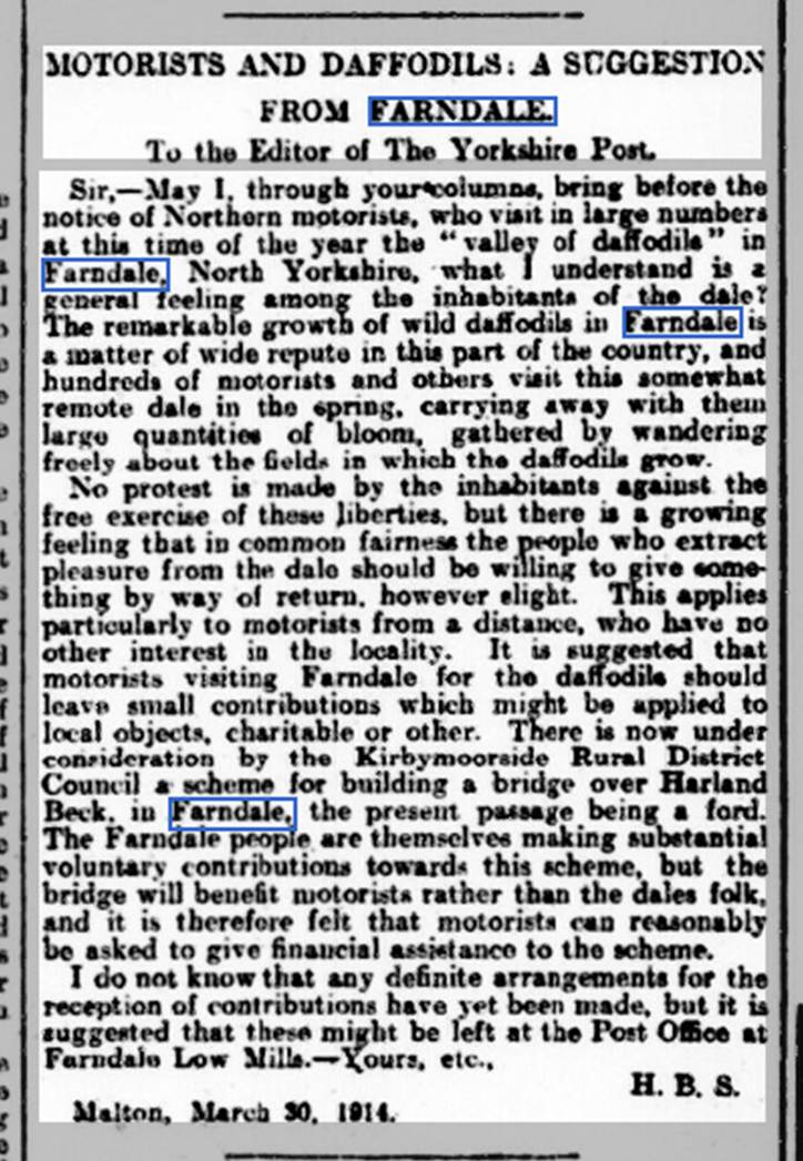

(Yorkshire
Gazette, 4 April 1903)
(Yorkshire Post and Leeds
Intelligencer, 31 March 1914) (Yorkshire Post, 15 May 1914)
Farndale Timeline
Bede described the area where Farndale lay as ‘vel bestiae commorari vel hommines
bestialiter vivere conserverant.’:
‘a land fit only for wild beasts, and men who live like wild beasts.’.
1035
Orm Gamallson of Kirkdale was the Lord
of Chirchebi, later Kirkbymoorside, which included the lands which would
one day be called Farndale.
Both Orm and Gamel are Scandinavian names, so Orm is likely to be
descended from the Scandinavian settlers of North Yorkshire. It is possible
that he benefited from the handing out of English Estates by King Canute
(1016-1035).
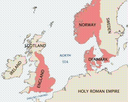
The territory of King Cnut
Orm was prominent in Northumbria in the middle years
of the eleventh century. He married into the leading aristocratic clan of the
region. His wife Aethelthryth was the daughter of Ealdred, Earl of Northumbria
in the mid eleventh century. His brother in law was Siward, Earl of Northumbria until 1055, famous for his
exploits against Macbeth, the King of Scots.
On November 24, 1034, Malcolm II died of natural causes. One
month later, his son, Duncan MacCrinan, was elected king. For six uneasy years,
Duncan ruled Scotland with a thirst for power countermanded by his incompetence
on the battlefield. In 1038, Ealdred, earl of Northumbria, attacked southern
Scotland, but the effort was repelled and Duncan's chiefs encouraged him to
lead a counterattack. Duncan also wanted to invade the Orkneys Islands to the
north. Over the objections of all of his advisers, he
chose to do both. In 1040, Duncan opened up two
fronts. The attack on the Orkneys was led by his nephew, Moddan,
and Duncan led a force toward Northumbria. Both armies were soon routed and
reformed only to be pursued by Thorfinn, mormaer of Orkney. Macbeth joined
Thorfinn and, together, they were victorious, killing Moddan.
On August 14, 1040, Macbeth defeated Duncan's army, killing him in the process.
Later that month, Macbeth led his forces to Scone, the Scottish capital, and,
at age 35, he was crowned king of Scotland.
Siward, Orm’s brother in law, is perhaps
most famous for his expedition in 1054 against Macbeth, King of Scotland, an
expedition that cost Siward his eldest son, Osbjorn. The origin of Siward's
conflict with the Scots is unclear. According to the Libellus
de Exordio, in 1039 or 1040, the Scottish king
Donnchad mac Crínáin had attacked northern Northumbria and besieged Durham.
Within a year, Macbeth had deposed and killed Donnchad. The failed siege
occurred a year before Siward attacked and killed Earl Eadwulf of Bamburgh, and
though no connection between the two events is clear it is likely that they
were linked.
The Annals of Lindisfarne and Durham, written in the early 12th
century, related under the year 1046 that "Earl Siward with a great
army came to Scotland, and expelled king Macbeth, and appointed another; but
after his departure Mac Bethad recovered his kingdom". Historian
William Kapelle thought that this was a genuine event of the 1040s, related to the
Annals of Tigernach entry for 1045 that reported a "battle between the
Scots" which led to the death of Crínán of
Dunkeld, Donnchad's father; Kapelle thought that Siward had tried to place Crínán's son and Donnchad's brother Maldred on the Scottish
throne. Another historian, Alex Woolf, argued that the Annals of Lindisfarne
and Durham entry was probably referring to the invasion of Siward in 1054, but
misplaced under 1046.
1055
“Orm the son
of Gamel acquired St Gregory’s Church when it was completely ruined and
collapsed, and he had it built anew from the ground to Christ and to St Gregory
in the days of King Edward and in the days of Earl Tostig”. (inscription on the Sundial at the Saxon Church of St
Gregory) The
inscription refers to Edward the Confessor and to Tostig, the son of Earl
Godwin of Wessex and brother of Harold II, the last Anglo Saxon King of
England. Tostig was the Earl of Northumbria between 1055 and 1065. It was therefore
during that last peaceful decade, immediately before the Norman conquest, that
Orm, son of Gamel rebuilt St Gregory’s Church at Kirkdale.
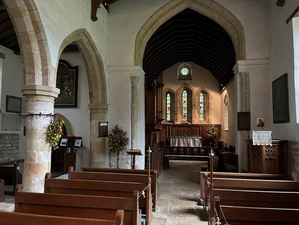
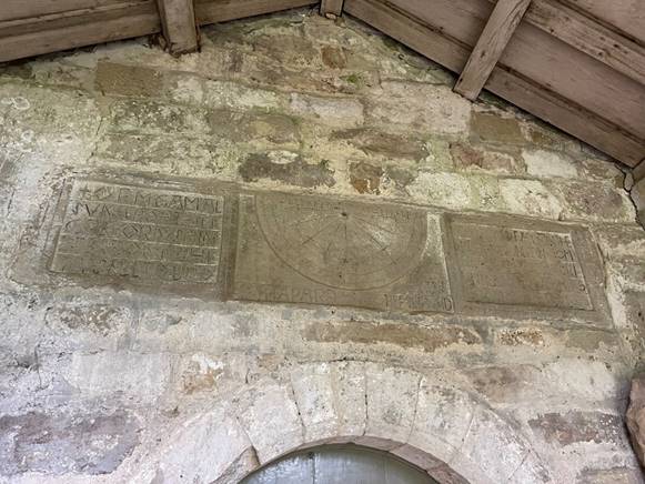
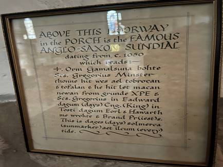
Kirkdale Church
Photos of the Church and the sundial taken in 2021
The sundial at Kirkdale is one of a
number of late Anglo Saxon sundials in the
area. The Kirkdale sundial is particularly intricate in its design
and he best preserved as it was coated I plaster for
many centuries prior to 1771 and was protected by the porch.
The central panel contains the sundial and an Old
English inscription above it which reads “This is the day’s sun-marker at
every hour”. The left panel reads “Orm the son of Gamel acquired St
Gregory’s Church when it was completely ruined.” The right
hand panel reads “and collapsed, and he had it built anew from the
ground to Christ and to St Gregory in the days of King Edward and in the days
of Earl Tostig”. At the foot of the panel, a further inscription reads “Hawarth made me, and Brad the priest”.
King Edward referred to in the panel is King Edward
the Confessor, 1042 to 1066, who restored the Kingdom of Wessex to the English
throne. He was a deeply pious and religious man who presided over the
rebuilding of Westminster Abbey. He left much of the running of the country to
Earl Godwin and his son Harold. Edward died childless in 1066, 8 days after the
completion of Westminster Abbey. There was then a power struggle. Despite no
bloodline, Harold Godwinson was elected to be king by the witan (the high
council of nobles and religious leaders). William, Duke of Normandy claimed
that Edward had promised the throne to him. Harold defeated an invading
Norwegian army at the Battle of Stamford Bridge in Yorkshire,
but then marched south to face William of Normandy in Sussex and was
killed at the Battle of Hastings. This was the end of the Anglo
Saxon kings and the beginning of the Norman dynasty.
Tostig, the son of Earl Godwin of Wessex and brother
of Harold II, the last Anglo Saxon King of England was the Earl of Northumbria
between 1055 and 1065. It was
therefore in the course of that decade that Orm, son
of Gamel rebuilt St Gregory’s Church.
The surviving parts of Orm’s church adopt a style
reflective of the Romanesque architecture of the eleventh century mainland Europe and it is possible that Orm may have travelled to
Rome when Tostig made a pilgrimage there in 1061.
Domesday Book recorded that Chirchebi comprised
five carucates of land. A carucate was a medieval land unit based on the land
which eight oxen could till in a year. So presumably this area of land
described the five carucates of cultivated land around Kirkdale. Before the
Conquest, civilised Chirchebi was in the possession of Orm and it
comprised ten villagers, one priest, two ploughlands, two lord’s plough teams,
three men’s plough teams, a mill and a church.
A carucate or carrucate
(Latin, carrūcāta or carūcāta) was a medieval unit of land area
approximating the land a plough team of eight oxen could till in a single
annual season.
However this area of civilisation was part of a much wider
wild estate which Chirchebi formed, which was said to be twelve leagues
(about 42 miles) long by the time of the Normans.
Earl Waltef who had a manor and 5 carucates at Fadmoor which comprised three ploughlands.
1066
By 1086 the ownership of Chirchebu
had passed to Hugh, son of Baldric. The landholdings of Orm
Gamallson of Kirkdale, were forfeited to Hugh fitzBaldric after the conquest.
Hugh Fitz Baldric
Hugh fitzBaldric was a German archer
in the service of William the Conqueror and was made Sherrif of the County of
York, replacing William Malet after his capture in 1069.
Hugh FitzBaldric was born in about 1045 in Cottingham, Yorkshire
(now part of Hull). He married Emma de Lascelles in 1050. They had a daughter
Erneburga Fitz Baldric (1075-?).
Hugh FitzBaldric died in about 1086 in Cottingham, Yorkshire, aged
about 41 years old.
Hugh first appeared in the historical record around 1067 when he
was the witness to a charter of Gerold de Roumara.
Hugh held the office of Sheriff of Yorkshire from 1069 to around 1080,
succeeding William Malet in that office.
When the land of the Saxon earls was confiscated after the
Norman Conquest, it would appear that Orm’s property
was acquired by, or granted to Ralph de Mortimer; and
Barch’s by Hugh FitzBaldric.
Ralph de Mortimer was the only son of Roger, who derived his surname
from Mortemer en Lions in the Pays de Caux, between Neufchatel and Aumale
in France. Ralph de Mortimer died in his castle of St. Victor-en-Caux on 5 August 1100 (or
1104) and was buried in the Abbey church there. He left two sons, Hugh and
William; and a daughter, Hawise, who became the wife of Stephen, Earl of
Albemarle and Holderness. Hugh’s descendants became the Earls of March; William
died childless. The family seems to have no recorded connection with Gilling, except
for a later reference (in the 12th century) when Peter de Ros, who
was linked with the Mortimers by marriage, gave two carucates of land to St.
Mary’s Abbey, York. It is likely that this land so granted was Orm’s, which had
probably come into the Ros family by marriage. The Ros family also had land of
Ralph de Mortimer’s in Whenmore. In the 12th century
the land was in the possession of the Mowbrays and the Stutevilles.
Barch’s portion was granted to Hugh FitzBaldric (i.e. Hugh the son
of Baldric). It is not known which Norman family he came from, if indeed he was
Norman. It has been stated that he was a German archer in the service of
William the Conqueror. However, before 1067 he “witnessed a charter of Gerald,
granting the Nuns of St. Amand in Rouen the church of his fief of Roumare”. Immediately after the capture of York by William
in September 1069, Hugh FitzBaldric appears to have been made Sheriff of the County
of York by the King. He fell into trouble by supporting Robert Duke of Normandy
against William and presumably lost his lands. However, nothing more is heard
of him.' John Marwood’s History of Gilling, Chapter 8: After the Saxons: The Ettons of Gilling.
Hugh had lands in Yorkshire and Lincolnshire,
and was listed in Domesday Book as a tenant-in-chief. Hugh's tenure of
the estate at Cottingham in Yorkshire is considered to mean that he was a feudal
baron. Katharine Keats-Rohan states that Hugh lost his lands after the
conclusion of Domesday Book in 1086, likely for supporting Robert Curthose as
king against William Rufus after the death of William the Conqueror. But I. J.
Sanders states that Hugh's lands were divided after his death and does not
mention any forfeiture of the lands.
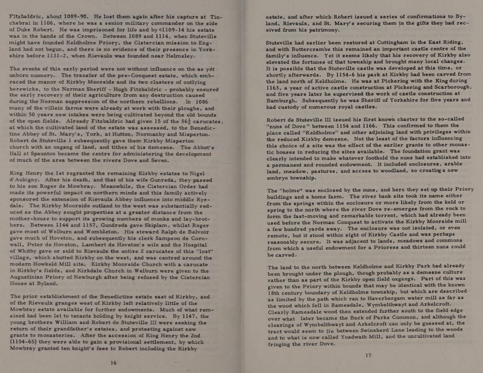
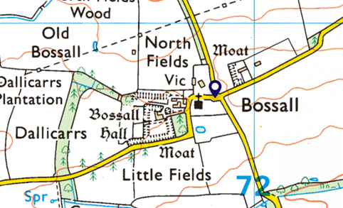
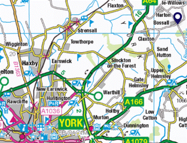
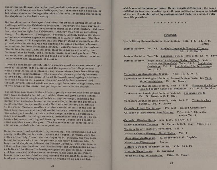
One of Hugh's holdings included the village of Bossall in the hundred of Bulford
(now in the Ryedale district of North Yorkshire). In 1086, there were 19 residents
and a priest, as well as a church, in the small community. This property
produced an annual income of "3 pounds in 1086; 2 pounds 10 shillings in
1066".
It is possible that the Hugh fitz
Baldric who witnessed a charter of Robert Curthose's in 1089 is the same person
as the former sheriff.
Domesday Book records that Walter de Rivere and Guy of Croan
were son-in-laws of Hugh.
Hugh gave some of his English lands to Préaux
Abbey in Normandy and St Mary's Abbey in York.
Hugh was memorialized in the liber vitae of Thorney Abbey.
When the land of the Saxon earls was confiscated [by the
Normans] after the Conquest it would appear that Orm’s
property was acquired by, or granted to, Ralph de Mortimer; and Barch’s by Hugh
FitzBaldric.
... let us follow what is known about Barch’s portion. As we
have already seen, it was granted to Hugh FitzBaldric (i.e. Hugh the son of
Baldric). It is not known which Norman family he came from, if indeed he was Norman.
It has been stated that he was a German archer in the service of William the
Conqueror. However, before 1067 he “witnessed a charter of Gerald, granting the
Nuns of St. Amand in Rouen the church of his fief of Roumare”.
Immediately after the capture of York by William in September 1069, Hugh
FitzBaldric appears to have been made Sheriff of the County of York by the
King. He fell into trouble by supporting Robert Duke of Normandy against
William and presumably lost his lands. However, nothing more is heard of him.
In England Hugh son of Baldric was an important
tenant-in-chief in Yorkshire, and to a smaller extent in Lincolnshire; he also
held two manors in Nottinghamshire, single holdings in Wiltshire and Berkshire,
and interests in four holdings in Hampshire. In Yorkshire Hugh son of Baldric
held about 50 manors with many berewicks and sokeland, assessed at
approximately 410 carucates. The greater part of these holdings passed,
presumably by royal grant, to Robert de Stuteville. 'The estates of Hugh son
of Baldric, Domesday lord of Cottingham, weredivided
after his death and the bulk of his lands in Yorkshire passedto
Robert I de Stuteville.' Ivor JohnSanders, English Baronies: AStudy of Their Origins and Descent 1086-1327
Count Robert of Mortain held Fadmoor and it was waste. Later it fell into the
hands of Hugh son of Baldric before passing first to
Roger de Mowbray and later to William and then Nicholas de Stuteville in 1200.
1086
The Kirkbymoorside estate passed to the Stuteville
family (Robert I de Stuteville) in 1086, when Hugh died.
There is more information about the Domesday Book here.

Orm (son of Gamal) is associated with 61 places before the
Conquest; 0 after the Conquest.
Kirkby Moorside was transferred to Hugh
son of Baldric. It contained Households: 10 villagers.
1 priest. Land and resources Ploughland: 2 ploughlands. 2 lord's plough teams. 3
men's plough teams. Other resources: 1 mill, value 4 shillings. 1 church.
Tenant-in-chief in 1086: Hugh son of Baldric. Lord in 1086: Hugh son of Baldric. Lord in 1066: Orm (son of Gamal).
From the
Essay New Settlements in the North Yorkshire Moors, 1086 to 1340 by
Barry Harrison, in Medieval Rural Settlement in North East England,
Architectural and Archaeological Society of Durham and Northumberland, Research
Report No 2, Edited by BE Vyner, 1990: The North Yorks Moors was an appropriate area for the study of
medieval agriculture, since it appears to have been largely empty of
settlements in 1086.The only developed manor in the moorlands proper was in the
Esk Valley where a 12 carucate holding was located at
Danby, Crumbeclive (Crunkley
Hill in Glaisdale) and Lealholm. This was an
extensive area, said to measure seven leagues in length by three leagues in
width, within which Danby (six carucates) was the major focus of settlement.
The long valleys on the south side of the watershed appear to have functioned
mainly as resources for woodland and pastures for settlements in the Vale of
Pickering and although some settlements in the moors may have been subsumed
into consolidated Domesday entries for lowland manors, the descriptions of
moorland tracts granted to the new monasteries (Whitby, Guisborough, Rievaulx
and Byland) in the early and mid 12th century contain
very little evidence of functioning communities of any kind.

So we start with a clear palate, to understand how
agriculture developed after the Norman Conquest.
1106
The Stutevilles were deprived of the Kirkbymoorside
estate in 1106 when it was granted to Nigel d’Aubigny, one of Henry I’s ‘new men’.
Nigel d’Aubigny was one of Henry I’s “new men”. Nigel d'Aubigny (Neel d'Aubigny or
Nigel de Albini, died 1129), was a Norman Lord and English baron who was the
son of Roger d'Aubigny and Amice or Avice de Mowbray.
His paternal uncle William was lord of Aubigny, while his father was an avid
supporter of Henry I of England. His brother William d'Aubigny
Pincerna was the king's Butler and father of the 1st Earl of Arundel. He was
the founder of the noble House of Mowbray. He is described as "one of
the most favoured of Henry's 'new men'". While he entered the king's
service as a household knight and brother of the king's butler, William d'Aubigny, in the years following the Battle of Tinchebrai in 1106 Nigel was rewarded by Henry with
marriage to an heiress who brought him lordship in Normandy and with the lands
of several men, primarily that of Robert de Stuteville. The Mowbray honour
became one of the wealthiest estates in Norman England. From 1107 to about
1118, Nigel served as a royal official in Yorkshire and Northumberland. In the
last decade of his life he was frequently traveling
with Henry I, most likely as one of the king's trusted military and administrative
advisors. Nigel's first marriage, after 1107, was to Matilda de L'Aigle, whose prior marriage to the disgraced and
imprisoned Robert de Mowbray, Earl of Northumbria, had been annulled based on
consanguinity. She brought to the marriage with Nigel her ex-husband's lordship
of Montbray (Mowbray). Following a decade of
childless marriage and the death of her powerful brother, Nigel in turn
repudiated Matilda based on his consanguinity with her former husband, and in
June 1118 Nigel married to Gundred de Gournay (died
1155), daughter of Gerard de Gournay and his wife Edith de Warenne, and hence
granddaughter of William de Warenne, 1st Earl of Surrey. Nigel and Gundred had son who would be known as Roger de Mowbray
after the former Mowbray lands he would inherit from
his father, and he was progenitor of the later noble Mowbray family. Nigel died
in Normandy, possibly at the abbey of Bec in 1129.
1129
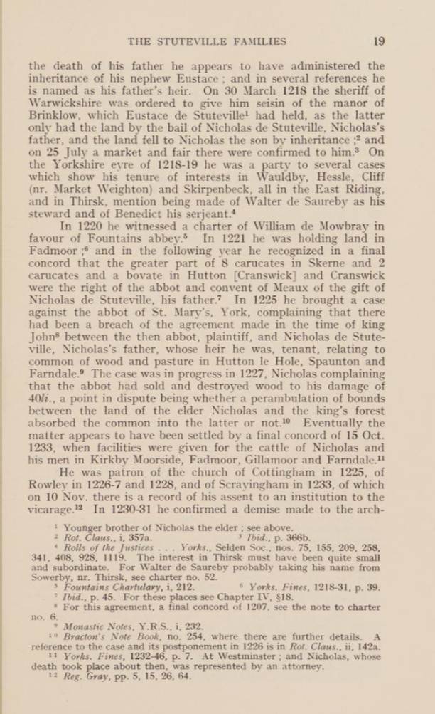
On Nigel d’Aubigny death in
1129 his widow Gundreda administered the estate on
behalf of her under age son, Roger de Mowbray (1120 to
1188).
Nigel’s widow Gundreda
administered the estate on behalf of her under aged son Roger de Mowbray.
It was she who granted the whole of Welburn and
Skiplam together with the western side of Bramsdale to Rievaulx Abbey who
developed the whole area as a series of granges and cotes, including Colt House
and Stirk House in Brandsale.
1133
Henry II became King.
1138
On reaching his majority in 1138, Roger de Mowbray took
title to the lands awarded to his father by Henry I both in Normandy including Montbray, from which he would adopt his surname, as well as
the substantial holdings in Yorkshire and around Melton.
Sir Roger de Mowbray (1120–1188) was an Anglo-Norman nobleman with
substantial English landholdings. A supporter of King Stephen, with whom he was
captured at Lincoln in 1141, he rebelled against Henry II. He made multiple
religious foundations in Yorkshire. He took part in the Second Crusade and
later returned to the Holy Land, where he was captured and died in 1187. Roger
was the son of Nigel d'Aubigny by his second wife, Gundreda de Gournay. On his father's death in 1129 he
became a ward of the crown. Based at Thirsk with his mother, on reaching his
majority in 1138, he took title to the lands awarded to his father by Henry I
both in Normandy including Montbray, from which he
would adopt his surname, as well as the substantial holdings in Yorkshire and
around Melton. King Stephen - Soon after, in 1138, he participated in the
Battle of the Standard against the Scots and, according to Aelred of Rievaulx,
acquitted himself honourably. Thereafter, Roger's military fortunes were mixed.
Whilst acknowledged as a competent and prodigious fighter, he generally found
himself on the losing side in his subsequent engagements. During the anarchic
reign of King Stephen he was captured with Stephen at
the battle of Lincoln in 1141. Soon after his release, Roger married Alice de
Gant (d. c. 1181), widow of Ilbert de Lacy and daughter of Walter de
Gant. Roger and Alice had two sons, Nigel and Robert. Roger also had at least
one daughter, donating his lands at Granville to the Abbaye aux Dames in Caen
when she became a nun there. In 1147, he was one of the few English nobles to
join Louis VII of France on the Second Crusade. He gained further acclaim,
according to John of Hexham, defeating a Muslim leader in single combat. King
Henry II - Roger supported the Revolt of 1173–74 against Henry II and fought
with his sons, Nigel and Robert, but they were defeated at Kinardferry,
Kirkby Malzeard and Thirsk. Roger left for the Holy
Land again in 1186, but encountered further misfortune being captured at the
Battle of Hattin in 1187. His ransom was met by the Templars, but he died soon
after and, according to some accounts, was buried at Tyre in Palestine. There
is, however, some controversy surrounding his death and burial and final
resting-place. Mowbray was a significant benefactor and supporter of several
religious institutions in Yorkshire including Fountains Abbey. With his mother
he sheltered the monks of Calder, fleeing before the Scots in 1138, and
supported their establishment at Byland Abbey in 1143. Later, in 1147, he
facilitated their relocation to Coxwold. Roger made a generous donation of two
carucates of land (c.240 acres), a house and two mills to the Order of Saint
Lazarus, headquartered at Burton St Lazarus Hospital in Leicestershire, after
his return from the crusades in 1150. His cousin William d'Aubigny,
1st Earl of Arundel and his wife Adeliza, the widow of King Henry I, had been
amongst the earliest patrons of the order and, when combined with Roger's
experiences in the Holy Land, may have encouraged his charity. His family
continued to support the Order for many generations
and the Mowbrays lion rampant coat of arms was adopted by the Hospital of
Burton St Lazars alongside their more usual green cross. He also supported the
Knights Templar and gave them land in Warwickshire where they founded Temple
Balsall. Roger is credited with assisting the establishment of thirty-five
churches. The House of Mowbray, the senior line of which would become Barons
Mowbray, descended from Roger's son Nigel, who died on crusade at Acre in 1191.
Robert II de Stuteville, one of the northern barons,
commanded the English at the battle of the Standard in August 1138
Robert II de Stuteville was born about 1084 in Yorkshire. Son of Robert (Estouteville) d'Estouteville I.
Brother of Nicolas I (Estouteville) Stuteville and
Emma (Estouteville) de Grentmesnil.
Husband of Erneburge (Fitzbaldric)
Stuteville. Husband of Jeanne (Talbot) de Stuteville.
Father of Burga (Stuteville) Pantulf,
Nicholas (Stuteville) de Stuteville, Alice (Stuteville) Fleming, Osmund
(Stuteville) de Stuteville, John (Stuteville) de Stuteville, Patrick
(Stuteville) de Stuteville and Robert (Stuteville) de Stuteville III. Not
believed to have held lands in England. A supporter of Robert Curthose with his
father, he was captured at St.Pierre-sur-Dive
shortly before the battle of Tinchebrai. Died after 1138
after about age 54 in Cottingham, Yorkshire.
The
landowners enjoyed significant revenues from rents, fines, reliefs,
benevolences, maritages (the fee paid by a vassal following the feudal lord’s
decision on a marriage), wardships and opportunities for escheat (the reversion
of land when owners died without heirs). They were also relieved of many of the
costs of running modern estates, because they were owed duties of service. The value
of these estates is best seen not in monetary terms, but in the works they
undertook. The castles were obviously works of significant labour. The growth
of monasteries also reflected the power held by the nobility, including the
costs of building churches.
(South Yorkshire, the History and Topography of the
Deanery of Doncaster in the Diocese and County of York by Rev Joseph Hunter,
1828, page xvi to xviii).
1141
Roger de Mowbray was a supporter of King Stephen, with
whom he was captured at Lincoln in 1141, he rebelled against Henry II.
1154
Gundreda, on behalf of her guardian, gave land to Rievaulx
abbey land which included a place called Midelhovet, where Edmund the
Hermit used to dwell, and another called Duvanesthuat,
together with the common pasture within the valley of Farndale.
See full details at FAR00002.
By 1166, Roger de Mowbray having fallen out of favour with
Henry II, the lands of Kirkbymoorside had passed to the House Stuteville.
Robert III de Stuteville claimed the barony, which had been forfeited by his
grandfather, from Roger de Mowbray, who by way of compromise gave him Kirby
Moorside. Roger gave Robert Kirkby Moorside for 10 knights' fees in
satisfaction of his claim (Victoria
County History – Yorkshire, A History of the County of York North Riding:
Volume 1 Parishes: Kirkby Moorside, 1914).
Robert
III de Stuteville, Baron of Cottingham, was son of Robert II de
Stuteville (from Estouteville in Normandy), one of
the northern barons who commanded the English at the battle of the Standard in
August 1138. His grandfather, Robert Grundebeof, had supported Robert of
Normandy at the battle of Tinchebray in 1106, where
he was taken captive and kept in prison for the rest of his life. Robert III de
Stuteville was witness to a charter of Henry II of England on 8 January 1158 at
Newcastle-on-Tyne. He was a justice itinerant in the counties of Cumberland and
Northumberland in 1170–1171, and High Sheriff of Yorkshire from Easter 1170 to
Easter 1175. The King's Knaresborough Castle and Appleby Castle were in his
custody in April 1174, when they were captured by David of Scotland, Earl of
Huntingdon. Stuteville, with his brothers and sons, was active in support of
the king during the war of 1174, and he took a prominent part in the capture of
William the Lion at Alnwick on 13 July (Rog. Hov. ii. 60). He was one of the
witnesses to the Spanish award on 16 March 1177, and from 1174 to 1181 was
constantly in attendance on the king, both in England and abroad. Stuteville by
his wife, Helewise de Murdac, had two sons William
and Nicholas and two daughters, Burga, who was married to William de Vesci and
Helewise, who was married firstly to William de Lancaster, secondly to Hugh de Morville
and thirdly to William de Greystoke. He may have also had sons Robert, Eustace
and Osmund. Robert de Stuteville was probably brother of the Roger de
Stuteville who was sheriff of Northumberland from 1170 to 1185,
and defended Wark on Tweed Castle against William the Lion in 1174.
Roger received charge of Edinburgh Castle in 1177, and he built the first
Burton Agnes Manor House. However Roger may have been
his kinsman, not his brother, as son of Osmund de Stuteville (b. about 1125, of
Burton Agnes, Yorkshire, England, d. before Sep 1202) and his wife (m. abt 1146) Isabel de Gressinghall, daughter of William Fitz
Roger de Gressinghall. He is the probable founder of the nunneries of Keldholme
and Rosedale, Yorkshire, and was a benefactor of Rievaulx Abbey. He seems to
have died in the early part of 1186. He claimed the barony, which had been
forfeited by his grandfather, from Roger de Mowbray, who by way of compromise
gave him Kirby Moorside. The
Stutevilles favoured the Benedictine monks of St Mary’s Abbey, York and their
own small house of nuns was founded at Keldholme near Kirbymoorside.
Rievaulx Abbey was unable to sustain its claim to the
Farndale property and a little before 1166, Robert de Stuteville granted
Keldholme Priory timber and wood in Farndale together with a vaccary, pasture
and cultivated land in East Bransdale
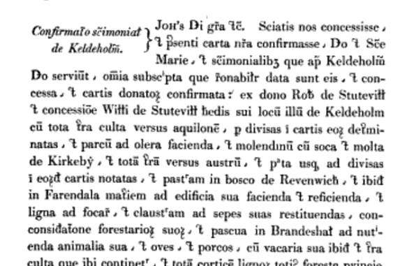
Rotuli Chartarum, 1199-1216,
page 86:
Confirmation of Keldeholm. Know that we have granted
and confirmed the present charter regarding Keldeholm,
all the signatures that were given to them. Grant of charters confirmed by the
gift of Robert de Stuteville and the grant of William de Stuteville to his
son, that place of Keldholme, with the whole tract
of land towards the north of Kirkeby and the whole tract towards the south and
as divided as marked by the eord cartis
and pasture in the forest of Ravenwich, and there
in Farendala hay, and pasture in the forest of Ravenwich … (this translation needs to be reworked!)

1173
Roger supported the Revolt of 1173–74 against Henry II
and fought with his sons, Nigel and Robert, but they were defeated at Kinardferry, Kirkby Malzeard and
Thirsk.
The Stutevilles came back into favour with the
accession of Henry II and Roger de Mowbray was compelled to hand back Kirbymoorside, along with many others
fees.
1186
Roger
left for the Holy Land again in 1186 to join the Second Crusade, but encountered
further misfortune being captured at the Battle of Hattin in 1187. His ransom
was met by the Templars, but he died soon after and, according to some
accounts, was buried at Tyre in Palestine.
Robert III de Stuteville died in 1186.
1200
The
arrangement of 1166 between Roger de Mowbray and Robert III de Stuteville was
not ratified in the king's courts, and the dispute broke out again between
William de Stuteville, son of Robert, and William de Mowbray, grandson of
Roger, in 1200. However in time, William de Mowbray
confirmed the previous agreement and gave 9 knights' fees in augmentum (Victoria County History –
Yorkshire, A History of the County of York North Riding: Volume 1 Parishes:
Kirkby Moorside, 1914).
1207
In or
about 1207 the Abbot of St. Mary's obtained from King John rights in the forest
of Farndale which the King had recovered from Nicholas de Stutevill. (Pipe
R. 11 John, m. 11, Yorkshire Feet of Fines, Pedes Finium
Ebor, regnante Johanne
(1199 to 1214), Edited by W. Brown, Surtees Society, volume 94, 1897, page 113 to 114.
This records a legal settlement in which Nicholas de Stuteville formally
recognises and grants to the Abbot of St Mary’s, York, full and perpetual
rights of woodland and pasture in Hutton (Hoton) and Spaunton
(Spanton), confirming an earlier charter of his father Robert de
Stuteville. The abbey gains free use of fuel‑wood, building timber, pasture, pannage, and certain
cultivated land, with only limited oversight from foresters. There was a case
heard before the king between the Abbot of St Mary’s, York (claimant), and Nicholas
de Stuteville (defendant). The dispute concerned common rights of wood and
pasture in the villages of Hutton and Spaunton. The
abbot claimed these rights belonged to his free tenement in those places. Nicholas
acknowledged and granted to the abbot, the church of St Mary’s, and its monks
including the full common rights of woodland and pasture in Hutton and Spaunton in pure and perpetual alms, free from all secular
service or exaction together with everything previously granted in the charter
of his father Robert de Stuteville, which Nicholas warranted (legally
confirmed).
Robert
had granted the village of Hutton in Ryedale, with all its appurtenances, as
far as the river Dove; rights for the abbey’s men of Hutton and for the abbey’s
hall at Spaunton to take dead wood for fuel; green
wood for building, without needing permission from the forester, pasture and
pannage for the abbey’s animals and pigs, without payment or damage. If any
forester found waste or offence, it must be properly remedied. The agreement
included permission for the abbey’s men to cultivate the land at Hogtweit to the extent already cleared when the charter was
made but they may not clear more land without Robert’s consent, just as they
had agreed. Robert also noted his intention regarding profitable land near the
Dove under Gillingmoor mill, previously lent to his
servant Godfrey. Finally, Robert states that he himself cannot clear any
woodland without the abbey’s consent.
The
extract confirmes that the monks of St Mary’s Abbey,
York, and their men at Hutton were allowed to take fuel‑wood and building timber in
Farndale, and that their animals and pigs had pasture and pannage there without
payment. It also stated that any forest offences found there must be remedied,
and that the abbey had long‑standing,
recognised rights in Farndale.
St Mary’s Abbey held significant rights in the Ryedale area by the
early 13th century. The Stuteville family were major local lords, and this
settlement confirms a long‑standing relationship between them and the abbey. The abbey’s
rights were unusually strong: freedom from foresters, perpetual alms, and
mutual control over woodland clearance. The Feet of Fines entry served as a
royal confirmation of these rights, making them legally secure.
Robert de Stuteville had given the nuns of Keldholme the
right of getting wood for burning and building in Farndale, (Cal. Rot. Chart. 1199–1216 (Rec. Com.), 86) and in or about 1207 the Abbot of St. Mary's
obtained from King John rights in the forest of Farndale which the king had
recovered from Nicholas de Stuteville. (Pipe R. 11 John, m. 11)
Keldholme Priory had right of pasture in Bransdale and
Farndale by grant of its founder, Robert de Stutevill.
Ryedale Historian,. Vol 1,
1965:
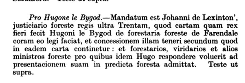
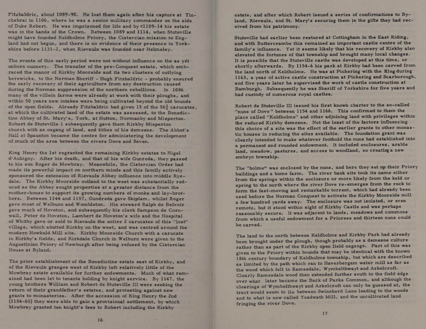
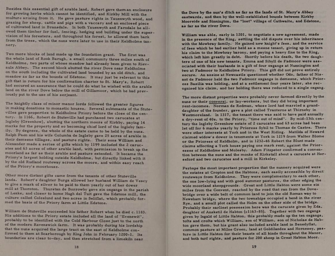
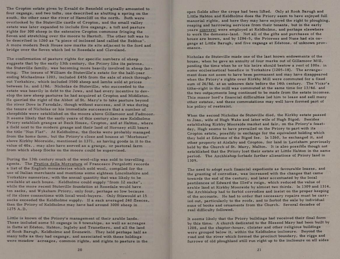
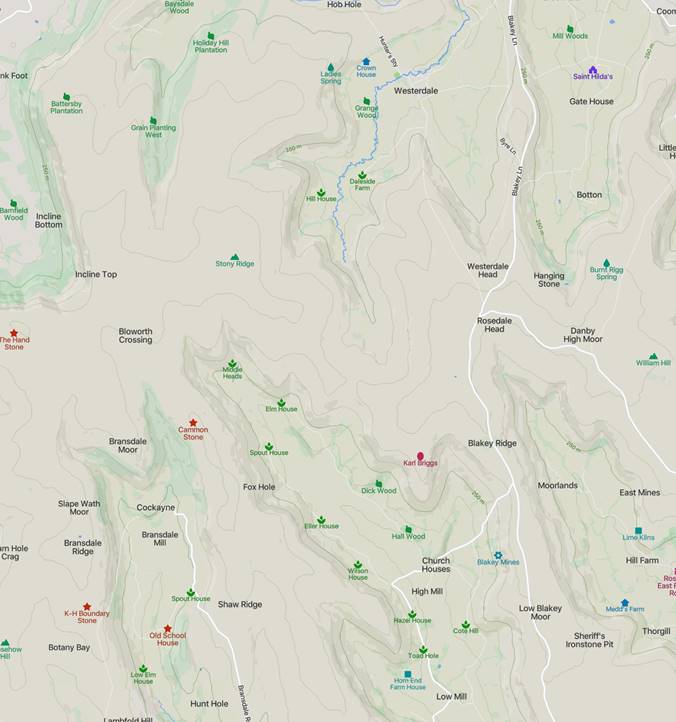
Nicholas de Stuteville (also Lord of Liddell, Stoteville, Estuiteville) (c1182
to 1233) came from the Anglo-Norman family Stuteville .
He was a younger son of Robert III de Stuteville (who died in 1183) and his
wife Helewise. After the death of his elder brother William de Stuteville , the possessions of the family, which included
Liddell in Cumberland and Cottingham in Yorkshire, came first in royal
administration. King Johann Ohneland left it to his confidant Brian de Lisle , who exploited the goods ruthlessly. It was not until
1205, when probably Williams minor son Robert died, Nicholas could inherit the
inheritance of his brother. However, the king demanded an extraordinarily high
fee of 10,000 marks from him before the possessions were handed over to him.
Since he could not raise this money, he had to hand over to King Knaresborough Castle . As from 1213
rebelled a noble opposition to the king, to mare Ville closed like many other
northern English barons Easter 1215 the rebels in Stamford on. With the recognition
of the Magna Carta 1215, the king also had to return Knaresborough Castle to
Stuteville. However, Stuteville
continued to support the rebels as the Barons opened war against the king. As a
rebel, he was on 16 December 1215 by Pope Innocent III excommunicated
. Apparently, he was captured on May 20, 1217
in the victorious for the royal party battle of Lincoln .
Mare Ville fell into the captivity of William Marshal, 1st Earl of Pembroke , the Regent for the minor King Henry III. who
hoped for a high ransom from him. Mare
Ville paid over 1000 Mark ransom, but before he was released, he had to goods
from Kirby Moorside and Handed over to Liddel , who
provided annual income of £200. And he
probably died before the end of the war of the barons in September 1217, at the
latest before 30 March 1218. Lord Of Stuteville (1191 - 1233).
For rights in the forest of Farndale in 1209, 1210 and
1211, see FAR00003.
1217
The
William de Stuteville of 1200 was succeeded by his brother Nicholas de
Stuteville, who fought against the King at Lincoln in 1217 and was taken
prisoner there. He bound his manors of Kirkbymoorside and Liddell to pay 1,000
marks as his ransom (Victoria County History – Yorkshire, A History of the County of
York North Riding: Volume 1 Parishes: Kirkby Moorside, 1914).
1225
Entries
in the Curia Regis for 1225 and 1227 refer to Nicholas de Stuteville and
pastures at Hoton (Hutton), Spaunton and Farendal. See FAR00005.
1229
In
1229 Henry III decreed, ‘the whole of the
forest of Galtres and the forest between the Ouse and
the Derwent, and the forest of Farndale, are ancient forests.’ But the
forest was not much used.
The Close Rolls, 13
Henry III for 1229: It should be remembered that the walkers of
the forest of the county of York came runt and recognized before the King
that the whole forest of Gautric and the forest
between Usam and Derewent
and the forest of Farendal are ancient forest,
and that they had been deceived in the perambulation of the forest other
times in which it was recognized that certain parts of those forests had been
reforested , which they just brought back to the forest; and thence they
brought forth the finished writing, which was sealed with their seals.
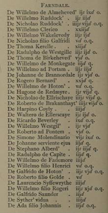
1233
The abbot and Nicholas II de Stuteville (son of
Nicholas I de Stuteville) came to an agreement concerning common of wood and
pasture here, this being renewed in 1233. In 1232 Nicholas quitclaimed common
of pasture in Farndale to the Abbot of St. Mary's, York. (Feet of F. Yorks. 17 Hen. III, no. 14). Nicholas (Coll. Topog. et Gen. i, 11; Baildon, Mon. Notes (Yorks. Arch. Soc., 232). He had an elder son Robert, who was enfeoffed of 1 knight's fee
in Middleton. Nicholas succeeded to Kirkby Moorside and Buttercrambe.
‘The Abbot grants that if the cattle of Nicholas or of his heirs or of his men
at Kikby, Fademor, Gillingmor or Farndale,
hereafter enter upon the common of the said wood and pasture of Houton,
Spaunton and Farendale, they shall have free way in and
out without ward set; provided they do not tarry in the said pasture.’ 17th
year of the Reign of Henry III. (Yorkshire Fines Vol
LXVII). See FAR00007.
At
about the same time Robert gave to St Mary’s Abbey, who held the nearby manor
of Spaunton, as much timber and wood as they required together with pasture and
pannage of pigs in Farndale. The contemporaneous documents suggest that Farndale
was regarded primarily as a resource for timber and pasture in the mid twelfth
century, with little evidence of settlement.
The
William de Stutevill of 1200 was succeeded by his brother Nicholas, who fought
against the king at Lincoln and was taken prisoner there. He bound his manors
of Kirkby Moorside and Liddell to pay 1,000 marks as his ransom. His son
Nicholas in 1232 quitclaimed common of pasture in Farndale to the Abbot of St.
Mary's, York (Feet of F. Yorks. 17 Hen. III, no. 14).
Nicholas
died in 1233, leaving two daughters and co-heirs, Joan wife of Hugh Wake, and
Margaret, whose marriage had been granted to William de Mastac
(Victoria
County History – Yorkshire, A History of the County of York North Riding:
Volume 1 Parishes: Kirkby Moorside, 1914).
1241
Hugh
Wake died in or about 1241 and Joan obtained the custody of his heirs till
their full age.
Inquisitions Post Mortem,
Edward I, File 31, Pages 252-262, Calendar of Inquisitions Post
Mortem: Volume 2, Edward I. Originally published by His Majesty's
Stationery Office, London, 1906: Extent,
Tuesday the eve of the Annunciation, 10 Edw. I. Kerkeby
Moresheved. The manor (full extent given with
names of tenants), including the park a league in circuit with 140 deer
(ferarum), a wood called Westwode
a league in length, a messuage and great close in Braunsedale
held by Nicholas son of Robert Nussaunt rendering an arrow at Easter, rents of
nuts and woodhens, 'gersume,' marchet
and the tenth pig, a messuage called La Wodehouse, waste places called Coteflat, Loftischo, Godefreeruding, Harlonde, and
beneath Gillemore Clif, dales called Farndale
and Brauncedale, and waste places called Arkeners and Sweneklis, held of
Roger de Munbray. Knights' fees pertaining to the manor:—
Circa 1250
In the mid thirteenth century, Lady Joan de Stuteville
successfully prosecuted the Abbot of St Mary’s York, for exceeding his rights
taking wood from Farndale by actually assarting 100
acres of land.
Joan de Stuteville was said to be afforesting her
woods here in the reign of Edward I (1239 to 1307). (Hund. R. (Rec. Com.), i,
117.)
There is an undated Yorkshire Deed from about this
time: Grant by Nicholas Devias, being in good health and lawful power (in mea bona sanitate et ligia potestafe) to Alice his wife, for life, of an annual rent
of 10 li, which lady Joan de Stotevile gave him for his service, namely, 20s. from
the land in Farndale, held of him by Adam de Ellerschae, and eleven marcs from his two water-mills in Famedale,
and two and a half marcs from his water-mill in Brauncedale, payable half-yearly at Michaelmas and Easter.
Paying yearly at Christmas one silver penny for all service, etc. Witnesses,
Sir Richard Foliot, Sir Adam Newmarch [de Novo mercato),
Sir Henry Biset, Sir Thomas de Hetun, William de Pligt Peter de Giptun, Clement
de Nortun, Robert de Slucropt, Colin de Nortun and many others. (The Yorkshire Archaeological Journal, Vol 16, 1893,
page 92)
1253
The Close Rolls, 37 Henry III for 1253: For Hugh le Bigod. The
King committed to Hugh le Bigod the whole forest of Farnedala,
which the king recovered by the consideration of the court towards the Abbot of
St. Mary, to be guarded until the King's return from Vasconia, or as long as it
pleased the King, in the same manner as the aforesaid Abbot had that forest;
and J de Lessinton was ordered to release that forest
to the same Hugh to be kept as aforesaid. Test as above.
1254
In
1254 Henry III granted to Hugh le Bigod and Joan his wife a weekly market on
Wednesday at Kirkbymoorside and a yearly fair there on the eve, day and morrow
of the Nativity of St. Mary
1255
In
1255 Margaret was dead, and Joan Wake had her lands. She married as her second husband
Hugh le Bigod, but as a widow was known as Joan de Stuteville.
Before
her death she enfeoffed in the manor of Kirkby Moorside her son Baldwin Wake,
of whom the King took homage as her heir in 1276.
The Close Rolls, 39 Henry III for 1255: For Hugh le Bygod. It was ordered to John de Lexinton,
justiciar of the King's forest beyond Trent, that the charter which the king
caused to be made to Hugh le Bygod concerning the
forestry of the forest of Farendale he shall make a law before him, and
that grant shall be held according to what is contained in the same charter:
and he shall admit the foresters, greenkeepers and other ministers of the
forest for whom the same Hugh is willing to answer for his presentation in the
aforesaid forest.
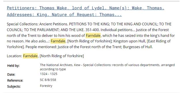
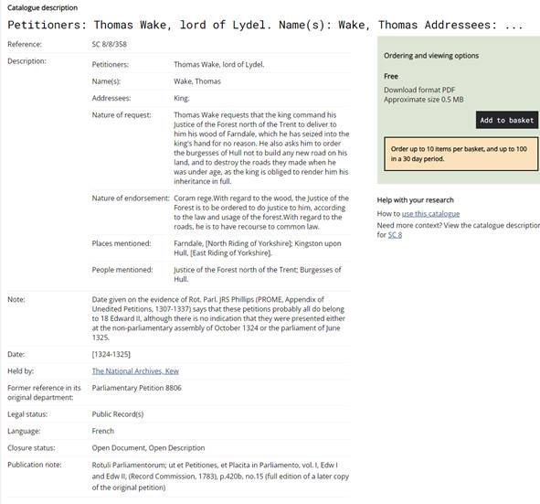
The Calendar of the
Liberate Rolls, 1251 to 1260, Page 212,
1255: Allocate to Hugh le Bygot, in
his fine of 500 marks for the forestership of Farndale, 100 l, paid at
Westminster to Ernald de Mone Pesaz. The associated index entries: Farndale,
Farendale [co York NR], foresterhip of, 212. Forests (i), chaces, hays, parks,
warrens and woods named … Farndale … forestership of Farndale, 212.
This medieval entry from the Liberate
Rolls of King Henry III is an official administrative and accounting order. It
means that the King is commanding his exchequer to deduct £100 from a large fine
owed by Hugh le Bigod because Hugh had already paid that £100 directly to a
royal agent named Ernald de Monte Pesaz. Allocate was a formal
accounting command meaning credit to the account of.
Hugh le Bigod was a prominent
thirteenth century English baron who later became Justiciar of England.
A fine in this context was not
a punishment, but a negotiated payment to the King to secure an office or
privilege. A mark was worth 2/3 of a pound, making his total debt 500 marks (equivalent
to £333 6s. 8d.). The forestership of Farndale was the royal office Hugh was
purchasing. Holding the forestership of Farndale granted him lucrative
administrative rights, land management duties, and local revenues. In
thirteenth-century England, the royal treasury frequently struggled with cash
flow. Instead of requiring subjects to pay cash directly to the central
Exchequer, the King often instructed debtors to pay his creditors or local
officials directly.
The Keeper
of the Royal Forests reported. ‘the forest
of Spaunton between the Dove and the Seven is so confined that deer do not
oft repair thither……..’ (The Close Rolls)
See FAR00004.
In the mid thirteenth century, Lady Joan de Stuteville
successfully prosecuted the Abbot of St Mary’s York, for exceeding his rights
taking wood from Farndale by actually assarting 100
acres of land.
Joan de Stuteville was said to be afforesting her
woods here in the reign of Edward I (1239 to 1307). (Hund. R. (Rec. Com.), i,
117.)
Only a few years later, the Inquisition
Post Mortem taken
after Joan’s death in 1276 reveals settlement on a grand scale. In Farndale,
bond tenants holding by acres and paying a standard rent of 1-0d for each acre
produced £27-5-0d, presumably for 545 acres. In East Bransdale, bondmen held
another 141 acres paying a standard rent of 6d per acre, but they are said to
hold ‘by cultures’. The significance of these terms is
explained in the IPM of Joan’s Son, Baldwin
Wake, taken only six years later in 1282, where the bondmen are said to hold
their land ‘not by the bovate of land, but by more or less’. Thus
standard bovate holdings, usually in the lowlands and in some of the older
settled moorland villas, have been dispensed with in favour of holdings of
varied size rented by the acre.
See FAR00017.
1277
The Survey of the
County of York by John de Kirkby known as Kirkby’s
Inquest, the Nomina Villarum for Yorkshire) was
taken in the fifth reign of Edward I. See p 110 (which refers to Roger de
Mowbray, Fadmore, Kyrkeby (Kirbymoorside) - In Kyrkeby Moreslieued are 5 caracutes, the
fee of Moubray; whence the church was endowed with a caracute;
and Liser' de Wake ten' 4 caracutes. …) and 320
(Kirkbymoorside was under the lordship of Thomas de Wake, Hovingham under
Johannes de Moubray and Muscoates under Nicholaus de
Stapleton) for the Wapentake of Ryedale and p 234 and 328 for Langbergh.
The next mention of Farndale, also Farendale,
Farendal, Farnedale
in the thirteenth century, is found at the beginning of the 13th century (Cal. Rot. Chart. 1199–1216 (Rec. Com.), 86). It formed part of the fee of the lords of Kirkbymoorside,
of which manor it was parcel. For an extent in 1281–2 see Yorks. Inq. (Yorks. Arch. Soc.), i, 249.
The
sheer scale is impressive enough, but there are features which point to a
planned campaign of settlement. It is difficult to imagine how men of
villain status, compelled to pay rents of 1s 0d per acre for minute holdings of
marginal land, could also have managed to undertake their own assarting. It
seems more likely that the land had been reclaimed in advance of letting, as at
Goathland, by the Lord’s agents, while the standard rents suggest a single
campaign on a large scale rather than piece meal assaulting. A
number of key questions cannot be answered from the sources we have used
so far. It is not clear whether settlement of the two Dales completed by 1282.
Baldwin
Wake died in 1282 and was succeeded by his son and heir John Wake who was
summoned to Parliament as Lord Wake by Edward I.
See FAR00020.
1293
Peter de Farndale (FAR00008)’s
son Robert (see FAR00012)
was fined at Pickering Castle in 1293 and Roger milne
(“miller”) of Farndale, also a son of Peter slew a soar in the forest in 1293.
Roger milne (“miller”) of
Farndale (FAR00013A),
son of Peter (FAR00008)
below together with Walter Blackhous and Ralph
Helved, all of Spaunton on Monday in January 1293,
killed a soar and slew a hart with bows and arrows at
some unknown place in the forest. All outlawed on 5th April 1293.
1298
John
Wake enfeoffed the King of his lands in 1298, and they were regranted to him
and his wife Joan in fee simple in the same year.
Joan
outlived her husband, and was 'lady of Liddell' during
the minority of her son Thomas Wake.
Lady
Joan de Stuteville, heiress of Cottingham, born 1216. She was the
daughter of Nicholas II de Stuteville and Devorguilla
of Galloway, wife of Hugh Wake, feudal lord of Bourne and Hugh Bigod, Chief
Justice of England, mother of Nicholas Wake, Sir; Sir Hugh Wake; Sir Baldwin
Wake, III, Lord of Bourne; Joan Burnet; Roger Bigod, 5th Earl of Norfolk and 2
others, the sister of Margaret de Stuteville, the half
sister of Nicholas III de Stuteville. This Joan, better known as the
"Lady of Liddell," survived her husband, and, resuming her maiden
name, left the barony to her son, Baldwin de Wake. The impression of her seal bore
the device of a lady riding on horseback sideways, a style which she is said to
have been the first to adopt. The Wake line ended in three co-heiresses, one of
whom married the Earl of Westmoreland, who succeeded to the barony of Kirbymoorside, and it remained in the possession of this
family until 1570. She died on or about 6 April 1276.
The
custody of this boy was granted to Henry de Percy, who transferred it to the
Society of the Ballardi of Lucca. This was ratified by the King, but later, 'not
recollecting his confirmation of the grant,' he 'caused the manor, then
in the hands of the merchants, to be taken into his hands, and he delivered it
with its fees &c. to the said Thomas, a minor and in his custody, who since
he has held the said manor has received £340 out of the issues thereof, for
which Henry de Percy has made supplication to the king to cause satisfaction to
be made to the merchants for his exoneration.' The King promised to make
payment.
The lay
subsidy assessments of 1301 afforded a brief glimpse
of the settlement pattern, listing numerous contributors bearing the names of
the farms which is still to be found at Farndale such as ‘Wakelevedy’ (Wake
Lady Green), ‘Westgille’ (West Gill), Monkegate (Monket House) and ‘Elleshaye (Eller House) and which are scattered all around
the dale. Further confirmation of this pattern is provided by surveys of 1570
and 1610, both of which give the names of many more extent farms and allow us
to identify others from field names.
There
are certainly several documents which can give an excellent picture of
settlement in the fourteenth century. The Poll Tax of 1377 is useful,
especially for its details about town populations, but the North Riding section
of it has been less well preserved than the West Riding. A series of Lay
Subsidies beginning in 1297 and recurring in 1301, 1327, 1334 hold out more
hope. Unfortunately that of 1297 is complete for the
East Riding only, and those of 1327 and 1334 while being comprehensive are
rather late for the purpose and so is Nomina Villarum
(1316). Besides, none of these give full details of the temporal possessions of
the monasteries (This is the disadvantage of Kirkby’s Inquest (c.1284) which is
otherwise very valuable. It does not record, for example, the settlements that
Rievaulx and Guisborough had outside the settled areas.) There remains the Lay
Subsidy of 1301. It is certainly comprehensive enough for the North Riding because
in spite of its title it covers the possessions of the
monasteries and so includes granges and lands which they had inside and outside
settled areas. The Subsidy has several uses too: it gives a clear picture of
monastic and lay settlement in 1301; it shows which areas were the most
prosperous because it indicates 1/15 of the value of moveable goods (i.e.
cattle, corn, etc.); and because it lists the lay contributors for each vill it affords some idea of the distribution of population
in 1301. The most interesting deduction it allows, however, is the relative
importance of monastic settlement in the area, and the extent to which
settlement had expanded or contracted since Domesday.
A
comparison of settlements in 1086 and 1301, introduces an immediate, but not
unexpected, contrast. In 1086 the greater part of the settled area (with
notable exceptions, e.g. Seamer) had been waste; in 1301 these places had
largely been re-established so that the picture reproduced a good deal of the pre-devastation
pattern of settlement in the North-East. The centres of population and
prosperity were in two main areas: Cleveland and the Vale of Pickering. This
again, reproduced a good deal of what Domesday has suggested in terms of such
relative values. Then, as in 1301, the Vale and Cleveland had predominated;
then, as in 1301, the clearly defined lines of villages on the north and south
margins of the Vale were evidently of the most significance. But in 1301 the
emphasis was multiplied many times. The whole settlement was clearly
rejuvenated and although the degree of continuity preserved was remarkable its
development in terms of settlement, population and wealth had been considerably
strengthened.
A
closer inspection of the maps suggests that some vital changes had occurred
by 1301. These comprised an extension of the settled area. Those areas
colonised since Domesday were mainly of two kinds: in the marshy valelands and in the moorland dales. In the latter,
Bilsdale, Farndale, Bransdale and Eskdale were mainly concerned. In the
former the Vale of Pickering especially in its central part was affected, but
settlement on the limestone dip slope to the north had also increased (e.g.
Skiplam, Carlton).
One
outstanding fact is evident — that the monastic share in the expansion of
settlement after 1086 was very great indeed. In Bilsdale, for example,
Byland and Rievaulx between them had settled almost the whole of the valley by 1301
while lay settlement was confined to a few vills in
the north of the valley (e.g. Raisdale, Broad Fields,
Bilsdale) — and these were largely dominated by Rievaulx. In Eskdale, too, a
whole series of new settlements had been established by Guisborough Priory at Skelderskew, Wayworth, Dibble
Bridge, Glaisdale . . . Rosedale was entirely a monastic settlement although
the iron stone in the dale was to attract lay settlers there by the
mid-fourteenth century. Bransdale and Farndale had apparently been colonised
by laymen— although even here Rievaulx had twelfth century pasture
rights which presumably led to some form of small settlement. At any
rate, by 1282 lay settlement here was considerable. There were, for
instance, 90 natives in Farndale and 54 natives and bondmen in Bransdale. Along
the north-east fringe of the moors at Stanghow, Scaling, Sandsend .... and in
certain spots deeper in the moors (e.g. Hartoft) laymen had played a major part
in the expansion of settlement.
Significant
as the monastic colonisation of uninhabited areas was it must be remembered
that their greatest contribution was to the development of the already settled
areas.
The
grange then was the spearhead of the monastic blitzkrieg—the
impact was just as startling; the results just as overpowering. It contributed
to the settlement of areas previously uninhabited, often unused. Even more
important it was the first of a new type of settlement in the area. The grange was
a dispersed form, perfectly adapted to the development of areas such as the
North-East Moorlands, where nucleated settlements were almost non-existent
(N.B. extreme nucleation in Valeland areas in
contrast). In fact, the value of the monastic grange site is emphasised today
by the many isolated farmhouses that are on the same spots.
(Monastic Grange as a
factor in the settlement of North East Yorkshire,
Bryan Waites, Yorkshire Archaeological Journal, Volume 40, 1962, page 647).
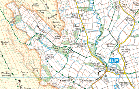
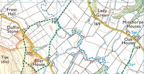
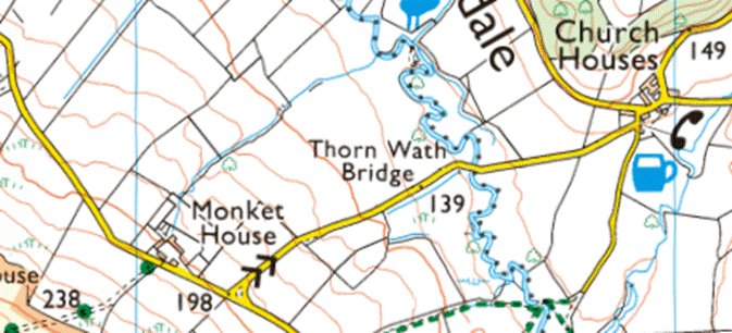

Yorkshire
Archaeological Society, Yorkshire Lay Subsidy 30 Ed. I (1301) The Subsidy:
Wapentake of Rydale, The Subsidy: Wapentake of Rydale, Pages 46-56, Yorkshire
Lay Subsidy 30 Ed. I (1301):
Farndale:
De Willelmo de Almeheved' ijs ixd o.
De Willelmo Ruddock' ijs iijd
De Nicholao Ruddock' iiijs vijd o.q.
De Willelmo Clerico xxiijd
De Willelmo Wakelevedy iijs ijd
De Nicholao filio Galfridi vd o.q.
De Thoma Kerelle xiijd
De Radulpho de Westgille iijs ijd o.
De Thoma de Birkeheved' vjd o.
De Willelmo de Monkegate iijd q.
De Willelmo ad Portam iijs iijd
De Johanne de Brannordale ijs vjd o.
De Rogero Bernard' xxjd q.
De Willelmo de Hoton' vd o.q.
De Hugone de Redmyre ijs vijd q.
De Nicholao de Ellrischaye iiijs vijd o.
De Roberto de Brakanthayt' iiijs vijd o.
De Harpino Coyly iiijd
De Waltero de Ellerscaye ijs ijd o.
De Ricardo Beverley ixd o.q.
De Willelmo Westgil' ijs vjd
De Roberto ad Pontem vjd o.
De Simone Molendinario vijs ixd o.
De Johanne serviente ejus iijd q.
De Stephano Alberd' ijs iijd q.
De Radulpho de Capite iijd q.
De Willelmo de Fademore iiijd
De Willelmo filio
Henrici vd o.q.
De Galfrido de Hoton' iijs vjd o.q.
De Roberto filio Golde vd
De Laurencio Syffewrythe iiijd
De Willelmo filio Rogeri iijs xjd o.q.
De Galfrido Saunder iijd
De Syther' vidua iiijd
De
Ada filio Johannis iijd o.q.
See FAR00029.
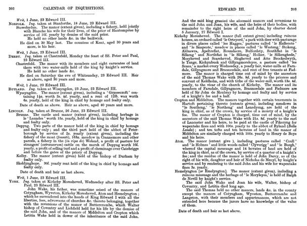
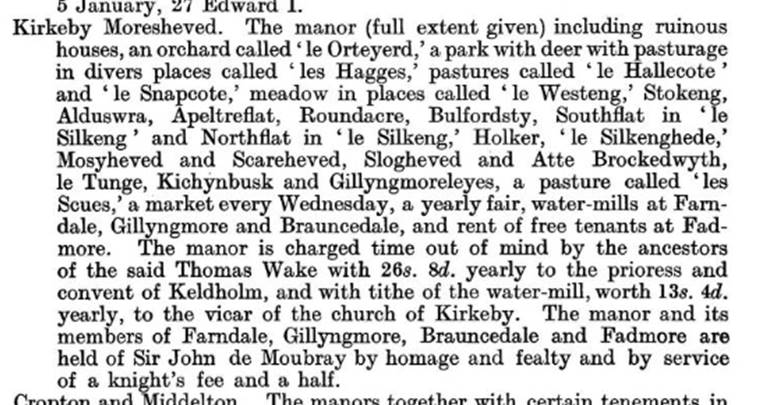

De Willelmo de Farndale was the first person in the
records who used the name Farndale outside of Farndale itself: De Willelmo de
Farndale (FAR00013),
living at Danby paid a tax of 3s in 1301 (Lay Subsidy).
1310
‘In 1310, 20 oxen the property of Nicholas the parker,
worth 8s, 6 oxen and 3 stirks of William in the horn worth £1 9s, a cow and a
stirk of Hugh Laverock 4s 8d and 6 oxen of William Stibbing
de Farndale…….’ (NRRY Vol III).
See FAR00033.
1323
In the Calendar of the Close Rolls, 22 August 1323: Pickering.
To the sheriff of York. Whereas it is found by an inquisition taken by William
de Ayremynne, Humphrey de Waleden, and John de Kylvyngton, by the oath of the
foresters, verderers, regarders, and other ministers at the forest of
Pickering, and of other lawful men of that county, that the following persons
committed trespass of venison in the forest after it came into the King's hands
as escheat by forfeiture of Thomas, late earl of Lancaster... that on Friday
the morrow of Martinmas, in the aforesaid year, Robert Capoun, knight, Robert
son of Marmaduke de Tweng, and eight unknown men with
bows and arrows and four greyhounds came to a place called ‘Ellerbek’, and
there took a hart and two other deers
(feras), and carried the venison away; and that on
Thursday before the Invention of the Holy Cross, in the aforesaid year, Robert
Capoun and seventeen unknown men came with bows and arrows and greyhounds to
the place called ‘Ellerbek’ against the assize of the forest for the purpose of
doing evil, but they took nothing; and that on Friday after the Translation of
Saint Thomas last, Adam (FAR00025)
son of Simon the Miller of Farndale, Richard son of John the Miller, and
three unknown men came to a place called ‘Petrenedle’,
and there took two hinds, and when they were proclaimed by the foresters, they left
one hind, which the foresters carried to Pykeryng
castle and the said malefactors carried the other away with them;... the King
orders the sheriff to take with him John de Rithre, and to arrest all the
aforesaid men and Juliana, and to deliver them to John de Kylvynton, keeper of Pykeryng castle, whom the king has ordered to receive them
and to keep them in prison in the castle until further orders.
‘At
Pickering before the Sheriff
of York in 1323, on Friday after the translation of St Thomas last, Adam son of Simon the miller of Farndale,
(21), Richard the son of John the miller three unknown men came to the place ‘Petrenedle’ and there took two hinds and when they were
proclaimed by the foresters they left one hind which
the foresters carried the other way with them...(long
list of other offenders)...... The King orders the
Sheriff to take with him John de Rithre and to arrest the aforesaid men and deliver
them to John de Kyltynton, Keeper of Pyckeryng Castle whom the King ordered to receive them and to keep them in prison
until further orders.’ Was this the
same Adam de Farndale, who would be 28 at the time which would fit? (Close
Rolls 22 August 1323, 17 Edward II page 15 and 16)
1324
John de Farndale (FAR00026) was
released from excommunication at Pickering Castle on 23 February 1324. This may
have related to a prior poaching offence.

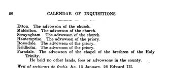
1325
An early planning dispute with the local
authority
The document relates to Thomas Wake’s costs for his service with
the King with foot soldiers at Berwick and Edinburgh. It also asks the King to
order that the Earls of Leicester and Richmond and Arundel be ordered to accept
one homage for Kirkby in the fee of Mowbray to pay off their demand for homage.
Of relevance to us, it also asks that the justice of the forest
should be commanded to deliver his wood of Farndale.
The King seems to have replied that he should deliver a writ to the justice of
the forest to certify the reason for taking the wood.

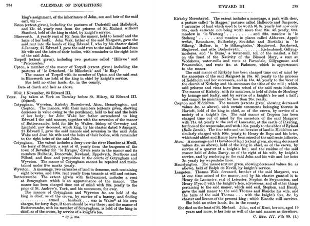
See FAR00039.
1327
Johanne de Farndale (FAR00026), paid taxes
at Crofton de Artoft of 2s 1d in 1327 (Lay Subsidy).
.
The 1327 Lay Subsidy
In late 1326 a popular rebellion led by Roger
Mortimer, 1st Earl of March resulted in King Edward II being deposed and
imprisoned. The King’s closest supporter Hugh le Despenser the elder, who was
lord of the manor of Fairford at that time, was captured and executed. The
King’s son was crowned as Edward III on 25 January 1327 and his father died, probably
murdered, while imprisoned in Berkeley Castle in September of that year.
However, as the new king was only 14 years of age at that time England was in
effect ruled by Mortimer and his lover Queen Isabella, Edward III’s mother. One
of the earliest pieces of legislation of the new reign was passed in September
to order a Lay Subsidy, a nationwide tax of the laity intended to raise money
to renew hostilities against Scotland which Edward II had pursued
unsuccessfully for some years.
The Lay Subsidy of 1327 was a flat rate tax of one
twentieth of the value of each person’s moveable goods, hence the tax is also
known as the Twentieth. The majority of moveable goods
were cattle, sheep and crops and therefore the tax fell harder on the rural
population than it did on those in the major towns. Two prominent local men in
each county were appointed as Chief Taxers, those for Gloucestershire being Sir
William Tracy and Robert de Aston. They then appointed other local men, known
as Subtaxers, to conduct the assessment and collect
the money from people. Those who were taxed included everyone from the lord of
the manor down to his peasant tenants (both freemen and serfs), traders and
craftsmen as long as they had moveable possessions
worth at least 10 shillings. The list of names, the Roll, was drawn up and sent
to the Exchequer in Westminster for approval. The assessment took some time to complete and it was not until between February and June of
1328 that the money was actually collected.
Lay Subsidy Records 1327 for Farndale?
1333
Johanne de Farndale (FAR00026), paid
taxes of 2s at Crofton cum Hartoft in 1333 (Lay Subsidy).
Lay
Subsidy Records 1332/1333 for Farndale?
1336
John de Farndale (FAR00026), bail by
him for poaching, given at Pickering before Richard de Wylughby and John de Hainbury
on Monday 2 Dec 1336 (Yorkshire Fees).
30 July
1345
‘At Reading. Licence for the alienation in Frank Almoin by Thomas
Wake of Lyde to the friers of the Holy Order of the Holy Cross of a toft and
10 acres of land in the moor of Blakenhowe in Farndale, for them to found a house of the Order there and to build an Oratory
and dwelling houses.’ (Patent Rolls)
1346
The
thirty fifth year of the reign of Edward III (1312 to 1377) was 1346.
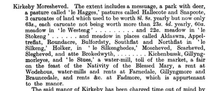
1347
A History of the County of York:
Volume 3. Originally published by Victoria County History, London, 1974, The
Religious Houses of Yorkshire: The different orders of
friars were well represented in the county. In York itself there were houses of
Dominicans, Franciscans, Carmelites, Austins, and of the short-lived Order of
the Sack. In 1257 Walter de Kirkham, Bishop of Durham, granted 4 acres of land
at Osmotherley for the establishment of a priory
of Crutched Friars, and in 1347 Thomas Lord Wake of Liddell had royal
licence to grant a toft and 10 acres in Blakehowe
Moor in Farndale for the foundation of a house of the same order, but in
neither case does the design seem to have been carried out. See FAR00039.
Inquisitions
Post Mortem, Edward III, File 155, pages 540-556,
Calendar of Inquisitions Post Mortem: Volume 10,
Edward III. Originally published by His Majesty's Stationery Office, London,
1921: Inquest taken at Buttercrambe,
Thursday after the Purification, 35 Edward III. Cotyngham
and Wytheton. The manors held of the king in chief as
of the crown by homage and fealty and by service of a barony and by service of
finding a mounted esquire suitably armed to bear the king’s coat of mail
(lorica) in the war in Wales for forty days at his own costs, if there is war
in Wales. Buttercrambe. The manor held of the king in
chief as of the crown by homage and fealty and by service of a knight’s fee. Kirkeby
Moresheved. The manor, with lands &c. in Farndale,
Gillyngmore, Brauncedale
and Fademore, held of John de Moubray by homage
and fealty and by service of a knight’s fee and a half.
1349
Thomas
Wake remained in possession of his lands until he died in 1349.
His
heir was his sister Margaret, wife of Edmund Earl of Kent, whose son John
succeeded her.
1350
‘In 23 Ed III. Inquisition taken at Kirby Moorseved refers to an early fair in Farndale.’ (Patent Rolls). See FAR00041.
23 Edward III = 25 January 1349 to 24
January 1350 - https://www.medievalgenealogy.org.uk/cal/reg11.htm
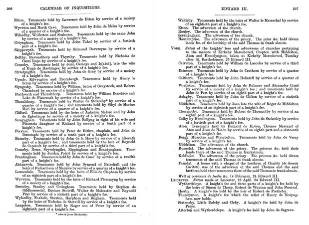

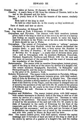
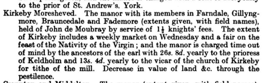
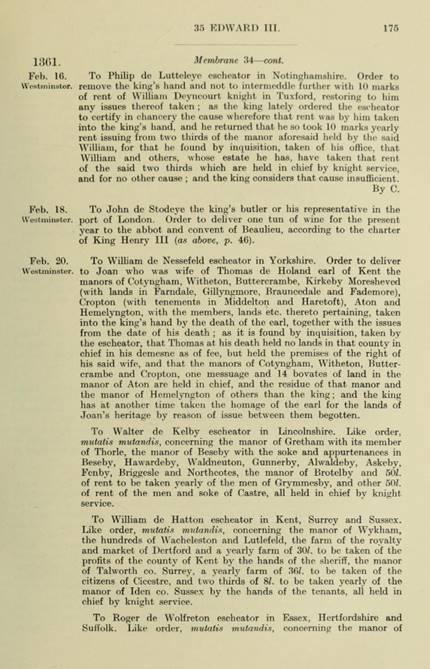
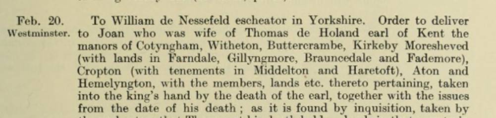
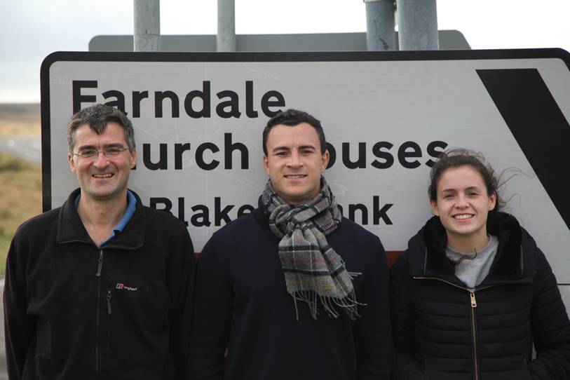
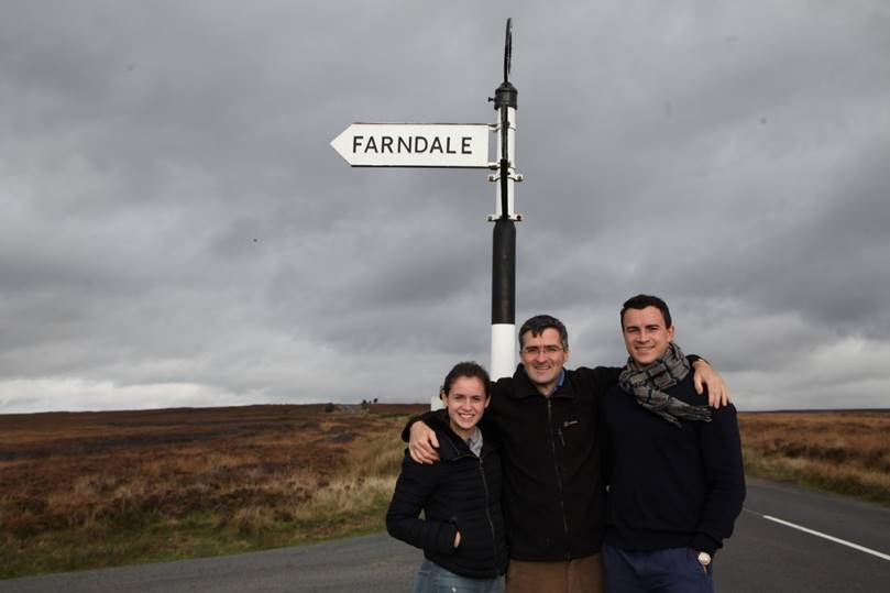
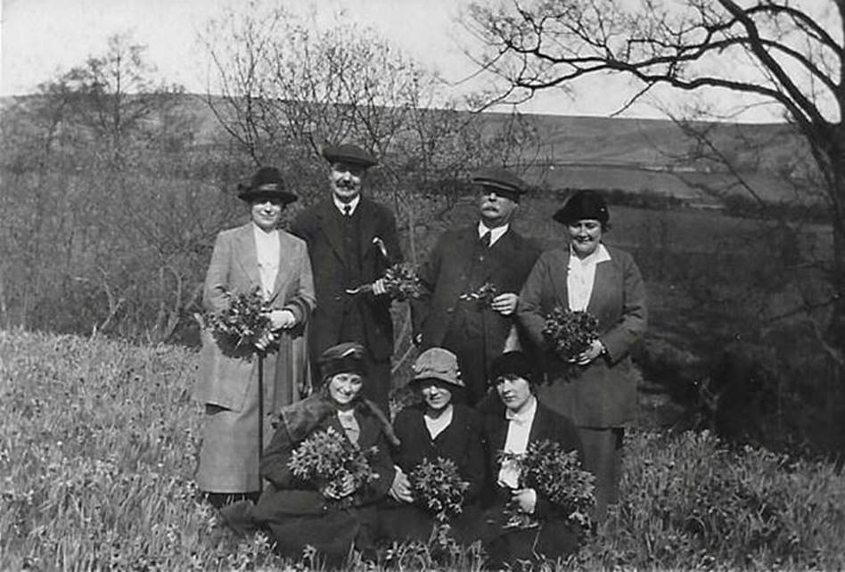
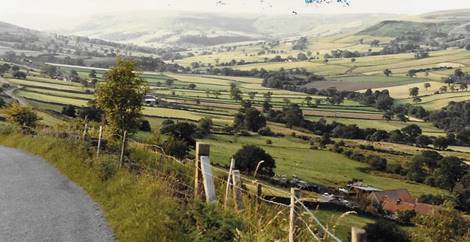
Calendar
of Inquisitions Post Mortem: Volume 9, Edward III.
Originally published by His Majesty's Stationery Office, London, 1916: Inquest
taken at Kirkeby Moresheved, Wednesday after SS.
Peter and Paul, 23 Edward III. John Wake, his father, was sometime seised of the manors of Cotyngham,
Wyveton, Kirkeby Moresheved,
Aton and Hemelyngton; which he surrendered into the
hands of King Edward I with all the liberties, fees, advowsons of churches
&c. thereto belonging, together with the reversions of the manor of Buttercrambe, which Walter bishop of Coventry and Lichfield
held for his life by the demise of the said John, and of the manors of
Middelton and Cropton which Letitia Wake held in dower of the inheritance of the
said John. And the said king granted the aforesaid manors and reversions to the
said John and Joan, his wife, and the heirs of their bodies, with remainder to
the right heirs of the said John, by charter dated 5 January, 27 Edward I. Kirkeby
Moresheved. The manor (full extent given) including
ruinous houses, an orchard called ‘le Orteyerd,’ a
park with deer with pasturage in divers places called ‘les Hagges,’ pastures
called ‘le Hallecote’ and ‘le Snapcote,’
meadow in places called ‘le Westeng,’ Stokeng, Alduswra, Apeltreflat, Roundacre,
Bulfordsty, Southflat in
‘le Silkeng’ and Northflat
in ‘le Silkeng,’ Holker, ‘le Silkenghede,’
Mosyheved and Scareheved, Slogheved and Atte Brockedwyth,
le Tunge, Kichynbusk and Gillyngmoreleyes, a pasture called ‘les Scues,’
a market every Wednesday, a yearly fair, water-mills at Farndale, Gillyngmore and Brauncedale, and
rent of free tenants at Fadmore. The manor is charged
time out of mind by the ancestors of the said Thomas Wake with 26s. 8d. yearly to
the prioress and convent of Keldholm, and with tithe
of the water-mill, worth 13s. 4d. yearly, to the vicar
of the church of Kirkeby. The manor and its members of Farndale, Gillyngmore, Brauncedale and Fadmore are held of Sir John de Moubray by homage and
fealty and by service of a knight’s fee and a half.
1352
John
died three years later, however, without issue, and his sister Joan, 'the fair
maid of Kent,' was his heir.
1353
27 Edward III = 25 January 1353 to 24 January 1354 - https://www.medievalgenealogy.org.uk/cal/reg11.htm
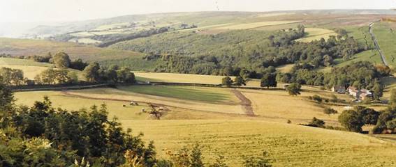
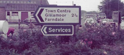
Inquisitions
Post Mortem, Edward III, Files 118 and 119, Pages
41-57, Calendar of Inquisitions Post Mortem: Volume
10, Edward III. Originally published by His Majesty's Stationery Office,
London, 1921: Inquest taken at York, 3 February, 27 Edward III. … Kirkeby
Moresheved. The manor with its members in
Farndale, Gillyngmore, Brauncedale
and Fademore (extents given, with field names), held
of John de Moubray by service of 1 1/2 knights’ fees. The extent of Kirkeby
includes a weekly market on Wednesday and a fair on the feast of the
Nativity of the Virgin; and the manor is charged time out of mind by the
ancestors of the earl with 26s. 8d. yearly to the prioress of Keldholm and 13s. 4d. yearly to the vicar of the church
of Kirkeby for tithe of the mill. Decrease in value of land &c. through the
pestilence.
1358
On 15 Oct 1358, a
pardon was given by the Sergeant at Arms to William Attwode for having
enfeoffed John de Banaby and William Farndale (FAR00034),
chaplains of the Manor of Derleye, held in chief, and
then re-entered into the Manor, which they quit-claimed to him without the
King’s licence and grant that he shall retain the same fee.’ (Patent Rolls).
1360
The Fair
Maid of Kent’s first husband was Thomas Holand, created Earl of Kent in 1360,
by whom she had a son and heir Thomas Holand.
1361
The Close Rolls, 20 February 1361, 35 Edward III:
Feb 20, Westminster. To William de Nessefeld escheator in Yorkshire. Order to
deliver to Joan who was wife of Thomas de Holand earl of Kent the manors of
Cotyngham, Witherton, Buttercrambe, Kirkeby Moresheved
(with lands in Farndale, Gillyngmore, Brauncedale and Fademore), Cropton
(with tenements in Middleton and Haretoft), Aton and Hemelyngton, with the members, lands etc thereto
pertaining, taklen into the king’s hand by the death
of the earl, together with the issues from the date of his death; as it is
found by inquisition, taken by the escheator, that Thomas at his death held no
lands in that county in chief in his demesne as of fee, but held the premises
of right of his said wife, and that the manors of Cotyngham,
Witherton, Buttercrambe and
Cropton, one messuage and 14 bovates of land in the manor of Aton are held in
chief, and the residue of that manor and the manor of Hemelyngton
of others than the king; and the king has at another time taken the homage of
the earl for the lands of Joan’s heritage by reason of issue between them
begotten.
See FAR00046A.
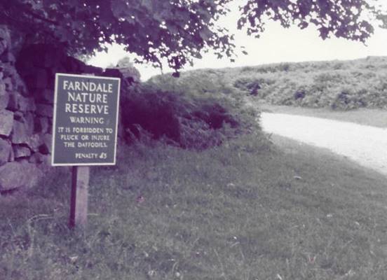
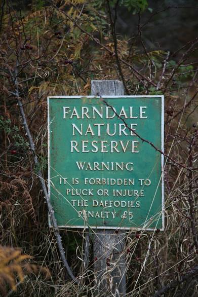
1365
Later
Joan, the Fair Maid of Kent married Edward the Black Prince, with whom in 1365 she
settled this manor on Thomas Holand and Alice his wife and their heirs, with
reversion to the prince and herself.
1384
There appears to
have been a significant cattle and horse rustling expedition in 1384 involving
John Farndale (FAR00042A).
Calendar
of Patent
Rolls,1381-1385, 8 Richard III Part I – page 507 and 508: ‘On 10 Dec
1384, At Westminster. Commission of Oyer and Terminer. John Farndale and
others broke their close, houses and hedges at Wittonstalle
and Fayrhils, Co Northumberland and seized 30
horses, 20 mares, 100 oxen and 100 cowes valued at
£200 and carried them off with goods and chattels, assaulted his men,
servants and tenants and so threatened them that they left his service. For 13s
4d paid the hanaper.’
1386
In
1386 Thomas Holand complained that various persons 'besieged Kirby Moorside,
assaulted men and merchants about their business in the market there, and created
such a disturbance that those of that country dared not come to the place; so
threatened his tenants and servants that they dared not come to their lands or
do their services, broke his park and close, entered his chase and warren,
hunted therein without leave, felled trees, fished in his several fishery and
took away fish, trees and other goods and chattels.'
1388
19
November 1388. Licence for the inhabitants of Farndale (Ferndall) to
have masses celebrated in the chapel of Farndale (the York
Archbishop Registers).
1396
On 19 April 1396, ‘Pardon to Robert de Wodde of Farndale,
for the death of John Hawlare of Kirby Moorseved,
killed there on Monday, the eve of the Purification in the 18th year.’
(Patent Rolls). See FAR00053.
1397
In
1397 Thomas Earl of Kent died, and Alice was left in possession for life.
There
was a serious armed robbery. Calendar of Patent Rolls, Richard II, 1396 to 1399, 21
Richard II Part III, 1398, page 365: ‘May 2, At Westminster. Commission of Oyer and Terminer to
Henry de Percy, earl of Northumberland, John Depeden, knight, Thomas Colvyle
the elder, knight, John Markham, William Gascoigne, Richard de Norton, John de
Burgh, William de Nenson, and Miles de Stapilton, on complaint by High
Gascoigne, parson of Staynegreve, that Peter de Clay,
son of John de Clay of Fadmore, Richard de Thornton
of Neuton, Thomas Wolthwayt of Farnedale,
William Irpe, John de Bolton, ‘coseur’, Robert de
Thornton of Neuton, John del Clay of Fadmore, Richard del Clay, Richard Candy, Thomas de
Crathorne the elder, Adam Helmeslay, and other armed malefactors broke his
close and houses at Steingreve, assaulted him, fished
in his several fishery there, and took away his fish and goods and chattels
to the value of 200 marks as well as 1000 marks in money, and assaulted
his men and servants. For 4 marks paid in the hanaper.’ See FAR00054.
1399
Of
her sons, Thomas the elder was beheaded as a traitor in 1399 and his brother
Edmund died before his mother in 1408, when the earldom of Kent fell into
abeyance.
The
heirs of Edmund were Edmund Earl of March, son and heir of his eldest sister Eleanor,
and the four sisters of Eleanor—Joan Duchess of York, Margaret wife of Thomas
Duke of Clarence, Eleanor wife of Thomas Earl of Salisbury, and Elizabeth wife
of Sir John Nevill, kt.
Kirkbymoorside
seems to have been assigned with Great Ayton and Hemlington to Elizabeth
Nevill.
1446
There
is a reference to William Thornburgh of Farndale, a collector of taxes in the
North Riding in The Fine Rolls, 1446, 24 Henry VI, page 39.
1473
Ralph
second Earl of Westmorland, son of Elizabeth, was in possession of the 'manor'
in 1473, when he granted it to Sir Ralph Nevill, kt., his nephew.
1499
The
latter succeeded him and died in possession in 1499, leaving a grandson and
heir Ralph.
Ralph
was succeeded by his son and heir Henry, who appears to have leased the house
and park here to his brother Christopher Nevill.
1539
In
1539 to 1440, Sir Ralph Eure and Sir
Nicholas Fairfax mustered men from the Ryedale communities including 83
from Farndale, 71 from Kirkbymoorside (The History of Ryedale, John
Rushton, 2003, page 161).
1569
Both
Christopher and his nephew Charles, the next Earl of Westmorland, were
implicated in the Yorkshire rebellion of 1569 and were attainted.
Kirkby
Moorside was thus forfeit to the Crown. At the time of the attainder, however,
the manor was held by Lady Gascoigne, widow of Henry Earl of Westmorland, for
life. Her right had been disputed by Charles, who had forcibly entered into
possession of the manor, but she apparently made good her claim, and had leased
it to Ralph Bowes, farmer.
On
her death he made suit to the Crown to have his lease continued; this was
granted, and his lease was again renewed in 1571, 1592 and 1595.
1570
Further
confirmation of this pattern is later given in surveys of 1570 and 1610, both
of which give names of many more extant farms.
The
1570 document described 71 tenements in Farndale, 40 on the east side and 31 on
the west, together with two mills and a few cottages paying altogether just
over £54 in rent.
Humberston’s
Survey, 1570
After
the suppression of the rebellion, which raged in the north of England during
the months of November and December, 1569, usually called
the Rising in the North, the estates of the leaders were forfeited by their
subsequent attainders, and came into the hands of Queen Elizabeth. With the
object of ascertaining their value and condition she sent, in the spring of the
following year, certain Commissioners to survey them. The Commission was issued
on March 10, 1569-70, and directed to Edmund Hall and William Humberston. The
return made by these two Commissioners, in two volumes, is preserved amongst
the Exchequer papers in the Public Record Office, and
is known by the title of "Humberston's Survey."
The
view and surueie of the lordship of Kyrkeby Moresyde, in the county of Yorke, parcell of the possessions of Charles, late erle of Westmerland, wyth all his rightes, membres and appurtenaunces, and
of all the landes and possessions in Famedale, Braundesdale, Fadmore, and Gyllymore, parcell of the sayd manour, made by Edmond Hall, William Homberston, and John
Jenkyns, the seyxt of June in the yere aforsaid (1570). And the said lordship ys
within foure myles of
Malton in Ryedale, and in th'est parte
of the county of Yorke, in the edge of the moreland,
and ys a very stately lordshipp,
and extendyth into the townes,
hamlettes, and dales of Farnedale,
Braundesdale, Fadmore, and Gyllymore, and ys in compas aboue xxvj
miles, and inhabyted with many welthy and substancyall men, and haue very good fermes by
reason of the greate and, large comons
and wastes; and all the tenauntes, except the towne of Kyrkeby, hold their fermes and tenementes by
indenture for terme of yeres,
whiche are very fynable landes, after the leases be determyned.
And the towne of Kyrkeby is
a market towne, inhabyted
all with pore people, and hold their cotages by copye of courte roll to them and
to their heyres, accordyng
to the custome of the manour,
payeng certeyne rentes, customes, and servyces, and haue no landes or other comodytes to theyr cotages, so as their rentes must of necessyte decay, onles the comens which Henry,
late erle,* toke from the tenauntes, aboute viij or ix yeres past, and
enclosed them, whiche was th'only
releyf of the inhabitauntes
of the towne, wherein they kept euery
man one, twoo, or three kyen,
for the releyf of themselves, their wyves and chyldren.
The scyte of the manour ys scytuat in throne syde of the parke, buylded of stone, and covered parte
with leade and parte with
slate, and served for a removyng house for th'erles, when their pleasure were
to come to hunt and take pastyme in that country. The
house is but symple for an erle,
but a good house for a gentleman of worshipp; and the
demeane very good and batefuU for corne
and gresse, and greate
plenty of mewn ground, lyeng
by a fayre ryver," suffycyent
for the provysyon of a house for any gentleman of
worship.
The parke adioynyth to the scyte of the manour, very well
planted with wood and tymbre, wherin
are large laundes, and ys
well replenyshed with fallow deere, and conteynyth in compas two myles and a half, and in measure, by the pole of xxj fote, clxxvij
acres, wherin ys one keper,' which hath for his stipend yerely
\xs, y'ujd.y
and suche other casuall comodytes and proffittes as to
the sayd office apperteynyth.
(The
Yorkshire Archaeological Journal, 1893, Vol 17, p146)
1577
Christopher Saxton’s Map of Yorkshire, 1577


1830
House
of Lords Journal Volume 63: 16 November 1830', in Journal of the House of
Lords: Volume 63, 1830-1831 (London, [n.d.]), pp. 51-101:
Farndale: Also, Upon reading the Petition of the
Members of a Society and Congregation of Wesleyan Methodists worshipping at the
Wesleyan Methodist Chapel, Farndale, in the County of York, whose Names are
thereunto subscribed …
1848
A Topographical
Dictionary of England. Originally published by S Lewis, London, 1848: FARNDALE,
a chapelry, in the parish of KirkbyMoorside, union of
Helmsley, wapentake of Ryedale, N. riding of York, 13 miles (N. W.) from Pickering;
containing 463 inhabitants, of whom 188 are in Farndale Low Quarter, and 275 in
Farndale West or High Quarter. These two townships together comprise about 9780
acres, whereof 6220 are in the latter, which is situated on the west of the
river Dove. The chapel has lately been enlarged. FARNDALE-EASTSIDE, a chapelry,
in the parish of Lastingham, union of Helmsley, wapentake of Ryedale, N. riding
of York, 5 miles (N.) from KirkbyMoorside; containing
383 inhabitants. It occupies the east side of the higher part of the deep
moorland dale of the river Dove, and comprises 9103 acres, of which 6341 are
waste land or common. The tithes have been commuted for £33. 15. payable to the
Archbishop of York, and £21 to the vicar of the parish, who has a glebe of 1½
acre. The chapel is a small edifice.
1858
The
Rosedale Railway was a 31.4 km goods only railway line
running from Battersby Junction via Ingleby Incline, across the heights of the North
York Moors to reach iron ore deposits in the remote hills of the Rosedale
valley. It opened to traffic as a narrow gauge railway
to Ingleby Incline top in 1858, converted to standard gauge and opened to
Rosedale West in 1861. It closed completely in 1929. Apart from Ingleby
Incline, no major engineering works were constructed, and as such, particularly
the east branch, the railway followed the contours of the surrounding hillside.

It passed
across the heights of the northern end of Farndale including through a cutting
of Middle Head, the realm of the medieval Edmund the Hermit. There is a walk
from the Lion’s Inn and Blakely How which passes along the northern edge of
Farndale, along the line of the old railway.
1870
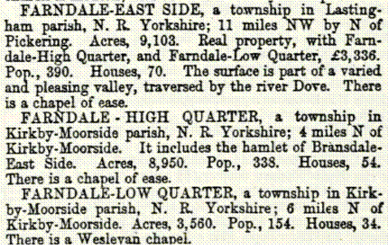
(John
Marius Wilson. 1870. Imperial Gazetteer of England and Wales, Volume 2, page
694).
1886
The church
of St Nicholas and St Mary, Bransdale-cum-Farndale, was built in 1886 to
replace an earlier structure. It consists of chancel, nave, south porch and
small western tower containing two bells.
1933
Hull
was empowered in 1933 to obtain water from Farndale, but the scheme was not
proceeded with after the Second World War. In 1952 the corporation bought the Elloughton and Brough Water Company, and new works were
completed on the River Hull, in Watton parish, in 1959 (A History
of the County of York East Riding: Volume 1, the City of Kingston Upon Hull.
Originally published by Victoria County History, London, 1969).
The Farndale Hunt
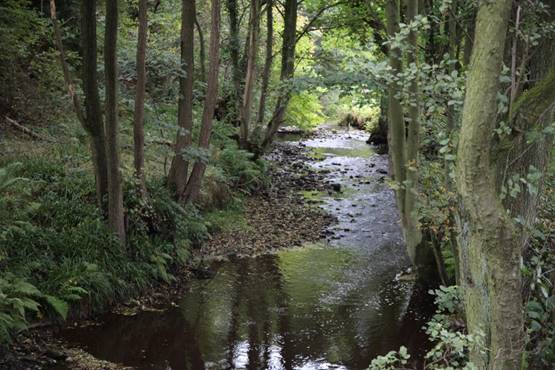
https://www.facebook.com/farndalehunt
There
are multiple newspaper articles about the Farndale hunt.
(Ripon
Observer, 15 January 1914)
Wordsworth’s Farndale
William Wordsworth, married only a few miles from
Farndale.
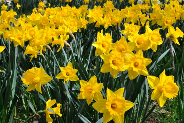
|
I
wandered lonely as a cloud |
Continuous
as the stars that shine |
The
waves beside them danced; but they |
For
oft, when on my couch I lie |
Tradition
says that they were planted by monks from nearby Rievaulx Abbey.
To
explore the daffodils in the Spring, the traditional walks starts
at the tiny hamlet of Low Mill, a cluster of stone houses. Its 100-seat, corrugated-iron-clad
hall was built for Farndale Silver Band in the 1920s. The signed footpath from
the car park in Low Mill joins the riverside walk beside the River Dove.
Farndale
has been a nature reserve since 1953 and strict
by-laws prohibit picking the flowers or uprooting the bulbs.
The
riverside path passes through many gates to reach High Mill. Two supernatural
presences once inhabited this area: one was a tenacious hob – a mischievous spirit
– that fell out with a local farmer. When the farmer tried to move house, the
hob mounted the removal cart, so the farmer stayed put. The other ghost is Sarkless
Kitty, a local girl who drowned herself, in her chemise (sark). Over
the years, Kitty’s ghost was seen sitting naked in Farndale’s trees, waving her
sark to signal the deaths of young men. Follow the lane to Church Houses.
Farmers
petitioned the local landlord for a pub in 1875 and the
inn was named after him, the Feversham Arms. Pass the pub and veer right to the
church; there are more daffodils in the churchyard. Follow the lane uphill.
Just past Mackeridge House turn right on a clearly
signposted footpath to Bragg Farm and Bitchagreen Farm.
Enjoy
great views over Farndale from this section. Jet, coal and iron ore were once
mined in the valley, but the greatest threat to its beauty came in the
twentieth century.
In the
1930s and the 1960s, there were plans to dam and flood the valley as a
reservoir for Hull. Both were defeated by conservationists. From Bitchagreen
Farm, continue south on clearly marked paths back to High Wold House and
finally Low Mill.
Farndale, a photographic
journey
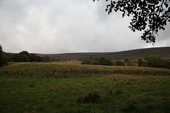
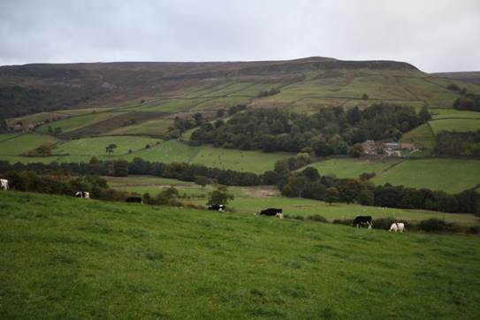
Richard
Farndale, Jamie Farndale and Sarah Farndale in 2016
Sarah,
Richard
and Jamie
Farndale at Farndale in 2016
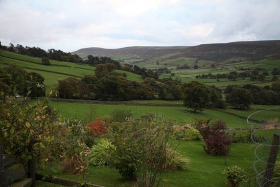
Dorothy
Farndale (centre front) and Grace
Farndale (right front) at Farndale in about 1922
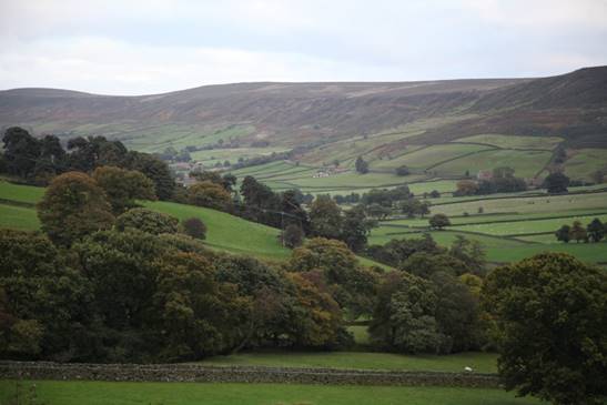
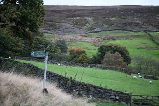
Farndale views in 1980
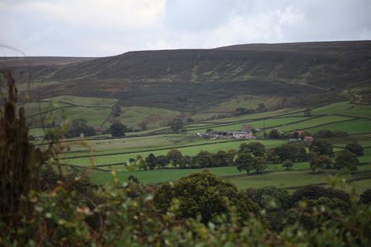
Farndale sign at Kirkbymoorside in
1980
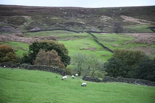
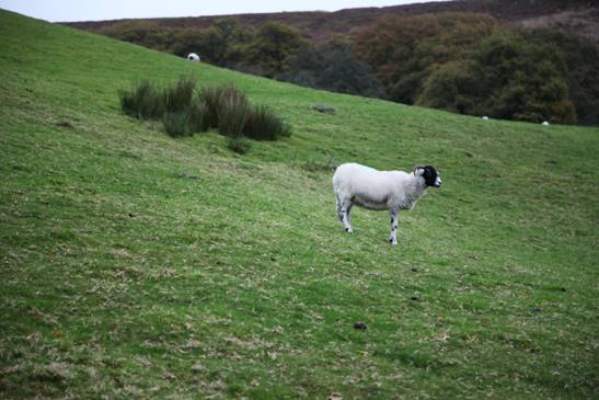
Photograph of the sign in
1980
There’s no inflation in Farndale! The fine
was still five pounds in 2016!
A suggestion in 1914:
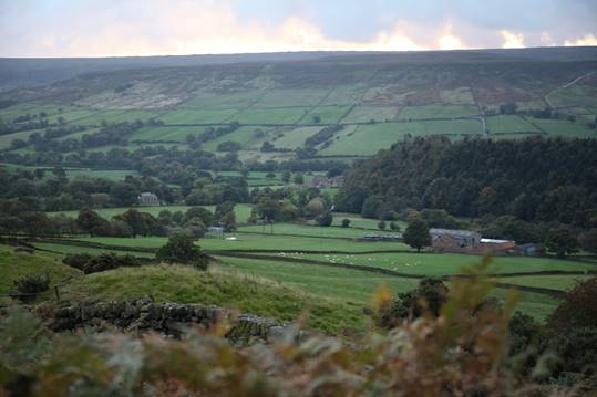
(Yorkshire Post and Leeds
Intelligencer, 31 March 1914)
Farndale, a photographic journey
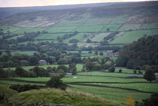
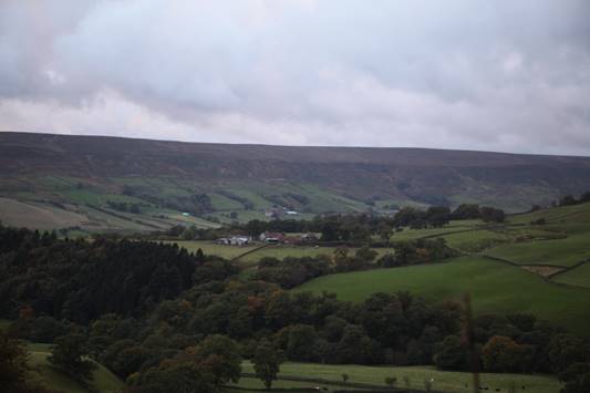


Links, texts and books
The Ryedale
Historian
Volume
1, 1965, page 7, Notes on the History of Farndale in the Middle Ages, Arthur H
Whitaker.


Volume 1, April
1966


Gillamoor and Fadmoor
(Ryedale Historian Vol 4 1969)


Life in Ryedale in the 14th century
(Ryedale
Historian Vol 8 1976)


(Ryedale
Historian Vol 9 1978)


Mesolithic records including Farndale (Yorkshire
Archaeological Journal, Vol 42, 1966, p 314 317 318 320 321 322)
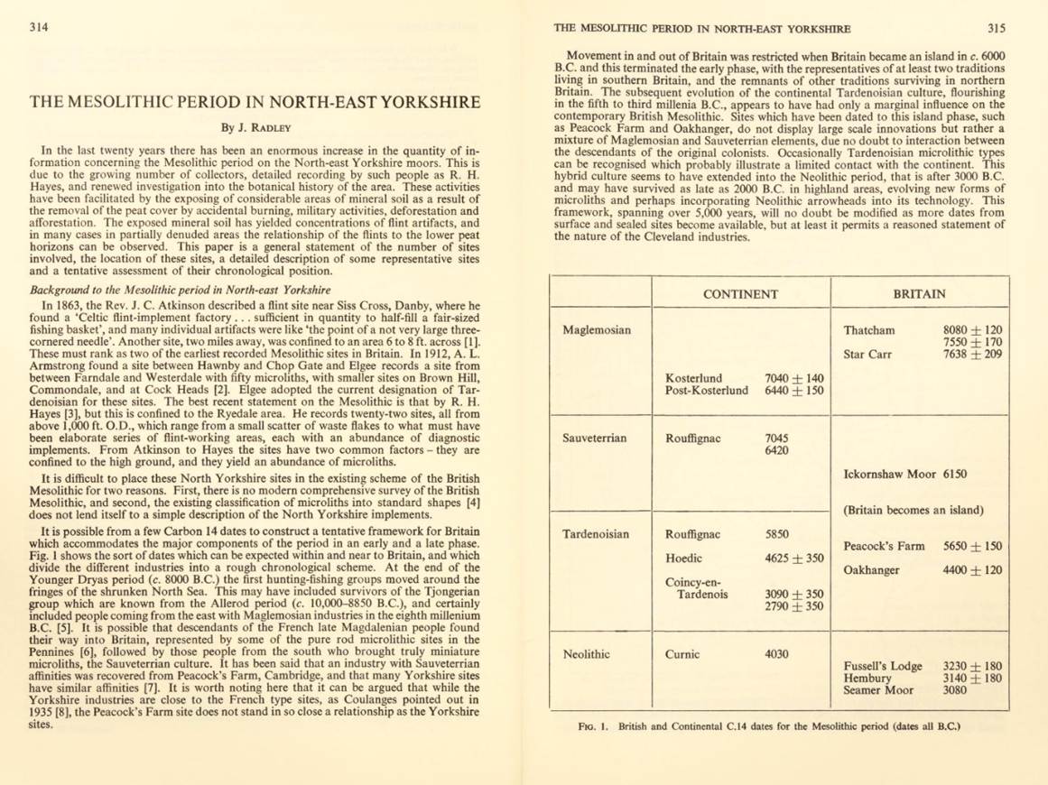
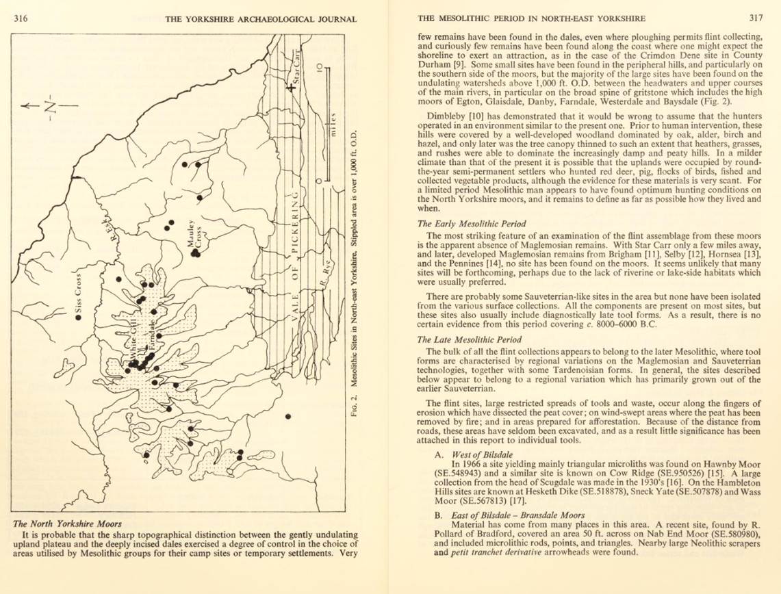
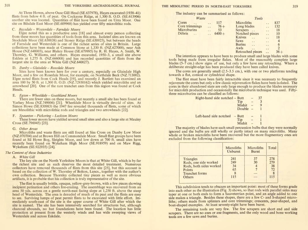
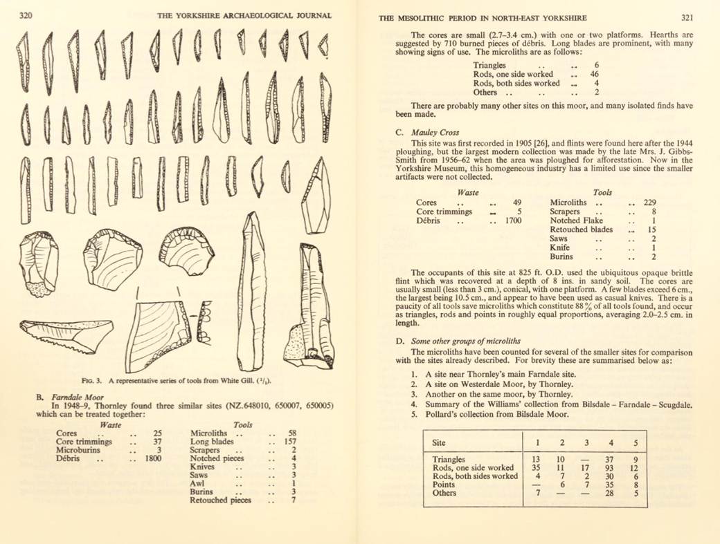
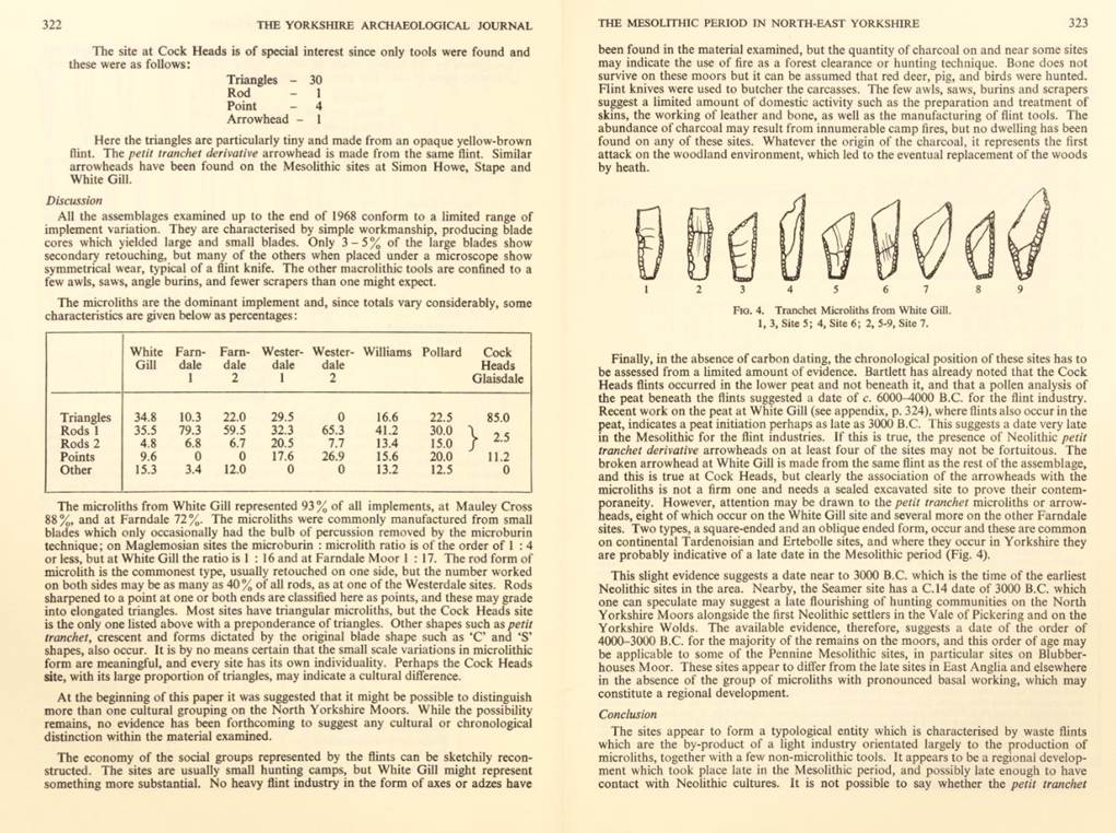
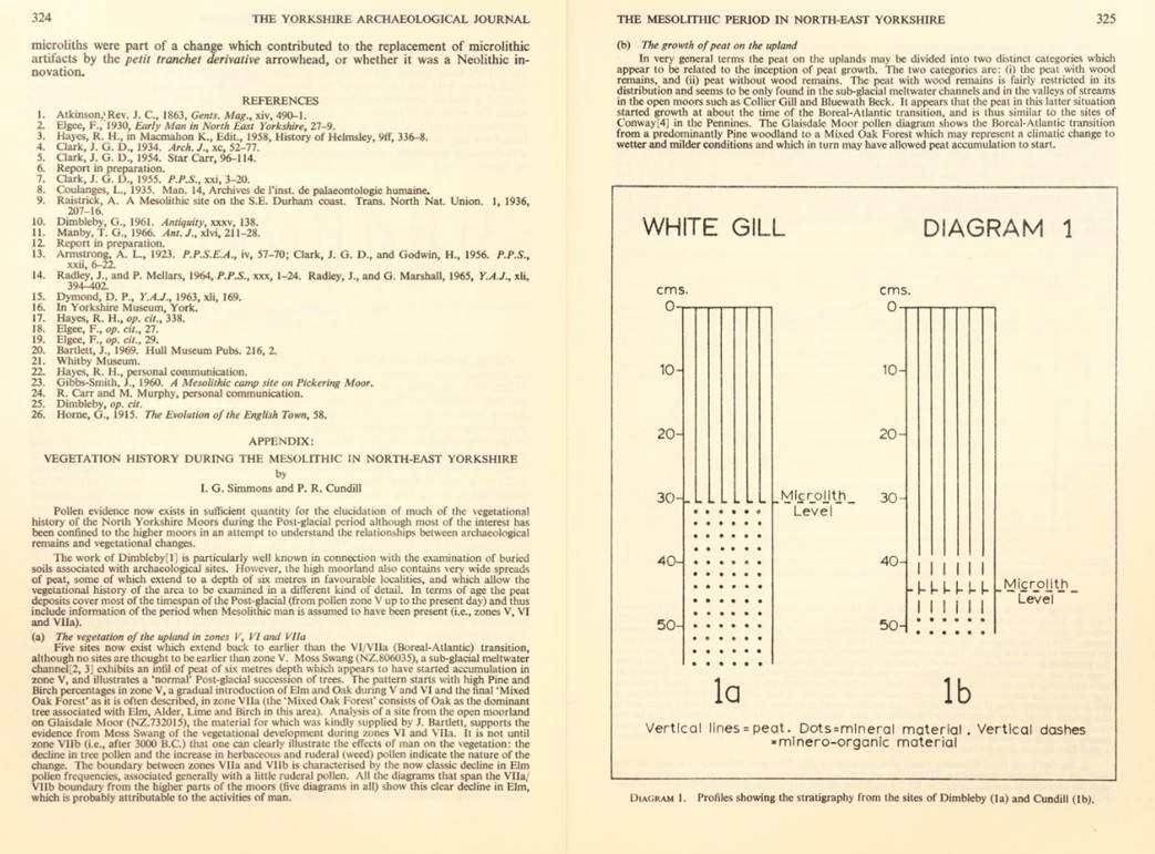
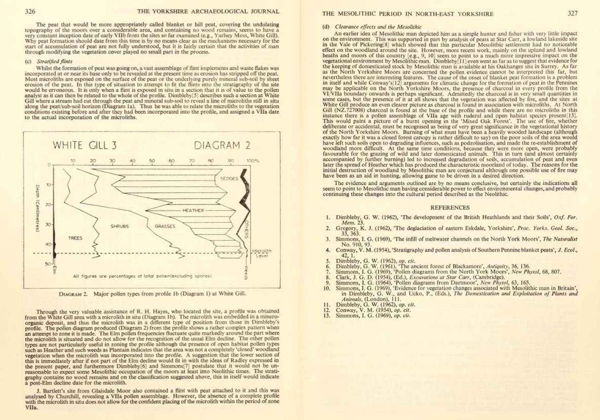
Early Yorkshire
Charters Stuteville, 1952, Yorkshire Archaeological Society, pages 19, 87
to 88, 92. 93n, 94, 203