The Cradle
One
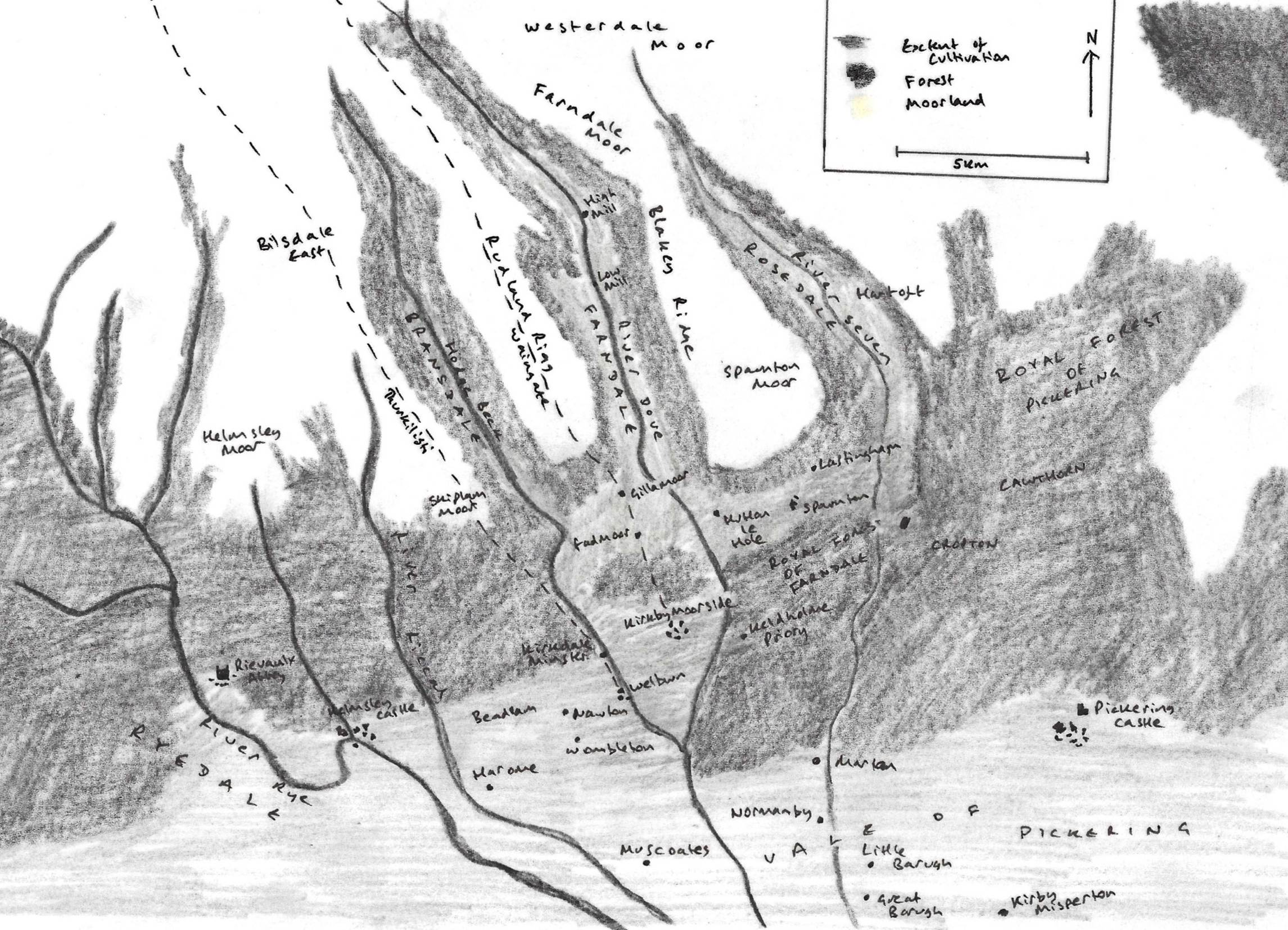
of five dales which run southwards from the central watershed of the North York
Moors, Farndale was a forested wilderness until the eleventh century when it
became a nominal part of the estate of an elite class. Its name first appeared
in 1154 when two small parcels of land were given to the Cistercian monastery
of Rievaulx. Its southern reach was concurrently subsumed into the growing
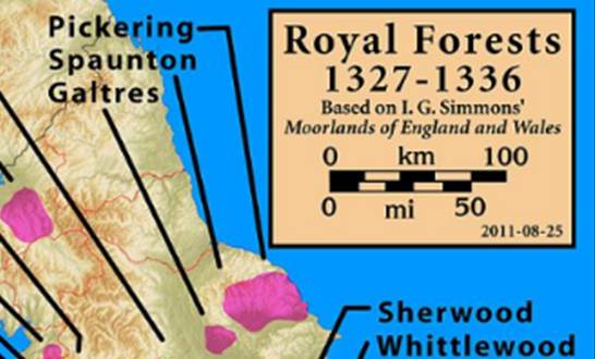
royal forests of Pickering and Galtres. In the
thirteenth century the lay elite landowners began to clear large areas of the
dale for settlement by a villein class who, over time, became tenanted farmers.
This was a period of tension between the monastic, royal and lay interests.
Those of lower status who occupied the dale came off worse from that tension,
particularly in their encounters with a draconian forest law which challenged
their traditional freedoms. Nevertheless, by the fourteenth century there was a
burgeoning population and the evidence allows us to build a vibrant picture of
life in the dale, and the individuals who lived there.
This is the story of Farndale as it
first blinked into the historical record.
Scene 1 – The emergence of Farndale from the
mists of time
Wilderness
A
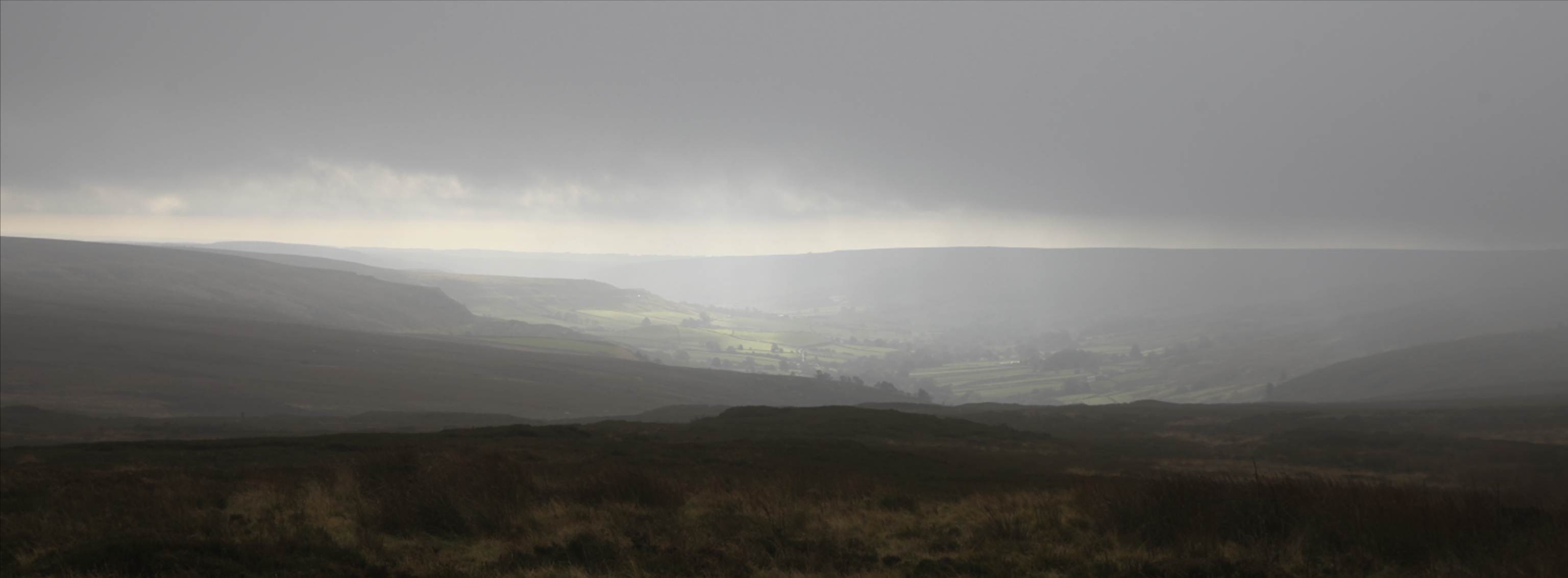
traveller in the mid twelfth century who looked down from the moorland on
Blakey Ridge into the wilderness that would soon become known as Farndale would
have seen the canopy of an expanse of forest that filled the valley and
continued southward to the edge of the Vale of Pickering. This was frontier
country at the edge of civilisation.
There
is evidence that the forest had once spread onto the high ground as well as
through the dales[1]. At Burton Howe, northwest of the head of
Farndale, the forest was still dense in the Bronze Age.
The
surrounding heights on Westerdale and Rudland Rigg provide some of the richest
flint tool sites in Britain[2]. Raymond Hayes interpreted a rich find of
flints on Rudland Rigg at Three Howes as a temporary camping site in a forest
clearing once occupied by hunters following red deer[3]. Close by, an ancient standing stone that
sits beside the main track was called the cam maen
or bank stone by Celtic Iron Age incomers.
Flint
arrowheads and an urn were found on Stony Ridge on Farndale slope[4]. Bronze Age barrows overlook the dale from
the moors. The round barrow at Blakey Howe marks the remains of a prehistoric
funerary monument and the promontory of Horn Ridge[5] which juts from the western slope into
Farndale, is rich with relics of the Bronze, Celtic and Roman ages. In the
second or third century CE a Roman soldier had dropped his bronze arm purse
there, near a prehistoric cairn overlooking the dale[6].
Yet,
after Cedd had founded the monastery at Lastingham, only a couple of kilometres
from the mouth of the dale, centuries later in 653 CE, Bede told us that Cedd
had found a land vel bestiae
commorari vel hommines bestialiter vivere conserverant, ‘fit only for wild beasts, and men who
live like wild beasts’[7].
Human
encounters with the dale over eons of time were, like our imaginary twelfth
century traveller, observations made from above the dale and not the experience
of folk who lived there.
The
deep slumber continued through the Saxon and Scandinavian periods, but by the
eleventh century, Orm Gamalson, Yorkshire’s Hrothgar[8], held lands across the region which included
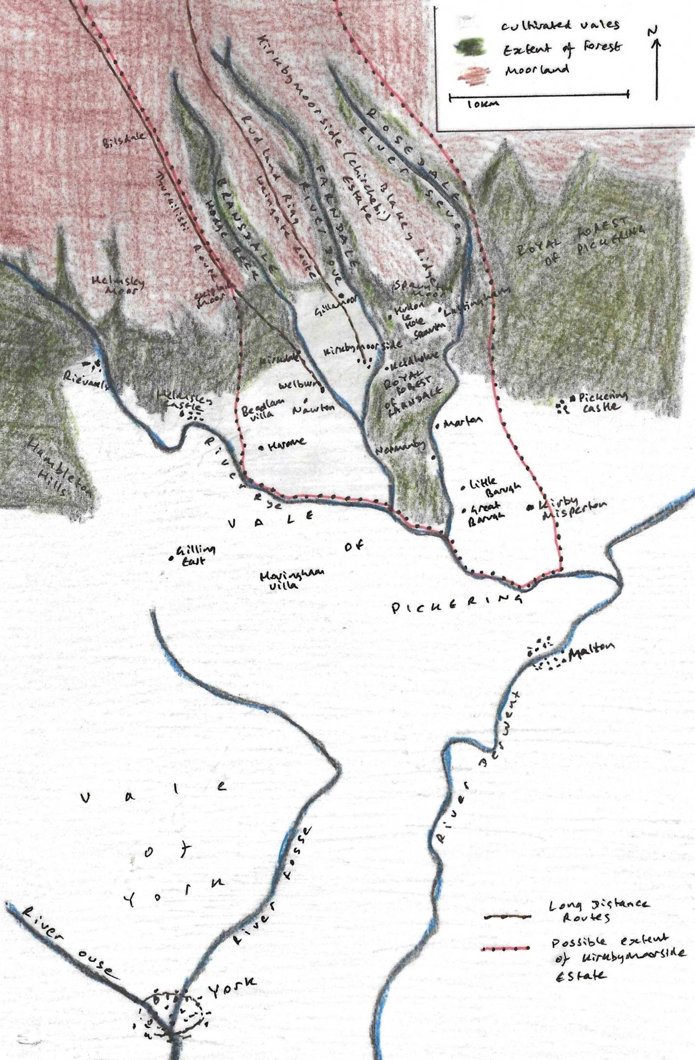
the estate of Kirkbymoorside, recorded as Chirchebi in the Domesday Book[9]. The estate of Chirchebi by the time
of the Domesday Book was likely focused on the small settlement Chirchebi
itself, and another small community around the exquisite seventh century
minster at Kirkdale, only a couple of kilometres to the east. Around those two
small communities was a constellation of berewick
farms at such places as Hoton (Hutton-le-Hole) and Gillamoor, nestled into the edges of the dales; and from
Kirby Misperton to Harome across the north western
reaches of the Vale of Pickering. Nevertheless the forested dale lands seem to
have been nominally incorporated into the wider estate since Domesday Book
recorded estate dimensions of 12 by 2 leagues, or about 60 by 10 kilometres[10] allowing us to approximate the estate
boundaries. The nascent dale remained a wilderness as the new millennium began,
but came to be a notional part of the land possessions of the elite class.
After
the Conquest, the manor and estate of Chirchebi had passed to Hugh Fitz
Baldric, a German archer and Sheriff of the County of York since 1069. When he
died in 1086, the estate passed to the Stuteville family[11]. However the turn of the twelfth century was
a challenging period for the Norman nobility obliged to select the right
brother to support in the royal clashes between the Conqueror’s sons. When this
period of uncertainty ended with Henry I (1100 to 1135)’s defeat of his elder
brother Robert Curthose in Normandy in 1106, it was Nigel d’Aubigny
who emerged as one of Henry’s ‘new men’. Nigel’s mother was Avice of Montbray in Normandy. He married Gundreda
of Gournay, and they had a son who would become Roger de Mowbray. It was House
Mowbray who took control of Kirkbymoorside as the dust settled.
As
the Mowbray interest emerged, Henry I reserved an extensive area across Ryedale
and Pickering as Royal Forest, solely for the use of the King’s household.
Officers were appointed to manage and protect the royal forests. In Yorkshire,
within the forested land from the Dove to the Seven was to be preserved all
my needful things, the hart and the hind, the wild
boar and the hawk, in the same land[12]. The great royal forests of Galtres and Pickering in time came to subsume the Farndale
forest[13], at this stage an area of forest south of the
dale between Farndale’s River Dove and Rosedale’s River Seven.
Thus
it was that half a millennium after Lastingham was founded, the dale was little
changed, still a place of monastic isolation, where a hermit called Edmund now
made his home. That was about to change.
First Contact
It
has been suggested that Henry I, the Conqueror’s youngest son, first gifted
pasture in Farndale and Bransdale to the nuns of Keldholme to feed their sheep,
pigs and cattle [14] although
the record of this transaction, and the name of the place, did not appear until
the later thirteenth century. There is doubt as to whether such a grant was
made as early as the reign of Henry I[15].
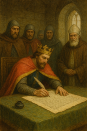
The
name Farndale first appeared in the written record in the Rievaulx Cartulary,
which recorded a gift by the Mowbrays made in 1154. A cartulary was a register
of lands and rights kept by the great noble houses and by monasteries.
A
new monastic order had been founded at Citeaux, near Dijon, in 1098, a
rejection of a perceived Benedictine relaxation of the more austere standards
set by the desert fathers[16]. By the early twelfth century, under the
direction of the Burgundian Bernard, the new order was engaged in international
expansion. In 1131 Walter Espec, a burly
military figure of Hemsley Castle, founded a new Cistercian Abbey at a tranquil
location on the banks of the Rye, which river gave its name to Rie vaulx, a corruption of the French valle. In 1147 the charismatic Aelred became abbot.
He later wrote of the peace, everywhere serenity, and marvellous freedom
from the tumult of the world, where our food is scanty, our garments
rough, our drink is from the stream and our sleep is often upon our books[17]. Yet the influence of a seemingly isolated
community at Rievaulx would soon stretch across Ryedale.
|
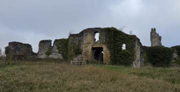
This history of the Cistercian monastery of
Rievaulx, in whose Chartulary the name Farndale was first recorded in 1154 |
|
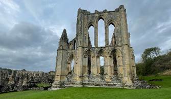
The breathtaking abbey
ruins that must have been held in astonished awe by our forebears when the
abbey broke through the soil of Ryedale, adjacent to Farndale, in only a
couple of decades before it started to take control of swathes of those lands |
|
A History of Helmsley
to about 1500 |
In
1154, the year when the Plantagenets started their long dynasty, Roger de
Mowbray bestowed upon the new Cistercian monastery of Rievaulx, Midelhovet,
that clearing in Farndale where the hermit Edmund used to dwell; and another
clearing which is called Duvanesthuat and common of
pasture in the same valley of Farndale[18]. Midelhovet was, no doubt, the craggy
heights above the northern end of Farndale known as Middle Head today. It has
been suggested that Duvanesthuat was the area
where the fallen Duffin Stone lies today, along the West Daleside
Road. It is more likely to have been land in Douthwaite Dale, adjacent to
Hutton-le-Hole, the latter having already been long settled by that time. Thwaite,
from the Old Norse thveit, is generally
associated with a meadow or clearing, which might suggest some low level prior
cultivation there. Although settlement in the dales was on a small scale at
this time, monastic grants were not always of uncleared land. Some of the land
was de culta terra, ‘of cultivated land’[19]. Nevertheless the endeavours of the monks
after receipt of land grants gave rise to a rapid extension of cultivation into
formerly virgin forest such as in Farndale.
|
1154 to 1399
England in the Middle Ages |
|
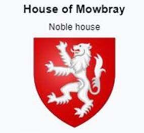
The descendants of Nigel D’Aubigny to whom our
ancestors owed their allegiance in the twelfth century |
|
The First Reference to Farndale
Rievaulx Cartulary,
1154 |

The
grant by Roger followed a previous grant to the Order on an unknown date but
during Roger’s minority, by his mother and ward Gundreda
of land at Middelhoved near ancient routes
over the moors known as Waingate and Thurkilesti[20].
The
name Farndale seems to derive from the Celtic fearn
meaning ‘fern’ and the Scandinavian dalr,
meaning ‘dale;’ and so was the ‘dale where the ferns grew.’, though there is an
alternative suggestion that Farndale derives from the Celtic farnoch and means the place of the alders[21]. There are indeed many alders in Farndale
today, though the fern is a woodland plant and no doubt flourished there. Any
use of the name prior to 1154 was oral, so we cannot know when it was first
uttered.
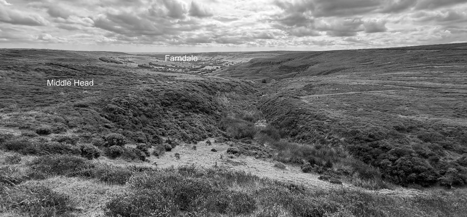
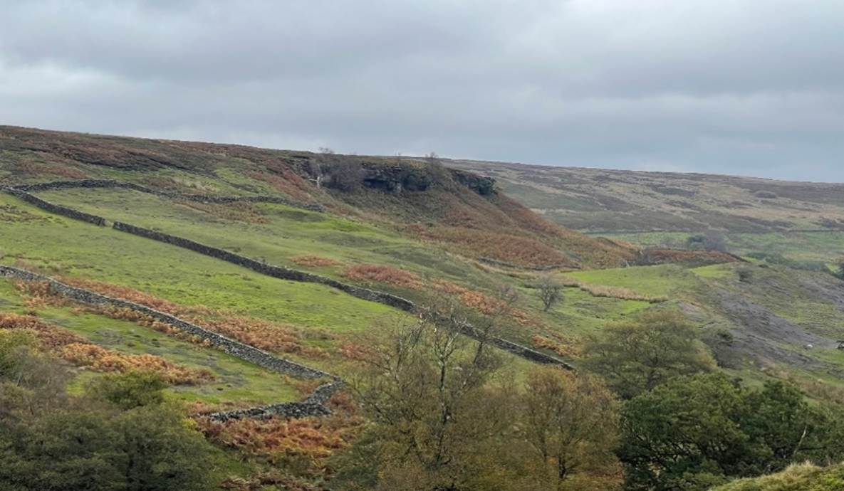
Middle Head in
2025 from the northern heights above the dale The crags of Middle Head,
Farndale, where Edmund the Hermit used to dwell
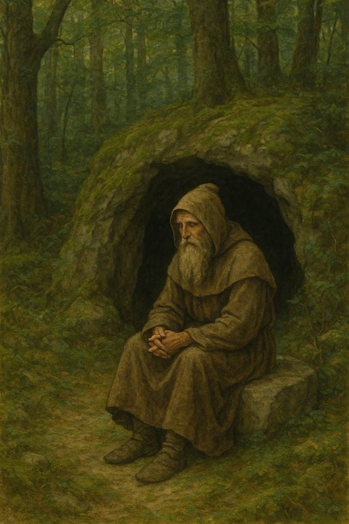
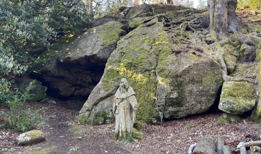
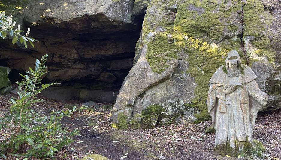
The
reference to the hermit Edmund was to a legendary figure of the North York
Moors in the twelfth century. He is also associated with Hob Hole on Westerdale
moor and was reputed to have been a cousin of King Stephen.
There were ancient
settled communities living on the Kirkbymoorside estate, but no farmers had yet
reached the forested inner dales. The settled communities of the estate were
focused in the small town of Kirkbymoorside, and in the more rural cultivated lands
around the church of Kirkdale. These folk, of Anglo Scandinavian descent,
farming only a few miles south of Farndale, were the ancestors of a small group
of villeins who would soon clear land in Farndale, and start cultivation there
too.
In
1154 those living in the indigenous communities would have wondered in awe at
the elven halls of the Cistercians of Rievaulx Abbey, which had risen out of
the soil beside the Rye in only twenty years since the Cistercian monks had
first arrived there. Such places as Midelhovet and Duvanesthuat,
dimly known to the farming folk around Kirkdale, came into contact with a new
order of monks, so recently arrived, bringing French Cistercian traditions and
constructing towering halls, a Rivendell[22] to the agricultural people of the settlements
on the vales.
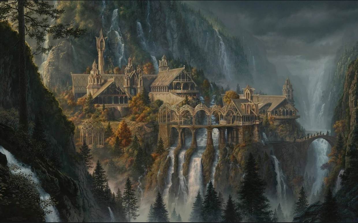
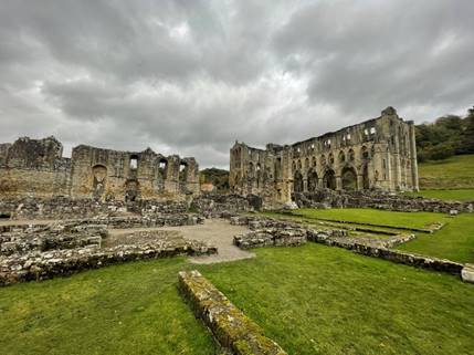
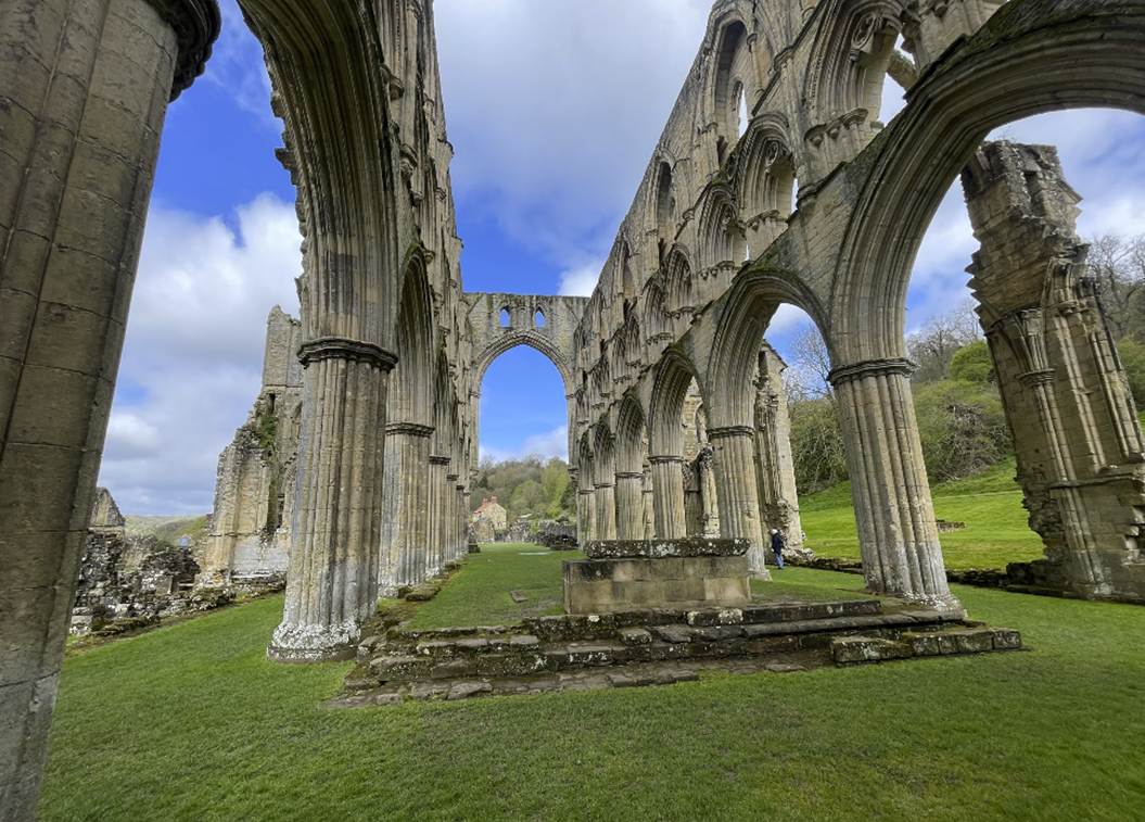
Tolkein’s Rivendell
Rievaulx
When
Henry I had died in 1135 he had precariously left the English throne to his
daughter Matilda. The throne was immediately seized by Matilda’s cousin,
Stephen of Blois who reigned until 1154. There followed another period of
turmoil known as the Anarchy, during which the elite classes again had
to choose sides. It fell to Matilda’s son by her second husband, Geoffrey
Plantagenet, nicknamed after the sprig of broom, planta genista, which
he wore in his hair, to overwhelm Stephen in 1153 and establish a new
Plantagenet monarchy in England. That son, who became Henry II (1154 to 1189),
found a land in crisis which coincided with the emergence of Farndale from the
shadows. The uncertainty was not yet over as Henry sought to wrest the church’s
jurisdiction over the legal affairs of his realm ending in the controversial
murder of Thomas Becket. He faced another family revolt, spurred on by his
ambitious wife Eleanor of Aquitaine which was not resolved until the mid 1170s.
The
eventual outcome though was a more centralised state when Henry II took castles
across the land into royal control and established legal jurisdiction over
criminal and civil law after the Assize of Clarendon in 1166 had wrested
control from the church. Royal sheriffs and justices took responsibility for
the enforcement of the law and juries of twelve local men were obliged to
report to them under oath all the crimes that had been committed in each
community. This was a period when the reach of royal government began to
stretch into local communities.
By
the end of the revolt, Roger de Mowbray was compelled to hand back effective
ownership of the Kirkbymoorside estate to the House Stuteville along with many
other fees. Robert de Stuteville III granted privileges in Farndale to other
monastic houses. In 1166 he allowed privileges in Farndale to a small daughter
abbey of St Mary, York at Spaunton near
Hutton-le-Hole[23]. At about the same time he granted rights to
timber and wood in Farndale to Keldholme Priory together with pasture and
cultivated land in Bransdale[24].
|
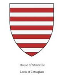
The descendants of Robert de Stuteville to whom
our ancestors owed their allegiance in the eleventh and then from the late
twelfth century |
The
accumulation of land by the new monastic orders such as Rievaulx was alarmingly
rapid and large numbers of granges were established by the end of the twelfth
century[25]. Over time the former donors of the landowner
classes came to regret their gifts and began, often unsuccessfully, to attempt
to evict the monks from their lands.
Concurrently
with growing tension between nobility and church, Henry II’s Assize of the
Forest[26] in 1184 imposed vigorous control over the
royal forests. By this time about a third of the lands of England were royal
forest. The carrying of bows and arrows in the royal forests was forbidden,
oaths of good behaviour were demanded and dogs had their toes clipped to
prevent them pursuing game. Savage penalties were often imposed. A complex
hierarchy of verderers, regarders and agisters were appointed to administer the
forests. Customary rights to timber were to be overseen. The right to wood was
referred to as bote. Pickering folk could use green or dray wood for housebote,
dry wood for firebote, or haybote
for fencing[27]. It seemed that the whole focus of the
kingdom was directed on its forests and the laws that controlled them.
After
the expensive interlude of Richard I’s ambitions in the Holy Land, when few
could resist demands to fund the King’s ransom and his subsequent fresh
consolidation of royal power, King John (1199 to 1216) started to sell off
tracts of royal forests in the north east to raise revenue[28]. Nevertheless John passionately embraced the
Plantagenet legal machine to touch every aspect of the lives of ordinary people[29] since there was profit to be made from the
selling of writs. Travelling courts asserted royal rights across the nation and
royal eyres between 1207 and 1210 raised thousands of pounds from the
encroachment of forest land and from poaching offences.
Discontent
with the laws ensured that the forest became a political issue. The Northern
Barons, who included William de Mowbray and Richard de Percy, were united in
kinship and in their dislike of the King. They led the revolt that culminated
with Magna Carta wherein, hidden amidst a plethora of more bespoke
terms, there were some gems of English justice. No man should be imprisoned
except by the lawful judgement of his peers. Justice was not to be delayed.
Since the worst excesses of royal authority were exercised in the royal
forests, such as at Pickering and Farndale, Magna Carta was accompanied
by the Charter of the Forest which sought to address the worst of the
restrictions and provide some limitation on the King’s power arbitrarily to add
to the growing size of the royal forests. John soon repudiated the agreement,
but the regime of the young Henry III reissued Magna Carta and the
Charter of the Forest in 1225[30] to provide some curb to royal power[31].
Yet
when Henry III (1216 to 1272) declared himself of full age on 9 January 1227
even within the restrictions of the new law, he began measures to reclaim the
forest rights of the Crown[32]. The political issue continued until the
later fourteenth century, by which time large areas of forest had been
deforested.
By
the early thirteenth century there was thus a tension between the competing
rights of Crown, nobility and the monasteries. The Crown sought to regain its
interests in the protection of the royal forests. The monasteries increasingly
relied upon their lay brethren’s efforts across their widespread gifted lands
to provide a commercial income, particularly from the blossoming wool trade, to
support their monastic communities. The elite landowners by this time had come
to realise that by clearing land for cultivation, they could settle the villein
classes to eek out a subsistence level existence,
while paying in service, goods or rent for the privilege.
In
1225 Nicholas II de Stuteville brought a case against the abbot of St Mary’s
York complaining about the exercise of the 1166 grant of timber rights in
Farndale, eventually resolved in 1233 by recognising the grazing rights of
Nicholas and his tenants provided they do not tarry in the said pasture,
whilst accepting the abbot’s right to timber[33].
|
The Forest of Farndale as a royal forest and monastic
supply base 1128 to 1255
The Crown’s insistence
on a Royal Forest and gifts of clearings in Farndale to monastic houses |
At
the same time the Crown was reasserting its control. In a verdict recorded in
the chancery records on 29 October 1228[34] Henry
III decreed that the whole of the forest of Galtres
and the forest between the Ouse and the Derwent, and the forest of Farndale,
are ancient forests and that those who trespassed into the forest were
deceived in the perambulation of the forest, in which it was recognized that
certain parts of those forests were newly afforested, which they have just
brought back to the forest.
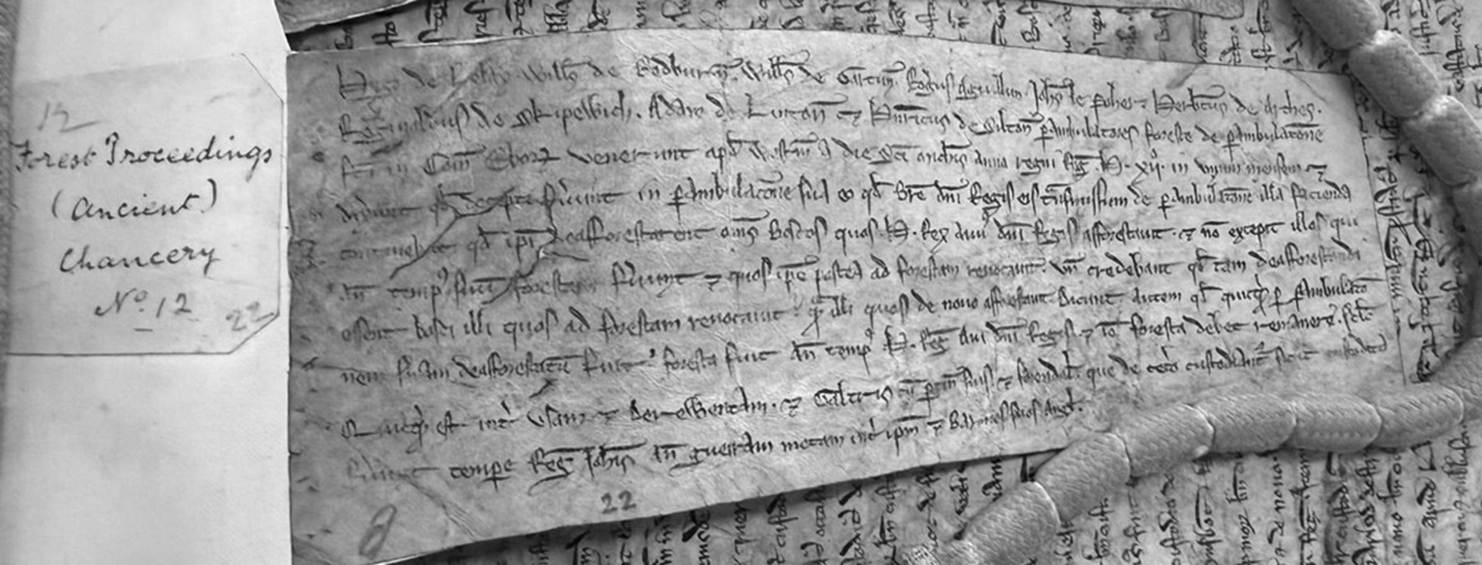
Henry’s decree on the forest of Farndale,
Chancery Records, 1228 held by the National Archives (C 47/11/1/22)
When
Nicholas Stuteville died in 1233, his daughter Joan, the Lady of Liddell became
Lady of the Stuteville estates. She married Hugh Wake who died on Crusade in
1241, but left three sons including Baldwin Wake. Joan married her second
husband, Hugh le Bigod, but as a widow continued to be known as Joan de
Stuteville. Her seal was embossed with the image of a lady riding sideways, a
style which she is said to have been the first to adopt.
In
1253 the King committed to Hugh le Bigod the whole forest of Farnedala until he returned from Vasconia
(Gascony) where Henry was dealing with an uprising stirred on by the harsh
approach taken by his governor, Simon de Montfort[35], another costly campaign which left the Crown
heavily in debt. After the King’s return, on 2 May 1255 Hugh le Bigod paid 500
marks for the office of forester of Farndale, which included his right to hunt
hares with dogs in all Yorkshire’s forests[36].
On
30 June 1267 Edmund Crouchback knelt before his father, Henry III, to accept
the charter which made him Earl of Lancaster. He rose as the owner of land in
almost every corner of England, and which included the Honour and Forest of
Pickering [37]. The Great Cowcher or caret regum[38], comprises evidence of title for the Duchy of
Lancaster. It focuses on land and property transactions, including details
about the landscape and the nature of tenure across the duchy's estates. It is
an invaluable source for the Lancastrian holding in Ryedale including the
activity of the first settlers of Farndale.
|
The Duchy of Lancaster and the Honour and Forest of Pickering The surprising
association of our early family history with the House of Lancaster |
This
was two centuries prior to the Wars of the Roses, but serves to illustrate that
the later competing interests between the Houses of York and Lancaster related
to a competition between noble houses, not as is often imagined today, a
geographical civil war involving the two modern counties.
The stage for our family to build
their new home was set.
Scene 2 – Making a Home
Settlement
Assarting is the act of clearing forested lands for use
in agriculture. It was illegal to assart any
part of a royal forest without permission. The process was sometimes undertaken
by individuals or groups of individuals, but in Farndale it was likely to have
been instituted by the land owners as part of a campaign of settlement. Land outwith the royal forest which had previously been common
land, became privately controlled after assarting, so that those in occupation
of the land were required to pay rent and faced new restrictions in land use.
This
process of assarting in Farndale by the lay nobility was probably
underway by the second or third decade of the thirteenth century.
|
The
cultivation and early history of Farndale c
1220 to 1400
|
|
|
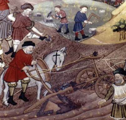
We might suppose that the clearing of
Farndale was undertaken by the villeins, the serfs or peasants, who were then
put onto the land to work it, compelled to pay rents for tiny holdings of
marginal land. The farmers who were relocated into Farndale were likely to have
been Anglo-Saxon-Scandinavians reduced to serfdom since the Conquest. However
the newcomers were an ancient people who had farmed the lands only a few
kilometres to the south for a thousand years through the years of stability of
the Roman empire, the periods of Anglo-Saxon dominance, and the influx of
Scandinavian influence. The evidence of rents being applied in Farndale by 1276
suggest a campaign on a large scale. Though no doubt suppressed by Norman
domination for two hundred years, these ancient people may have had influence
themselves in this period of clearance of new lands.
|
The
newcomers were an ancient people who had farmed the lands only a few
kilometres to the south for a thousand years through the years of stability
of the Roman empire, the periods of Anglo-Saxon dominance, and the influx of
Scandinavian influence |
By
the mid thirteenth century there is an undated deed recording a grant given by
Joan de Stotevile to Nicholas Devias for service. It included a right to rent
amounting to 20s from Farndale land held by Adam de Ellerschae
and eleven marcs from two watermills in Farndale[39].
Hence,
by the mid thirteenth century Farndale was a community of sufficient size to
have two watermills, with rent being paid by named individuals. It is likely
that the principal mill was at Low Mill[40], where the West Gill flows down to meet the
Dove, and another probably smaller mill a little upstream at High Mill, where
the Daffy Café refreshes walkers today. The funding for these state of the art
projects must have come from the Stutevilles and seems to have been completed
in the early phase of clearance.
|
The
context of the mill industry in Yorkshire and the evidence of mills in
Farndale |
|
c 1255 to c 1334
Perhaps the first significant person we can identify who bore the
Farndale name He paid the highest rent of 7s 9d in Farndale in the 1301
Subsidy, suggesting as miller, he was the wealthiest inhabitant Simon had a servant, John, in 1301 We know of four sons, two of whom left the dale to seek their
fortunes elsewhere, and two of whom became regular poachers, for which they were fined and outlawed |
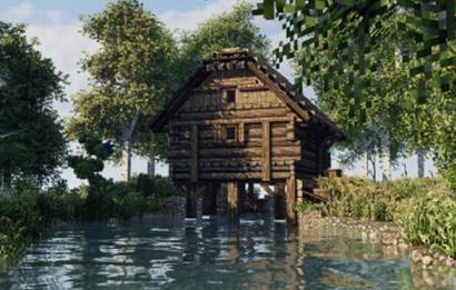
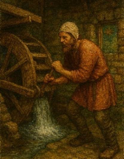
The River Dove would have provided an
optimal source of power for milling. There was a nineteenth century watermill at High Mill on Mill Lane
south of Church Houses, Farndale,
which is almost certainly the site of an earlier mill. The hamlet of Low Mill
was also the site of an earlier mill on the River Dove and is located where the
fast flowing West Gill Beck flows down from the high ground to meet the River
Dove. Both these mills were located centrally within the valley.
The power lay with their noble
overlords, who had held the estate since the Norman Conquest, arbitrarily
distributed by the Conqueror to his supporters and battle heroes. Until now the
forested lands of the dales had been little more than prestige holdings, where
they sometimes hunted. Their estates provided them with a simple way to pay
their premiums in gifts of land to monastic houses in their insurance deals
with the Cistercian and Benedictine monks, to ensure their continued good
fortune after they died. As the new thirteenth century dawned however, they
found ways to use their more peripheral landholdings to impose obligations in
rent and service on those same folk, thereby deriving a perpetual income.
It is difficult to know the extent to
which the agriculturalists of Kirkdale and Kirkbymoorside were coerced or saw
opportunity. It was this band of folk, placed into the new lands of Farndale in
the early thirteenth century, who were the direct ancestors of the modern
Farndale family.
With a rapid expansion of monastic
interest across the region, it came as a shock to some landowners that the
monks were not all that was simple and submissive; no greed, no
self-interest and whilst the monastic expansion continued there was
evidence of clawback and even eviction from previous grants. Tension between the triumvirate of interest of the church
and monasteries; the Crown and its royal forests; and the increasingly
commercial lay nobility was growing. The villein folk who toiled a living in
the dale were the primary victims, deprived of their antique common rights of
grazing, and competing with increasingly protective interests of church, state
and nobility.
We can judge the extent of this
process, because there are three recorded snapshots of the progress of
cultivation in 1276, 1282 and 1301.
An
Inquisition
Post Mortem (“IPM”) taken after Joan’s death in 1276 evidenced the
extent of settlement that had taken place. Bonded tenants paying a standard
rent of 1s per acre provided an income of £27 5s 0d[41]. With 20s to a pound, this evidenced a
cultivated area of 545 acres in Farndale. Seven cottars in Farndale raised
another 15s 8d and Duthethwayt was listed
separately as producing 32s per annum from holdings held by plot rather than by
acres. The record also evidenced that the watermill, now enfeoffed[42] to Sir John Denias, by then rendered 18l[43] per annum.
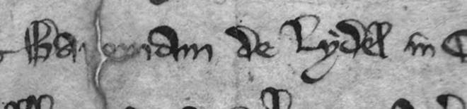
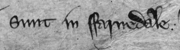
Inquisition
Post Mortem 1276, Extracted from Chancery Records, held by the National
Archives (C 133/15/2)
|
The
Inquisition Post Mortem of Lady Joan de Stuteville provides evidence of the
extent of cultivated land by the mid thirteenth century |
|
In
1282 there was another Inquisition on the death of Joan’s son, Baldwin Wake[44]. The Farndale rents then amounted to £38 8s
8d together with two strikes of nut (valued at 43s 9d) and services in the form
of harrowing at Lent (valued at 29s 4d). If the rent was unchanged from 1276,
this implies an increase of cultivated land to 768 acres in only six years,
which suggests a rapid pace of settlement. Perhaps there were changes in survey
techniques or rent increases which might also have contributed to the total
rent increase, but the evidence suggests that this was a period of intense activity
in the dale.
There
were four score and ten natives in Farndale in 1282, described as servi or serfs. They held land by more or less,
which suggests variable sizes of holdings.
It
seems unlikely that men of villein status, compelled to pay rents of 1s per
acre for holdings of marginal land, could have managed this scale of assarting.
It seems more likely that land was reclaimed in advance of letting by the
landowner’s servants, as had occurred in Goathland for instance, as part of a
coordinated campaign[45].
Nevertheless, assuming the same rent
applied, the cultivated acreage had increased by over 200 acres in only six
years. This was organised and planned agricultural development, led no doubt by
the Stuteville landlords, but
a process in which our ancestors were engaged throughout the thirteenth
century. It must have involved some hard ancestral graft. By the mid thirteenth
century Farndale was a thriving community of two watermills.
|
The
Inquisition Post Mortem of Baldwin Wake provides evidence of a rapidly
expanding community |
|

In
1301 Edward I, Longshanks, had subdued rebellion in Wales and built
castles at great expense to exercise his control there. He turned his attention
to Scotland and required funds to pay for his campaigns. Among his enemies were
the direct descendants of the Yorkshire de Brus family of Skelton Castle,
destined to take the Scottish throne in 1306. In 1301 he therefore imposed a
Lay Subsidy valued at one fifteenth of the value of every person’s moveable
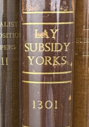
possessions. The Yorkshire Lay Subsidy[46] provides a remarkable record of the
settlement pattern and the names of individuals and their occupations and
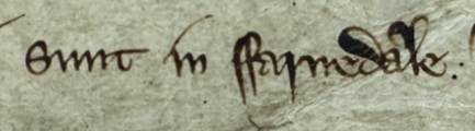
locations at the turn of the fourteenth century. The record for Farndale[47] listed 39 individuals and the rent they paid.
The Subsidy also recorded some of the places within the dale where they lived.
There was a family at Wakelevedy, which is
likely to be the location of Wake Lady Green on the East Daleside
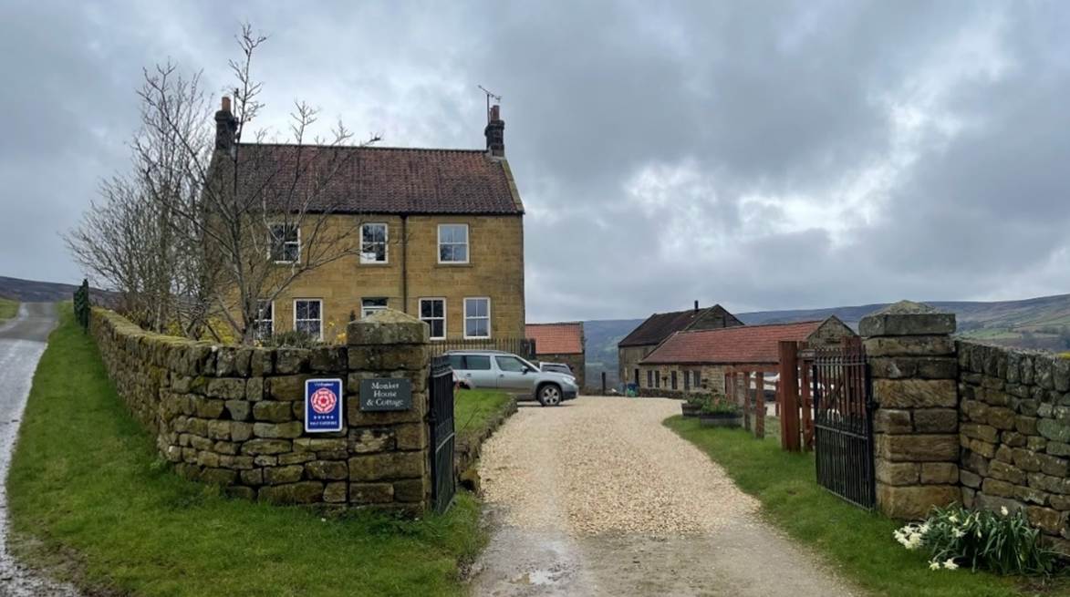
Road. Another lived at Monkegate[48], where Monket House
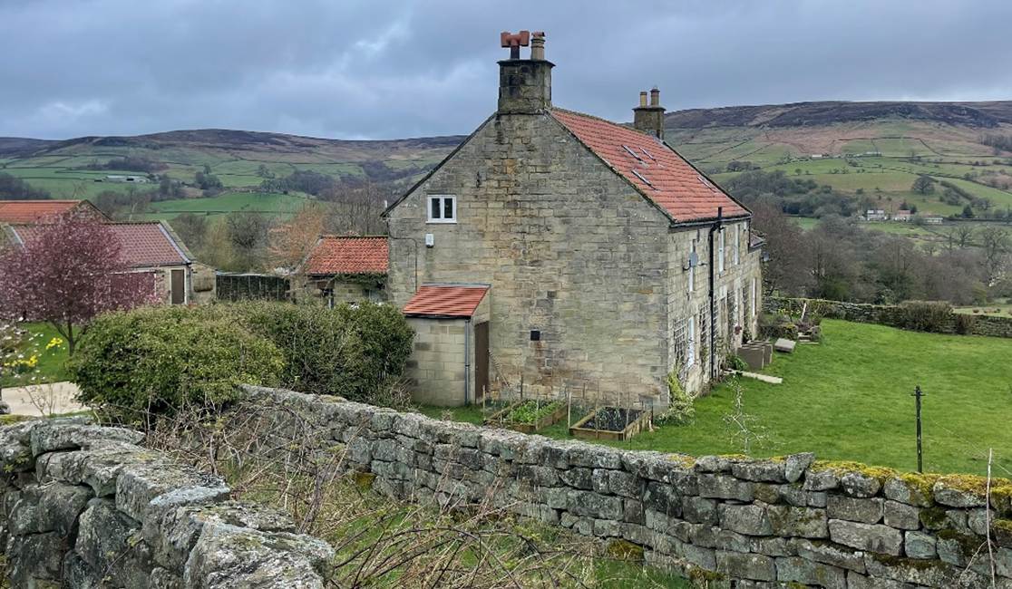
provides holiday lets today. There were individuals at Ellescaye,
presumably descendants of Adam, likely to be the location of Eller House on the
West Daleside Road today. Others lived at Westgille, the burn which flows down from Rudland
Rigg into the hamlet of Low Mill. There were others who had come to the dale
from such places as Fadmore and Hoton
(probably Hutton-le-Hole).
|
Detailed
evidence of the inhabitants of Farndale is provided by the 1301 Yorkshire
Subsidy, a tax imposed to fund the Scottish Wars |
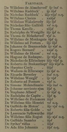
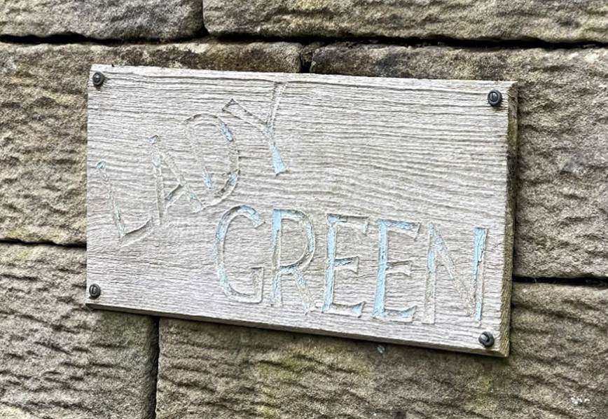
De Willelmo
Wakelevedy was William of Wake Lady Green, which still lies today on the East
Dale Road.
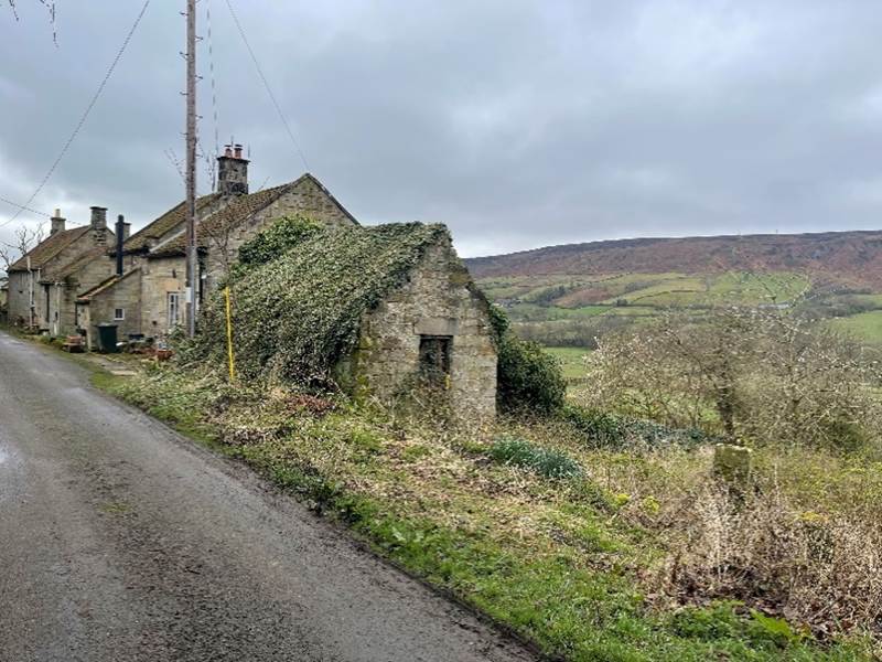
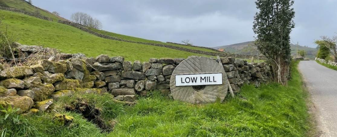
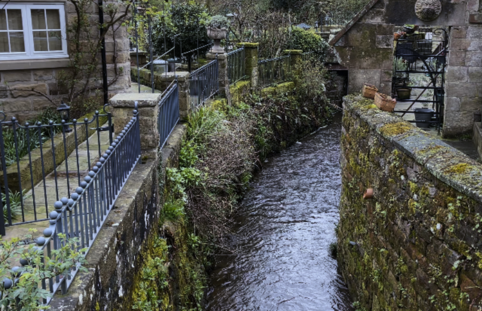
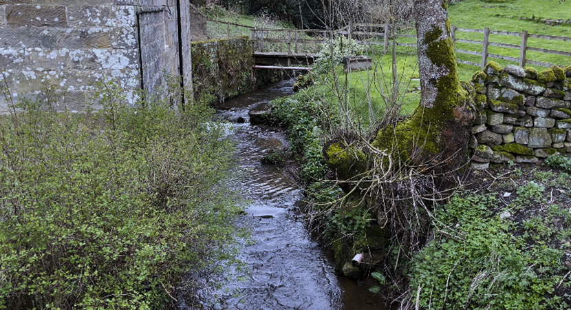
De Radulpho
de Westgille was Radolf of the West Gill stream that
runs into modern Low Mill.
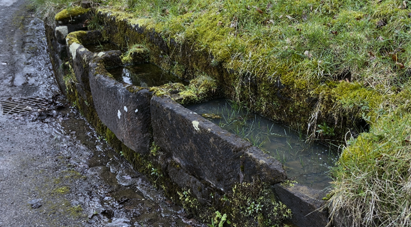
De Willelmo
de Monkegate was William of Monket
Gate, now Monket House at the entrance to the West
Dale Road.
De Waltero
de Ellerscaye was Walter of the lands which are now
Eller House on the West Dale Road.
We
can therefore envisage the transformation of a forest wilderness during the
course of the thirteenth century into a thriving community, with agricultural
activity across eight hundred acres and more of cultivated land, serviced by
two watermills along the river Dove, and populated by a complex mix of folk
whose energy created a new landscape within a remarkably short timescale.
Recognisable
individuals started to become identifiable at the time when the system of names
amidst non elite communities had begun to evolve. Individuals started to
differentiate between themselves by nicknames, occupations and residence. As
settlements grew in size, names became more discerning. When de Farndale
was no longer sufficient to differentiate between those who all lived in
Farndale, folk were referred to by places within the dale such as Westgille or by their occupation. In time it was those who
left the dale to move to other places who might use de Farndale as an
identifier. As the new practice bedded in, these names started to become
hereditary. Our narrative of the history of Farndale, is therefore able to
enrich its depth with the stories of ordinary individuals at the very earliest
period when this became a possibility.
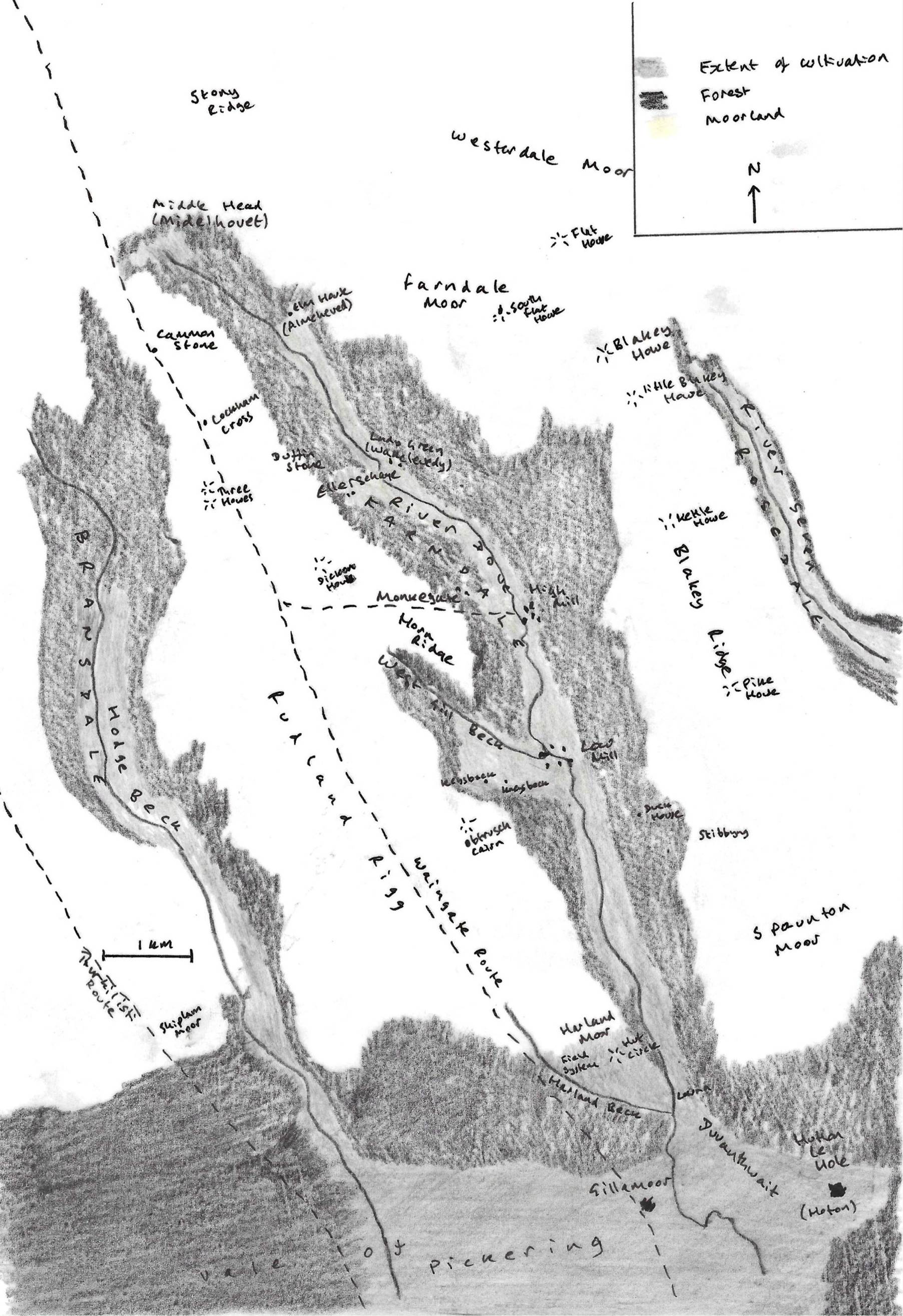
The
Lay Subsidy provides a dramatis personae. The evidence allows us to
bring our nascent dale to life, with the stories of the actors who lived there
eight hundred years ago.
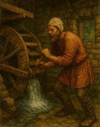
The
highest rent was paid in 1301 by Simone Molendinario, ‘the miller’ who
paid 7s 9d rent, suggesting a worth in moveable goods of £5 16s 3d. His servant
(serviente ejus),
Johanne paid 3d. We might imagine the heart of a community at Low Mill where
the West Gill flows down to meet the River Dove and that this was likely to
have been the location of Simon’s mill.
|
c 1255 to c 1334
Perhaps the first significant person we can identify who bore the
Farndale name He paid the highest rent of 7s 9d in Farndale in the 1301
Subsidy, suggesting as miller, he was the wealthiest inhabitant Simon had a servant, John, in 1301 We know of four sons, two of whom left the dale to seek their
fortunes elsewhere, and two of whom became regular poachers, for which they were fined and outlawed |
Simon
must have paid a significant rent to the Stuteville landlord for his state of
the art technology. By the turn of the century this was Thomas Wake, the Second
Baron Wake of Liddell. The rent was eleven marcs[49] from the two watermills in the mid thirteenth
century and Simon’s mill was likely the more substantial with a higher rent. We
might imagine a model whereby he received an annual income from operating the
mill of say £8, with a deduction of say £4 to pay his rent, and annoying
impositions of national taxes, like his payment of 7s 9d in 1301, together with
the costs of operating the mill, and some remuneration to his servant John. We
will shortly discover that Simon’s sons were the victims of draconian forest
laws, and the imposition of fines that would have further depleted family
resources. Although he may have had a far more substantial turnover than the
other folk of the dale, he may not have been so wealthy in the residue of funds
he had left to feed his family. He was left with a comparative wealth in
moveable comforts, which might equate to a value of about £4,000 today, perhaps
the value of about six horses[50], but much of this value may have been in the
tools of his trade.
Simon’s
servant Johanne in time came to be called John the Miller, and it may be that
the miller-servant relationship blossomed into a partnership in time.
|
c 1256 to c 1330
John appears in the records as John the Miller through the
misdeeds of his poacher sons. He may have been John, the servant of Simon the
miller in 1301, who eventually became a more substantial partner in the
business, with both men later being referred to as the miller. He may have been
Simon’s brother, or his servant or a business partner, or all of those things He also had
poaching sons. |
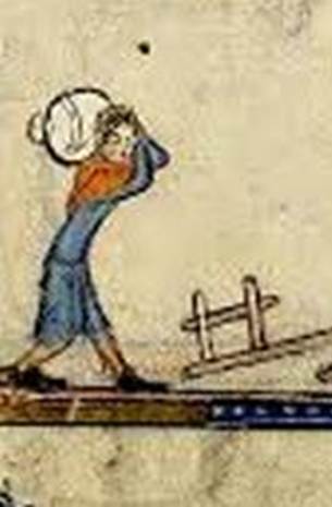
Radolpho
and Willelmo Westgille, who also paid relatively high
tax in 1301 in Farndale, presumably represented a family on the slopes above
Low Mill alongside the West Gill beck. It seems likely that their brother was
Richard de Westgill who paid tax in the 1327 and 1333[51] Lay Subsidies in Kirkebimoresheved
(Kirkbymoorside) amidst a relatively select group, including the Domino
Thomas Wake, suggesting a family that was punching above its weight. Richard’s
sons were trespassers and poachers in Pickering Forest, though such activity
ranged from foraging for survival by subsistence levels villeins to the
sporting adventure of the elite classes[52].
In
medieval Europe, a cleric was often an ordained person sometimes in minor
orders of the clergy. A clericus was also
appointed in lay legal matters by the thirteenth century, including in the
operation of the forest laws[53]. De Willelmo clerico who paid 23d in the 1301 subsidy might
therefore have been a priest or an administrator of forest laws. On 19 November
1388, a licence was given to the inhabitants of fferndall
to have masses celebrated in their chapel[54], so we might imagine that William was an
early religious leader in the dale.
Roberto
ad Pontem perhaps lived at a bridge across the
Dove and we might imagine him to have lived at a crossing point in the lower
dale, perhaps at Lowna where the crossing would later
inspire the tale of the fateful enchantress, Sarkless
Kitty.
Syther’
vidua, the widow of Syther, paid 4d tax.
Robert de Brakeanthayt (‘the bracken field’) paid 4s 7d. The Ruddock brothers
paid 2s and 4s. Laurencio Syffewrythe (Latin for
‘suffocation’, but we know not why) paid 4d. There were others. This was a
rich, diverse community.
Early
fourteenth century Farndale was a community of developed social structure,
comprising each of Shakespeare’s seven ages, from the infant, mewling and
puking to the generation of the sixth age, turning again toward
childish treble, pipes and whistles in his sound[55].
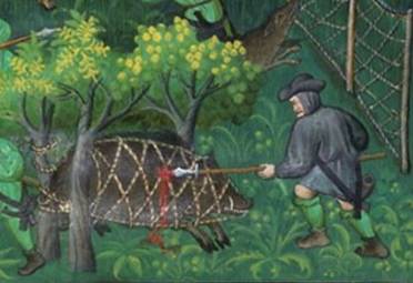
The first recorded
poaching incident involving the folk of Farndale was on a cold Monday in
January 1293, when five men, including Roger the Miller of Farndale and Walter Blackhous of Farndale went hunting in a part of West Rosedale that belonged to St Mary’s
Abbey and at an unknown place in the forest they killed a soar (a sow or female
boar), and a hart (an adult male deer, generally a red deer over five years
old), with bows and arrows. They were all outlawed.
Of
a second generation of the settlers of Farndale, Roger the Miller, may have
worked at High Mill, perhaps the person also known as De Rogero Bernard (the
‘brave bear’) in 1301. He was regularly involved in poaching activity together
with his sons, Richard, John and Thomas who were all excommunicated for their
misdeeds. Meantime, William the Smith of Farndale may have continued the family
smithy business of Robert, perhaps his father.
It is through the poaching and trespassing
activities of the medieval inhabitants of the dale, that we can add further
depth to our understanding of the fourteenth century landscape and its actors.
The poachers of Farndale
will be the subject of Act 7.
|
A study of the nature of
poaching in Pickering Forest |
|
Roger the Miller of Farndale, the “Hard Bear” c 1255 to c 1345
The miller of Farndale who probably worked at High Mill A poacher by 1293 who was probably the person described as burly
as a bear |
During the thirteenth century, we have
a picture of serfs, who together formed a body of folk who must have included
our ancestors, toiling the soil in a dreadful battle of survival, but who by
the end of that century seem to have acquired a degree of wealth, sufficient to
be tapped for royal taxes.
Grazing
rights around the dale varied. Some pasturages continued to be reserved for the
use of the King where there was no right in common and here, cattle were grazed
at a fixed price or agisted, to be paid to the
bailiff. Not the least of the profits derived from the possession of a
forest was that arising from the agistment of cattle in waste grounds[56]. Agistments were also made on the high
moor. These sums were collected by the agisters, of whom there were two in each
ward.
A
number of local folk had taken draught beasts into Pickering Forest in the
reign of Edward III in 1310, where the beasts were found and forfeited for a
price[57].
Thomas Wake, the Lord of Liddell, whose tenants they were, claimed that the
price had already been paid and the tenants should be discharged of the matter.
Those
from Farndale were:
|
Individual from Farndale |
Draught animals found in Pickering
Forest |
Value of the beasts agisted |
|
1 oxen
and 2 stirks[58] |
7s 4d |
|
|
Walter ,
son of Robert the Smith of Farndale |
5 oxen |
20s |
|
3 oxen |
12s |
|
|
Hugh Laverok of
Farndale |
1 cow and 1 stirk |
4s 8d |
|
William Stibbyng of
Farndale |
6 oxen |
24s |
|
William
de Waldehus of Farndale |
5 oxen, 4 cows and 4 stirks |
38s 8d |
|
4 oxen and 1 stirk |
17s 8d |
|
|
Alice,
daughter of Roger |
1 cow |
3s |
|
Henry,
son of Hugh of Farndale |
6 oxen, 2 bullocks and 2 beasts of
burden |
38s |
|
6 oxen and 1 cow |
27s |
|
|
Hugh
del Radmire of Farndale |
6 oxen |
24s |
|
William
ad Portam of Farndale |
5 oxen |
20s |
|
John
the shepherd of Farndale |
9 oxen, 1 cow and 1 stirk |
41s 8d |
|
Roger,
the groom of John the shepherd of Farndale |
1 bullock |
4s |
|
Nicholas
de Harland of Farndale |
1 ox and 1 bullock |
7s |
|
Alan
de Wrelton of Farndale |
4 oxen and 2 cows |
19s |
|
Stephen, son
of William |
2 bullocks and 1 ox |
12s |
|
John, son
of Helewise |
4 oxen, 3 bullocks, 1 cow, 2 beasts of
burden and 1 stirk |
38s 8d |
Our
dramatis personae is thus expanded, and often with details of family
lineages, occupations, and detail of their livestock.
|
Meet the Medieval
Inhabitants of Farndale We have records of many of the folk who lived in Farndale in the
thirteenth and fourteenth century Here you can meet the whole crowd of the medieval inhabitants of
Farndale |
The
dale’s early story continued to be one of two parts, of the ordinary folk who
worked the dale and of the elite class who owned it.
In
1325 Thomas Wake asked that the justice of the forest should be commanded to deliver his wood of Farndale. The King replied
that Thomas should deliver a writ to the justice of the forest to certify the
reason for taking the wood. In a subsequent document, again Thomas asked that
the justice of the forest should be commanded to
deliver his wood of Farndale and added that he had seized it without reason[59]. The King eventually ordered that the
official do justice to Thomas Wake, according to the usage and law of the
forest. It seems that the bureaucracy and ambiguity of the law was ever
thus. Since every writ made money for the Crown, there was every reason to
prolong the experience.
On
30 July 1347 Thomas Wake obtained licence for a grant of a toft and ten acres
of land on the moor at Blakenhowe, then part of
Farndale, to the House of the Holy Cross, to allow them to found a house of
their order there, and to build an oratory and dwelling houses[60]. The Friars of the Holy Cross, also called
the Crutched Friars, were not one of the four principal Mendicant Orders of
Friars and they struggled to gain recognition after being disapproved of by the
Archbishop of York. Religious bodies were often granted land for building which
they never in fact occupied. It was partly in an attempt to prevent abortive
grants of land that Edward I passed the Statute of Mortmain in 1279. Yet these
Brethren of Holy Charity do seem to have had a chapel on Blakey Ridge above Farndale.
Two years later, in the Inquisition Post Mortem on the death of Thomas Wake in
1349, in Farndal a house with a chapel of
the brethren of holy charity[61] was of the avowson
of the said Thomas and the said brethren hold their tenements there of the said
Thomas in frank almoin[62]. It has been surmised that the Lion Inn at
Blakey might have been built on the same site as the friars’ chapel. Since
houses of friars traditionally provided accommodation and refreshment to
travellers, this seems a natural progression.
In 1349, the dale remained part of the
community of Kirkby Moresheved, where there
was a yearly fair, and there were still two water mills in Farndale[63].
On
19 November 1388 licence was granted to the inhabitants of Farndale to have
masses celebrated in their chapel[64].
The
dale was filled with agricultural activity, from Eller House and Monket House on the west side, to Lady Green to the east,
focused around its mills and with its hub at Low Mill. Simon the Miller worked
the mill in Low Mill, alongside his servant and later partner, John the Miller,
serving a diverse agricultural community. Robert was the community’s smith.
John the Shepherd of Farndale had at least 9 oxen and 3 cattle, and a groom,
called Roger. Bells may have tolled high above the dale from the Friary on
Blakey Ridge and the folk of Farndale had their own chapel, where William may
have been their first priest,
A
dynamic dale with ancient roots
The
richness of evidence thus provides a detailed picture of the very first
inhabitants of Farndale.
We
know of eight individuals (Gilbert, Nicholas, Adam, Simon, John, Robert, Hugh
and Alfred) of a first generation who were probably not so different in age,
who might perceivably have been brothers or part of the same family.
Alternatively they may have been unrelated, but were simply those who took the
name of the dale as they started to live there. However we interpret their
relationships, they were of the same community who claimed the working dale
from ancient forest.
|
Meet the Medieval Inhabitants of Farndale We have records of many of the folk who
lived in Farndale in the thirteenth and fourteenth century Here you can meet the whole crowd of the
medieval inhabitants of Farndale |
Prior
to the occupation of Farndale and until the thirteenth century, the
agricultural community of the wider Kirbymoorside
estate was focused on the Minster of St Gregory at Kirkland and stretched to
such places as Welburn, Harome, Nawton,
Great Barugh, Normanby, Kirkby Misperton and Marton, all of which are name
checked in the Domesday record as places of ancient community. There had been
some modest inroads into the dales, to Fadmore, and
the area of Spaunton, near Lastingham. Spaunton has evidence of agricultural use back to Roman
times[65]. The Roman Villas of Beadlam[66] and Hovingham[67] are both within the bounds of these
agricultural lands, dating to the third century CE. These were likely to have
been the heart of their own estates, perhaps feeding the hungry Roman legions
of Eboracum. This would suggest that the estate of Kirkbymoorside had
ancient roots, perhaps back to these Roman estates.
The
lands of the Kingdom of Deira, later Northumbria and in time the County of
York, were ravaged over time by the Anglo-Saxon-Jute invasions following Roman
collapse in the early fifth century, and the Scandinavian invasions which
followed the raid on Lindisfarne in 793 CE. Roman Eboracum, Deiran Eoforwic,
and Scandinavian Jorvik, only thirty or so miles to the south, was
variously ravaged and subsumed into these new political units. Immediately
before the Conquest in 1066, Harold defeated Hardrada and his treacherous
brother Tostig at Stamford Bridge near York, and after Harold’s defeat, the
vicious William, unimpressed with northern resistance to his new reign,
punished these lands with his Harrying of the North.
Yet
despite its proximity to such violence, and perhaps because of it, the
agricultural lands of the Kirkbymoorside estate, nestled as they were at the
far corner of the vale lands and into the protection of the edges of the dales,
were a place where stability had a chance to endure over generations. Whilst an
integral part of the momentous events occurring only a few miles away, these
were lands which could likely avoid the bloodshed and even flourish, at the
edge of the drama. Indeed the richness of the archaeological evidence suggests
exactly that.
The
estate of Kirkbymoorside was thus a place of relative stability and successful
agriculture, which stretched back through Norman, Scandinavian, Anglo Saxon,
Deiran, and Roman times with a degree of consistency. It may have had its roots
in the Brigantian period which preceded the Roman,
and perhaps to the Beaker Folk whose remains still lie within its territory,
particularly the Ryedale windypits[68] and on the high moors. Those who settled in
Farndale from about 1220 were likely to have been descendants of this ancient
community.
The
occupation of Farndale from the early thirteenth century was a continuation of
an antique story, and the first folk of Farndale brought their own rich
cultural and historic identity, and no doubt a deep rooted agricultural
experience.
The
most beautiful woman in all the realm of England
In
the mid fourteenth century, Farndale was part of the lands which fell to the
Stuteville-Wake and Kent heir, Joan Plantagenet (1328 to 1385), who came to be
known as the Fair Maid of Kent. She was the daughter of Margaret Wake of
Liddell and Edmund of Woodstock, the First Earl of Kent, and the youngest son
of Edward I. The Fair Maid provides glamour to Farndale’s story.
|
en son temps la plus belle de tout la roiaulme d'Engleterre et la
plus amoureuse The
most glamorous owner of Farndale |
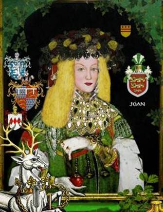
The
young Joan had been brought up, a royal princess in the Plantagenet court of
Edward III and her domain was the royal courts in southern England and France.
She was cousin of the King.
In
1340, aged only thirteen, Joan had secretly married the twenty six year old
Thomas Holland, her Knight. She had not first gained royal consent, which she
was required to do as a royal princess. Shortly after the union, Holland left
for the continent as part of an English expedition in Flanders. The following
winter, while Holland was still overseas, Joan's family arranged for Joan to
marry William Montagu, son and heir of William Montagu, first Earl of
Salisbury, who had helped Edward III to secure his throne from the Mortimer
regime. The scared young Joan didn’t disclose her existing marriage.
When
Holland returned from the French campaigns in about 1348, he confessed the
secret marriage to the King and appealed to the Pope for the return of his
wife. In 1349, the proceedings ruled in Holland's favour. Pope Clement VI
annulled Joan's marriage to Salisbury and Joan and Thomas Holland were ordered
to be married in the Church.
Joan
had relinquished her place in the Salisbury title, for the lowly, though
impressive, knight, Thomas Holland. They had five children.
It
was Joan, the royal princess, who inherited the titles of Kent and Liddell
after the death of her brother John in 1352. Far north from the royal court,
part of her new landholdings included Farndale.
It
is not likely that she ever visited her lands at Kirkbymoorside and so sadly
was probably never seen gracing Farndale. She was more interested in royal
politics and courtly intrigue than in the tedious administration of her distant
landholdings.
In
1353 an Inquest taken at York during Edward III’s reign confirmed Joan’s
Stuteville-Wake holdings in Kirkbymoorside. It included the manor with its
members in Farndale, Gillyngmore, Brauncedale
and Fademore, held of John de Moubray by service of
1½ knights’ fees. The extent of Kirkeby includes a weekly market on Wednesday
and a fair on the feast of the Nativity of the Virgin; and the manor is charged
time out of mind by the ancestors of the earl with 26s 8d yearly to the
prioress of Keldholme and 13s 4d yearly to the vicar of the church of Kirkeby
for tithe of the mill. Decrease in value of land through the pestilence[69].
Although
practical ownership of Kirkbymoorside had been of the House Stuteville since
about 1175, the complexities of the feudal hierarchy meant that the Stutevilles
continued to hold the land of House Mowbray.
Thomas
Holland, whose modest possessions were unlikely to have kept Joan in the style
to which she was accustomed, but whose military charm seems to have
nevertheless entranced her, therefore took title to Joan’s lands, though he was
not summoned to take the formal title of Earl of Kent until 1360. With the Kent
and old Stuteville landholdings, the couple could live more luxuriously.
On
28 December 1360, Holland died of illness in Normandy. On his death came an
Order to deliver to Joan who was wife of Thomas de Holand earl of Kent the
manors of Cotyngham, Witherton,
Buttercrambe, Kirkeby Moresheved
(with lands in Farndale, Gillyngmore, Brauncedale and Fademore),
Cropton (with tenements in Middleton and Haretoft),
Aton and Hemelyngton, with the members, lands etc
thereto pertaining, taken into the king’s hand by the death of the earl,
together with the issues from the date of his death[70] … The manor, with lands in Farndale, Gillyngmore,
Brauncedale and Fademore,
held of John de Moubray by homage and fealty and by service of a knight’s fee
and a half.
So
the Kent and old Stuteville lands passed back to Joan.
The
lovely Joan did not have to wait long before marrying the heir to the throne.
On 10 October 1361 she married her cousin Edward, the Black Prince, son of
Edward III, the Prince of Wales.
For
a short while Farndale was held directly by the Black Prince, the lad who had
earned his spurs at Crécy, the military hero of Poitiers.
However
in 1365 Joan and her new husband, the Black Prince, formally settled the
Kirkbymoorside manor on her son by her former husband, Thomas Holland, the
Second Earl of Kent, and Alice FitzAlan, his wife and their heirs, with
reversion to the prince and herself. So Joan’s direct interest in Farndale
passed on to her Holland sons. Perhaps her elevated lifestyle meant that by
1365 she was not so bothered about retaining her northern lands in her direct
ownership. The Kent and Kirkbymoorside lands thus passed to the line of the
Hollands.
There
is a record though that the Black Prince ordered his keeper of the Farndale
wood to deliver a single oak, suitable for shingles, for the roofing of
Gillamoor chapel. So Joan and the heir to the throne did retain some interest
over the Farndale lands. Farndale had after all been a royal hunting ground[71].
Joan
and the Black Prince had two sons of their own, and the surviving second of
them became the disastrous King Richard II.
The
French chronicler Jean Froissart called Joan en
son temps la plus belle de tout la roiaulme d'Engleterre et la plus amoureuse,
"the most beautiful woman in all the realm of England, and the most
loving". The immortal title of the "Fair Maid of Kent" seems to
have been adopted later, though Froissant did refer
to her as cette jeune damoiselle
de Kent. She was described in the Herald Chandos’ Le Prince Noir, as
Une dame de grant pris, Qe belle fuist, plesante et sage, “a
lady of great worth, who was beautiful, pleasant, and wise.”
It
was Joan whose honour, it was later suggested, Edward III protected in a famous
incident which was claimed to have given rise to the motto of Edward’s new
Order of the Garter, honi soi qui mal y pense.
The
Black Prince died in 1376, so Joan's son Prince Richard succeeded his
grandfather Edward III when he died in 1377, aged 10. As Queen Mother, Joan
exercised considerable influence during the early years of her son's reign. She
enjoyed respect as a venerable royal dowager.
Joan
died on 7 August 1385 aged 57 and was buried beside her first husband, Thomas
Holland, in Stamford, Lincolnshire. The Black Prince had built a chantry chapel
for her in the crypt of Canterbury Cathedral, where he himself was buried with
ceiling bosses sculpted with likenesses of Joan’s face, but she chose her true amor.
There
are plenty of historical novels[72] written about the lovely Fair Maid, the most
renown of Farndale’s proprietors.
The
Crucible
Humberston’s Survey of 1570 described 71
tenements in Farndale, 40 on the east side and 31 on the west, together with
two mills and a few cottages paying altogether just over £54 in rent. He
observed that the townes, hamlettes, and dales of Farnedale,
Braundesdale, Fadmore, and Gyllymore were inhabyted
with many welthy and substancyall
men, and haue very good fermes
whereas the towne of Kyrkeby
is a market towne, inhabyted
all with pore people[73].
The
dale remains a lovely place in the North York Moors National Park. It is said
that its famous daffodils were first introduced into Farndale by the Rievaulx
monks. It continues to be a thriving agricultural community, having withstood a
post war threat to flood it as a reservoir.

Sarah,
Richard and Jamie Farndale, descendants of the first inhabitants of the dale
It
is also the crucible of my family story. All those who still bear the name of
the dale are descended from the same family and from those who first cleared
the sleeping forest for agricultural use in the twelfth century. My family are
the descendants of those who had left the dale by the turn of the fourteenth
century, perhaps descended from the pioneer John Farndale, the son of Simon the
Miller. Although never to return, we have retained the name of our dale since
we left it in the early fourteenth century.
If you follow the Farndale Story, as I
suggest, in the order of the numbered Acts, we will next travel backwards in
time, before later taking up the story again with the generations which would
follow, from Act 7.
Go Straight to Act 2, the Primeval Swamp
or
|
This is a new
experiment. Using Google’s Notebook LM, listen to an AI powered podcast
summarising this page. This should only be treated as an introduction, and
the AI generation sometimes gets the nuance a bit wrong and definitely
mispronounces words. However it does provide an introduction to the themes of
this page, which are dealt with in more depth below. |