The
Estate of Kirkbymoorside and the Game of Thrones

The estate referred to as Chirchebi in the Domesday Book in the Eleventh Century
|
Return to the Home Page of the Farndale Family
Website |
The story of one family’s journey through two
thousand years of British History |
The 83 family lines into which the family is divided.
Meet the whole family and how the wider family is related |
Members of the historical family ordered by date of
birth |
Links to other pages with historical research and
related material |
The story of the Bakers of Highfields, the Chapmans,
and other related families |
Headlines are in brown.
Dates are in red.
Hyperlinks to
other pages are in dark
blue.
References and
citations are in turquoise.
Context and local
history are in purple.
Geographical
context is in green.
The Estate of Chirchebi
The estate of Chirchebi at the
time of the Domesday Book was likely focused on the small settlement Chirchebi
(later Kirkby Moresheved and Kirkbymoorside) itself,
and another small community around the exquisite seventh century minster at Kirkdale, only a couple of kilometres to the east. Around those two small
communities was a constellation of berewick
farms at such places as Hoton (Hutton-le-Hole) and Gillamoor,
nestled into the edges of the dales; and from Kirby Misperton to Harome across the northern reaches of the Vale of Pickering.
The estate included lands that
stretched to dimensions of 12 leagues (about 42 miles) by 2 leagues (about 7
miles), so whilst the actively settled lands comprised the cultivated lands
around Chirchebi and Kirkdale, the wider estate must have stretched far
northward into the dales and onto the moors, encompassing wild and uncultivated
regions that were of little practical use to its landowners, save for
occasional hunting expeditions.
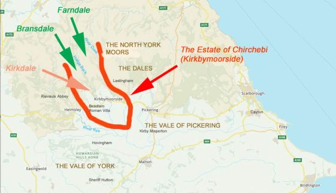

Map 1
- Representation of the possible extent of Kirkbymoorside Estate, late Eleventh
Century
(Locations of Rievaulx and Helmsley to emerge in the following century).
Kirkbymoorside
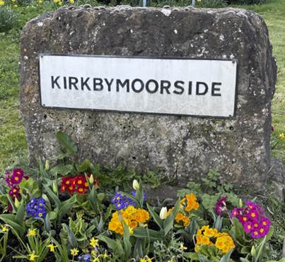
Kirkbymoorside
lies only 25 miles north of York. The name Kirkby Moorsheved,
which evolved into Kirkbymoorside, suggests that one of the key reasons for the
settlement’s establishment was the shelter offered by the southern slopes of
the moors into which the town nestles.
Its
antiquity is revealed by finds of stone axes; traces of the Celtic language in
the street names of Tinley Garth (garden) and Howe End (a ’howe’
being a burial mound); and Anglo-Saxon and Scandinavian artefacts including a
silver coin dating from around 790 CE, found within the grounds of the parish
church of All Saints.
Railway
companies spelt the name on the station as Kirbymoorside,
which is how it is traditionally pronounced. It is generally spelt Kirkbymoorside.
Kirk means church and -by is the Scandinavian word for
settlement. Moresheved which later morphed
into moorside, means top of the moor (The Concise Oxford Dictionary of English Place Names, 1960, Eilert Ekwall, page
280) and was a later expansion of the town’s name, presumably when the
number of Kirkbys necessitated further
differentiation. The name roughly translates as the settlement with a church
by the moorside.
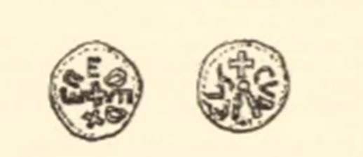
A silver sceat or coin of Aethelred I, King of Northumbria
(reigned 789 to 796 CE) was found in the churchyard in 1965 (A Sceat from All Saints Church,
Kirkbymoorside, Raymond Hayes, Yorkshire
Archaeological Journal, Volume 41, 1966, page 566 to 567)
suggesting that a settlement had been established at Kirkbymoorside by the
eighth century. There may have been a church in the settlement by about the
ninth century, and certainly by the tenth century. A sceat,
meaning ‘wealth’ or ‘money’, was a type of Anglo Saxon
coin in circulation in the seventh and eighth centuries CE.
As the Normans landed their amphibious invasion of England in
1066, the town with a church nestled into the southern edge of the North York
Moors, had thus adopted the Scandinavian derivation by, and was referred
to as Churchby, Chirchebi, or Kirkby.
The lands which nestled around Chirchebi
into the side of the wilderness of dales and moors, at the north western edge of the Vale of Pickering had been an
agricultural heartland for centuries. The Roman Villas of Beadlam and Hovingham were
likely to have been the heart of estates of the fourth century CE, probably
supplying the Roman military forces in Eboracum and
these lands under the protection of the dales’ edge, appear to have survived
and perhaps prospered during the tumultuous periods of Anglo-Saxon and later
Scandinavian invasions.
By
the time of the Conquest (TRE), Chirchebi was part of a great estate,
one of many in the hands of Orm Gamalson, who
had rebuilt nearby Kirkdale
Minster in the 1050s CE and left his mark on the landscape in the form of a
remarkable sundial.
Before
the Norman Conquest Kirby was in two manors, one of which belonged to Gamal, a
noted Saxon who possessed a considerable deal of property in these parts and
was Lord of the Manors of Lestingham, Spanton and
other places; and was ranked among the Northumbrian Nobles. In the Doomsday
survey we find it in the hands of Torbrand and Orm
the son of Gamal. Orm was Lord of the Manors of Kirby, Danby and Lealholm, and being of noble descent, is said to have
married Etheldreth daughter of Aldred, Earl of
Northumberland. (History of Kirkdale and
Vicinity, Part III, Kirkbymoorside, Tom
Parker, Ryedale Historian, Volume 11, 1982, page 10).
The status
of Kirkbymoorside before the Conquest (TRE) seems to have been that of a large
Anglo-Saxon manor with numerous outlying berewicks (Darby & Maxwell, Domesday
Geography of Northern England, 1962, page 82). A berewick was an outlying area of farmland belonging
to a manor.
Soke
estates consisted of a central manor controlling outlying ‘berewicks’
and ‘sokelands’. ‘Berewicks’
were detached portions of demesne land. Sokelands
were portions of land from which the lord of the central manor had the right to
collect judicial fines and/or extract obligations of service. Soke rights are considered to be privatised relics of the early system
of royal vills withy surrounding territories that
owed obligations of service. Of course because soke
was a jurisdictional right, soke estates could be reconstituted or created de
novo: not all soke estates are direct survivals from royal vills
with surrounding territories of obligation. However, in some cases the central
settlement of a soke estate includes a church controlling a mother parish
roughly coterminous with that estate. In these cases, it seems likely that the
estate and mother parish reflect the outlines of early Anglo-Saxon territories
of obligation. (Locating
Ingetlingum and Suthgedling: Gilling West and Gilling
East, Thomas Pickles, Northern History, Volume 46, Issue
2, 2009, pages 320).
The Domesday Book Evidence
In midwinter 1085, William the Conqueror announced the
Domesday Project to his witan. The King had mickle thought (great
thinking) and sooth deep speech (true and deep conversation) with his
Witan about his land, how it were set and with whilk (which) men. (The Anglo
Saxon Chronicle, 1085).
The Great Survey was made in the course of the first seven months of the year 1086. Commissioners were sent into every shire, who inquired by the oaths
of the men of the hundreds by whom the land had been held in King Edward’s
days, and what it was worth then; by whom it was held at the time of the
Survey, and what it was worth then ; and lastly,
whether its worth could be raised. Nothing was to be
left out. (Domesday Book for Yorkshire, Yorkshire Archaeological Journal, Volume 13, 1895, page 321). So very narrowly did he let spear it out, that there was not a hide
nor a yard of land, nor further, it is shame to tell, and it thought him no
shame to do, an ox nor a cow nor a swine was left that was not set in his writ.
(The History of the Norman Conquest in England, 1879, Edward A
Freeman).
The Domesday Book reveals the extent of landholdings or Orm Gamalson
immediately before the Norman Conquest (TRE).
The focus of Orm’s estate was in the Hundred
of Maneshou and included the settlements of Armundrebi (Amotherby); Broftone (Broughton); Coltune (Coulton); Nesse
(East and
West Ness); Neutone (East Newton); Frideton (Fryton); Gedlinghesmore (Gillamoor);
Berch (Great Barugh); Grimeston (Grimston); Harem (Harome);
Haruade (Hawade); Houetune (Hoveton
- Kirkdale); Hovineham (Hovingham); Hortcorp (Howthorpe Farm);
Hotun (Hutton le Hole);
Chirchebi (Kirkbymoorside);
Lechestorp (Laysthorpe Lodge
or Leysthorpe); Berch (Little Barugh);
Martone (Marton); Middelha; Misperton (Kirby Misperton);
Nagletune (Nawton); Neuhune (Newsham); Normanebi (Normanby); Ritone (Ryton); Slingelbi (Slingsby); Holme
(South Holme);
Walerum (Walton); Wad;
and Wellebrune (Welburn).
The settlements in brown are those listed in the Domesday Book
as forming part of the estate of Chirchebi (Kirkbymoorside). These
locations can be located on Map 2 below.
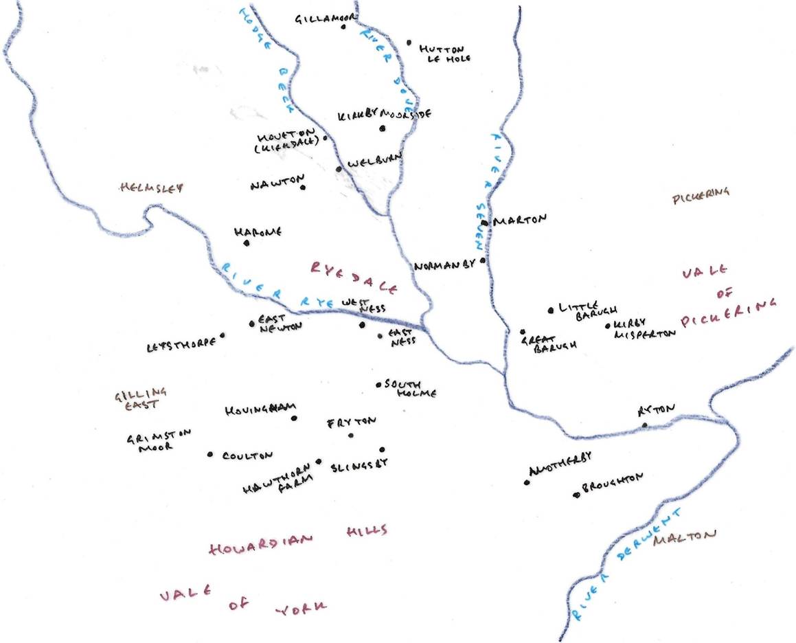
Map 2 - The settlements (in black ink)
belonging to Orm Gamalson in the Hundred of Maneshou immediately prior to the Norman Conquest
Orm held lands more widely across this part of Yorkshire.
In the Hundred of Burton, south
of Kirkbymoorside Orm held the settlement of Butruic (Butterwick).
In the Hundred of Langbaurgh to
the north of the North York Moors, Orm held lands which included the
settlements of Camisedale; Crubcelive
(Crunkly Gill);
Danebi (Danby); Broctun (Great Broughton);
and Lelun (Lealholm).
In Hundred of Yarlestre
to the east of modern Thirsk, Orm held lands which included the settlements of Ardene
(Arden Hall); Baghebi (Bagby); Carleton
(Carlton Husthwaite, which I think is more likely to have been the relevant
location than Carlton
Miniott); Iselbec (Islebeck Grange);
Chirchebi (Kirby
Knowle); and Sudtune (Sutton
under Whitestonecliffe).
In the Hundred of Allerton, north
of Thirsk, he held lands which included Kepwick.
In the Hundred of Scard
to the south of Malton, he held lands at Breddale
(Burdale);
Cheretorp (Kennythorpe);
and Lanton (Langton).
In the Hundred of Toreshou
to the northeast of Malton, Orm held the settlements of Esrelton
(East Heslerton); and Scirefburne
(Sherburn).
In the Hundreds of Bulford and Warter, between York
and Malton, he held land in Haslinton (Heslington); Bittecrame (Buttercrambe);
Scacheldene (Scackleton);
and Torp (Thorpe Hill).
In the Hundred of Acklam to the
south of Malton and east of York, Orm held lands in Fridarthorp
(Fridaythorpe);
Redrethorp (Raisthorpe);
Scradiztorp; and Syctedale
(Thixendale).
In York, Orm held the area of Heuuarde
(Heworth). He
lived there.
In the Hundred of Ainsty to the south of
York, he held the settlement of Badecorpel (Bishopthorpe).
In the Hundred of Craven (around
Bolton Abbey) near Skipton, he held lands in Brecebi
(Birkby Hall)
and Holecher (Holker).
It is therefore possible to map out the wider extent of Orm’s
holdings, and this might be a clue to the pattern of settlement and
relationships between settlements in the wider area before the Norman Conquest.
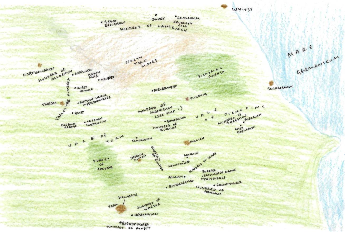
Map 3 – The Extent of Orm Gamalson’s
Holdings immediately before the Norman Conquest, c 1060
Kirkbymoorside
was Chirchebi in the Domesday Book of 1086. In the Domesday Book, the
principal settlement of Chirchebi itself comprised of 10 villagers, 1 priest, 2 ploughlands, 2 lord's plough
teams, 3 men's plough teams, 1 mill, value 4 shillings, 1 church.
After the Harrying of the North Saxon landowners gave way to Norman Rule and in Kirkbymoorside Hugh Fitz Baldric, a German archer who became the
Sheriff of the County of York in 1069 took possession of Kirkbymoorside (TRW).
The system of landholding introduced by the Normans, with its inception in the
Domesday Book, introduced the Feudal System as the basis of English property
ownership.
The record confirmed that the
tenant-in-chief in 1086 (TRW) was Hugh son of Baldric
whilst before in 1066, it had been Orm, son of Gamal (TRE).
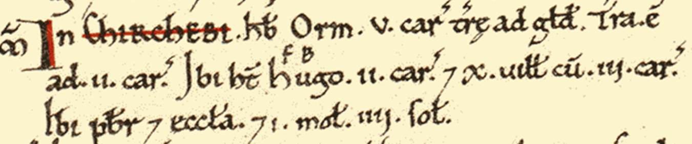
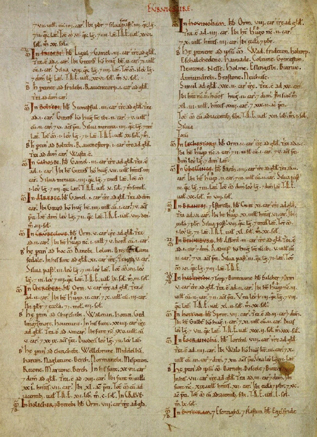
Chirchebi itself and its
surrounding villages was listed in three consecutive entries in the Domesday
Book (Domesday Book, Yorkshire page 60, The National Archives, E
31/2/2/6262, E
31/2/2/5539, E
31/2/2/6257)
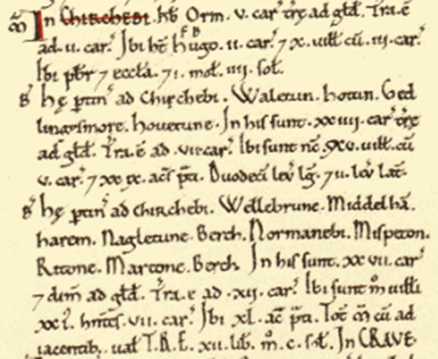

In Chirchebi (Kirkbymoorside)
Orm had 5 carucates of
land taxable. There is land for 2 ploughs. Hugh son of
Baldric has there two ploughs: and 10 villagers with 3 ploughs. There is a priest and a church. 1 mill, 4s.
These belong to Chirchebi (Kirkbymoorside):
Walerum (Walton), Hotun (Hutton le Hole), Gedlinghesmore (Gillamoor)
and Houetune (Hoveton).
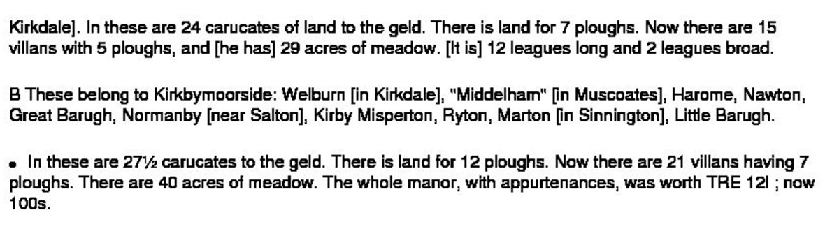
In these there are 24 caucates of land taxable. There
is land for 7 ploughs. Now there are 15 villagers with 5 ploughs. Meadow, 29 acres. 12 leagues long and 2
leagues wide.
These belong to Chirchebi (Kirkbymoorside):
Wellebrune (Welburn),
Middelha (“Middelham”),
harem (Harome), nagletune
(Nawton), Berch (Great Barugh),
Normanebi (Normanby), Misperton (Kirby Misperton), Ritone (Ryton), Martone (Marton), Berch (Little
Barugh). In these there are 27 ½ caucates
taxable. Land for 12 ploughs. Now there are there 21 villagers who have 7
ploughs. Meadow, 40 acres. Value of the whole manor with its appurtenances,
before 1066 £12; now 100s.
A League is 3 statute miles (4.83 km), so the area referred to in
to in the second entry is about 60 x 10 km.
The boundary of the estate of Chirchebi (later
Kirkbymoorside) can therefore be approximated from these details, including the
name of the settlements of which it was comprised.
Whilst the estate was clearly in the hands of the great landowner,
Orm Gamalson, the Domesday Book also records interests in some of the lands
within the estate in others before the Conquest.
Harome included 1 ploughland in the possession of Sortcol, an area of wasteland held by Uhtred and another
area of wasteland held by Thorbrand, son of Karli.


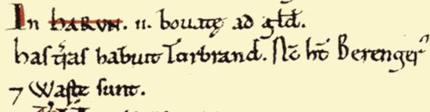
Nawton also included wasteland in the hands of Ulf, son
of Carlton and Thorbrand, son of Karli.


Thorbrand, son of Karli, also held a more substantial interest
comprising 2 ploughlands, 3 lord’s plough teams, a meadow of 12 acres, a mill
and church in another separate part of the Chirchebi estate:
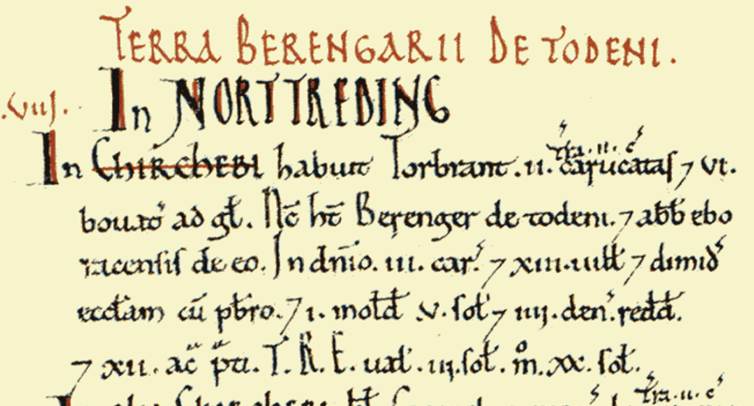
Open Domesday has associated this landholding as part of Kirby Misperton,
though I think it is probable that this is a reference to Kirkdale, and that
Thorbrand may have had an interest there. Orm was clearly the major landowner
of the estate, and it is possible that this was a form of sub tenancy. It may
be that Thorbrand was the person in actual possession of Kirkdale, after Om had
rebuilt the church, and it is notable that the name of the priest in c 1055
when Orm rebuilt the church was Brand. Chirchebi, the settlement with a
church, may therefore have defined the dual settlements of Kirkbymoorside and
Kirkdale, each with their own church, being the primary settlements in the
wider estate. Orm held the dominant interest in the whole estate, but Thorbrand
held Kirkdale of him.
Welburn
is the settlement immediately to the south of Kirkdale. Here, in addition to
Orm’s holding, there was 0.5 ploughlands held by Grim before the Conquest and
wasteland held by Torbrand, son of Karli.


My interpretation is that the great nobleman Orm was the principal
pre-Conquest landowner of the Chirchebi estate. Within his estate,
certain pieces of land, generally tiny plots of ploughland or wasteland, were
held by others, most likely as sub tenants of Orm. Kirkdale, which we know from
its sundial had been rebuilt by Orm in about 1055, was in the possession of Torbrand, son of Karli. Torbrand
may have been of the same family as the priest of Kirkdale church, Brand. As
Orm’s primary interest in Kirkdale is evidenced by the sundial, this seems
likely to have been some form of secondary interest to Orm’s, but Torbrand was recorded in the Domesday Book as the effective
owner.
There may have
been some religious association between
Kirkdale and Horn Ridge adjacent to Waingate
and overlooking Farndale. We therefore have an association between Kirkdale and
both Farndale and Bransdale, suggesting they were all part of the same
political entity.
The Domesday Book
evidence and the eighth century evidence of the association between the horned
valley, Ceolfrith and Kirkdale, all support the thesis that the wider estate of
Kirkbymoorside comprised Kirkbymoorside, Kirkdale, the berewicks
nestled at the northwest corner of the Vale of Pickering, as well as the
wilderness lands of the moors and dales to the north. The estate of
Kirkbymoorside was a place of Anglo Saxon
significance.
A Geographical perspective
The
parish of Kirkbymoorside lies on the southern edge of the North Yorkshire Moors
between Bransdale, the valley of the Hodge Beck, on the east, and Farndale, the
valley of the River Dove, on the west. These two streams converge to the south
of the town which stands back to the north of the main Thirsk-Scarborough
road, the A 170, midway between Helmsley and Pickering. (An
Excavation at Neville Castle, Kirkbymoorside,
1974, RAH Williams, Yorkshire Archaeological Journal, Volume 49, 1977, page
87).
The width of the Kirkbymoorside estate described in Domesday Book
of about 10 km is approximately the distance from of Kirby Misperton to Harome. It seems likely that the listed settlements were
the focus of the estate, nestled into the side of the dales at the edge of the
Vales of Pickering and York. This was an ancient settled
land and would have been cultivated over centuries.
It seems most likely that the longer distance of 60 km represented
a projection into the dales and onto the moors, which was effectively a nominal
holding including as yet untamed
lands. It was akin to the ‘line on a map’ approach of the age of later European
empires. It represented a claim which extended into the wilderness.
Whilst we can’t be sure of the boundaries, this would make sense
as we know that lands in Farndale, Bransdale and Rosedale (within the area of
this nominal projection) started to be given post Conquest to monasteries and
then land in those dales started to be cleared in the thirteenth century. In
other words the nominal reservation of the wild daleland and moorland in the eleventh century led to the
settlement and cultivation of those higher lands in the centuries which
followed.
The dales at the time of the Conquest were heavily forested and
the moors were open and exposed as today, though in Neolithic to Bronze Age
time the forest may have extended onto the moors. The heights of the moors had
a long history and excavations of flints and arrowheads, barrows and cairns are
plentiful in such places as Westerdale Moor, Blakey Ridge and Rudland Rigg. The
interior region was well known, but largely untamed.
We might therefore represent the extent of the estate of
Kirkbymoorside in the mid eleventh century. It might be expected that the River
Rye may have marked the southern boundary and the line of the Thurkilisti route is a likely candidate to
have marked the western boundary.
That the estate included the dales might also be supported by the
association of Bransdale with the church at Kirkdale, and the evidence of its
unique sundial.
The Domesday survey of 1086 recorded that Chirchebi
(Kirkbymoorside) had two churches, one of which was in the manor of Orm, a
considerable local landowner. If this refers to Kirkdale, as seems probable,
the other church, in the manor of Thorbrand, would be Kirkbymoorside parish
church. (I think it more
likely that the manor was that of Orm, and Thorbrand held a secondary interest
in the church at Kirkdale, see above).
The last sentence of the inscription occurs below the sundial:
‘and Hawarth me wrought and Brand PRS’.
Although this is a common Anglo-Saxon maker formula, it can be construed as
referring either to the sundial itself - that is it was ‘signed’ by its makers
- or to the entire minster.
Recent literature on the Kirkdale inscription has read PRS for an
abbreviation of the Old English PR(EO)S(T), priest, or the Latin PR(E)S(BYTER).
Brand is perpetuated in Brandsdale, the
name of the valley for some miles upstream of Kirkdale. The Hodge Beck was
known as the River Bran until comparatively modern times.
(Anglo
Saxon Sundials in Ryedale, John Wall,
Yorkshire Archaeological Journal, Volume 69, 1997, page 93).
In other words Brand was a name at
the time of Domesday Book of the Priest of Kirkdale and its probable landowner,
Thorbrand. It is also the name of the dale most associated with Kirkdale, whose
watercourse, the Hodge Beck it shares, Bransdale. Bransdale comprises the Old Norse
components Brandr and dalr
and so, was the valley of Brand.
In other words there was a close association between Kirkdale, the
location of one of the two churches of the Chirchebi estate, and Bransdale, a
name shared with the Anglo-Saxon-Scandinavian priest shortly before the
Conquest, the landowner mentioned in the Domesday Book and the Hodge Beck which
runs through Bransdale and alongside Kirkdale. Bransdale was already seen as a
part of the estate of Chirchebi, even though it was a wild place like Farndale
in the eleventh century.
Kirkdale may also have had a close association with the wilderness
of Farndale and it is possible that the Horn Ridge
above that dale, adjacent to the ancient cross moorland route of waingate, was a place associated with Kirkdale by
the early eight century CE. There is a separate exploration of the possible association of the Horn Ridge with the cornu
vallis where Ceolfrith of
Monkwearmouth-Jarrow rested before his final journey towards Rome.
Post Conquest History
The Game of
Thrones between the royal houses for possession of Kirkbymoorside sets the scene
for the emergence of Farndale into the historical records, first as a place of
monastic grants, and shortly thereafter, as a place of lay settlement.
The town’s
name evolved from Chircheby or Kirkby
to be known as Kirkby Moorsheved (Moresheved meaning top of the moor).
1086
When Hugh son of Baldric died in 1086, almost as the ink dried on the Domesday
Book, the estate passed to Robert D'Estoteville or de Stuteville (Early
Yorkshire Charters, Volume 9, Stuteville, C T Clay, 1952, page 70). The Stuteville family built a moated wooden castle on Vivers Hill behind the church with commanding views of the
town and beyond.
On the east of the church rises the
hill on which is the site of the ancient castle of De Stuteville. Of this ancient Baronial Castle there are now no traces excepting the
deep Moat surrounding it. The Family which occupied it were great in their day
and great benefactors of the catholic church. The first which came to England
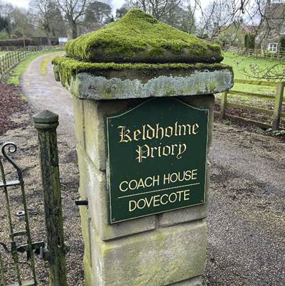
was Robert de Stuteville. Lord of Kirby, he founded the celebrated Priory for
Cistercian Nuns at Keldholme in the reign of Henry I; he succeeded Eustace
Fitzjohn as Lord of Knaresborough in the same reign. (History of Kirkdale and
Vicinity, Part III, Kirkbymoorside, Tom Parker,
Ryedale Historian, Volume 11, 1982, page 13).
1106
However the turn of the twelfth century was
a challenging period for the Norman nobility obliged to select the right
brother to support in the royal clashes between the Conqueror’s sons. When this
period of uncertainty ended with Henry I’s defeat of his elder brother Robert
Curthose in Normandy in 1106, it was Nigel d’Aubigny
who emerged as one of Henry’s ‘new men’. The Mowbrays came into possession of Kirkbymoorside. Nigel’s mother was Avice of Montbray in Normandy. He married Gundreda
of Gournay, and they had a son who would become Roger de Mowbray. It was House
Mowbray who took control of Kirkbymoorside as the dust settled.
1138
In the reign of King John, William de Stuteville had the
command of Northumberland, Cumberland and Westmorland with all their castles;
and in the reign of Stephen, Robert de Stuteville was present at the celebrated
Battle of the Standard fought near Northallerton, A.D. 1138. (History of Kirkdale and
Vicinity, Part III, Kirkbymoorside, Tom
Parker, Ryedale Historian, Volume 11, 1982, page 13).
Shortly afterwards a dispute arose between the families as to
the right of possession, and the Henry II restored the barony of Kirkbymoorside
to the Stutevilles. It remained with the Stutevilles and then, through Joan,
the daughter and heiress of Nicholas Estoteville (ie Stuteville), to Hugh de Wake.
Nicholas de Stuteville gave an annuity of four
marks out of his mill at Gillamoor to the nuns of St. Mary's at Keldholm, and the family enriched that Priory with several
grants out of their immense possessions, as may be seen in the records of that
House. This ancient family besides being Lords of Kirby and Knaresborough were
also Lords of .Hemlington in Cleveland, and possessed
lands in Bransdale, Farndale, Rosedale, Ingleby, Evenitt,
Keldholm, Kirby Mills, Rookborough
and other places. (History of Kirkdale and
Vicinity, Part III, Kirkbymoorside, Tom
Parker, Ryedale Historian, Volume 11, 1982, page 13).
1233
Hugh, son of Baldwin de Wake, married in the
17th year of Henry III, A.D. 1233, Joan, daughter of the last-named Nicholas de
Stuteville, who being his heiress, carried the Barony of Kirby to that family.
Hugh de Wake died about the year 1241, and Joan his wife died in
the 4th year of Edward I (1276). The impression of her seal is a woman
riding on horseback holding the bridle in her right hand. (History
of Kirkdale and Vicinity, Part III, Kirkbymoorside, Tom Parker, Ryedale Historian, Volume 11, 1982, page 13).
The Stutevilles’ ownership of Kirkby thus became the ownership of
the Wakes through marriage of a Stuteville daughter.
The town
grew in importance and prospered under the Wake family
1254
Kirkbymoorside
has served as a trading hub at least since 1254, when it became a market town.
The Wednesday Market, which still thrives today, was established that year
along with an annual fair
On 10 December 1254 Henry III granted to the Lord of the Manor of
Kirkeby Moresheved, Hugh le Bigod, a charter to hold
a weekly market on Wednesday and a yearly fair in the autumn.
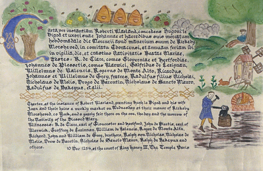
Kristi Sillaots’illuminated
replica on vellum of the original Medieval Latin text and a translation
1276
Joan was succeeded at this place by Baldwin de Wake, her son,
who at his decease left two sons, John and Thomas, and one daughter, Margaret.
John and Thomas dying without issue in the reign of Edward III, Margaret, their
sister, succeeded them. She had married Edmund de Woodstock, Earl of Kent, and had
one daughter, Joan, for her beauty called the Fair Maid of Kent, who married
Edward the Black Prince, father of Richard II. She had previously married
Sir Thomas Holland Knight, afterwards Earl of Kent. (History
of Kirkdale and Vicinity, Part III, Kirkbymoorside, Tom Parker, Ryedale Historian, Volume 11, 1982, page 13).
1349
The town was badly impacted by the Black Death. The wooden castle lay in ruins. A
loss of order within the town followed.
1362
Thomas died A.D. 1362 leaving Thomas his son
and heir.
1408
Prosperity
returned after 1408, when the Neville family assumed an interest, although
little remains of the fortified manor they built to the north of the town. The
Nevilles remained Catholic and took part in the Rising of the North of 1569.
Thomas was succeeded at this place by Edmund
Holland, Earl of Kent, whose sister Elizabeth, married John, Lord Nevill of Raby,
who died A.D. 1423.
In
consequence of this marriage Kirby passed to the Nevills,
who had their residence at the Castle whose ruins may still be seen upon the
hill at the north-west end of Castle Gate. The foundations of this castle, once
the pride and security of the town are still traceable. On the accessible side,
which is east and north, it seems to have been defended by strong works which before
the use of gunpowder would render it impregnable. The walls and towers on the
north-west side have been built on the edge of a deep ravine called the Manor
Vale; a large portion of these walls is yet standing. In the year 1730 a wing
of this castle, with substantial rooms in it, was pulled down and removed to
build the Tollbooth, and the work of despoilation only ceased about forty years
ago. So it may be said of this as of so many of its kind;
Sic transit gloria mundi. One of the keys of this castle, having a fleur de lys on its handle, is kept at one of the old houses in
Castle Gate. When we reflect that in this castle has dwelt one of the highest
families, the powerful Nevills; the mighty Earl of Salisbury and his yet
mightier son the renowned King-maker Warwick, members of the same family, we
regret that nothing remains of its greatness but a ruined wall.
(History of
Kirkdale and Vicinity, Part III, Kirkbymoorside, Tom Parker, Ryedale Historian, Volume 11, 1982, page 14).
Neville
Castle stood slightly to the north of the town on ground sloping down from the
north-east to the south-west between the 91 m (300 ft) and 83 m (270 ft)
contours at grid reference SE 695869. On the west a steep slope down into Manor
Vale, a dry river valley, formed the castle’s western boundary, while the
remainder of the grounds lay in three fields known until recently as Manor
Vale, Horse Park and Calf Garth. About 500 m east of Neville Castle lies the
moated enclosure known as Stuteville Castle, while about 200 m to the south
stands High Hall, an early seventeenth-century building; these represent the
predecessor and successor of Neville Castle.
From
about 1200 the Stuteville family held Kirkbymoorside and reputedly lived in the
moated enclosure bearing their name. At some period the
manorial residence moved to the site under discussion. The manor passed from
the Stutevilles into various hands and eventually became the property of the
Nevilles, Earls of Westmorland.
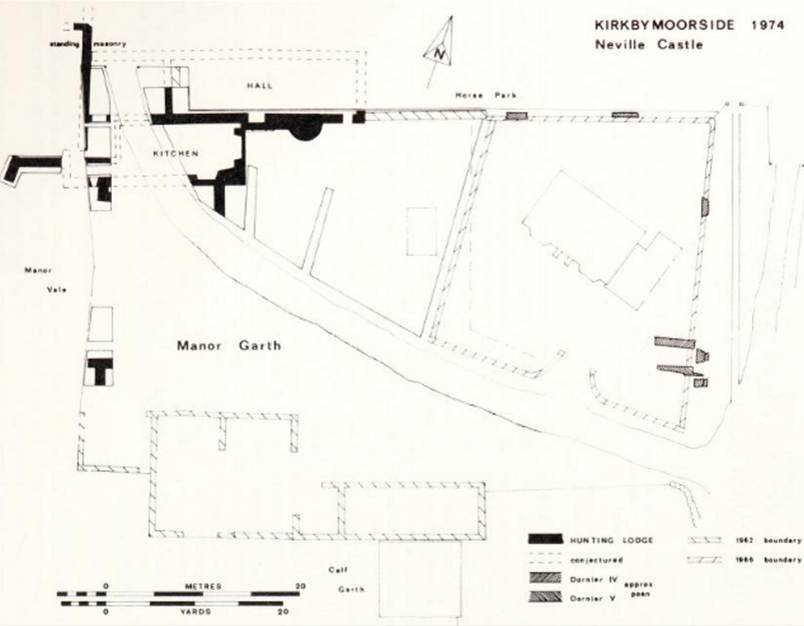
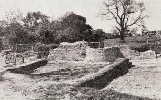
Neville
Castle, the hunting lodge of the Nevilles The Hunting Lodge
The
hunting-lodge was built in the style of the fifteenth or sixteenth century but
may represent the rebuilding of an earlier stone-built manor house. There are re-used
stones in the window recess of the original kitchen and tooling on the buttress
in Manor Vale is typical of the earlier mediaeval period. Only after further
excavation will the complete plan of the lodge be revealed and perhaps then the
several periods of rebuilding and extension will be better understood. Pottery
in the demolition material in the kitchen and at the base of the bay window is
of the late sixteenth century and at this time the lodge was leased to a
farmer. He may well have lived in part and converted the remainder for
agricultural use. By the end of the seventeenth century High Hall had become
the new ‘manor house’.
(An Excavation at Neville Castle, Kirkbymoorside, 1974, RAH Williams, Yorkshire Archaeological Journal,
Volume 49, 1977, page
87)
1569
The Nevilles remained Catholic and took part in the Rising of the
North of 1569.
1570
From this castle in the year 1570, Charles
Nevill, sixth Earl of Westmorland made his escape in a great snow, from the
man-hunting myrmidons of Queen Elizabeth. But his estate and castle with its
extensive parks were only a small appendant to the vast domains of the family.
"The chief residence of the powerful Family of the Nevills," says
Camden, "was at Raby Castle, the most extensive and magnificent in the
North of England." (History of Kirkdale and Vicinity, Part
III, Kirkbymoorside, Tom Parker, Ryedale
Historian, Volume 11, 1982, page 14).
In 1569
the sixth earl was attainted and Kirkbymoorside was forfeited to the Crown. A
farmer leased the castle up to the end of the sixteenth century (An
Excavation at Neville Castle, Kirkbymoorside,
1974, RAH Williams, Yorkshire Archaeological Journal, Volume 49, 1977, page
87).
1614
By 1614 the town was starting to be referred to as Kirkbymoorside,
rather than Kirkby Moorsheved.

Easter Term,
1614, 12 Jas 1
(Yorkshire Fines for the Stuart Period, Volume 2 (1614 to 1625), Edited by William Brigg,
Yorkshire Archaeological Society Record Series,
volume
58, 1917, page 2 (Folio 5,
Kirkbymoorside 1614)).
1730
The great Toll Booth in the middle of the town was built about
1730 with stone taken from the Nevilles' manor.