The vicinity of Farndale in the Anglo Saxon period (400 CE to 794
CE)
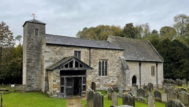
FAR00001H
|
Return to the Home Page of the Farndale Family
Website |
The story of one family’s journey through two
thousand years of British History |
The 83 family lines into which the family is divided.
Meet the whole family and how the wider family is related |
Members of the historical family ordered by date of
birth |
Links to other pages with historical research and
related material |
The story of the Bakers of Highfields, the Chapmans,
and other related families |
Dates are in red.
Hyperlinks to other pages are in dark blue.
Headlines are in brown.
References and citations are in turquoise.
Context and local history are in purple.
BCE - Before the common or current era. The contemporary equivalent of
BC.
CE - Common or current era. The
contemporary equivalent of AD.
kya – abbreviation for a thousand years
YBP – Years before present
|
The
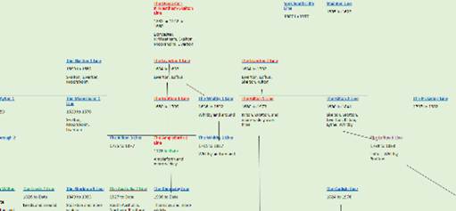
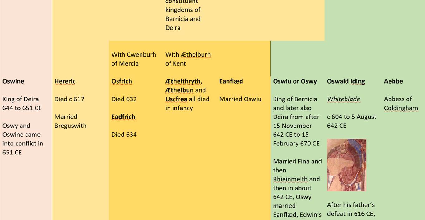
Genealogy of the Kingdoms of Deira, Bernia and Northumbria
The Family Tree of the
Kings of Deira and Bernicia and their merger into the Kingdom of Northumbria |
|
400 to 866 CE |
According to Bede, the Angles came from Ageln
in the Jutland peninsula of Denmark. Archaeological evidence is sparse for the
earliest phase of their settlement in this area.
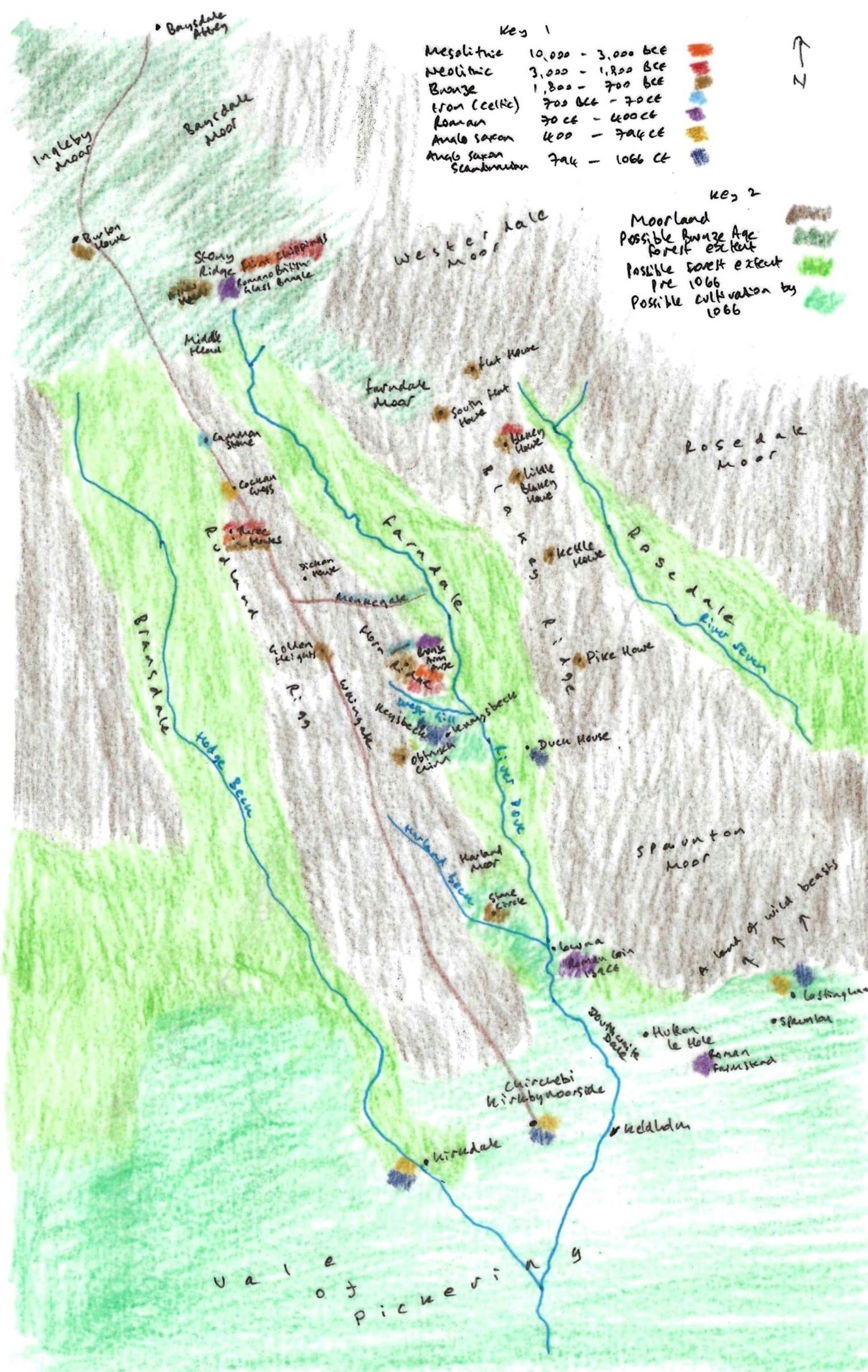
A representation of Farndale and its vicinity prior to
1066
Key 1 is a colour code for archaeological finds around
Farndale and the period of time with which they are associated, giving an indication
of settlement patterns around Farndale through time. Key 2 shows the possible
extent of moorland, woodland up to the Bronze Age and woodland up to 1066 and
beyond, and the area of cultivation at the edge of the Vale of Pickering.
A circular area six miles in radius
with the centre at Helmsley was chosen and it was decided to analyse the change
in settlement patterns between the Mesolithic (beginning 7600 B.C.) and the
Domesday Book (1086). The programme of investigation began with the mapping of
settlement sites for each of the six periods.
With the Anglo-Saxon period (and the
first settlement pattern to in any way resemble the modern one) we enter into
an area of deep controversy. The traditional idea of incoming Angles, Saxons
and Jutes driving out the native population and settling on their land is now
being challenged, and it is now in vogue to see the incoming barbarians as far
less numerous than previously thought and, rather than fighting the native
population, settling beside them and occupying areas which had not previously
been intensively cultivated. Continuity, rather than change, is now emphasised.
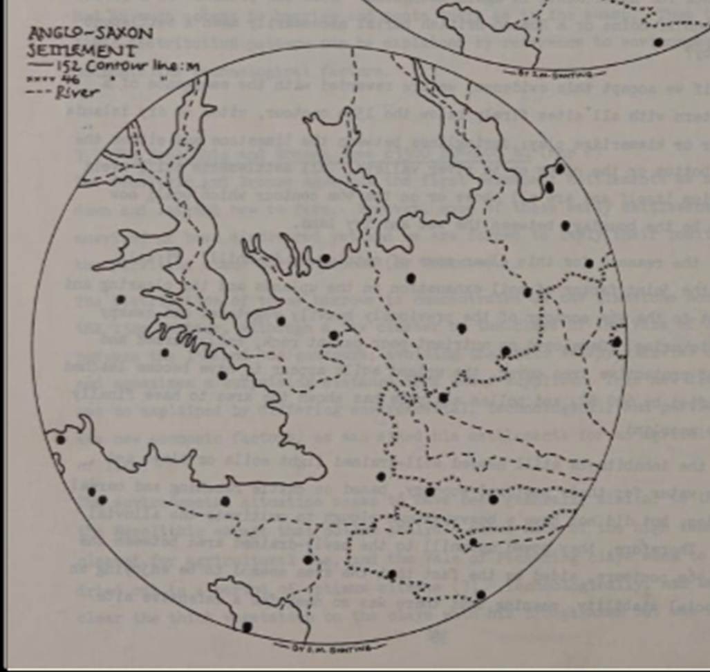
However, in this area the hypothesis is not backed up by the evidence
of the Survey. The Anglo-Saxons brought no new technology with them and there
seems to have been no environmental change between the Roman and Saxon periods
with the result that the newcomers settled in the same area on the map as the
Romano-British - between the 152m and 46m contours. However, except in five
cases (Helmsley, Carlton, Gillamoor, Hovingham and
Great Edstone circles), there is no evidence of the
Anglo-Saxons settling on Romano-British sites, and even on those sites there is
no evidence of actual continuity. The Romano-British population seems to have
completely disappeared and people speaking English have moved in and named
their settlements with their own dialect.
Thus the mapping of place-name evidence shows a picture of a
completely new settlement pattern with the same environmental limitations of
the now agriculturally useless moors and the over-heavy soil of the alluvium.
In particular settlements are normally found on springlines
between the oolite sandstone and limestone and either the alluvium or the
clays. However, a few sites are located either on the clays within the Vale of
Pickering or in the river valleys.
A glance at the modern geological map shows this up very clearly.
Overall, the pattern is of far more sites being clustered in and
around the dry parts of the Vale of Pickering, where the Anglo-Saxons could
practise their predominantly arable economy within reach of arable or grazing
land, water, fuel and building materials. There is, however, evidence of four
settlements on suboptional land above the 152m
contour and this confirms what is known from documentary evidence of a degree
of population pressure on the good land.
(A look at Ryedale Settlement Patterns, Ryedale Historian, Volume 12, 1984, page
31)
After the Angles were
converted to Christianity, they left more substantial evidence. Christianity
came to Yorkshire not from Rome via Canterbury, but from the north and
ultimately from the west. Monasteries were established on sites resembling
Lindisfarne, which offered qualities of remoteness but also access to
settlements. Lindisfarne as well as sites such as Iona in Scotland, were near
to navigational routes which were then primarily by sea.
Whitby was founded by Aidan and Hilda was its
most famous abbess. Another cell was later established in Forge Valley near Scarborough.
The founding of an early
monastery at Lastingham
was vividly described by Bede. When Cedd
established the early Celtic monastery at Lastingham in 653 CE, only a few
miles south from the entrance to Farndale, he deliberately chose a place at the
edge of civilisation. The Venerable Bede when
he recorded the event a century later described the area where Farndale lay, vel bestiae commorari vel hommines
bestialiter vivere conserverant,
‘a land fit only for wild beasts, and men who live like wild beasts’ (The Ecclesiastical History of the English People by
Bede, Book
III, Chapter 23,
edited by Judith McClure and Roger Collins, Oxford University Press,
reissued 2008). These early monks must have gazed across the wild Spaunton
Moor in the direction of the wooded valley that would become Farndale, and felt
they had reached a place at the end of the world.
The tension between the
Celtic and Roman forms of Christianity was resolved at the Synod
of Whitby in 664 CE.
Closer to Farndale, the
little church of St Gregory at
Kirkdale near Kirbymoorside is secluded, lying
across the narrow valley. The agricultural lands around the focal points of
Kirkdale church and the small settlement of Kirkbymoorside was the likely to
have been the
home for centuries of the ancestors of those who later settled in Farndale.
This was the period of
the Deira. York,
by then Eoforwic remained a centre of power and influence
only a short distance south of our ancestral lands. Alcuin was a
pioneer of educational techniques, which he took to the court of Charlemagne,
to establish a European educational system.
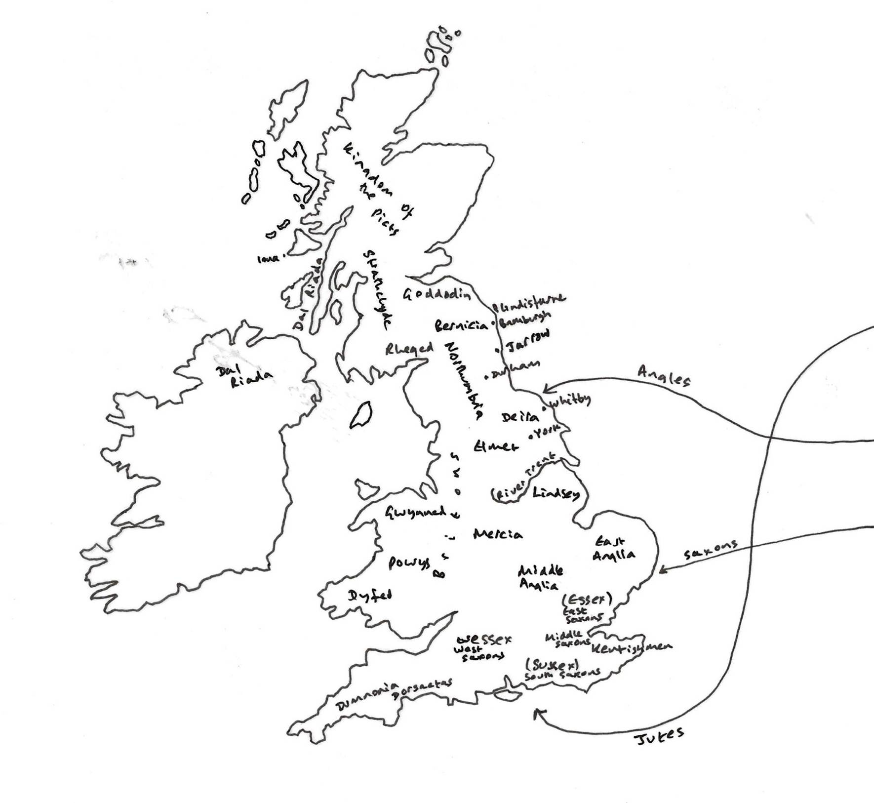
Kingdoms of Britannia and
Ireland in the early Seventh Century CE
Local organisation
focused around a lord’s great hall (later called manors by the Normans). From
these would satellite outlying demesne farms which were called berewicks. Free men held soke estates. There were some
larger sokes which belonged to the King,
church or Earl. In other words, there was an informal hierarchy from larger to
smaller lordships. (John Rushton, The History of
Ryedale, 2003, page 23).
To the north, in lands to
become the home of a branch of the Farndale family centuries later, a Saxon
Princess was buried at Carlin How.
Cockam Cross is a way
marker, probably of late Anglo Saxon origin. Its broken shaft has been used as
a guide stone. It is inscribed with the following on each of its faces: Stoxla Rode, Farndale, Bransdale
and Kirby Rode. Stoxla stands for
Stokesley and Kirby for Kirkbymoorside. The carved names are of course
of much later date.
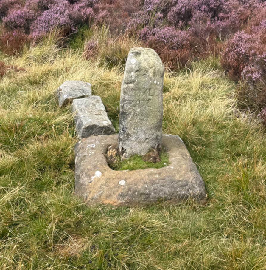
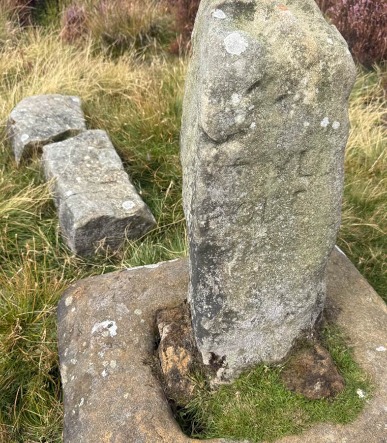
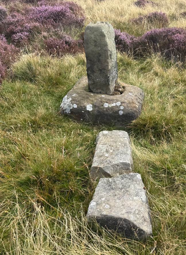
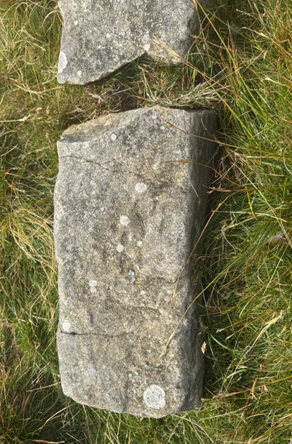
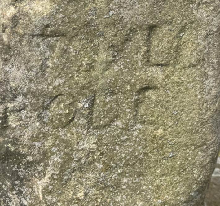
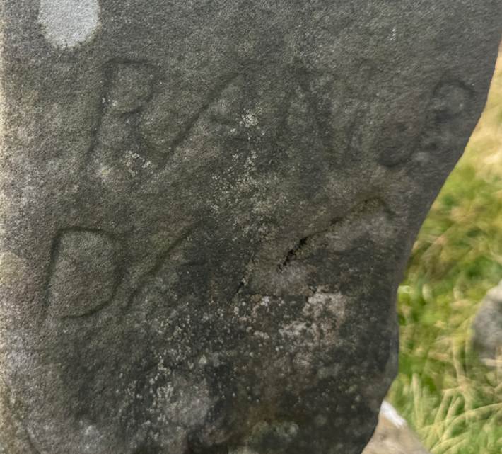
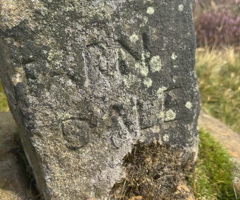
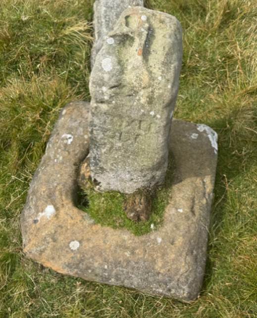
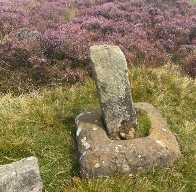
Cockam Cross, August
2025
An early Saxon sceatta in perfect condition was found in 1957 on the bleak
moorland ridge (1400 ft. high), south-west of Westerdale above White Gill (NZ
640021)(on
the lower slopes of Stony Ridge). He picked it up on the surface of the
peaty soil with flint flakes. Whilst it was about the commonest type of sceatta in the country, very few sceattas
of any type come from north and west of the Fosse Way, except for fairly large
numbers at Whitby. Perhaps some early settler had gone up there looking for
strike-alight flints and lost a coin.
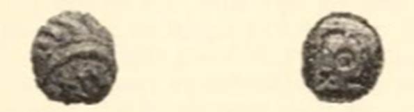
(A Sceatta from Westerdale,
North Riding, R H Hayes, Yorkshire
Archaeological Journal, Volume 41, 1966, page 567).
Many stories are
told of the origin of the cairns and standing stones on the exposed ridgeways
of the moors. Recently, in the Daleman, a controversy raged over the Ralph
Cross. A Middlesbrough man contended that this cross was raised by a Danby man
called Ralph to mark the spot where a countryman perished in a blizzard about
1840, hence the name Ralph's Cross. Granted that Young Ralph is more recent,
yet the name must be more ancient, for in support of Old Ralph is mention of Crucem Radulphi in a charter dated
1200 AD. They are certainly connected with the Abbey and Priory boundaries. Fat
Betty, so named for its squat base and shaftless wheel head, have connections
with Rosedale Priory. The type of head could be early Norman or late Medieval.
(Raymond Hayes, Farndale, 1961, unpublished, page 11).
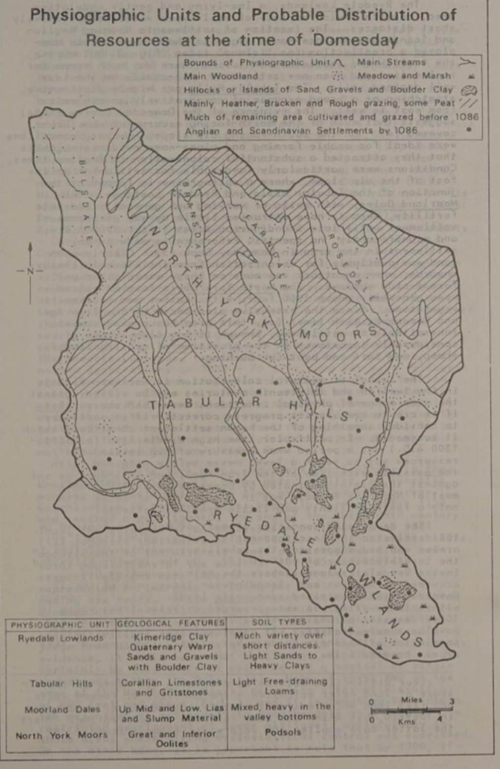
(Medieval Colonisation in Ryedale, R I Hodgson, Ryedale Historian,
Volume 10, 1980, page 47).
Some of the more intriguing and rare place-names in
our landscape are those that suggest or refer to the Anglo-Saxon ‘folk-moot’ or
Hundred court, a place of public assembly. They are names that contain the
place-name elements which refer to speech, such as ‘spell’ (Old English,
hereafter abbreviated as OE) in Spellgate and ‘maedel’ (OE), as in Malton, or to assembly places such as
‘mot’ (OE), meeting-place, or the wapentake name for ancient Ryedale, ‘Maneshou’. These names may indicate meeting places where
the Anglo-Saxons came together in popular assembly, the antecedents of our
present day councils and courts.
In Ryedale there are several names which hint at
possible Anglo-Saxon meeting places. Two of these names include the ‘spell’
element, one the ‘maedel’ element, and some others
have obscure suggestive names. The fact that there were several assembly places
in Ryedale suggests that they were not held in only one location. It may be
that some were more important than others. Some of the place-name elements are
ones that occur early in the Anglo-Saxon period, such as ‘maedel’
in Malton and the ‘mot’ site in Hovingham, suggesting that these were the
earliest assembly places, while the ‘spell’ names may occur later in the
Anglo-Saxon period.
The first of the ‘spell’ names occurs in Spelcros (var. Spelcrosse). The
name Spelcros appears in a charter of a land grant to
Rievaulx Abbey c. 1142-52: ... et ad Spelcros xu percatas in latum’
(... and at Spelcros 12 perches in breadth). This
early charter is describing land grants to Rievaulx Abbey and relate to Welburn
Grange in the area of Welburn/Skiplam/Wombleton. J.
Atkinson, the editor of Rievaulx Charters, suggests that ‘Spelcros
may possibly have stood where Stony Cross now stands.’” R.H. Hayes concurs with
this view and refers back to I. Cooper when he writes that ‘Stonycross
near Wombleton road junction with A170 maybe Spelcros mentioned in 1145 A.D.” Today only a cross-base
survives, at OS 668 848. The significance of the location of the cross is as a
meeting point of crossroads and footpaths/bridlepaths, suggesting an important
place in its earlier history. The cross stood in an elevated position
overlooking the vale to the south.
There are local stories associated with the cross, and as is so
often the case, these legends can become intertwined. The fierce local pagan
ruler Black Pig built his ‘howe’ (burial mound) on the site of the cross and
was buried there at Creaking Howe. The Anglo Saxon church of Kirkdale is about
three-quarters mile away. There is a local legend about the building of the
church.'” A Christian priest Ethelwald tried to build
a church at Stony Cross. However, the stones were removed each night to the
bottom of the dale at Kirkdale and so eventually Ethelwald
abandoned the haunted site at the crossroads and built the Anglo-Saxon church
at Kirkdale.
Although Creaking Howe has not been precisely identified it may be
that Spelcros marks its location. Spelcros
is on a rising piece of ground that could have been artificially raised, and so
possibly be a burial mound. If it is a burial mound this could explain the
legend of the attempt to build a church there. The Church in its early
conversion period chose important pre-Christian sites, such as burial mounds,
as places to build its churches. It is intriguing to consider why the location
was then changed to Kirkdale. Did the Kirkdale site have greater significance
in its location next to the Hodge Beck, originally called Rydover,
var. Redofram (from the Celtic, ‘dark’)? The water of
the Rydover had the phenomenal ability to rise and
dry up seasonally, a quality giving it a strong spiritual import in Celtic
times, and so the Kirkdale site may have taken precedence over a pagan burial
site.
J. Blair comments on the ‘rarity of place-names indicating the
holding of assemblies at crosses.’'' It would seem, then, that a popular
assembly taking place at a cross is uncommon and so a further layer of interest
is added to the ancient Spelcros.
In summary, Spelcros is a rare
place-name and is sited at a significant location of crossroads and footpaths.
It stands in an elevated position and incorporates the Black Pig legend. These
are the ingredients of one of Ryedale’s most intriguing landmarks.
So far the sites of these early places of assembly or folk-moots
have proved difficult to locate on the ground. It seems interesting that none
of the examples of possible places of assembly — Malton, Spellgate,
Spellcross and Mothow — now
seem to be located in town or village centres, although they were all close to
the local centres of Malton, Pickering, Kirkbymoorside and Hovingham. They do
seem to be sited in areas that had important local significance, such as near a
Roman site, or a cross, or a burial mound. They are all in areas with
commanding positions and splendid views. It is hoped that more may be found out
in the future, perhaps through the discovery of early records or through a
thorough study of field-names or through archaeological exploration, and that
new light will be thrown on this ancient institution that is the democratic
foundation of our own local system of government and justice.
(Anglo Saxon Assembly Places in Ryedale, Madge Allison, Ryedale Historian, Volume 25, 2010 to 2011, page 32).