1767 Estate Map of Kilton

A Plan of Joseph Tullie Esq's Estate, being the Compleat Manors of
Kilton in the Parish of Brotton near Guisbrough in
the North Riding of the County of YORK. By R. Richardson, 1767
The detailed estate map instructed by Joseph Tullie showing
Kilton in 1767, within the Records of the Skelton and Gilling Estate Office
|
Return to the Home Page of the Farndale Family
Website |
The story of one family’s journey through two
thousand years of British History |
The 83 family lines into which the family is divided.
Meet the whole family and how the wider family is related |
Members of the historical family ordered by date of
birth |
Links to other pages with historical research and
related material |
The story of the Bakers of Highfields, the Chapmans,
and other related families |



The Estate Map (Skelton and Gilling Estate Records)
Three maps
provide the main sources for this period – the Estate Map of 1767, the Tithe Map of 1844 and the first
Edition Ordinance Survey 6 inch map of 1856 (see Kilton entry for 1856). An
estate map was commissioned by Joseph Tullie and surveyed by R Richardson in
1767 and the original map is held by Skelton and Gilling Estates.
The 1767 Estate Map shows an enclosed
landscape, with the various tenancies marked. All the fields were named and
tracks and paths were marked. The map shows marked changes from the medieval
landscape. The 1767 map shows a landscape which, while containing much of the
medieval past, had undergone a dramatic transformation. Enclosure of the medieval
fields had taken place and probably partly as a result of
this the number of farmsteads had increased from perhaps five in the medieval
period to eight in 1767. An estate village had been established at Kilton, a
hunting lodge at Buck Rush and a number of new
buildings had been built. In addition, two new roads had been constructed, the
first linking Brotton to Kilton Thorpe and cutting through the enclosure
boundaries of Middle Field; the second running from Kilton Lane to the new farm
at Stank House, which continued on to the Lodge and
Buck Rush. The latter survives much as built and is a fine example of a broad c
18th century road which contrasts markedly with its medieval
predecessors.
The landscape had undoubtedly been
deliberately reorganised yet again. It is particularly interesting to note the
re-establishment of a major village at Kilton and the similarity of the plan
formed to its medieval predecessor and, indeed, to see that this attempts to create
a major nucleation within the Township was as unsuccessful as its predecessor.
It may be that the forces at work were much the same, the prosperity of the
post medieval village being dependent on the hall at its head in much the same
way as the medieval village may have been dependent on the castle.
The date of the reorganisation is not known,
it was certainly post medieval and probably post enclosure. Unfortunately
the date of enclosure is not known either. However, the complete appearance of
the estate village when set against its decayed nature in 1845 might suggest
that the reorganisation had taken place not long before.
(Robert
Daniels. 1990. Kilton: A Survey of Moorland Fringe Township in Medieval
Rural Settlement in North East England.
Architectural and Archaeological Society of Durham and Northumberland Research
Report No 2, edited by B E Vyner, page 53).
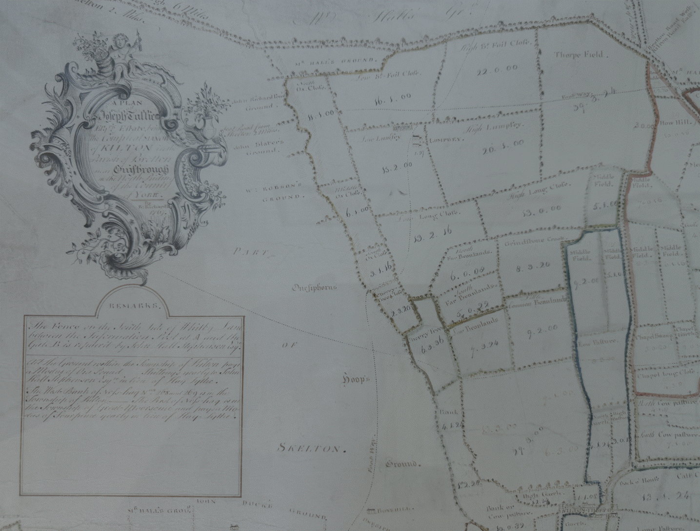

Remarks
The Fence on the South side of Whitby Lane
between the Information Post at A and the Gate B is repaired by John Hall
Stephenson Esq.
All the Ground within the Township of Kilton
pays a Modus of One Pound Six Shillings yearly to John Hall Stephenson Esq. in lieu of Hay Tythe.
The West Bank of Nofs hag Nos 268 and 269 is
in the Township of Kilton. The East of Nofs hag is in the
Township of Great Moorsholm and pays a Modus of Fourpence yearly in lieu of Hay
Tythe.

The Heart of Kilton

The Estate Village

Craggs Hill

Howe Hill area

Stank House area
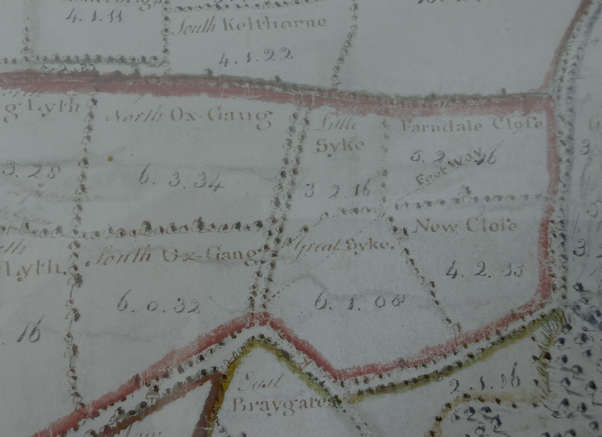

Braygate and
Farndale Close

Kilton Thorpe

Greenhills Farm

Buck Rush Farm
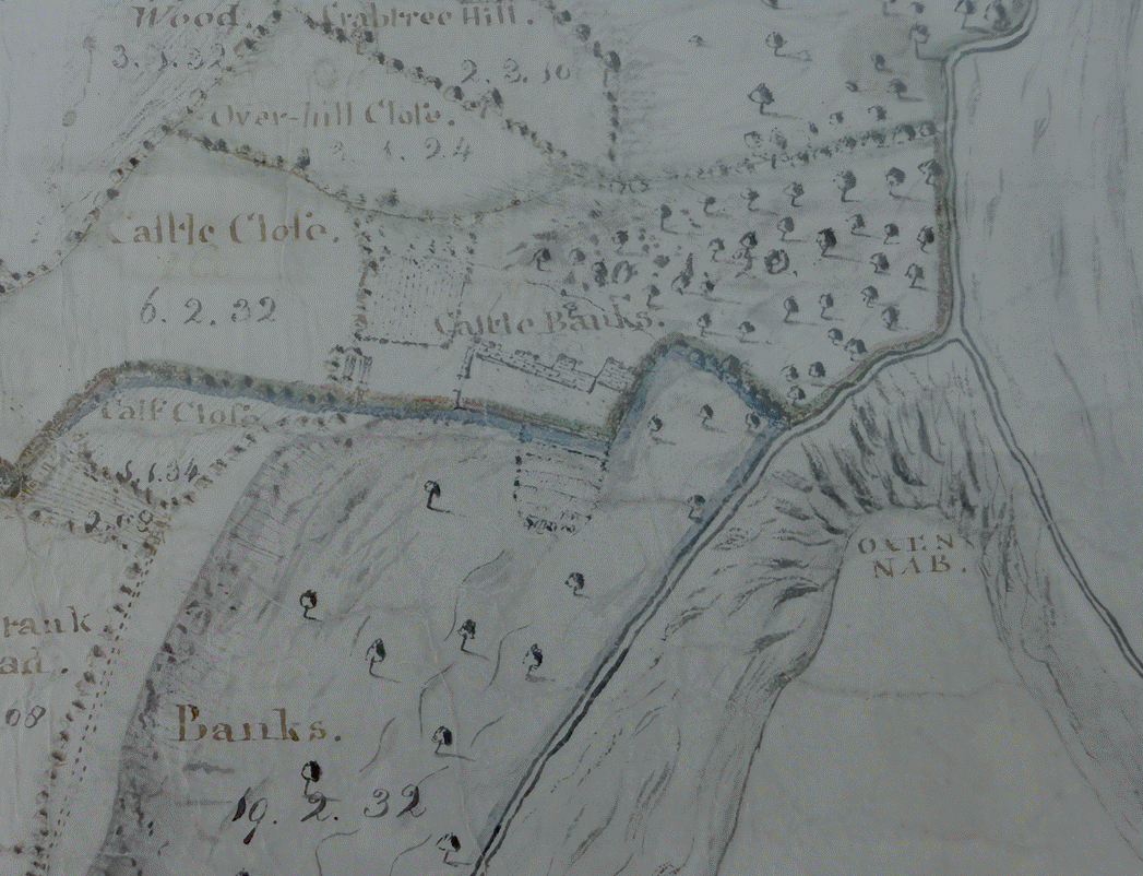

Kilton Castle area and the woodland
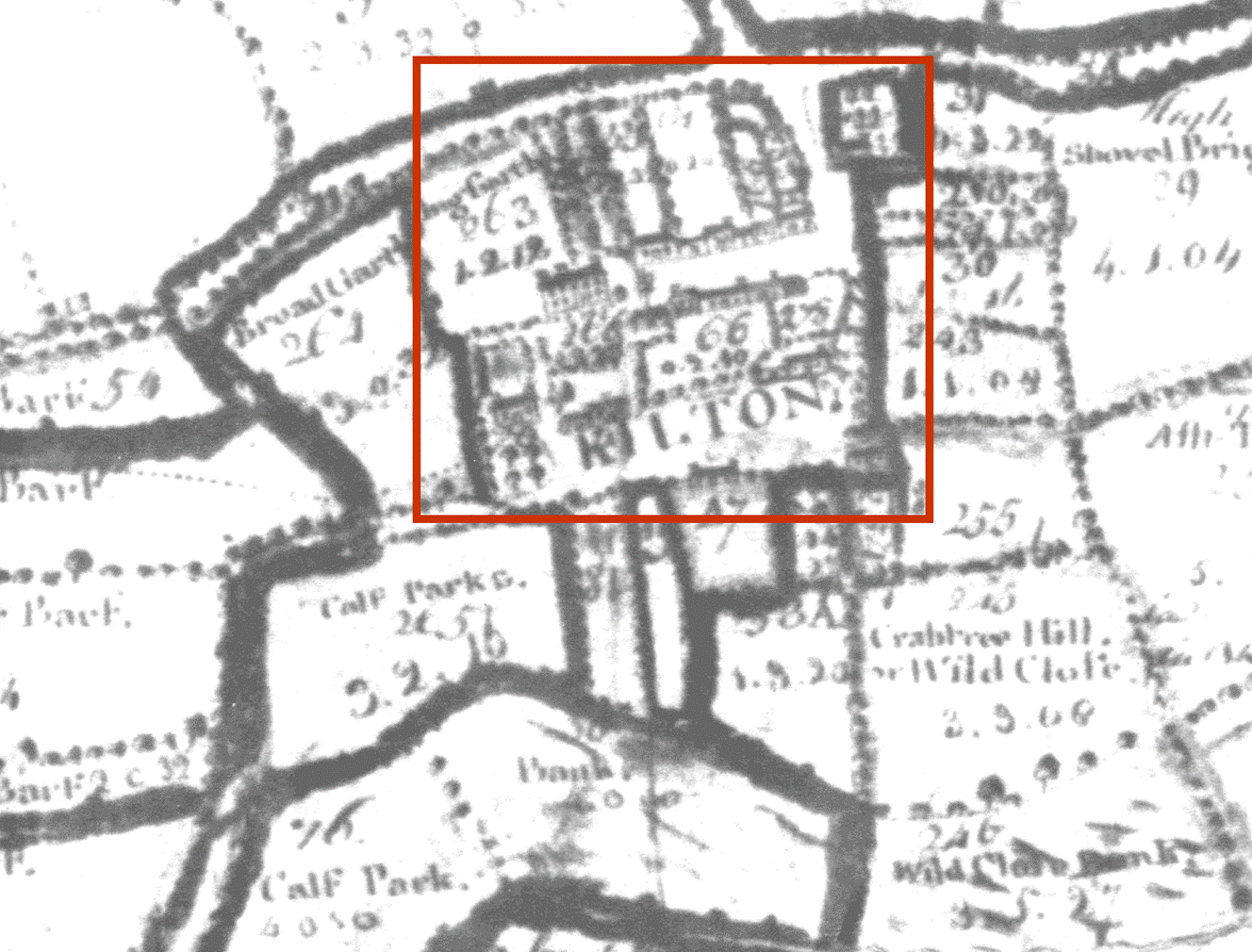

The
Village is highlighted by a red square Kilton
Hall is shown at the end olf the village street
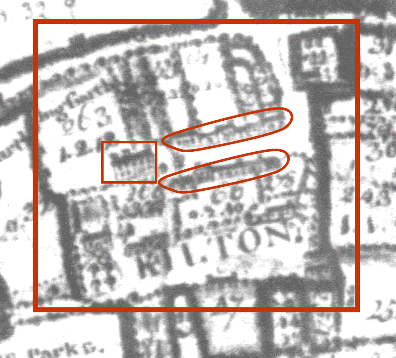

Five
houses on each side of the street, as described in John Farndale’s works.
Other houses highlighted yellow.
Robert
Daniels (Kilton: A Survey of a Moorland Fringe Township,
by Robin Daniels, 1990) redrew the Kilton Township Estate Plan of 1767
onto the 1856 OS 6 inch map:

The
1767 map shows a landscape which, while containing much of the medieval past,
had undertaken a dramatic transformation. Enclosure of the medieval fields had
taken place and probably partly as a result of this the number of farmsteads
had increased from perhaps five in the medieval period to eight in 1767. An
Estate village had been established at Kilton, a hunting lodge at Buck Rush, and
a number of new buildings had been built. In addition, two new roads had been
constructed, the first linking Brotton to Kilton Thorpe and cutting through the
enclosure boundaries of Middlefield, and the second running from Kilton Lane to
the new farm at Stank House, which continued on to the Lodge and Buck Rush. The
last of these roads survives much as built and is a fine example of a broad
eighteenth century road which contrasts markedly with its medieval
predecessors.
The
Kilton of 1767 was very different from medieval Kilton. While some of the
medieval properties either side of Kilton Lane had buildings on them, the
village had been moved to the north. A finer state village had been created,
with a street and green and two rows of cottages facing each other across it. A
post mill was shown at the western end of the South row.
The 1767 map
shows a complex of at least three buildings, wrongly labelled as Wilton Mill.
The mill building is shown extending over the stream and the wheel may have
been contained within a housing.