A Guide to its History including its associations with the
Farndale family
|
Return to the Home
Page of the Farndale Family Website |
The story of one
family’s journey through two thousand years of British History |
The 83 family lines
into which the family is divided. Meet the whole family and how the wider
family is related |
Members of the
historical family ordered by date of birth |
Links to other pages
with historical research and related material |
The story of the
Bakers of Highfields, the Chapmans, and other related families |
Introduction
Dates are in red.
Hyperlinks to
other pages are in dark
blue.
Headlines of the
history of Brotton are in brown.
References and
citations are in turquoise.
Contextual
history is in purple.
This webpage about
Brotton has the following section headings:
·
The
Farndales of Brotton
·
Brotton, an
overview
·
Brotton
Timeline
·
Buildings of
Brotton
·
People of
Brotton
·
Bibliography
·
Brotton Old
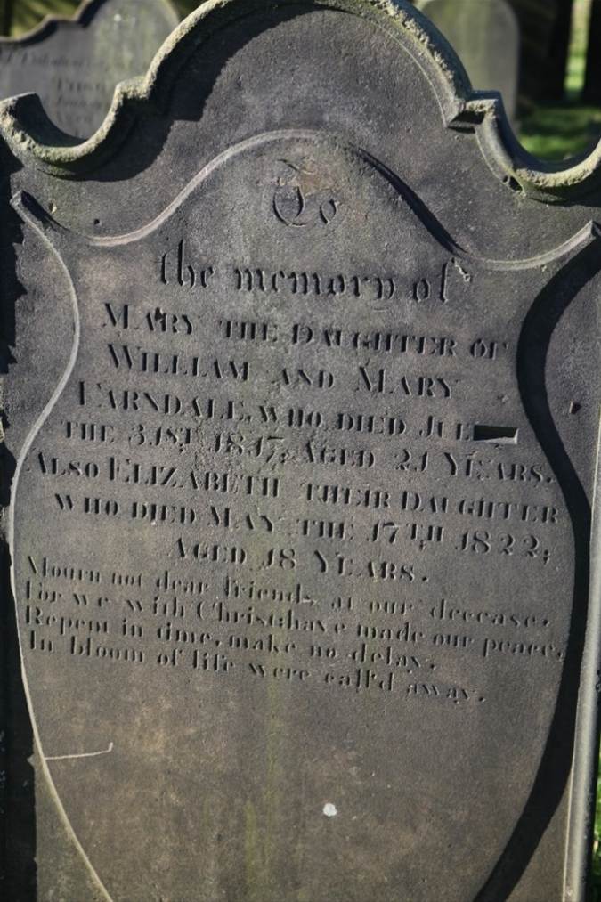
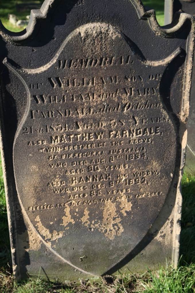
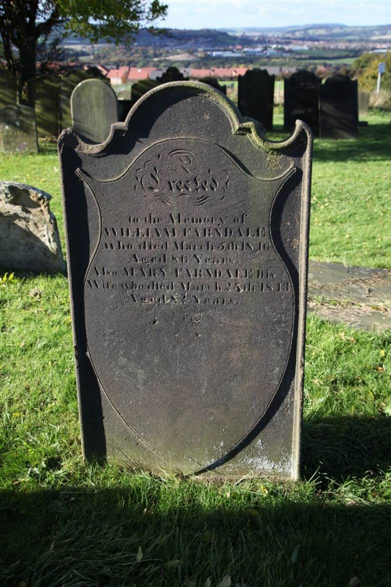
Churchyard – the Farndale gravestones
The Farndales of Brotton
There are three lines of Farndales associated with Brotton:
The Brotton 1 Line were the
descendants of Richard ffarndaill
(1650 to 1727) who married Martha Sawer and who was a Yeoman
of Brotton and the first mention of Brotton in the Farndale
ancestry.
The Brotton 2 Line were the
descendants of George Farndale (13 May 1753 to 19 November 1782)
who married Mary Stephenson and was the butcher of Brotton.
The Brotton 3 Line were the
descendants of John Farndale (27 October 1772 to 5 July 1833).
Many other Farndales were
associated with Brotton, which lies in the heart of Farndale country. And many
Farndales are buried at the Brotton old cemetery.
Its proximity to Kilton means that
the many Farndales who lived at Kilton saw Brotton as
the local town.
Click here for the
first mention of Brotton in the family records.
Brotton, an overview
In 1923, the
parish of Brotton, situated on the sea coast of Cleveland, included the
townships of Brotton, Kilton and Skinningrove and the
hamlet of Carlin How. It covered 4,262 acres, of which 1,183 acres
were arable land, 294 acres woods and plantations, and 1,720 acres permanent
grass. The chief crops were wheat, beans, barley and oats. The soil was a
strong clay with a subsoil of inferior oolite in Brotton and Kilton. The
highest point in the area was at 500 ft.
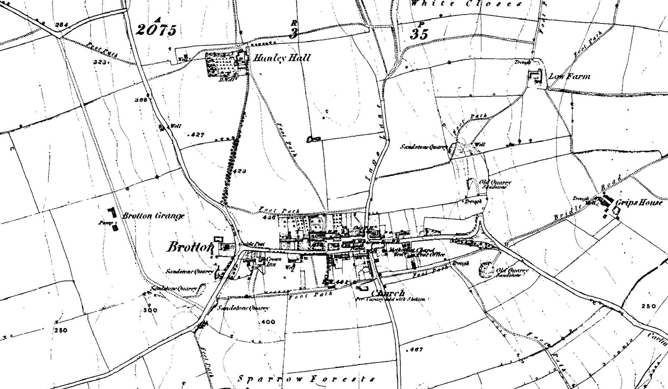
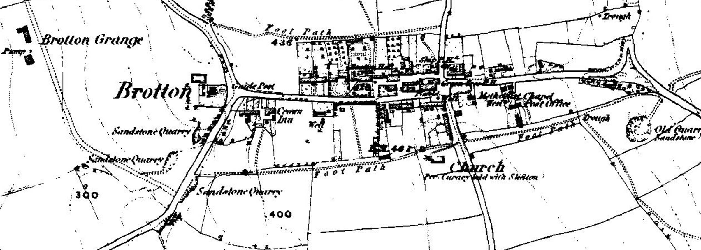
1857 Map of
Brotton
In the latter
half of the nineteenth century the importance of Brotton was greatly increased
by the development of the mining industry. Between 1861 and 1871 several
ironstone mines were opened in the parish. In 1874 there were five mines at
work in the parish:
· Brotton mines to
the north-west of the village;
· Kilton mines
further south in Kilton;
· Cliff and
Huntcliff mines near the coast in Skinningrove, northwest of the village
· Craggs Hall
mines, disused by 1923, south-west of Skinningrove.
· Lumpsey mine, in the
northern part of Kilton near the railway, was opened in 1880.
By 1923, there
was a special railway line for the mines in Kilton, and several public
buildings had been opened in connexion with the miners, such as the Miners'
Hospital at Skinningrove, built by Messrs. Pease & Co. of the Loftus mines
in 1871, and an institute in Skinningrove opened in 1875.
By 1923, Brotton
was a large village built on the western slope of the hill. The High
Street, which runs east and west, was then a continuation of the road from
Loftus.
· In the centre of
the village were the new church of St. Margaret; the rectory and schools.
· The public
elementary school in Brotton was built by Messrs. Bell Brothers, Morrison &
Co. and the lessors of the royalties of ironstone in Brotton, and was enlarged
in 1895.
· To the southeast
of the village is the old church of St. Margaret, then serving as a mortuary
chapel.
· The Wesleyan
Methodist chapel, built before 1855, lies towards the eastern end of the
village.
· There were
Primitive Methodist and United Methodist chapels and a Salvation Army meeting
room.
· The Roman
Catholic church, dedicated to St. Anthony of Padua, was built in 1906.
Brotton Hall, near the centre
of the village, was the manor-house. Hunley Hall lay about a quarter of
a mile to the north.
The Cleveland
Cottage Hospital, built by Messrs. Bell Brothers in 1874, is at the eastern
extremity of the village.
There was a railway
station to the south-west of the church, on the Saltburn and Whitby branch
of the North Eastern railway.
Below the station
and due west of the church lay Brotton Grange. Further north and on the
eastern side of the line was New Brotton, consisting of a few cottages
built about 1868. There was another railway station at Skinningrove. The
railway ran through Carlin How (Carlinghow in the
fourteenth to sixteenth centuries), and a mining hamlet east of Brotton.
(Victoria County History – Yorkshire, A History of the
County of York North Riding: Volume 2 The wapentake of Langbaurgh (east):
Brotton, 1923)
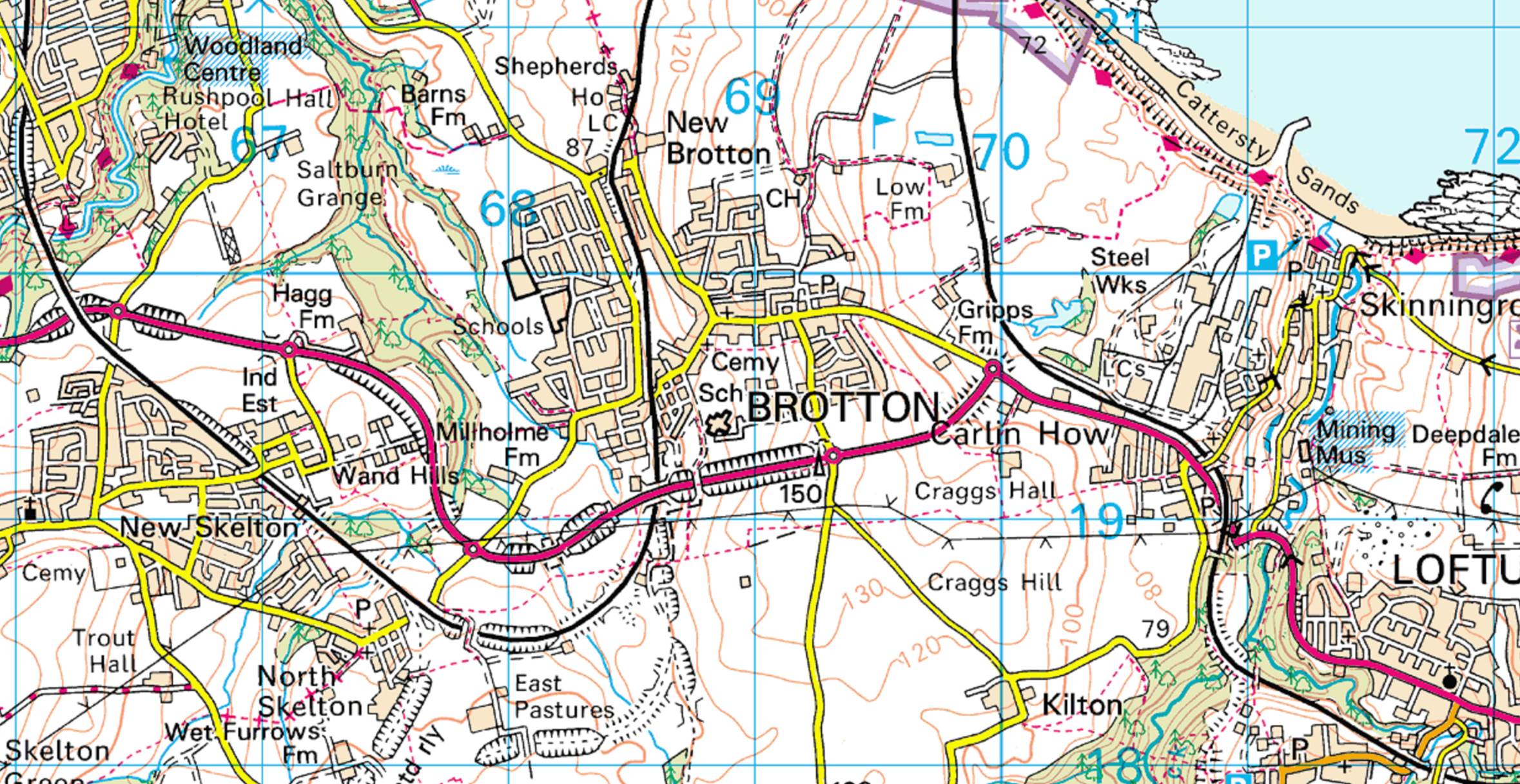
In 2023
Brotton is a village in the parish of Skelton and Brotton in North
Yorkshire. The local council is Redcar and Cleveland. It is about 4km
south-east of Saltburn-by-the-Sea, and 19km east of Middlesbrough and
23km north-west of Whitby.
The name of the
village (known in medieval times as 'Broctune')
means, "town on the brow of a hill", and is listed in the Domesday Book.
The hill is Warsett Hill. The large Huntcliffe was the site of one of the many Roman signal
stations built along the east coast to defend against Anglo-Saxon attack. The
name has evolved from Bro(c)tune 1086, Brocton 1272, Brotton from
1181. The old English is broc-tun.
In the twenty
first century Brotton became a bit more isolated when a bypass was opened in
1998 between the villages of Skelton-in-Cleveland and Carlin How.
The discovery
of ironstone brought
major changes to the village and a large increase in the population. The
majority of former miners' homes are found in the 'Brickyard' and 'the Park'
areas of the village.
Brotton village
is divided into two parts: 'Top End' (the area east of the railway line) and
'Bottom End' (the area to the west).
Brotton Anglican church
is dedicated to St Margaret. Today the village contains a parade of shops on
High Street, and its public houses include The Crown, The Ship,
The Green Tree and The Queen's Arms.
In 2023 Brotton
has two primary schools, Badger Hill Primary School and St Peters Church of
England school. There is also a school for children with learning difficulties,
Kilton Thorpe. The village secondary school, Freebrough Academy, has been rebuilt.
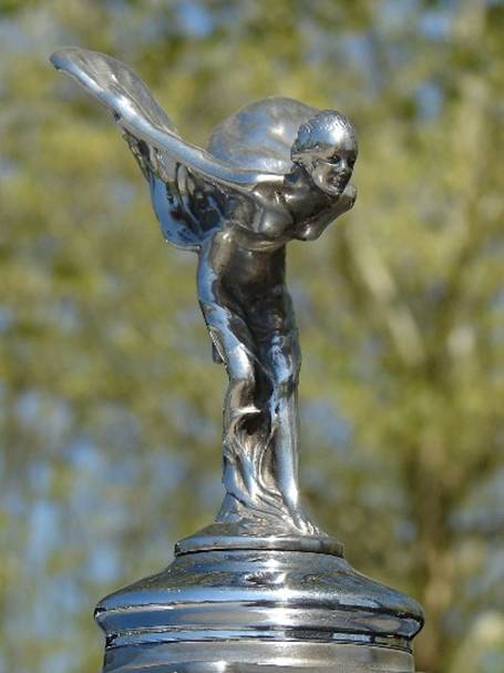
The
sculptor Charles Robinson Sykes (1875-1950),
was born in the village. He designed the Spirit of Ecstasy mascot which is used
on Rolls-Royce cars.
Brotton Timeline
2,300
BCE
The Howe Hill
Barrow at Brotton, a mile or so from Skelton, probably dates from about 2,300
BCE. It contained a hollowed out oak tree, which held the remains of a man.
Saxon
England
Before the Norman
Conquest, Ucted was the chief landholder in Brotton.
Uctred held a 'manor' of 12 carucates in Brotton (Victoria
County History – Yorkshire, A History of the County of York North Riding:
Volume 2 The wapentake of Langbaurgh (east): Brotton, 1923).
1066
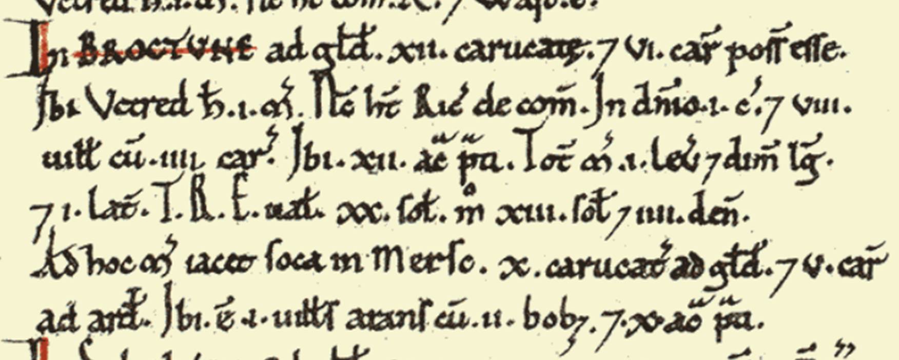
The Domesday Book recorded: “In Broctune
(Brotton), 12 carucates for geld, and 6 ploughs can be (there). Uctred had 1
manor there. Now Richard has (it) of the Count. On the demesne (there is) 1
plough, and (there are) 8 villeins with 4 ploughs. 12 acres of meadow (are)
there. The whole manor (has) 1 and a half leagues in length and 1 in breadth.
T.R.E. it was worth 20s.; now (it is worth) 13s. 4d.To this manor belongs soc
in Mersc (Marske) of 10 carucates for geld, and 5 ploughs to plough (them). 1
villein is there, ploughing with 2 oxen; and 10 acres of meadow.”
1086
By 1086 the manor
had passed to the Count of Mortain, and his tenant was Richard, referred to in
the Domesday Book (Victoria County History –
Yorkshire, A History of the County of York North Riding: Volume 2 The wapentake
of Langbaurgh (east): Brotton, 1923).
William Hornsby (The Domesday
Valets of the Langbargh Wapentake,
Yorkshire Archaeological Journal, Volume 25, 1920, page 334) suggested the Domesday Survey is assessed at the following
rates:
·
A demesne plough at 2.5 times villains' plough.
·
Villains usually 4d, bordars 2d, and sokeman 6d.
·
Meadow at 2d an acre.
·
Other elements at 1s 4d.
Brotton’s assessment in Domesday Book was "On
the demesne 1 plough and 8 villains with 4 ploughs, 12 acres of meadow.".
In Marske (soke), “one villain is there ploughing with 2 oxen and 10 acres of
meadow."
“ Valet 13s 4d." (Open
Domesday, Anna Powell-Smith).
He therefore suggested a breakdown of the rates paid of:
1 demesne plough
at 3s 4d;
8 villains at 4d
totalling 2s 8d;
4 villains’ ploughs
totalling 5s 4d;
12 acres of
meadow totalling 2s
Total, 13s 4d.
Early
Landowners
During the reign
of Henry I Brotton became part of the extensive estates of Robert de Brus, Lord
of Skelton.
1272
In 1272 the manor
of Brotton passed to the Thweng family of Kilton
Castle. In the division among the heirs of Peter de Brus in 1272 it passed to
Lucy wife of Marmaduke de Thweng of Kilton Castle (Victoria
County History – Yorkshire, A History of the County of York North Riding:
Volume 2 The wapentake of Langbaurgh (east): Brotton, 1923).
1301
The Lay Subsidy of 1301, showed that for the purposes of
this government tax Brotton was lumped together with Skinningrove and it’s not
possible to tell which taxpayers lived in Brotton and which in its smaller
neighbour. 34 taxpayers were listed. These were mostly heads of families who
had movable property of sufficient value to qualify for paying tax. Historians
reckon that these names represent only about a third or a quarter of the heads
of families, so medieval Brotton must have been quite a sizeable village. The
highest tax was paid by William Latimer, the lord of the manor, at more than 24
shillings. The total for the two villages was just over 73 shillings.
1407
In the
Inquisition Post Mortem of Thomas Fauconberge, Chivalier,
on 2 October 1407, there was an assignment to his widow Joan of his various
interests which included Brotton, to wit, from Kyltonthorp
descending to the sea; a plot of herbage next the castle called the Cunynggarth, as inclosed; a place
called the Langdikes next the castle with Penigarth [?], as inclosed. Also a
rent of 6s 8d from the tenants of Brotton for license to water their cattle at
Skelton bek. An acre of forland
at the Laphowpol [?], 30 acres at Wandels
on the south side, one acre on Swertmollde [?],
another on the . . . .; 6 roods in the Foulefen,
which John de Norton holds. Also one-third of 3 watermills in Skelton with its
members, called Holbekmyll, Saltbornmyll,
and Skinnengrefmyll ; one-third- of a fulling mill,
and of the profits of the oven, toll, market and fair there, and of the assize
of bread and ale, of the court of Skelton and of agistments in pasture and
feedings not in severalty, of waste, of casualties arising in wood or plain, as
in eyries [nisus] of sparrow hawks [esparverii],
falcons, hawks [acci-pitres], and other birds or
game, of warren and free chase, waifs and strays, etc., etc., and of the mining
of lead, iron, marl, coal and quarr3dng of slate and other mines in the
lordship of Skelton and its members. (Inquisitions post mortem relating to Yorkshire, of the
reigns of Henry IV and Henry V, page
71).
Late
fifteenth century to sixteenth century
The manor must
have been conveyed to the Conyers of Hornby in the late fifteenth century and
by the sixteenth century it was in the hands of the Conyers family (Victoria County History – Yorkshire, A History of the
County of York North Riding: Volume 2 The wapentake of Langbaurgh (east):
Brotton, 1923).
Seventeenth
century ownership
In 1641 Conyers
Darcy the elder, with his son Conyers and others, conveyed the manor to William
Wiggoner, who in 1655 made a conveyance of half the manor to Nicholas Wiggoner.
In 1687 Robert Wiggoner held this estate, and in 1697 Timothy Wiggoner, probably
his son, and others conveyed it to John Burdett. Its later history remains
obscure, though it may be this part of the manor which in 1787 was held by
William Jackson and his wife Mary, whose descendants, the Misses Jackson, are
landowners here at the present day.
1653
Parish registers
date from this year.
1673
From the returns
of the Hearth Tax of 1673 it appears that
Brotton was a sizeable village in the late 17th century. There were 40 single
hearth properties and 9 properties with 2 hearths. Only one property, that of
“Mr Fra Seaton” had 4 hearths. The returns record that a further 19
single-hearth homes were assessed as below the tax threshold (“The Hearth Tax List for the North Riding of Yorkshire,
Michaelmas 1673, Ripon Historical Society (2011)).
1678
A letter dated
from Whitby, 15th November 1678 (the Calendar of
State Papers): “To-day came some Newcastle men hither, who report
that Tuesday last part of Tynemouth Castle was intended to have been blown up
by powder, that 5 of the contrivers are taken endeavouring to carry on the
train, that a ballast man had several barrels of powder and arms found hid and
was fled, that 40 horsemen armed were heard and seen to march through Skelton
and Brotton 16 miles to the northward of this (town) in the dead of night. On
these reports and apprehensions this town has set a watch to guard our shipping
and town, 8 masters of ships each night.” This
was after the English Civil War and the Protectorate and well into the reign of
Charles II.
1778
The medieval
chapel of St. Margaret was rebuilt.
Late
eighteenth century
Smuggling was
rife at Old Saltburn in the late eighteenth century and John Farndale wrote: Since
the merry days alluded to the glory of Old Saltburn has departed – its
smuggling days have passed away – its gin vaults have disappeared – and the gay
roysterers who were wont to make Cat Neb and the
adjacent rocks resound with laughter, now rest in peace beneath the green
hillocks in the retired grave yards of Brotton and Skelton.
1801
The Census of 1801 recorded a population of 373 in
Brotton.
1815
There was a celebration of the Battle of Waterloo, in which John
Farndale (FAR00217) took a major role. “After the great battle of Waterloo, and
Buonaparte had been taken prisoner, that glorious event was celebrated at
Brotton by parading his effigy through the street and burning it before Mr R
Stephenson’s hall, amidst the rejoicings of high and low, rich and poor, who
drank and danced to the late hour. The author formed one of a band of musicians
that played on the occasion, and he composed a song commemorating the event,
which became very popular in that part of the country. Brotton bever before or
since saw the like of that memorable day.”
I am grateful to Dr Tony Nicholson
who has explained that the hall was built by the Stephenson family in the 1780s
after they had made a fortune as woodmongers, trading in timber as a fuel
source, and then when timber became scarce, in coal. With the money from this
trade, Robert bought a third of the manor of Brotton, and then built
‘Stephenson’s Hall’.
When
Robert Stevenson died in 1825, everything went to his daughter, Mary, who had
previously married Thomas Hutchinson, a master mariner from Guisborough. Mary
and Thomas settled in Stephenson’s Hall which soon became Brotton Hall and over
the years they bought various properties in Brotton.
In The History of
Kilton, With a Sketch of the Neighbouring Villages, By the Returned Emigrant,
Dedicated to the Rev William Jolley, Toronto, Canada, America, Middlesbrough,
Burnett & Hood, “Exchange” Printing Offices, 1870, Redcar Cleveland Library
Book No: R000040114 Classification: 942.854, Book No: R000040114, John
Farndale wrote:
The church has been greatly improved, new slated roof and a
most radical change in the interior; the old pews and pulpit are all gone, and
from the walls Our Fathers’ prayer; the Belief; the ten commandments, in the xx
chapter of Exodus, saying “I am the Lord thy God which brought thee out of the
land of Egypt, out of the house of bondage; thou shalt have none other gods
before me.” Had I not seen those well known tablets of young Squire Easterby,
of Skinngrove Hall, and Wm Tulley , Esy of Kilton Hall, on beautiful white
marble, I should have been at a loss to have known the old church again. I
looked at the place where the old pulpit stood, and I remembered the ministers
that once preached Jesus and the resurrection, among them my old master, the
Rev Wm Barrick, of Lofthouse, - he would descend from the pulpit and join in
the chorus of some twenty voices, 57 years gone, when I had the happiness to be
their chieftain. The parishioners had … most gladly … and paraded down the mid
street at the celebration of the great battle of Waterloo, and burned before Mr
Stephenson’s Hall, when barrels of ale were given to the frantic multitudes,
and the old gentlemen danced and sang until day break, and here we find
young Farndale, once dangling at the mouth of the well, with his bugle and
clarionet, the chief musician to the old gentleman, and who had also composed
the following lines for the occasion –
|
Hail! Ye victorious heroes, England’s dauntless saviours, ye Who on the plains of Waterloo, Won that glorious victory. |
It was a day the world may say, When Napoleon boldly stood, Upon the plains of the Waterloo, There flowed rivulets of blood. |
Before the foe he bravely fought, And when he’d all but won the day, Would it were night, or Blucher up, Our hero Wellington did say. |
But now behold in effigy, Him to whom kings such homage paid, Napoleon mounted on a mule As though he were on grand parade, Behold with joy all England sings, Brotton too is up and
gay, The band, the flag, the ball, the dance Ne’er ceased till the break of day. |
1822
The Topographical Dictionary of Yorkshire by Thomas Langdale
of 1822 described Brotton, in the parish of Skelton, east division of
the wapentake and liberty of Langbaraugh; 6 miles
from Guisborough, 14 from Stokesley, 15 from Whitby, population 373.
1840
White’s
Directory of 1840 listed 2 shopkeepers, 2 butchers, 2 tailors, 3 shoemakers, 3
blacksmiths, a wheelwright, a painter, a miller and 10 farmers. It also named
the Green Tree and the Ship.
1851
The Census of 1851 recorded a population of 321 in
Brotton.
1855
A Wesleyan chapel
had opened in Brotton.
1857
Cliff ironstone
mine at Huntcliff opened. It closed after thirty years.
1865
Brotton ironstone
mine, known locally as ‘Morrison’s mine’, was opened.
1868
Brotton was made
a separate parish from Skelton parish.
1871
The Primitive
Methodist schoolroom and chapel were opened.
Of about this
time, John Farndale wrote: Brotton in this ramble is a retired village, with
a very neat church, pleasantly situated, from the church yard of which there is
a lovely prospect of the vale of Guisbro’ and the
fine bay of Skinningrove. There is a valuable communion service in silver and
gold in this church, presented by one of the Tulleys,
and two or three fine marble tablets decorate the walls. Tindale, the sexton
here, an obliging person, is ever ready to show any visitor the interior.
He also recorded
that the local clergy of Brotton were R Jackson and R Stephenhouse,
Esqrs.: chapel of ease, Rev J Perrington – 2 miles.
1872
Huntcliff
ironstone mine opened, not far from Cliff mine.
1874
Cleveland Cottage
Hospital was built by Bell Brothers. It became known as Brotton Cottage
Hospital. Martins Bank opened a branch in Brotton.
1875
Railway passenger
services from Brotton began.
1876
A brass band
contest was held in Brotton.
1880
Lumpsey ironstone mine,
just south of Brotton, began production.
1892
St. Margaret of
Antioch, the parish church of Brotton, was consecrated.
1895
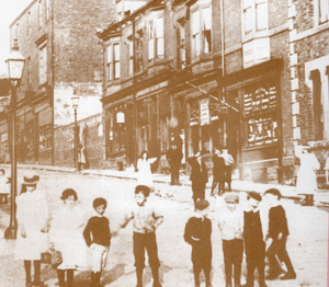
Brotton in about
1895
1897
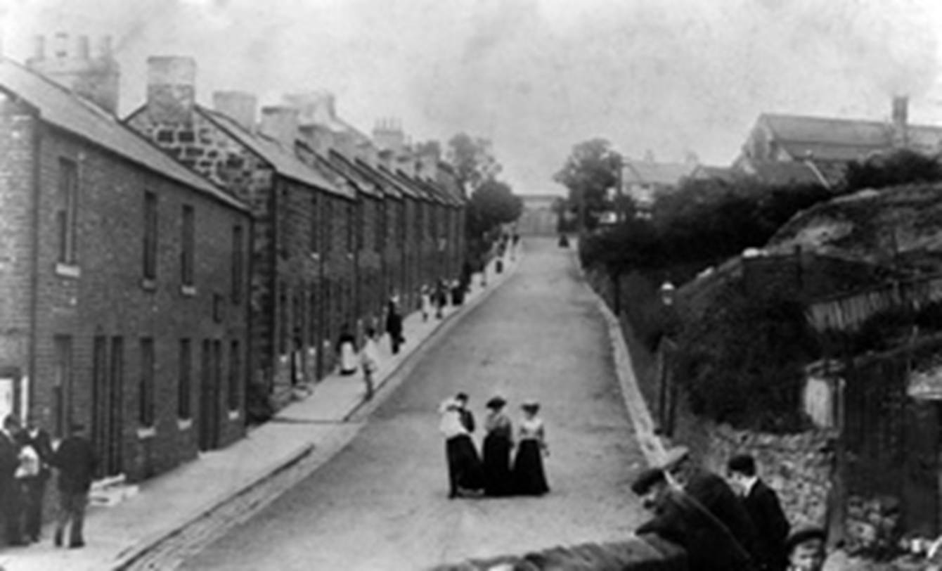
Brotton High
Street in about 1897
1898
The F.A. Amateur
Cup semi-final between Middlesbrough and Thornaby was played at Brotton because
of the smallpox epidemic in Middlesbrough.
1899
Brotton finished
fourth in the Northern Football League Division Two.
1901
The Census of 1901 recorded a population of 3,323 in
Brotton.
Two passenger
trains collided near Brotton station.
1906
St. Anthony of
Padua Roman Catholic church was opened.
Huntcliff mine
was closed.
1908
Brotton
Temperance Brass Band won the British Brass Band Association competition.
1909
The Wesleyan
Church was dedicated.
1914
The Palace cinema
and the Hippodrome cinema were opened.
During the First
World War Lumpsey Mine had a rail-mounted artillery
piece to defend the mine against Zeppelin attack.
Kelly’s
Directory of 1914 evidenced that Brotton was bustling, with 10 grocers, 9
shopkeepers, 2 greengrocers, 5 butchers, 5 drapers, 3 tailors, 4 shoemakers, a
chemist, a newsagent, a tobacconist, a watchmaker, a fancy goods dealer, 2
hairdressers, 2 blacksmiths and 2 joiners. In addition there were 3 beer
retailers as well as the Green Tree, the Ship, the Royal Hotel and the Queen’s
Arms.
1916
Zeppelin airships
made bombing raids along the coast.
1921
Production ended
at Brotton ironstone mine.
1923
The Brotton War
Memorial was unveiled.
1932
The Hippodrome
cinema was destroyed by fire.
1954
Lumpsey ironstone mine
was closed.
Brotton County
Modern School was opened.
1960
Brotton station
was closed for passengers.
1962
The official
opening of Brotton County Modern School, which became Warsett
School.
1966
The first Skelton
and Brotton District Carnival was held.
1978
Brotton
Conservation Area was created.
1985
Kiltondale home was opened.
It was demolished in 2011.
1993
The shale tips at
Lumpsey mine were flattened.
1995
A new hospital
was built to replace the old cottage hospital which was converted into homes.
1998
A new road
between Skelton and Carlin How bypassed Brotton.
2001
Warsett School, Brotton,
De Brus School, Skelton and Rosecroft School in Loftus were amalgamated to form
Freebrough College in Brotton.
2006
Brotton Library
was moved to Freebrough College.
2011
The Census of 2011 recorded a population of 7,000 for
Brotton Ward.
Buildings of Brotton
Selected
Buildings
Brotton Hall
(c.1780)
Brotton House (early
19th century)
Hunley House
(c.1870)
Brotton station
(1875)
St. Margaret’s
Church (1891)
St. Anthony’s
Roman Catholic Church (1907)
Cleveland Cottage
Hospital (1874)
The Guibal Fanhouse at Huntcliffe Mine (1872)
East Cleveland
Primary Care Hospital (1995)
Ivy Cottage (17th
century) demolished in 1936.
St. Margaret’s
old church (18th century) no longer exists
Brotton Grange
(c.1865) on Coach Road no longer exists
St. Peter’s
mortuary chapel (1778) demolished in 1958.
The Cleveland
Hall (c.1870) demolished in 1984.
The Hippodrome
(1914) destroyed by fire in 1934.
Warsett School (1962)
demolished after a fire in 2005.
People of Brotton
Charles Robinson
Sykes (18
December 1875 to 6 June 1950) was a sculptor from Brotton who designed the
Spirit of Ecstasy mascot for Rolls-Royce cars. He was born in Brotton. Sykes
was commissioned by Lord Montagu to make a special mascot for his 1909
Rolls-Royce Silver Ghost. Sykes produced a small statue of a young woman in
fluttering robes with a forefinger to her lips. It was named "The
Whisper".
Piercy Henderson
"Dolly" Morrison (30 July 1868 to 12 July 1936) was an English rugby union
three-quarter who played club rugby for Northern and Cambridge University and
played international rugby for England in the 1890s. He was born in Brotton to
Robert Morrison, a mine owner from Newcastle upon Tyne.
Mary Jarred (9 October 1899
to 12 December 1993) was an English opera singer of the mid-twentieth century.
She was born in Brotton. She sang at Convent Garden through most of the 1930s
and at Glyndebourne in the 1950s.
John Ronald
Murray
(born 1924) was a merchant seaman from Brotton who took part in the D-Day
Landings in 1944. For his bravery there
he was awarded the Legion d’Honneur.
Derek McLean (born 21
December 1932) was a footballer from Brotton who played for Middlesbrough in
the 1955-56 season and for Hartlepool United. He played alongside the future
international players Brian Clough, Alan Peacock and Edwin Holliday.
David (“Dave”)
William Charlton (27 October 1936 – 24 February 2013) was a racing driver. He was
born in Brotton but moved to South Africa where he became the country’s leading
formula one racing car driver in the 1970s. He participated in 13 World
Championship Formula One Grands Prix, debuting on 1 January 1965. He scored no
championship points. He competed in many non-World Championship Formula One
races, winning the South African Formula One Championship six times in
succession from 1970 to 1975.
Links
https://www.facebook.com/groups/brottonhistoryphotos/
Cleveland
& Teeside Local History Society entry on Brotton.
Texts and Books
“A Guide to
Saltburn-by-the-Sea and the Surrounding District” J. Farndale (1864)
“East
Cleveland Photographic Memories” R.Darnton (2010)
“Know Your
Parish: Brotton” M.Wall, C.F.H.S. Journal vol.3
no. 7 (1987)
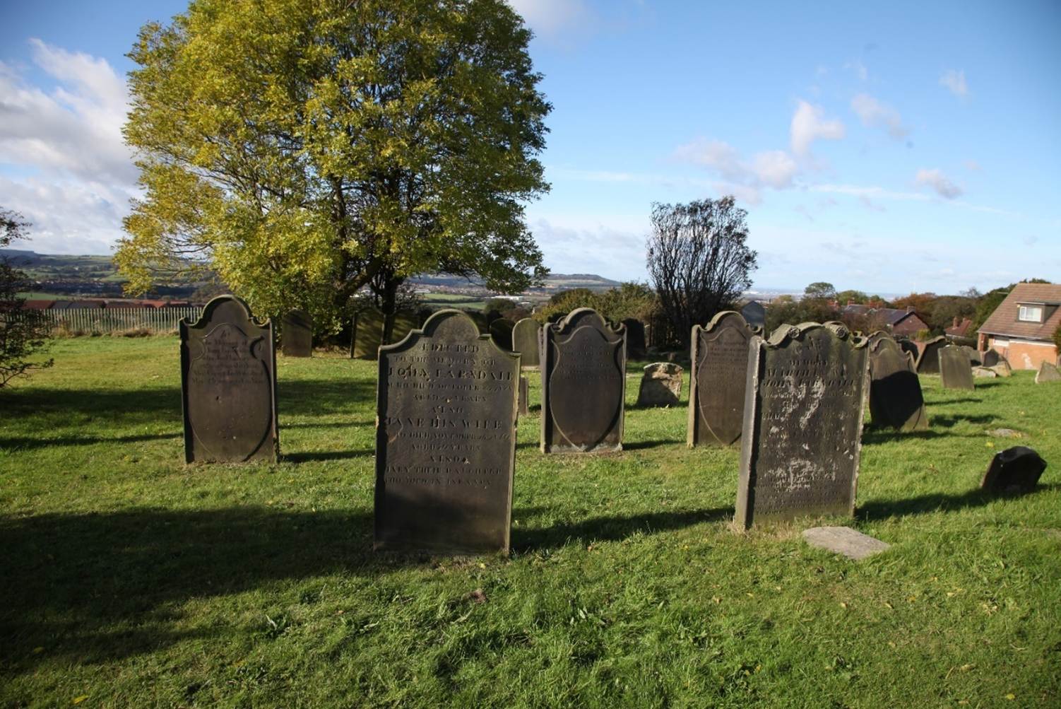
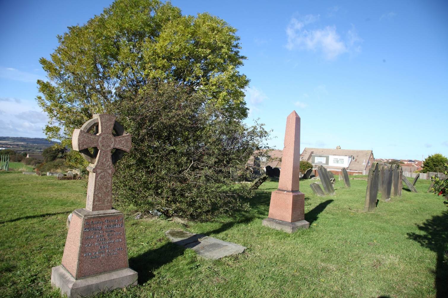
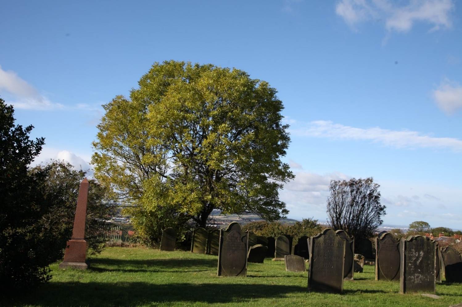
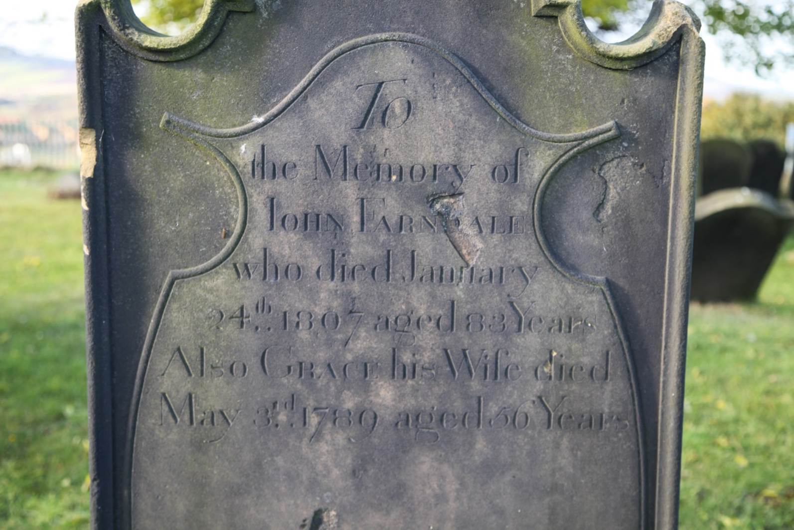
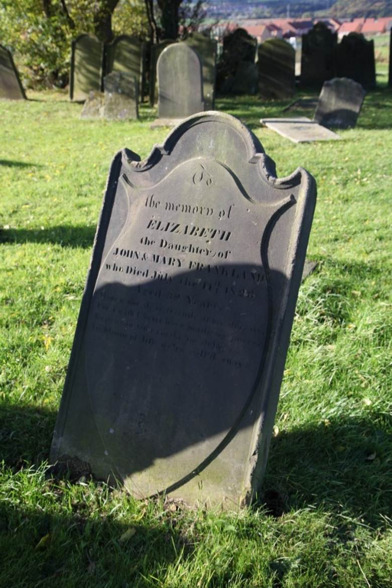
Brotton Old Churchyard
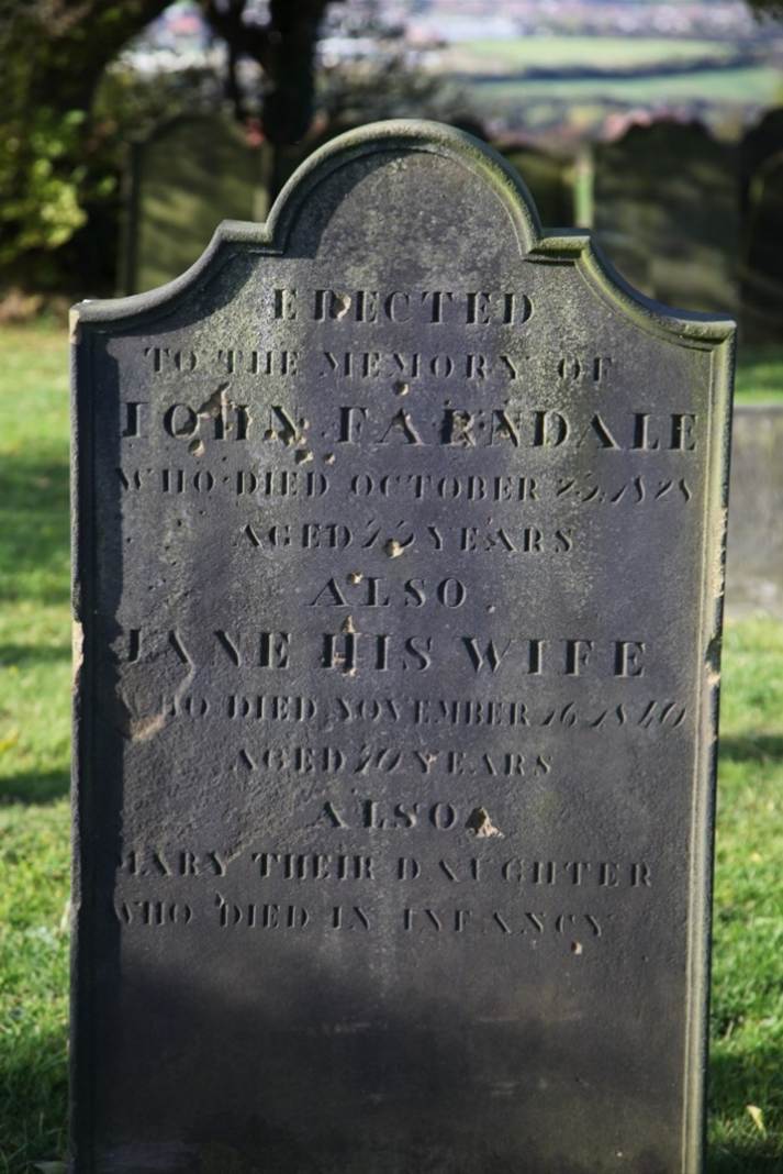
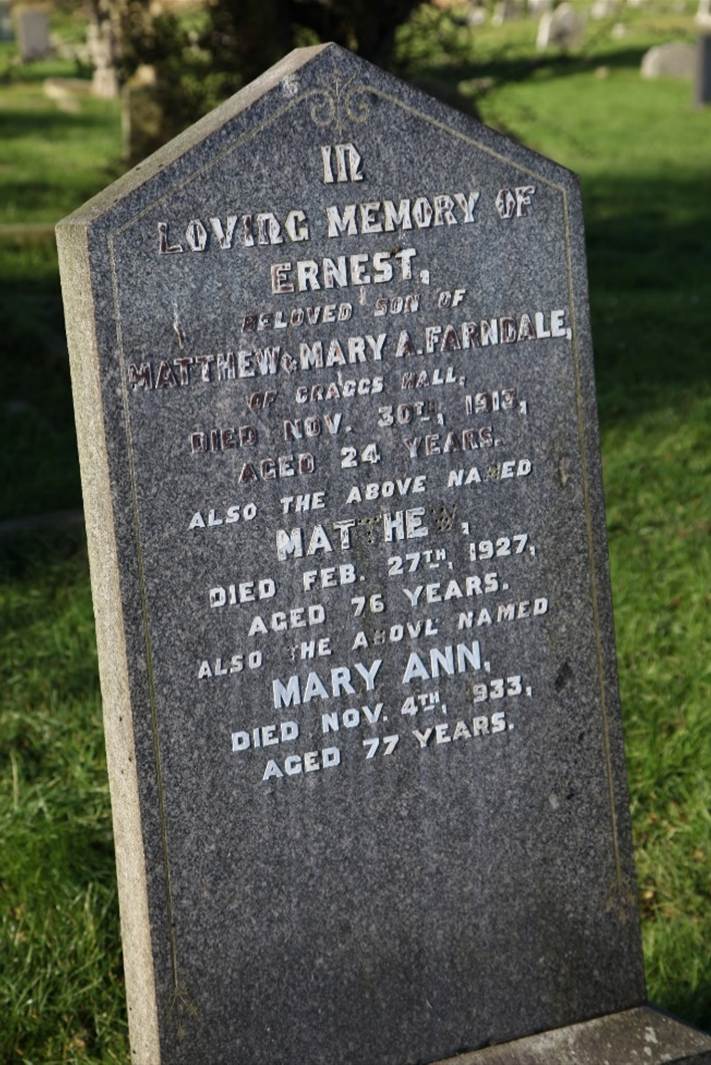
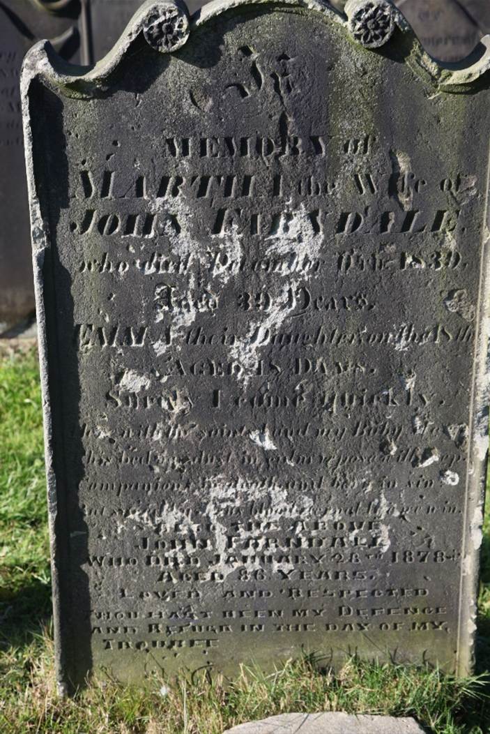
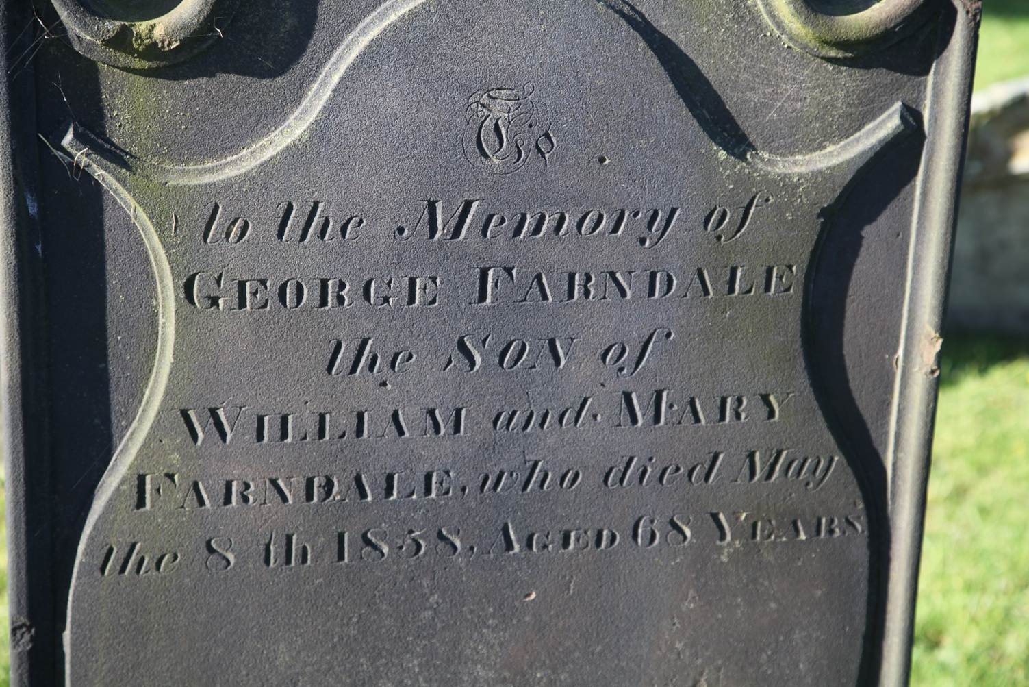
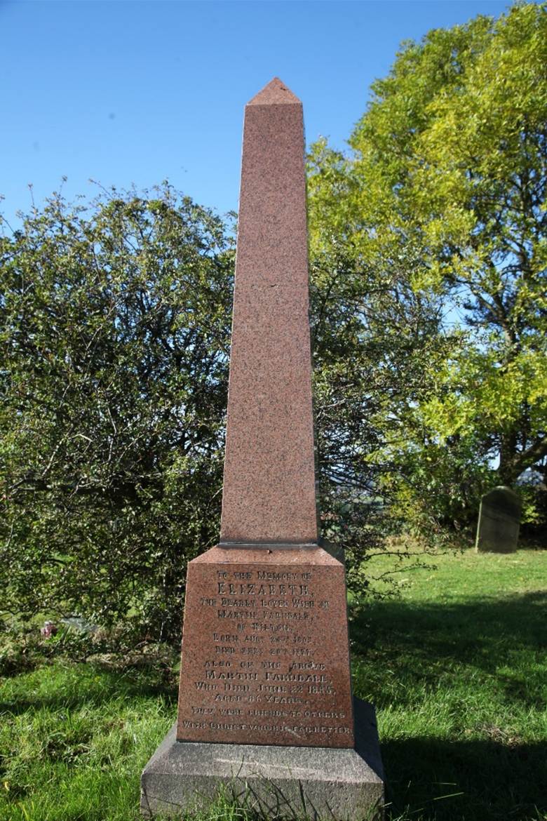
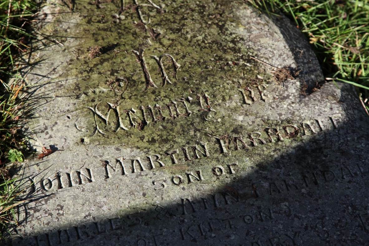
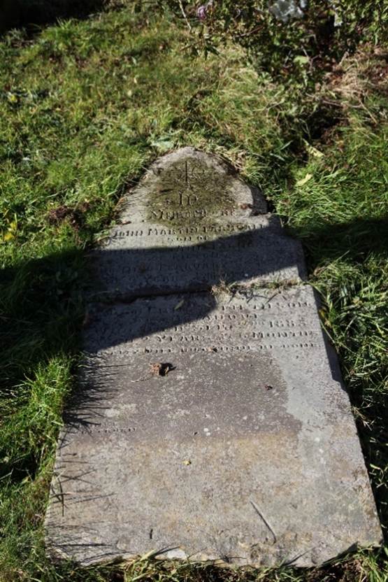
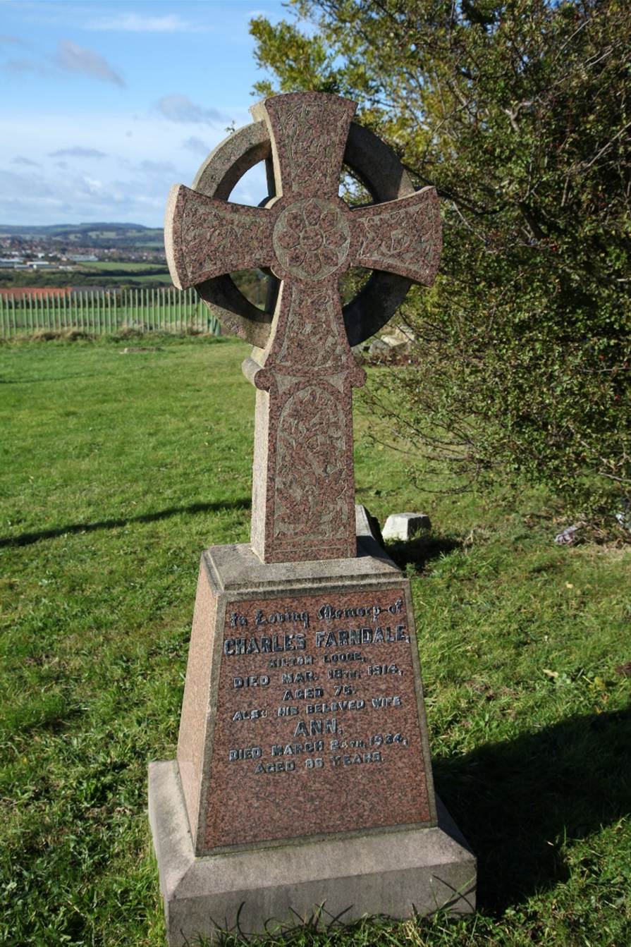
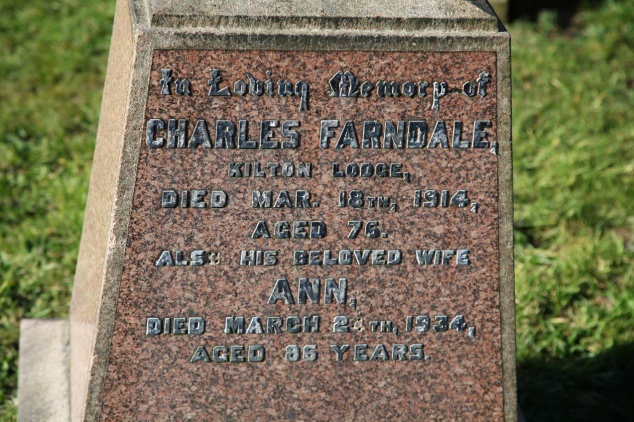
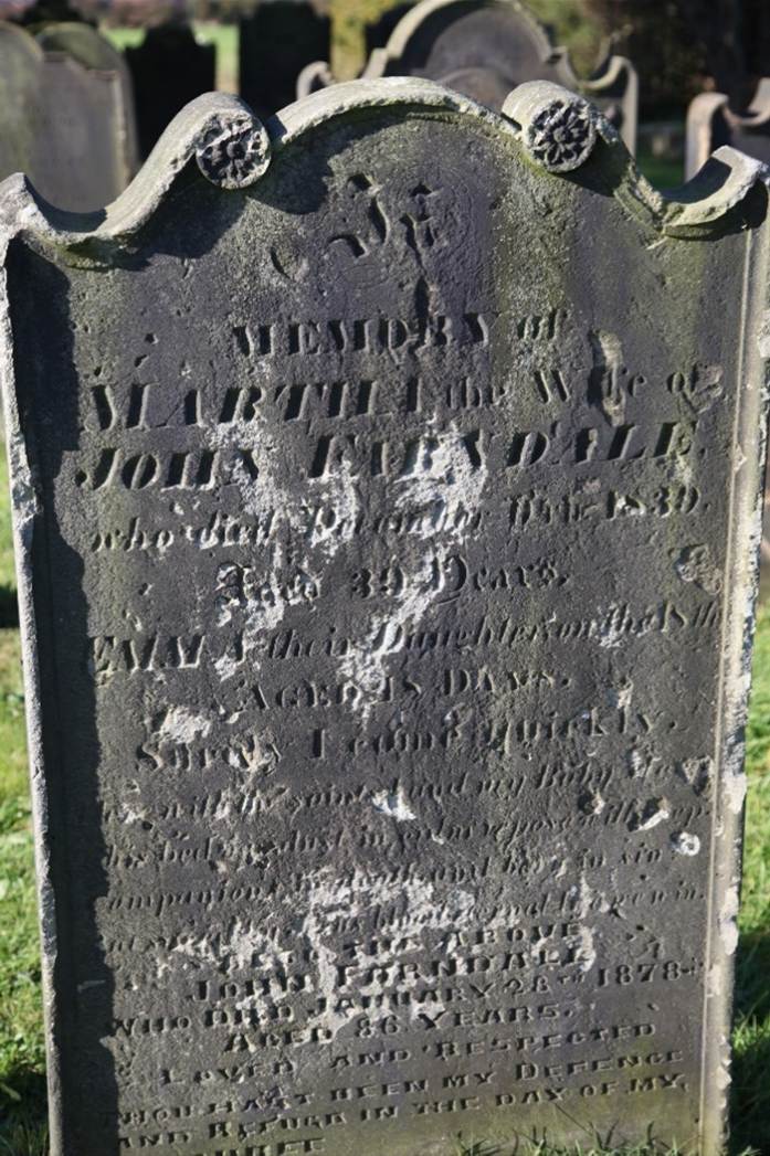
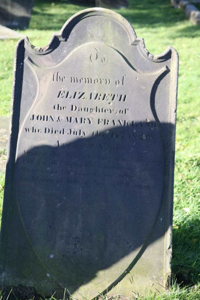
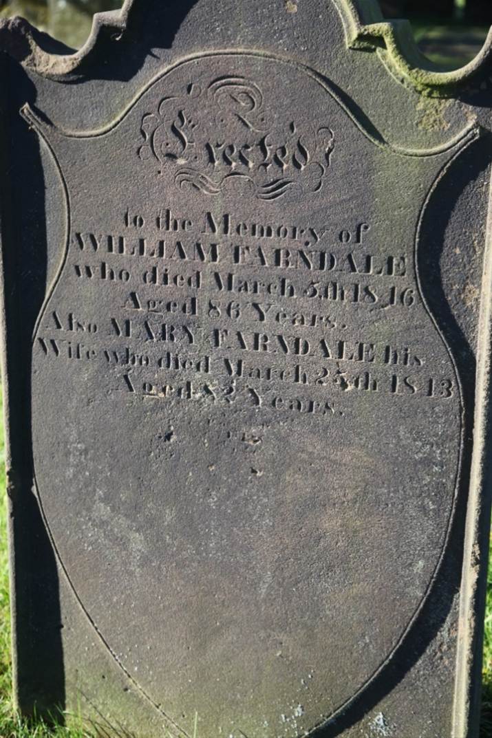
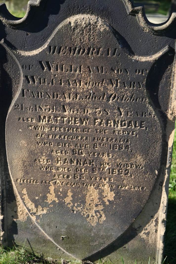
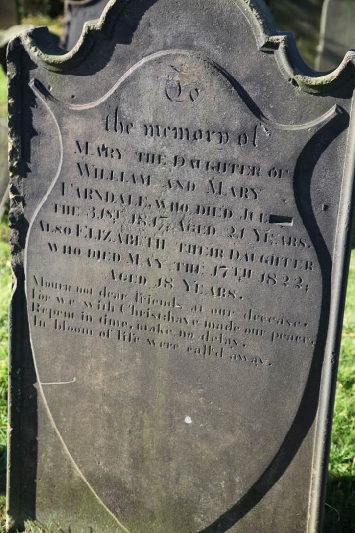
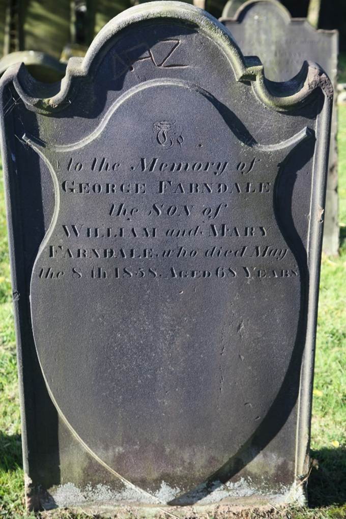
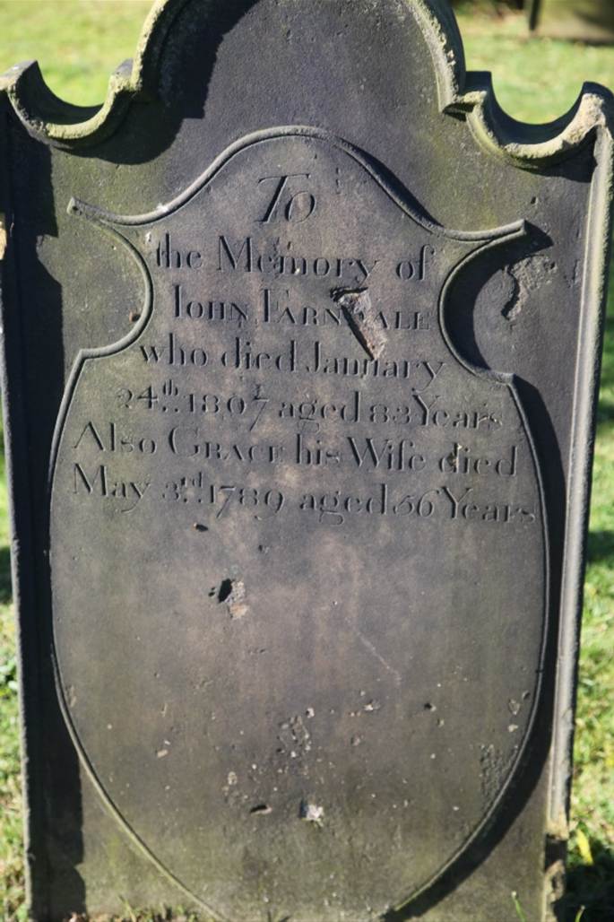
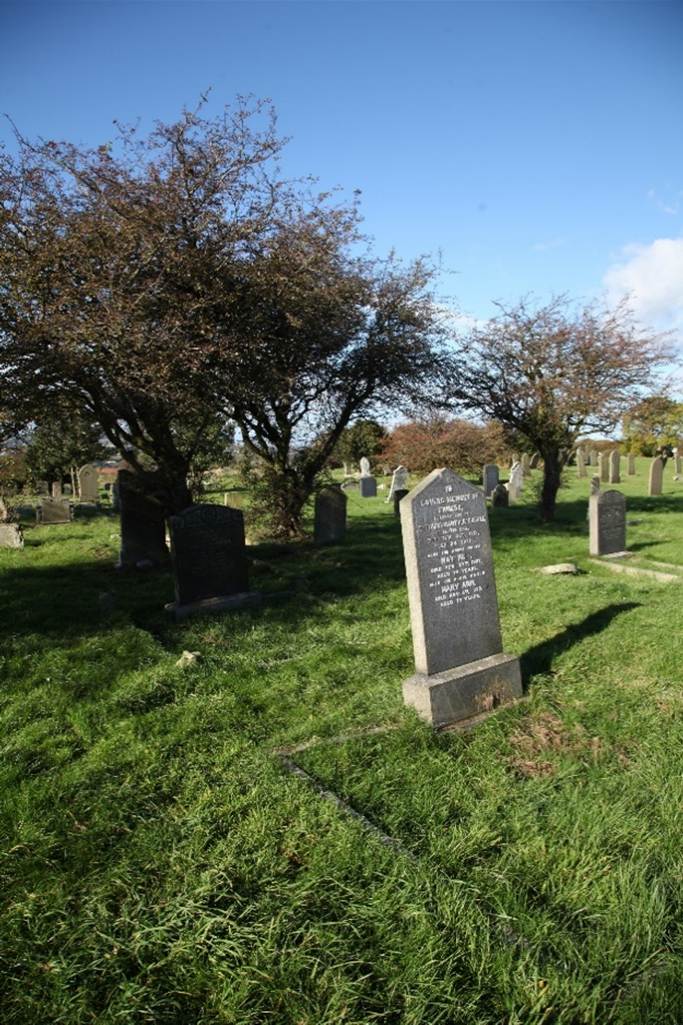
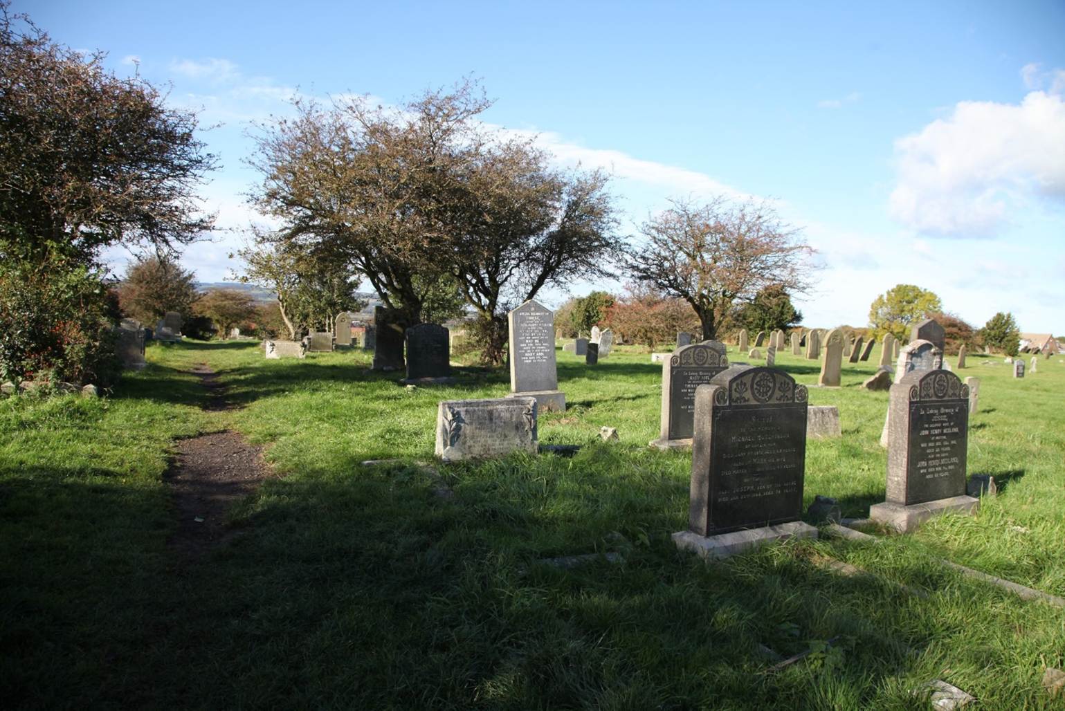
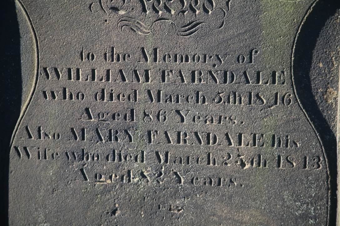
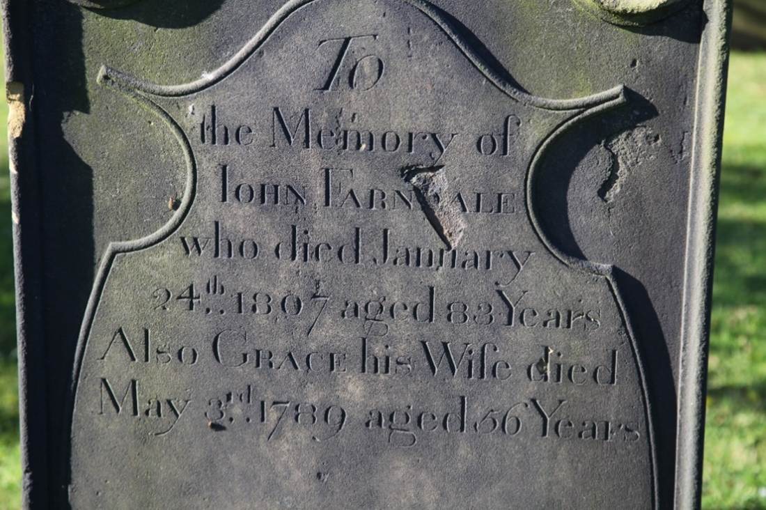
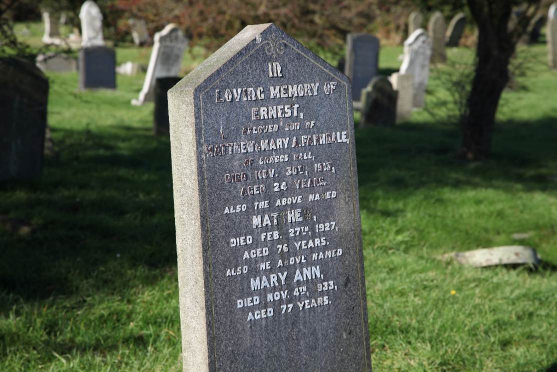
The Farndale
gravestones in Old Brotton cemetery in 2016: