The vicinity of Farndale in the Anglo Saxon Scandinavian Period
(793 CE to 1066)
FAR00001
|
Return to the Home
Page of the Farndale Family Website |
The story of one
family’s journey through two thousand years of British History |
The 83 family lines
into which the family is divided. Meet the whole family and how the wider
family is related |
Members of the
historical family ordered by date of birth |
Links to other pages
with historical research and related material |
The story of the
Bakers of Highfields, the Chapmans, and other related families |
Dates are in red.
Hyperlinks to other pages are in dark blue.
Headlines are in brown.
References and citations are in turquoise.
Context and local history are in purple.
BCE - Before the common or current era. The contemporary equivalent of
BC.
CE - Common or current era. The
contemporary equivalent of AD.
kya – abbreviation for a thousand years
YBP – Years before present
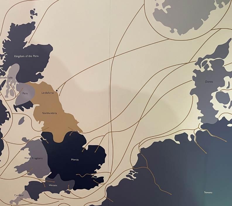
On 8 June 793 Vikings raided Lindisfarne, their first attack on the
British Isles. The raid was devastating for the community of Lindisfarne, but
had ominous implications for the wider religious and political world. By 875 CE
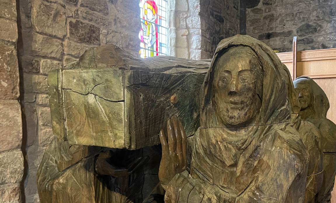
monks at Lindisfarne decided to leave and they took St Cuthbert’s coffin with
them to Chester le Street and then to Durham.
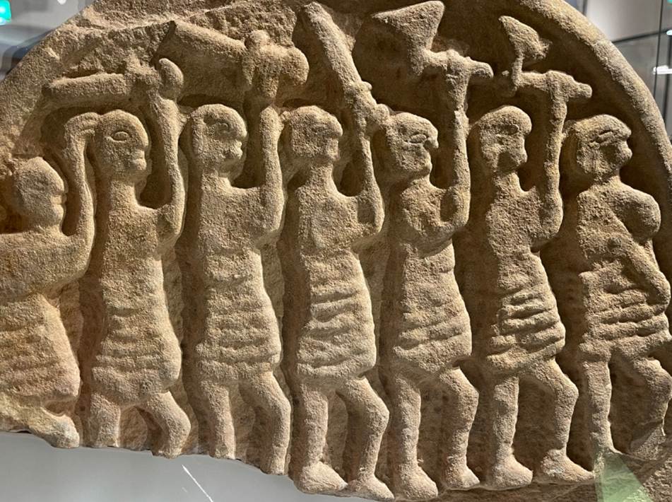
The Judgement Day Stone, Lindisfarne, c 800 to 825 CE
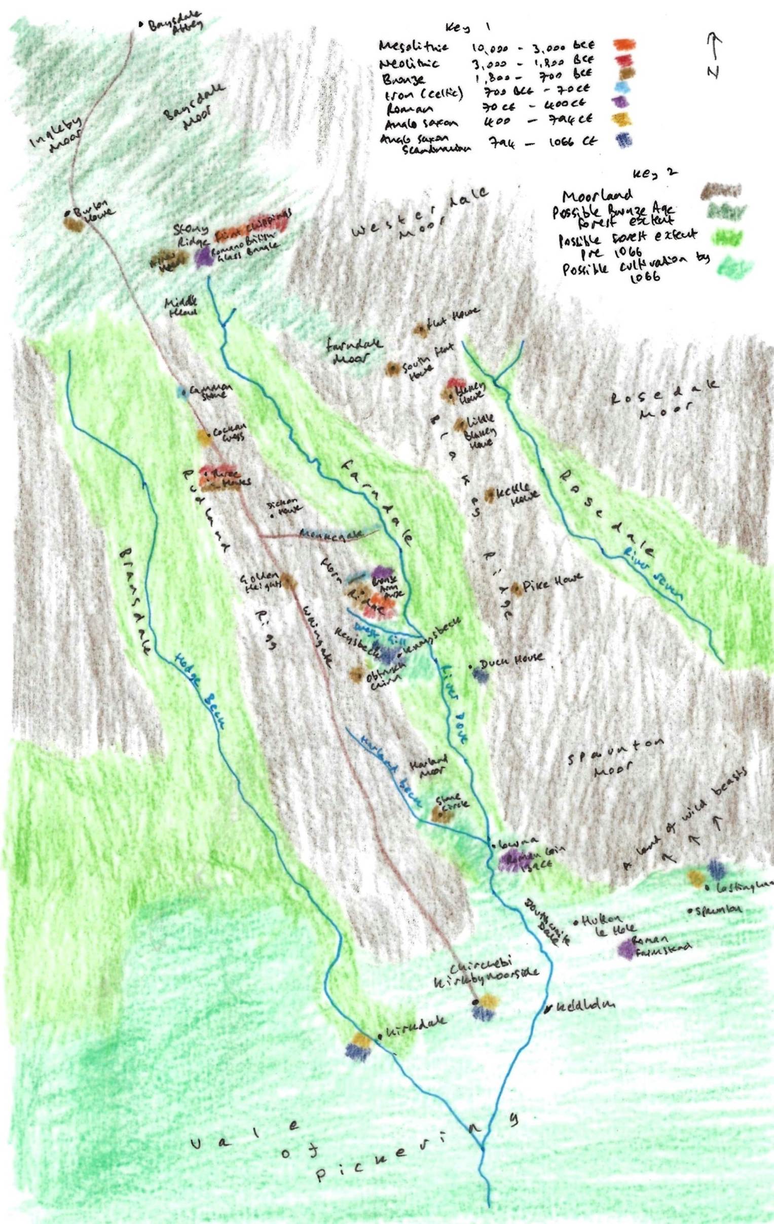
A representation of Farndale and its vicinity prior to
1066
Key 1 is a colour code for archaeological finds around
Farndale and the period of time with which they are associated, giving an
indication of settlement patterns around Farndale through time. Key 2 shows the
possible extent of moorland, woodland up to the Bronze Age and woodland up to
1066 and beyond, and the area of cultivation at the edge of the Vale of
Pickering.
This part of Yorkshire
saw two phases of Viking settlements both fairly peaceful, with no evidence of
armed conquest except for the taking of York, the political centre and market
of the area. York fell to the Danes in 867 CE. The extent and range of settlement
isn’t clear. In the early tenth century came a second wave of Scandinavian
speakers, with Norwegian tongues into northern Yorkshire from Cumberland.
The place names of the
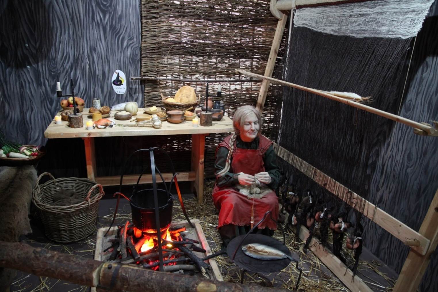
pre Norman countryside provide glimpses of pastures, valleys, marshes, farms.
The sculpture and churches in the tenth and eleventh centuries hint at a growth
of population around the edges of the moorland and on the lowlands and the
coast. Monuments suggest a framework of parishes along the tabular hills
stretching into the low ground.
The deep slumber of the dale that would become known as Farndale had
continued through the Saxon and Scandinavian periods, but by the eleventh
century, Yorkshire’s Beowulf lord, Orm Gamalson,
held lands across the region which included the estate of Kirkbymoorside,
recorded as Chirchebi in the Domesday Book (Kirby [Moorside]
in the Domesday Book, 1086, reproduced as Open Domesday by Anna Powell-Smith) which
in turn included Kirkdale.
The settled part of this estate was likely to have been limited to a small
settlement at Kirkbymoorside; the seventh century minster at Kirkdale, and the
ancient agricultural lands stretching from Kirkby Misperton to Nawton. Nevertheless, the forested northern dale lands,
seem to have been nominally incorporated into the wider estate since it was
described as having a depth of some 12 leagues (about 42 miles)
(New Settlements in the North Yorkshire Moors 1086 to 1340, Barry Harrison in Medieval Settlement in North
East England, Architectural and Archaeological Society of Durham and
Northumberland Research Report No 2, edited by B E Vyner, 1990, page 25).
The nascent dale remained a wilderness as the new millennium began, but
came to be a notional part of the land possessions of the elite class.
Before the Norman Conquest Kirby
was in two manors, one of which belonged to Gamal, a noted Saxon who possessed
a considerable deal of property in these parts and was Lord of the Manors of Lestingham, Spanton and other places; and was ranked
among the Northumbrian Nobles. In the Doomsday survey we find it in the hands
of Torbrand and Orm the son of Gamal. Orm was Lord of
the Manors of Kirby, Danby and Lealholm, and being of
noble descent, is said to have married Etheldreth
daughter of Aldred, Earl of Northumberland. (History of
Kirkdale and Vicinity, Part III, Kirkbymoorside, Tom Parker, Ryedale Historian, Volume 11, 1982, page 10).
The
status of Kirby Moorside before the Conquest seems to have been that of a large
Anglo-Saxon manor with numerous outlying berewicks (Darby & Maxwell, Domesday
Geography of Northern England, 1962, page 82).
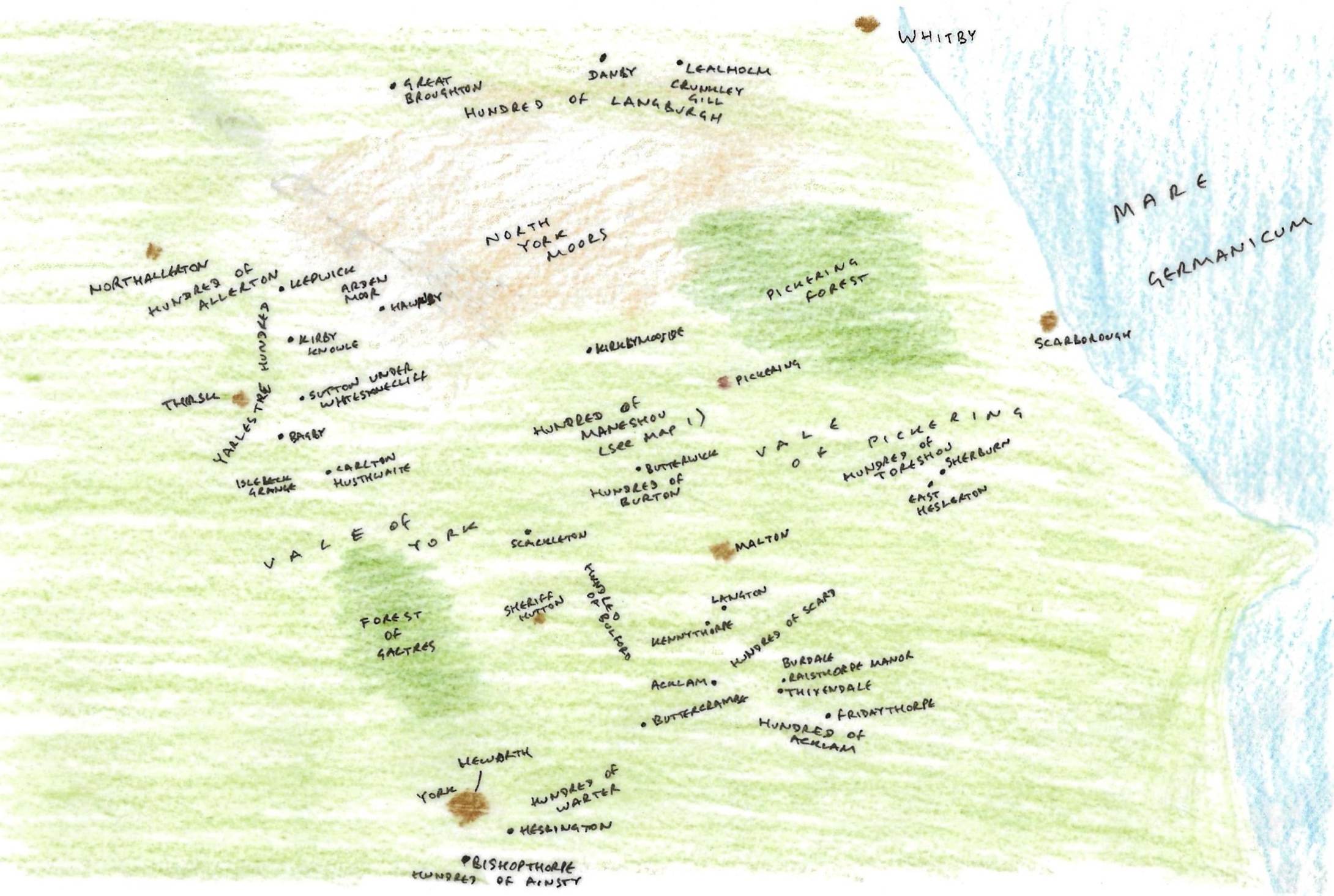
Orm Gamalson’s lands
before the Norman Conquest
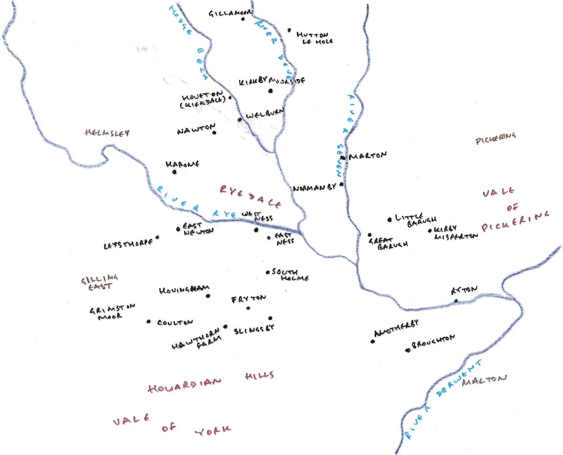
The Hundred of Manshou, part of Orm Gamalson’s
lands
By the period immediately preceding the Norman Conquest, the lands to
the south of Farndale were ancient agricultural settlements, focused on the
small town of Kirkbymoorside and the minster at Kirkdale, and nestling into the
edge of the dales as far as Gillamoor and Hutton le
Hole and perhaps as far as Harland Moor. Incursions into the dale may also have
occurred form the higher ground into the valley of West Gill and perhaps around
Duck House to the east.
The metropolis to the south became Jorvik.
The
Horn of
Ulph is an eleventh-century oliphant (a horn carved from an elephant's
tusk). It is two feet four inches long, and has a diameter at the mouth of five
inches. Given its size and condition, it is a particularly good example of a
medieval oliphant. Tradition holds that it is a horn of tenure, presented to
York Minster by a Norse nobleman named Ulph sometime around 1030. This suggests
that a powerful Scandinavian nobleman was willing to donate a very valuable
object to the Christian church by this time.
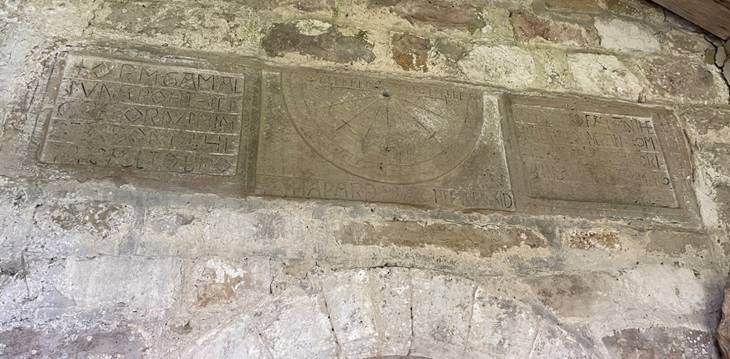
Orm’s
sundial at Kirkdale with the inscription, Orm the son of Gamel acquired
St Gregory’s Church when it was completely ruined and collapsed, and he had it
built anew from the ground to Christ and to St Gregory in the days of King
Edward and in the days of Earl Tostig (inscription
on the Sundial at the Saxon Church of St Gregory) refers to Edward the
Confessor and to Tostig, the son of Earl Godwin of Wessex and brother of Harold
II, the last Anglo Saxon King of England. Tostig was the Earl of Northumbria
between 1055 and 1065. It was therefore during that last peaceful decade,
immediately before the Norman conquest, that Orm, son of Gamel rebuilt St
Gregory’s Church at Kirkdale.
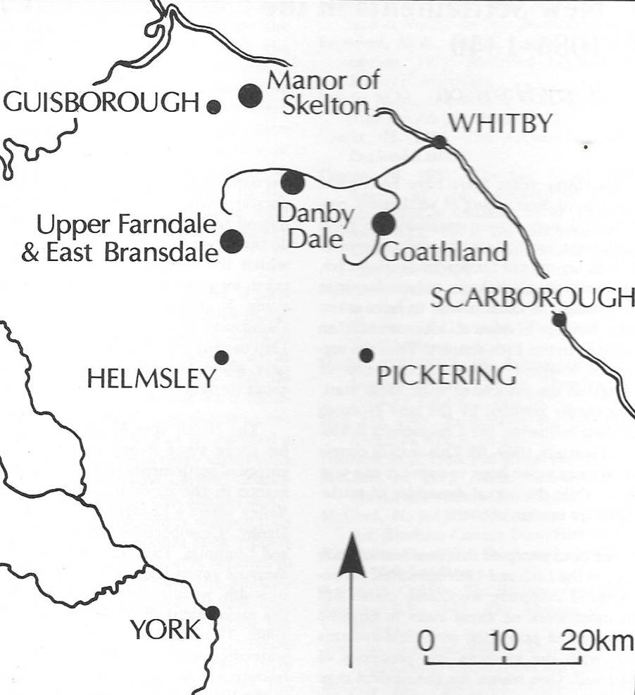
The North
Yorks Moors was an appropriate area for the study of medieval agriculture,
since it appears to have been largely empty of settlements in 1086. The only
developed manor in the moorlands proper was in the Esk
Valley where a 12 carucate holding was located at Danby, Crumbeclive
(Crunkley Hill in Glaisdale) and Lealholm.
This was an extensive area, said to measure seven leagues in length by three
leagues in width, within which Danby (six carucates) was the major focus of
settlement. The long valleys on the south side of the watershed appear to have
functioned mainly as resources for woodland and pastures for settlements in the
Vale of Pickering and although some settlements in the moors may have been
subsumed into consolidated Domesday entries for lowland manors, the
descriptions of moorland tracts granted to the new monasteries (Whitby,
Guisborough, Rievaulx and Byland) in the early and mid 12th
century contain very little evidence of functioning communities of any kind. New
Settlements in the North Yorkshire Moors, 1086 to 1340 by Barry Harrison,
in Medieval Rural Settlement in North East England, Architectural and
Archaeological Society of Durham and Northumberland, Research Report No 2,
Edited by BE Vyner, 1990
So we start
with a clear palate, to understand how agriculture developed after the Norman
Conquest.
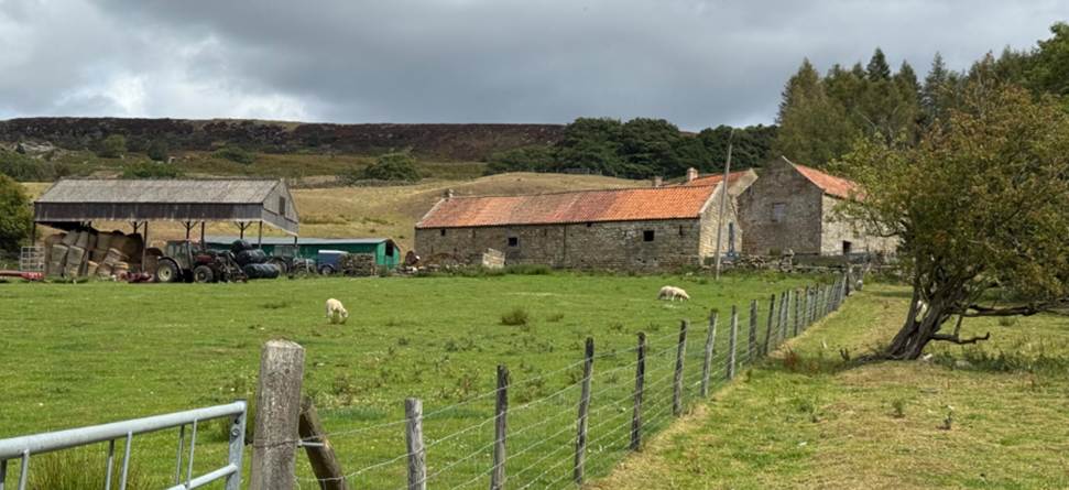
Keysbeck and Knaysbeck. Knaresbeck is old Norse for
twisting stream. These farmsteads suggest that the side valley of the West Gill
which sits beside the main dale of Farndale may have been the first area to be
cleared for cultivation, well before the clearance of the main dale in the
thirteenth century.
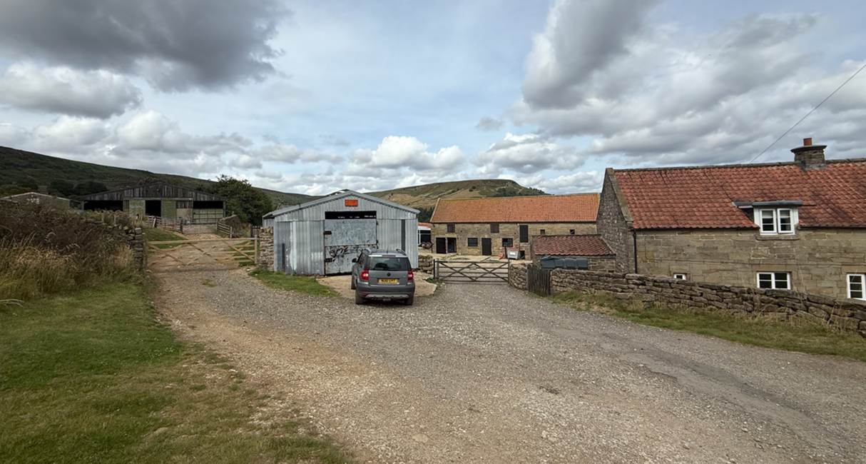
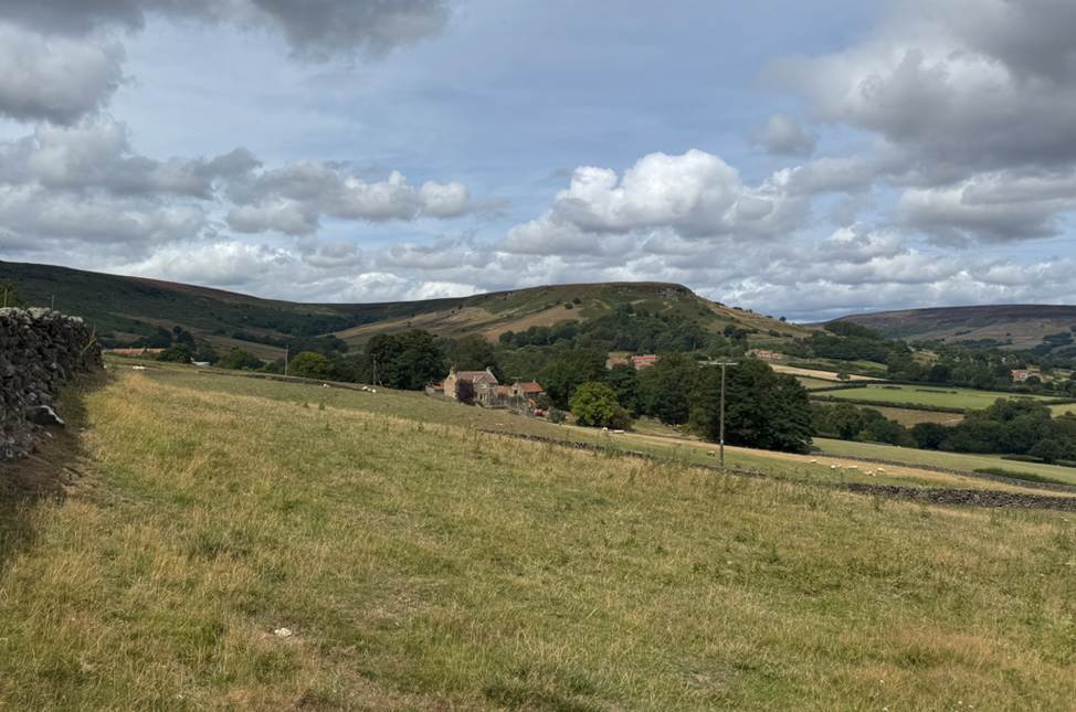
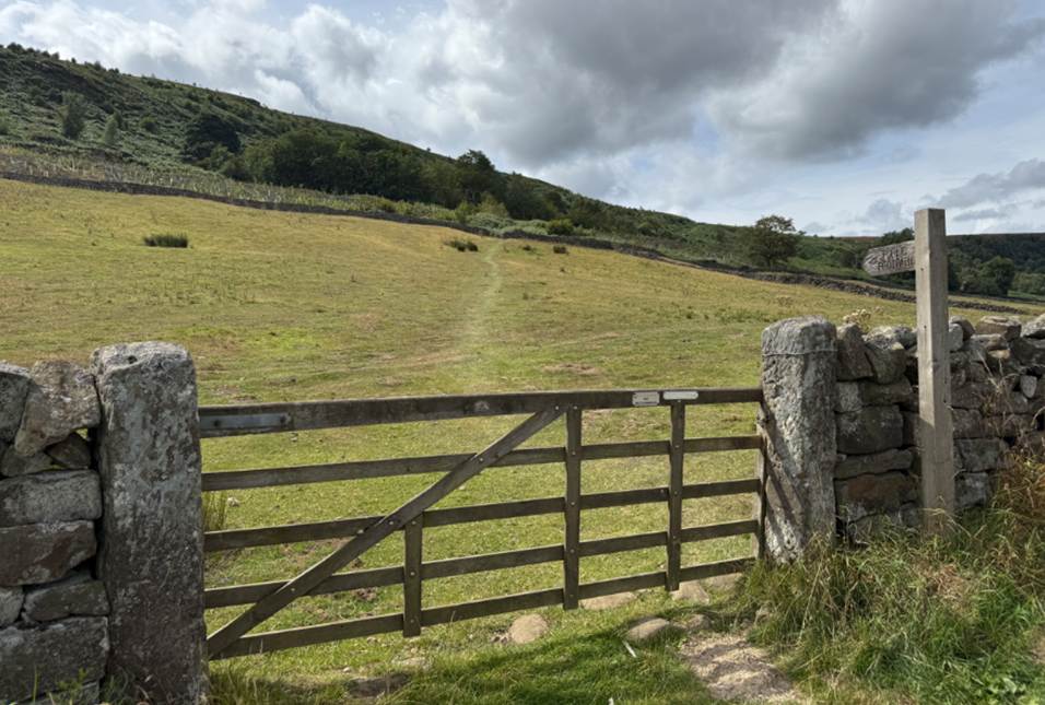
Keysbeck, 2025
Knaysbeck, 2025
Midway up the
eastern escarpment of Farndale lies Duck House. Farndale is fortunate to
retain, still, several of its ancient dwellings. Duck House is a good example
of a longhouse or coit of the Middle Ages. These
houses have their origin in the Saxon or Viking longhouses, usually of wood,
but were rebuilt in stone between 1500 to 1700 AD. The fireplace was in the
centre, screened from the draughts of winter by projecting speer. The living
room was here, and the parlour or best room, adjoining. At the end, now
converted into living rooms, where the cattle stalls, humans and animals all
lived under the same roof. Many records of this practise still exist even until
the 19th century. Duck House is now much altered. It has lost its thatched
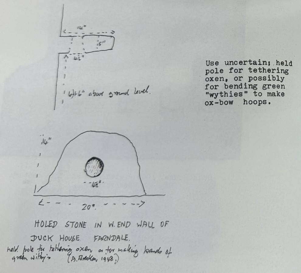
roof. At the west end of the dwelling house there is a curious stone ring high
up in the wall end. It is said to have been used for tying on the Green wooden wythies or saplings used for making bullock yokes. Ox bow
stones in Farndale Head were used for this purpose. Probably the ring was for
tying up bullocks with withies when not working. Bullocks were used for ploughing
and as draft animals from the Bronze Age, or even earlier to within the present
century. (Raymond Hayes, Farndale, 1961, unpublished, page 11).
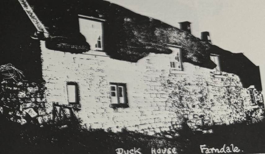
Duck House, 1948,
with sixteenth and eighteenth century renovations (Raymond Hayes, Farndale, 1961, unpublished, page
43).
It was built in 1520, but perhaps replaced a homestead with much earlier
origins.