Newfoundland and Nova Scotia
Historical and geographical information
|
Return to the Home Page of the Farndale Family
Website |
The story of one family’s journey through two
thousand years of British History |
The 83 family lines into which the family is divided.
Meet the whole family and how the wider family is related |
Members of the historical family ordered by date of
birth |
Links to other pages with historical research and
related material |
The story of the Bakers of Highfields, the Chapmans,
and other related families |
Dates are in red.
Hyperlinks to other pages are in dark blue.
Headlines of the history of the Newfoundland
are in brown.
References and citations are in turquoise.
Contextual history is in purple.
This webpage
about the Newfoundland has the
following section headings:
·
The
Farndales of Newfoundland
· Newfoundland
· Corner Brook
· St John’s
· Halifax, Nova Scotia
The Farndales of
Newfoundland
The Newfoundland Line are the
descendants of John Martin Farndale (FAR00613),
1886-1966 who emigrated to Newfoundland. See also the Newfoundland Farndales.
Raymond WS Farndale (FAR00804), served in 59th
(Newfoundland) Heavy Regiment Royal Artillery.
They lived at Corner Brook, St John’s, Toronto and Halifax.
Many of the
Canadian immigrants docked in Halifax on their journey west.
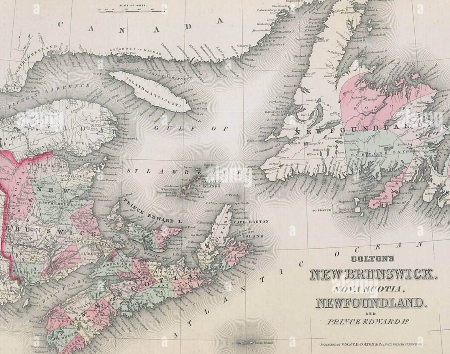
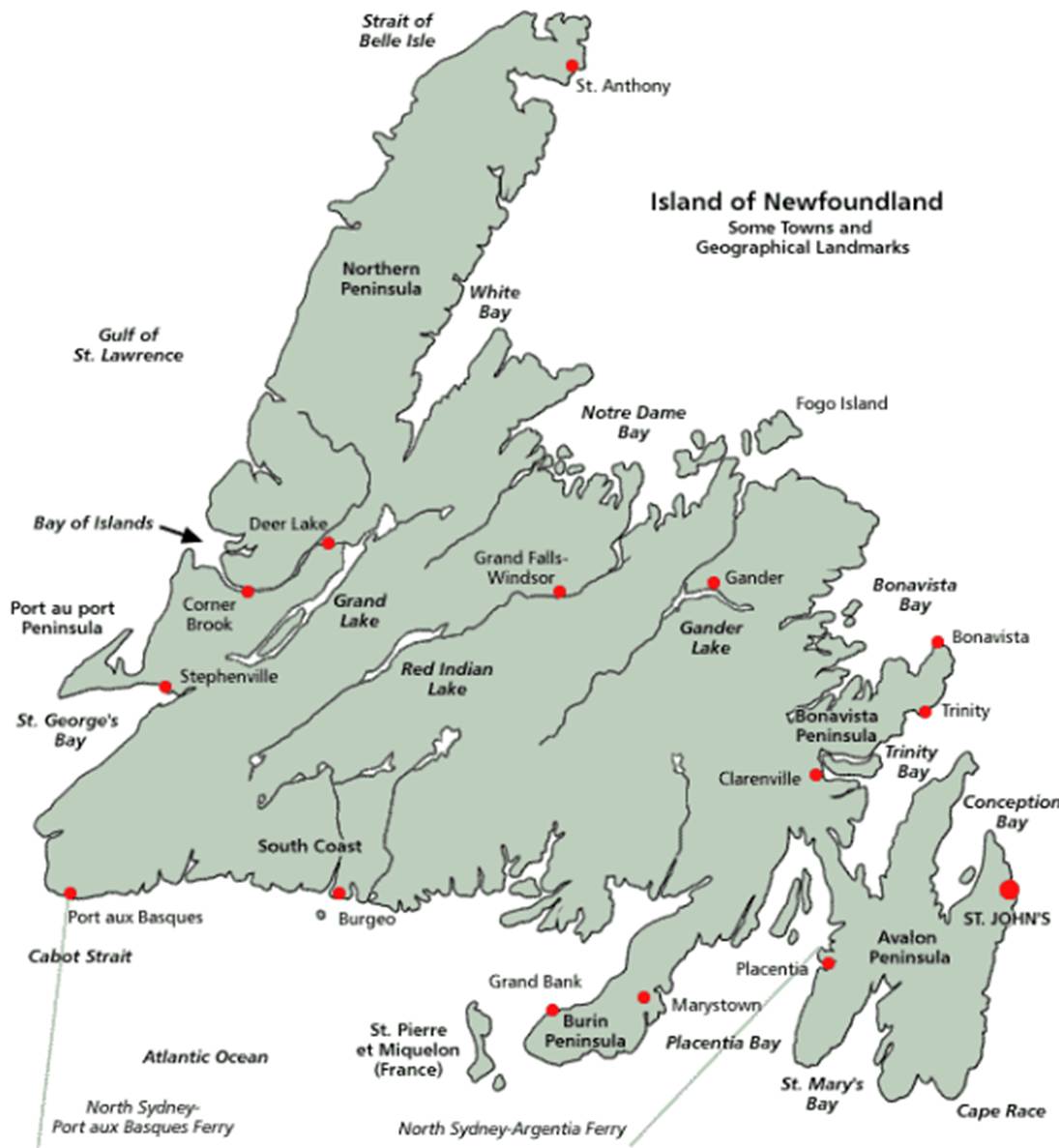
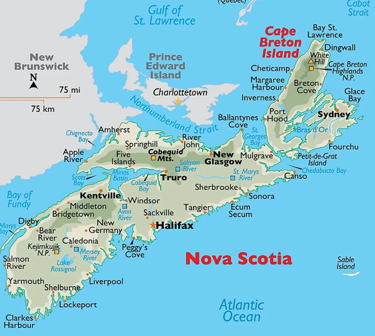
Nova Scotia and Newfoundland
Newfoundland
Nova Scotia
Corner Brook
Corner Brook is a city located on the west coast of
the island of Newfoundland in Newfoundland and Labrador, Canada.
Located on the Bay of Islands at the mouth of
the Humber River, the city is the second-largest population
centre in the province behind St. John's, and smallest of three
cities behind St. John's and Mount Pearl. As such, Corner Brook
functions as a service centre for western and northern Newfoundland. It is
located on the same latitude as Gaspé, Quebec, a city of similar size and
landscape on the other side of the Gulf of St. Lawrence. Corner Brook is
the most northern city in Atlantic Canada.
It is the administrative headquarters of the Qalipu Mi'kmaq First Nations band
government. The Mi'kmaq name for the nearby Humber River is "Maqtukwek"
1767
The area was surveyed by Captain
James Cook in 1767. The Captain James Cook Historic
Site stands on Crow Hill overlooking the city.
Nineteenth
century
By the middle of the nineteenth century the population of
Corner Brook was less than 100, and the inhabitants were engaged in fishing and
lumber work.
Corner Brook is home to the Corner Brook Pulp & Paper
Mill (owned by Kruger Inc.), which is a major employer for the region.
The area was originally four distinct communities, each
with unique commercial activities:
· Curling, with its fishery;
· Corner Brook West (also known as Humber West or Westside)
with its retail businesses;
· Corner Brook East (also known as Humbermouth
and the Heights) with its railway and industrial operations; and
· Townsite (known as Corner Brook), home to the employees of
the pulp and paper mill.
1948
Between 1948 and 1958, about 70 people from Latvia and
Germany settled in Corner Brook. They came as part of then
Premier Joseph Smallwood's New Industries program. They built and worked at
North Star Cement and the Atlantic Gypsum Plant.
1956
In 1956, the four communities were amalgamated to form the
present-day City of Corner Brook.
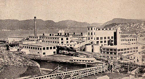
Pulp and paper industry, Corner Brook
St John’s
The St. John's metropolitan area is the most
populous census metropolitan area in the Canadian
province of Newfoundland and Labrador.
1500
St. John's was used by fishermen setting up seasonal camps
in the early 1500s. Sebastian Cabot declared in a handwritten Latin text in his
original 1545 map that St. John's earned its name when he and his father, the
Venetian explorer John Cabot, in the service of England, became the first
Europeans to sail into the harbour, on the morning of 24 June 1494 (per British
and French historians, in 1497), the feast day of Saint John the Baptist.
However, the locations of Cabot's landfalls are disputed.
1519
The earliest record of the location appears as São João on
a Portuguese map by Pedro Reinel in 1519.
1527
When the English mariner John Rut visited St. John's in
1527, he found Norman, Breton and Portuguese ships in the harbour. On 3 August
1527, Rut wrote a letter to King Henry on the findings of his voyage to North
America; this was the first known letter sent from North America.
1540
A series of expeditions to St. John's by Portuguese from
the Azores took place in the early 16th century, and by 1540, French, Spanish
and Portuguese ships crossed the Atlantic annually to fish the waters off the
Avalon Peninsula. In the Basque Country, it is a common belief the name of St.
John's was given by Basque fishermen because the bay of St. John's is very
similar to the Bay of Pasaia in the Basque Country, where one of the fishing
towns is called St. John (in Spanish, San Juan, and in Basque, Donibane).
1541
St. Jehan is shown on Nicolas Desliens's world map of 1541,
and San Joham is found in João Freire's Atlas of
1546.
1583
On 5 August 1583, an English Sea Dog, Sir Humphrey Gilbert,
claimed the area as England's first overseas colony under Royal Charter of
Queen Elizabeth I. There was no permanent population, however, and Gilbert was
lost at sea during his return voyage, thereby ending any immediate plans for
settlement.
1620
By 1620, the fishermen of England's West Country controlled
most of Newfoundland's east coast.
1627
In 1627, William Payne, called St. John's "the
principal prime and chief lot in all the whole country".
1630
Sometime after 1630, the town of St. John's was established
as a permanent community. Before this, English fishermen were expressly
forbidden by the English government, at the urging of the West Country fishing
industry, from establishing permanent settlements along the English-controlled
coast.
1665
The town's first significant defences were likely erected
due to commercial interests, following the temporary seizure of St. John's by
the Dutch admiral Michiel de Ruyter in June 1665.
1673
The inhabitants fended off a second Dutch attack in 1673,
when it was defended by Christopher Martin, an English merchant captain. Martin
landed six cannons from his vessel, the Elias Andrews, and constructed an
earthen breastwork and battery near Chain Rock commanding the Narrows leading
into the harbour. With only 23 men, the valiant Martin beat off an attack by
three Dutch warships.
1675
The population grew slowly in the 17th century. St. John's
was Newfoundland's largest settlement when English naval officers began to take
censuses around 1675. The population grew in the summers with the arrival of
migratory fishermen.
1680
In 1680, fishing ships mostly from South Devon set up
fishing rooms at St. John's, bringing hundreds of Irish men into the port to
operate inshore fishing boats.
1689
The English government planned to expand the fortifications
of Fort William in around 1689, but construction did not begin until after the
French admiral Pierre Le Moyne d'Iberville captured
and destroyed the town in the Avalon Peninsula Campaign in 1696. When 1500
English reinforcements arrived in late 1697, they found rubble where the town
and fortifications had stood
1705
The French attacked St. John's again in 1705, the Siege of
St. John's, and captured it in 1708, the Battle of St. John's, devastating
civilian structures with fire on each instance.
The harbour remained fortified through most of the 18th and
19th centuries.
1762
The final battle of the Seven Years' War in North America
(known as the French and Indian War in the US) was fought in 1762, in St.
John's.
Following a surprise capture of the town by the French
early in the year, the British responded and, at the Battle of Signal Hill, the
French surrendered St. John's to British forces under the command of Colonel
William Amherst.
1800
On 24 April 1800, the "United Irish Uprising"
occurred when 19 Irish soldiers who were part of the British garrison stationed
in Newfoundland mutinied. The mutineers, who were suspected to be members of
the Society of United Irishmen, fled to the countryside after the mutiny
failed, and were apprehended in a matter of weeks and court-martialled. Of the
17 mutineers captured, 8 were executed, 4 were let go while 5 were sentenced to
penal transportation.
The 18th century saw major changes in Newfoundland:
population growth, beginnings of government, establishment of churches,
reinforcement of commercial ties with North America and development of the
seal, salmon and Grand Banks fisheries. St. John's population grew slowly.
Although it was primarily a fishing station, it was also a garrison, a centre
of government and a commercial hub.
St. John's served as a naval base during the American
Revolutionary War and the War of 1812.
1892
The Great Fire of 1892 destroyed a significant portion of
the city.
1901
Guglielmo Marconi received the first transatlantic wireless
signal in St. John's on 12 December 1901 from his wireless station in Poldhu,
Cornwall.
1919
St. John's was the starting point for the first non-stop
transatlantic aircraft flight, by Alcock and Brown in a modified Vickers Vimy
IV bomber, in June 1919, departing from Lester's Field in St. John's and ending
in a bog near Clifden, Connemara, Ireland.
1939
During the Second World War, the harbour supported Royal
Navy and Royal Canadian Navy ships that were engaged in anti-submarine warfare.
It was the site of an American Army Air Force base, Fort Pepperrell, that was
established as part of the "Lend-Lease" Destroyers for Bases
Agreement between the United Kingdom and United States. The base included
several US-manned coast defence guns, and a Canadian-manned battery of two
Lend-Lease 10-inch M1888 guns was at Fort Cape Spear.
1942
The Knights of Columbus Hostel fire in December 1942 saw 99
military and civilian lives lost.
1960
The military base was transferred to Canadian control in
1960 and is now known as CFS St. John's.
1990s
St. John's, and the province as a whole, was gravely
affected in the 1990s by the collapse of the northern cod fishery, which had
been the driving force of the provincial economy for hundreds of years.
After a decade of high unemployment rates and depopulation,
the city's proximity to the Hibernia, Terra Nova and White Rose oil fields led
to an economic boom that spurred population growth and commercial development.
As a result, the St. John's area now accounts for about half of the province's
economic output.
Halifax, Nova Scotia
Halifax, officially known as the Halifax Regional
Municipality (“HRM”), is the capital of the
Canadian province of Nova Scotia.
Coastal areas of Nova Scotia in the region of Halifax were
inhabited seasonally by Mi’kmaq before the influx of Europeans.
1749
The first permanent European settlement in the region was
on the Halifax Peninsula. The establishment of the Town of Halifax, named after
the 2nd Earl of Halifax, in 1749 led to the colonial capital being transferred
from Annapolis Royal.
The establishment of Halifax marked the beginning of Father
Le Loutre's War. The war began when Edward Cornwallis arrived to establish
Halifax with 13 transports and a sloop of war on June 21, 1749. By unilaterally
establishing Halifax, the British were violating earlier treaties with the Mi'kmaq
(1726), which were signed after Father Rale's War. Cornwallis brought along
1,176 settlers and their families. To guard against Mi'kmaq, Acadian and
French attacks on the new Protestant settlements, British fortifications were
erected in Halifax (Citadel Hill) (1749), Bedford (Fort Sackville) (1749),
Dartmouth (1750), and Lawrencetown (1754), all areas within the modern-day
Regional Municipality. St. Margaret's Bay was first settled by French-speaking
Foreign Protestants at French Village, Nova Scotia who migrated from Lunenburg,
Nova Scotia during the American Revolution.
1917
6 December 1917 saw one of the greatest disasters in
Canadian history, when the SS Mont-Blanc, a French cargo ship carrying
munitions, collided with the Belgian Relief vessel SS Imo in "The
Narrows" between upper Halifax Harbour and Bedford Basin. The resulting
explosion, the Halifax Explosion, devastated the Richmond District in the North
End of Halifax, killing approximately 2,000 people and injuring nearly 9,000
others. The blast was the largest artificial explosion before the development
of nuclear weapons. Significant aid came from Boston, strengthening the bond
between the two coastal cities.
Bibliography