New Zealand
Gisborne and Masterton where Farndales settled
Historical and geographical information regarding the places where
Farndales settled
|
Return to the Home Page of the Farndale Family
Website |
The story of one family’s journey through two
thousand years of British History |
The 83 family lines into which the family is divided.
Meet the whole family and how the wider family is related |
Members of the historical family ordered by date of
birth |
Links to other pages with historical research and
related material |
The story of the Bakers of Highfields, the Chapmans,
and other related families |
Dates are in red.
Hyperlinks to other pages are in dark blue.
Headlines of the history of the New Zealand are in brown.
References and citations are in turquoise.
Contextual history is in purple.
This webpage
about the New Zealand has the following section headings:
·
The
Farndales of New Zealand
·
Gisborne
The Farndales of New
Zealand
The New
Zealand Line are the descendants of Ronald
Martin Farndale (FAR00852)(born
1919) who emigrated to New Zealand after service
ion the Second World War in 6th Field Ambulance RAMC in Greece and Crete and
his capture as a Prisoner of War at Sidi Rezegh. He became a builder in
Masterton, near Wellington, New Zealand.
The New Zealand 2 Line are the descendants
of Wilf Farndale (FAR00769)
who settled at Gisborne, North Island in 1964.
Frederick
Farndale (FAR00898)
also emigrated to New Zealand from Middlesbrough.
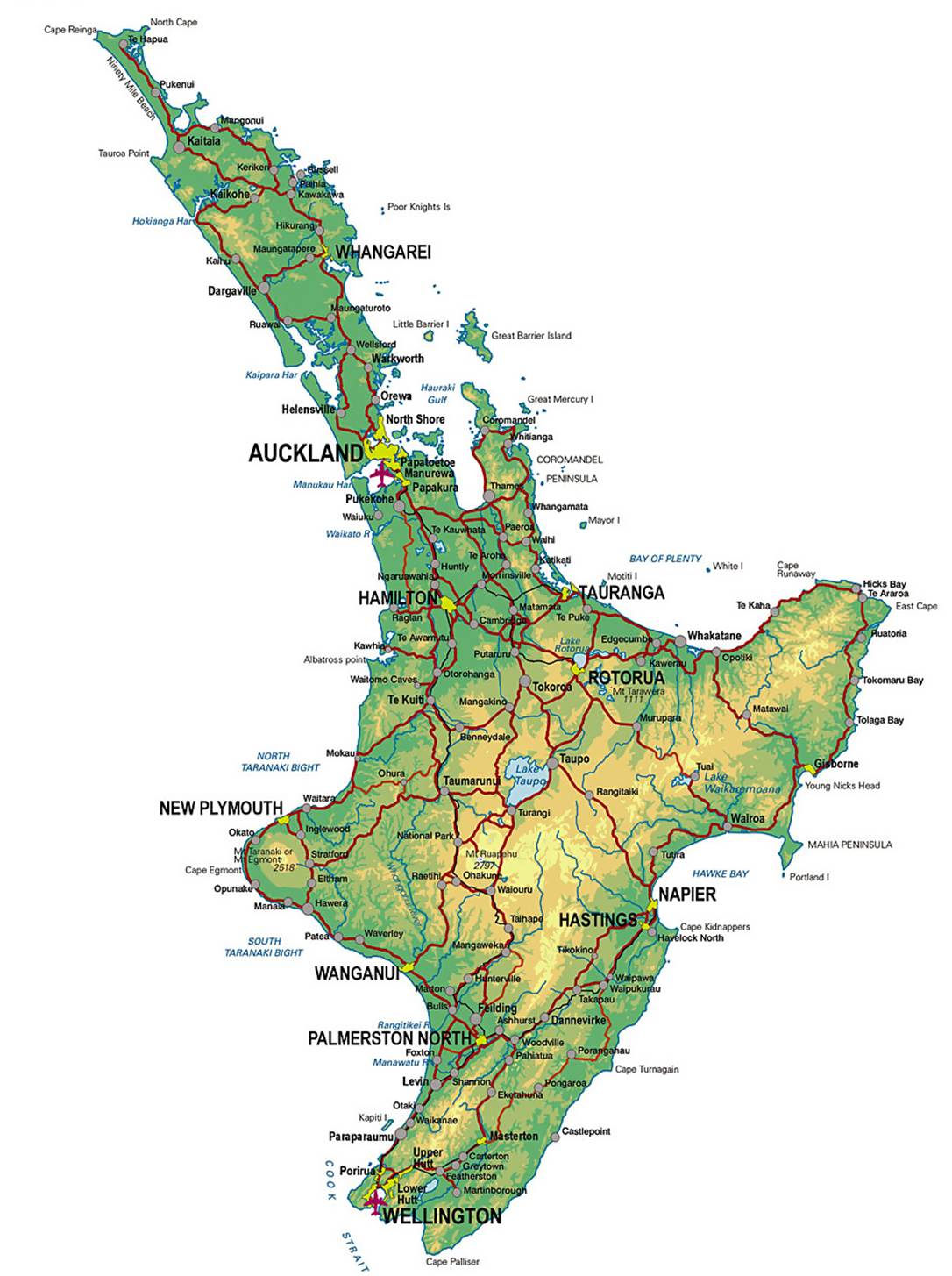
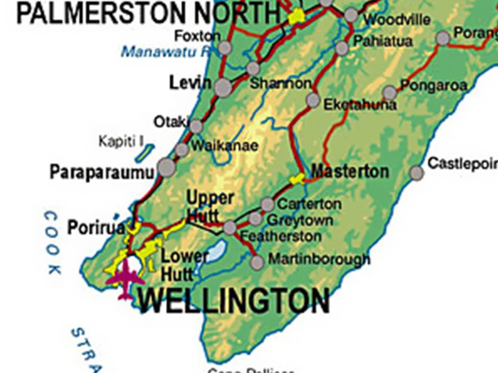
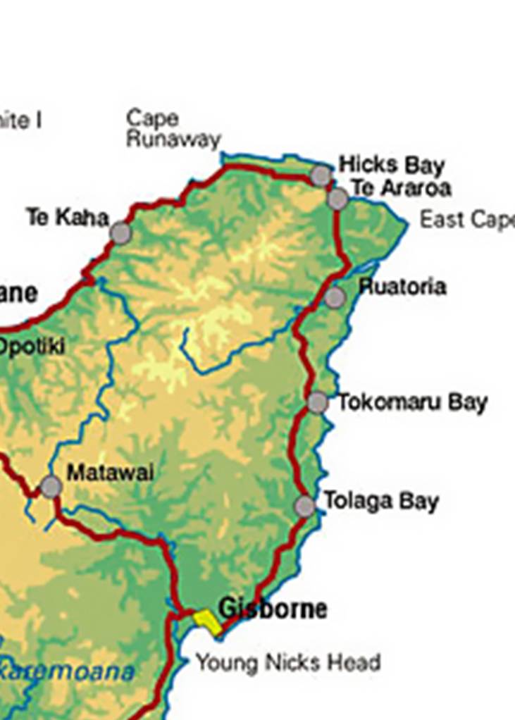
North Island, New Zealand
Masterton
Gisborne
New Zealand
1314
New Zealand was first settled by Polynesians from Eastern
Polynesia. Genetic and archaeological evidence suggests that humans emigrated
from Taiwan via southeast Asia to Melanesia and then radiated eastwards into
the Pacific in pulses and waves of discovery which gradually colonised islands
from Samoa and Tonga all the way to Hawaii, the Marquesas, Easter Island, the
Society Islands and, finally, New Zealand. In New Zealand there are no human
artifacts or remains dating earlier than the Kaharoa Tephra, a layer of
volcanic debris deposited by the Mount Tarawera
eruption around 1314. The 1999 dating of some kiore
(Polynesian rat) bones to as early as 100 CE was later found to be an error;
new samples of rat bone (and also of rat-gnawed shells and woody seed cases)
mostly gave dates later than the Tarawera eruption
with only three samples giving slightly earlier dates.
1500
The descendants
of these settlers became known as the Māori, forming a distinct culture of
their own. The latter settlement of the tiny Chatham Islands in the east of New
Zealand about 1500 produced the Moriori; linguistic
evidence indicates that the Moriori were mainland
Māori who ventured eastward. There is no evidence of a pre-Māori
civilisation in mainland New Zealand.
1642
The first Europeans known to reach New Zealand were the crew of
Dutch explorer Abel Tasman who arrived in his ships Heemskerck and Zeehaen.
Tasman anchored at the northern end of the South Island in Golden Bay (he named
it Murderers' Bay) in December 1642, and sailed northward to Tonga following an
attack by local Māori, Ngāti Tūmatakōkiri.
1820
There was a difficult relationship with settlers. Māoris from New Zealand first visited London in the
1820s. They encouraged white settlers in the 1820s and 1830s. Many settlers
were innocuous, even benevolent. However others were less scrupulous.
1840
Captain
William Hobson signed the Treaty
of Waitangi in 1840 with Māori rulers, intended to control white
settlement and regulate land sale.
1860s
British troops ended up fighting the Māori in the 1860s to
defend the settlers whose aggressive behaviour the British government deplored.
Masterton
Masterton is a large town in
the Wellington Region of New Zealand and the seat of
the Masterton District, a territorial authority or local government
district. It is the largest town in the Wairarapa, a region separated from
Wellington by the Rimutaka ranges. It is
100 kilometres north-east of Wellington, 39.4 kilometres south
of Eketahuna, on the Ruamahanga River.
1854
Masterton was founded in 1854 by
the Small Farms Association. The association was led by Joseph Masters,
after whom the town was named, and aimed to settle working people in villages
and on the land.
At first Masterton grew slowly,
but as its farming hinterland became more productive it began to prosper.
1870
In the 1870s Masterton overtook
Greytown as Wairarapa’s major town.
1877
Masterton became a borough in
1877.
1880
Masterton was reached by the
railway line from Wellington in 1880. The railway became for a time the main
line from Wellington to the north of New Zealand and its arrival cemented the
town’s position as the Wairarapa region’s main market and distribution centre.
.jpg)
The railway station opened 1880
demolished 1967
1900
.jpg)
The Post Office opened 1900
demolished 1960
1965
In April 1965 one of the country's
worst industrial accidents occurred at the General Plastics Factory on 170
Dixon Street.
1974
In essence providing support
services for rural industry, Masterton's real growth ended with that sector's
retrenchment after the 1974 British entry to the trade and political grouping
now the European Union.
Efforts to decentralise industry
to New Zealand's provinces gave Masterton a print works and some other
industries but the lost economic activity was not restored.
From the 1970s, people and
businesses left for opportunities elsewhere.
1980
In the 1980s, with government
deregulation and protective tariffs lifted, more businesses closed and the town
declined further.
1989
Masterton did not quite qualify to
be a city by 1989 when the minimum population requirement for that status was
lifted from 20,000 to 50,000.
Gisborne
Gisborne (Māori: Tūranga-nui-a-Kiwa,
"Great standing place of Kiwa") is a city in northeastern New Zealand
and the largest settlement in the Gisborne District. It had a population of
38,200 in June 2023.
The settlement was originally known as Turanga and renamed Gisborne in 1870 in honour of
New Zealand Colonial Secretary William Gisborne.
Circa
1300
The Gisborne region has been settled for over
700 years. For centuries, the region has been inhabited by the tribes of Te Whānau-a-Kai, Ngaariki
Kaiputahi, Te Aitanga-a-Māhaki,
Rongowhakaata, Ngāi Tāmanuhiri and Te
Aitanga-a-Hauiti. They descend from the voyagers of the Te
Ikaroa-a-Rauru, Horouta and Tākitimu
waka.
During the 14th century, Māori tribes
built fishing villages close to the sea and built pā on nearby hilltops.
1768
Gisborne's Kaiti Beach is the place where
British navigator Captain James Cook made his
first landing in New Zealand upon the Endeavour. Cook had earlier set off from
Plymouth in August 1768 on a mission bound for Tahiti. Once he had concluded
his duties in Tahiti, Cook continued south to look for a large landmass or
continent, before heading west. Young Nick's Head was thought to be the first
piece of New Zealand land sighted by Cook's party, and so named because it was
first observed by cabin boy Nicholas Young on 6 October 1769.
On 9 October, Cook came ashore on the eastern
bank of the Tūranganui River, accompanied by a
party of men. Their arrival was marred by misunderstanding and resulted in the
death and wounding of nine Māori over four days. It was also on the banks
of the Tūranganui River that first the township
of Turanga, then the city of Gisborne, grew as
European traders and whalers began to settle in the river and port area.
1831
Starting in the early 1830s, traders such as
Captain John Harris and Captain George E. Read set up the first trading
stations along the Tūranganui river and are
attributed to the founding of the town. In 1831 John Harris set up the first
trading station in Tūranga on behalf of a Sydney
firm.
Over the next 30 years, many more European
traders and missionaries migrated to the region.
1868
In 1868, the government bought 300 hectares of
land for a town site.
1870
The town was laid out in 1870 and the name
changed from Turanga to Gisborne, after the then
colonial secretary, and to avoid confusion with Tauranga.
1872
In 1872, Gisborne's first public school was
opened and its first newspaper, the Poverty Bay Standard was
established.
1877
A town council was formed in 1877.
1890
Rapid development came towards the end of the
century on the back of a thriving pastoral hinterland. Two freezing works and
many other industries were established.
1901
The population rose from 2,737 in 1901 to more
than 15,000 in 1926.
1914
Suburban Mangapapa
had its own town council from 1914 to 1924, when most of it joined Gisborne
1929
At the end of the 1920s Gisborne had all the
markers of a provincial capital except a railway line – an improved harbour, a
substantial post office, a high school and an impressive main street (Gladstone
Road). Large houses were built along the left bank of the Taruheru
River and a botanical garden developed on the right bank.
1955
The 1950s and 1960s was a further buoyant
period. Pastoral farming thrived, the port was complemented by a rail link and
an airport, and a food-processing and canning industry developed.
Substantial areas of state housing were built
off Childers Road, towards the airport. Gisborne attained city status (a
population of 20,000) in 1955. Gisborne High School was divided into boys’ and
girls’ schools, and Lytton and Campion colleges opened.
1976
The population reached 30,000 in 1976.
Bibliography