The vicinity of Farndale in the Iron Age (700 BCE to 70 CE)
Tension
between tribal groups led by proto kings
FAR00001
|
Return to the Home Page of the Farndale Family
Website |
The story of one family’s journey through two
thousand years of British History |
The 83 family lines into which the family is divided.
Meet the whole family and how the wider family is related |
Members of the historical family ordered by date of
birth |
Links to other pages with historical research and
related material |
The story of the Bakers of Highfields, the Chapmans,
and other related families |
Dates are in red.
Hyperlinks to other pages are in dark blue.
Headlines are in brown.
References and citations are in turquoise.
Context and local history are in purple.
BCE - Before the common or current era. The contemporary equivalent of
BC.
CE - Common or current era. The
contemporary equivalent of AD.
Go back to Bronze
Age Yorkshire.
Context – the Age of
Iron
As
bronze became more plentiful and iron made its first appearance, flint working
declined, though flint and stone continued to be used throughout the Roman
period and even later. The elegant pottery of the beaker food vessel and early
urn types gave place to a coarse, dark, gritty fabric devoid of ornamentation
apart from a few vessels with raised cordons or finger tip impressions round
the rims. The vessels were mainly wide rimmed jars, tall basket like urns and
straight sided platters.
By this time a kind of feudal aristocracy had
established itself, the warrior overlords living in or near strongly defended
hilltop forts, and the peasant farmers working for them and living in wooden
farmsteads.
These settlements were often bounded by dykes,
ramparts and ditches of the kind still visible on the wolds
and limestone hills. The horse became important, and cattle or horse folds
defended by internal ditch and outer bank were constructed to house them.
Towards the end of the Iron Age, the heavier
Celtic or Belgic plough was in use. This had wheels, coulter, share and mould
board and could tackle the heavy clay soils of the forest lowlands and such
lands as are found in the Vale of Pickering.
About 400 BCE a change in climate to the
colder and wetter Atlantic conditions caused vegetation to increase, especially
on the low ground. The size of the fields tended to increase too and probably
the large open fields with their strip cultivation may originate in this period.
By the time the Romans entered Yorkshire from
70 CE, the limestone hills north of the Vale of Pickering were settled and
cultivated in patches. There was still a large tract of forest in and between
the dales and up the sides of Bilsdale and Riccadale.
Traces of early occupation are likely at Baxtons,
Skiplam Rigg, Beadlam Rigg and around Carlton.
Some
time in this era the first ironstone must have
been quarried and smelted on the edge of the moors.
Beehive shaped quern stones are to be seen
around Helmsley. The querns are nearly always of hard freestone, the moor grit
or ironstone. They occur at the higher farms of the dales, Cockan
in Bransdale, Eskletts and Falcon Farm, Danby, hence
it appears that the early cultivation took place there.
(A History of
Helmsley Rievaulx and District, editor,
J McDonnell, 1963, page 43 to 46).
1,200 BCE
There is an In Our
Time podcast about the dawn of the European Iron
Age,
a period of great upheaval when technology and societies were changed forever.
800 BCE
The Early Iron Age
(crisis)
Iron
The Llyn Fawr
Hoard (c 750 CE) from Wales
included a new material alongside bronze objects, which included sickles made
of iron, the earliest iron objects in Britain. This marked the transition to a
new Iron Age. Bronze
had over time become a commodity beyond practical use, adopted as a currency of
wealth exchange. Iron provided an entirely new material, which, in contrast to
bronze, was more easily made, and could be used by all, not just the elite. It
marked a return to a practical material used for practical and agricultural
purposes. Yet the shift from bronze to iron took many generations, and there is
a mysterious gap in the continuum of history.
Iron
was not as beautiful as bronze, but it was stronger and kept its edge better,
which was ideal for weapons (The Little History of Yorkshire,
Ingrid Barton, 2024, page 22).
Economic Crisis
East Chisenbury
Midden on Salisbury Plain (800 to 600
BCE) reveals the response to the crisis. Wealth came to be measured in
livestock rather than bronze. Significant quantities of animals bones were
found on the site, suggesting feasting and conspicuous consumption to create
relationships over large landscapes. A new type of elite was emerging.
At Suddern Farm in Hampshire, near Danebury (600 BCE) there is evidence changing
burial systems, also suggesting a period of transition.
600 BCE
Stability
· This was the period of massive stone towers, brochs,
such as the Broch
of Gurness on Orkney (400 BCE) in the far north of Scotland, which may have
stood 10 metres high. These were defensive structures.
· The Crannog was another Celtic structure for defence, built on stilts into
the lochside.
· In mainland Britain farming communities were creating hill forts
as alternative defensive features, such as Tre’r Ceiri Hill Fort in North West Wales (200 BCE), which had started to appear from
around 600 BCE. Hill forts were also elevated places where people lived,
possibly in cooperative societies where labour was shared. These may also have
been places of feasting and the amassing of wealth. Grain and cattle were
increasingly preserved in pits and enclosures.
The
La Tène culture was a European Iron Age culture which developed and flourished
during the late Iron Age from about 450 BCE, succeeding the early Iron Age
Hallstatt culture.
500 BCE
The Middle Iron Age
(early kingdoms)
By 500 BCE there was more stability. It was at this
time that iron first appeared in quality. This was a period of impressive
technological innovation, illustrated by the Fiskerton tools in Lincolnshire (400 BCE). Iron could be hammered into multiple
different forms and, unlike the specialist skill of bronze working, was no
longer the preserve of the elite. Iron could be worked by ordinary folk. It
soon became central to village life. It is more elastic and versatile and could
easily be reworked if broken or misshaped. It was harder wearing. The ore was
easy to find and did not depend on a complex trade network. It also provided
the material for heavier ploughs with an iron tip that could withstand heavy
soils.
Other innovations associated with the Iron Age, such as faster
working rotary querns for grinding grain, were also time savers, allowing
greater productivity.
Violence
In the heart of the Iron Age, a more regional, divided, inward
looking Britain had emerged, intent to control the land and keep others out.
Those who controlled land could gain wealth on a new scale. The Danebury Hill Fort in Hampshire (c 500 BCE) is a vast hill fort dominating
increasing areas of land, creating a surplus for trade, but adjacent to
increasingly proximate alternate communities, with four other hill forts
visible from Danebury. They were competing. For the first time the physical
size of the island was becoming a constraint. As the population grew beyond the
holding capacity of the land, tension increased. Long
periods of peace were interspersed with sudden outbreaks of violence often
triggered by minor squabbles. The outcome was sometimes very violent warfare.
Weapons and skeletons from Danebury reveal the violence. Violence must have
been a constant experience of life, with injured young men living in
communities, perhaps dreading the time when they would next be called to defend
their settlements. These were no longer peaceful, cooperative societies.
Horses, previously uncommon,
started to be domesticated and used in battle, with early evidence of horse
riding. This allowed raiding at distance. Horses gave significant military
advantage.
400 BCE
Aerial photography has
revealed that much more of Yorkshire was farmed in the Iron Age than appears on
the ground. Extensive hut circles, field boundaries and ladder settlements,
where houses and fields are connected together in straight lines like ladders,
can be seen as crop marks in many places. The Wolds were, it seems, once again
more heavily populated than the rest of Yorkshire. Early ploughs could cope
better with the light Wold soils than the heavier
clays of the Vale of York. New land was brought into cultivation as the
population increased, and the system of Bronze Age dykes was greatly extended
as land was divided more and more. (The Little History of Yorkshire,
Ingrid Barton, 2024, page 23).
Roulston Scar
There
was a massive hill fort at Roulston Scar,
which dates to around 400 BCE. The site covers 60
acres, defended by a perimeter 1.3 miles long. It is the largest Iron Age fort
of its kind in the north of England.
There
are outlines of other such settlements near Grassington and Malham. The most
impressive Iron Age remains are at Stanwick, north of Richmond. Iron furnace
remains and slag from smelting have been found. Iron ore may have been mined in
Rosedale. Those living closer to the sea may have picked up ore from the
beaches.
A burial in Yorkshire also reflected changing beliefs. The body
was probably placed into the ground very quickly after death evidenced by the
survival of the brain tissue and the severing of the head, suggested a human
sacrifice. The Iron Age brought
increased animal and sometimes human sacrifice. Perhaps the crisis of 800 to
600 BCE brought with it an increasing compulsion to make sacrifice.
Celtic Britain
There
is an In Our Time podcast, The
Celts.
350 BCE
The Bronze Age people in Britain, such as the Beaker Folk were
influenced by Celtic speaking incomers who had moved north from the
Mediterranean via northern Gaul. The theory of a Celtic migration and conquest
is probably too simplistic. A sophisticated culture of warriors, druid priests
and artists evolved across Britian, both importing and exporting ideas across
trade zones, an indigenous culture in contact with, rather than conquered or
settled by, peoples from Continental Europe. Iron Age Britain evolved on sites
which had been occupied for thousands of years (A History of Britain,
At the Edge of the World, 3,000 BC to AD 1603, 2009, Simon Schama,
page 27).
There is an In
Our Time podcast, The
Druids.
The
ancestry of the Celtic people was complicated. It may best describe a host of
disparate people in northern Europe who lived about two thousand years ago,
with common cultural values, rather than a separate ethnic group. There was
though as common Celtic heritage, with shared ideas of status, hierarchy and
art, and a common language. The language has passed through generations in
Breton, Welsh and Cornish and more distantly in Gaelic and it was this language
that the folk of Yorkshire, centuries before the arrival of the Germanic
speaking Anglo Saxons, would have spoken. The Iron Age Celts did not speak a
single language, but rather several related languages descended from
Proto-Celtic. Torcos may have been used as the
word for a boar for instance. The language group was not related to English so
finding ourselves in a Yorkshire market in the Iron Age would present a
challenge in communication.
The Pocklington Iron Age burial ground is a prehistoric cemetery discovered in 2014 on the
outskirts of Pocklington in the East Riding of Yorkshire. Excavations have
uncovered more than 160 skeletons and more than 70 square barrows thought to
date to the Middle Iron Age that are attributed to the Arras culture, an Iron Age culture of East Yorkshire that has revealed more objects than other parts of Iron Age
Britain. A variety of grave goods have
been found along with the human remains, including weapons, beads, pots, and a
rare chariot burial.
The Battersea Shield (c 350 BCE) is an astonishing piece of early art, too small to
have been used in battle, but ceremonial, owned by a warlord. A new ‘Celtic’
decorative style had developed in northern Europe particularly amongst
communities that controlled the vital river courses such as the Seine and
Rhine. British Celtic art became a sophisticated form of this new style.
320 BCE
Origin Stories
In
320 BCE, the Greek explorer, Pytheas sailed around Britain and called it Pretannike, probably from the Celtic for ‘tatooed’, from which evolved Britannia over time.
The larger island of the British Isles came to be called Alba or Albion
and the western island (modern Irland) Ivernia
or Hibernia. Centuries later in the History of the Kings of Britain by Geoffrey of Monmouth, in 1136, a story emerged that the Trojan Brutus had landed in Albion
finding only giants and named the land Brutaigne.
300 BCE
A pinnacle of new Celtic art is the Kirkburn sword from
East Yorkshire (c 300 BCE). It is a composite item assembled from 70 separate
pieces, including iron, bronze and horn, into an exquisite item. It was used in
battle and repaired on one or more occasions.
The Kirkburn Warrior is
the skeleton of a man in his late 20s to early 30s. He was placed in the grave
in a crouched position with his knees pulled towards his chest. Three spears
were thrust into his body after he was buried, to mark his martial prowess,
with the shafts jutting out of the ground as a visible marker.
By 300 BCE Britain was a place of Celtic
warriors and horsemen. This was a new Celtic Age. The Scorborough or Wetwang Slack Iron Age Cemetery (c
300 BCE), about ten miles from Kirkburn, comprises
multiple small barrows each of which is a grave. There are many like it though
unique to East and North Yorkshire, but also found in the Marne region of
France, suggesting contact with the Continent. The Wetwang Woman
suggests the important role of women in Celtic society in Yorkshire at this
time. She died perhaps in her late 40s, but with teeth in a good condition
suggesting a privileged diet. She was buried lying in a chariot along with
horse driving artefacts. Amongst the artefacts was an object like a mirror, but
which would have been blurred and may have been an object used to peer into a
different blurred world of ancestors, to communicate with the dead. She was a
woman of importance, who may have been a priestess.
In
1880 a leaf shaped bronze sword, with a broken handle, was found on Soldier
Plain between Harome and Wombleton.
This
was the weapon of the Celtic warrior aristocracy. (A
History of Helmsley Rievaulx and District,
editor, J McDonnell, 1963, page 43).
200 BCE
Late Iron Age
By 200 BCE Celtic culture was well established.
By the late Iron Age (200 to 100 BCE)
a great advance had been made, with the invention of the rotary quern,
consisting of a conical or bunshaped upper stone,
usually about 13 inches to 15 inches in diameter (35 to 40 cms);
6 to 9 feet high, with a 3 to 4 foot diameter hopper, tapering to a 13 to 1
foot feed pipe, acting as a funnel for the grain to fall onto the lower stone.
The upper stone had a convex grinding surface, the outside often pecked or
pick-marked. It was rotated by two tapering or horizontal handles of wood. The
lower stone, often slightly wider, had a smooth concave grinding surface with a
spindle hole, not more than 2 inches deep. The spindle was a short vertical rod
less than 1 cm thick, of wood, bone, or iron, which passed right up through the
upper stone to a 'rynd', or bridge, made of wood, which was jammed into the
centre of the hopper, having a little socket on its lower face which rested on
top of the spindle; it thus carried part of the weight of the upper stone, but
had to be so adjusted that the outer edge of this stone rested lightly on the
lower stone. The rynd must not block the aperture of the feed pipe and hopper,
otherwise the grain would not slide down to the lower grinding surface. The
lower stone was often set at an angle to enable the flour to slide out of one
side easily.
Querns
of the beehive or bun-shaped types have been found associated with late Iron
Age pottery at the various sites including under the Romano-British floors at Spaunton.
(Querns: a survey of quern finds in North east
Yorkshire, Raymond H Hayes, Ryedale Historian, Volume 7, 1974, page 22).
Brigantes
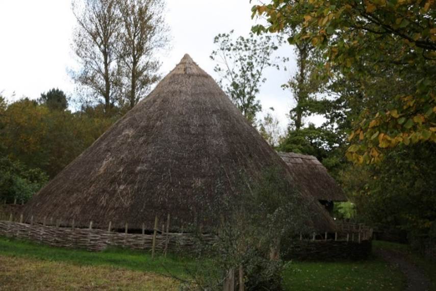
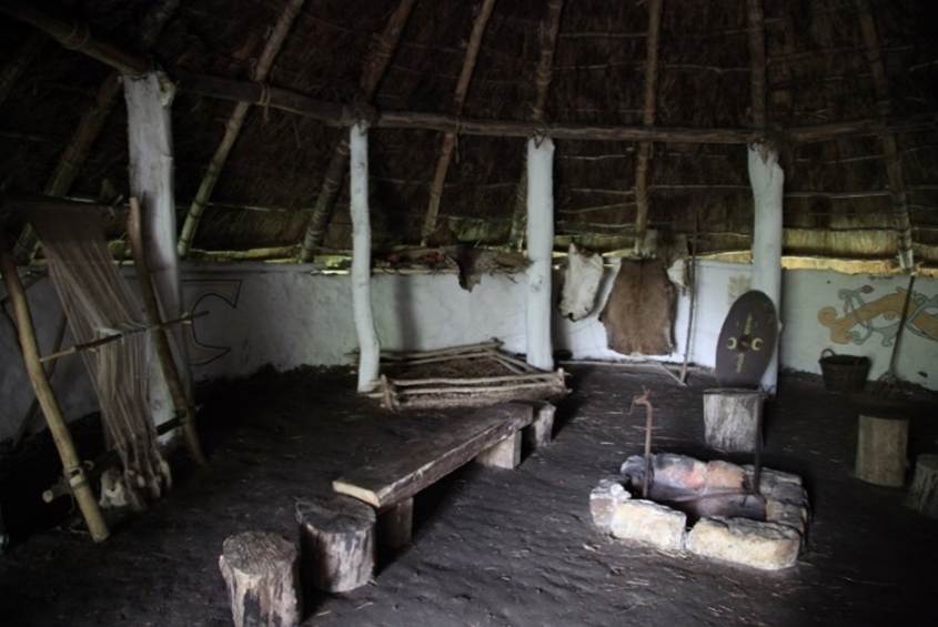
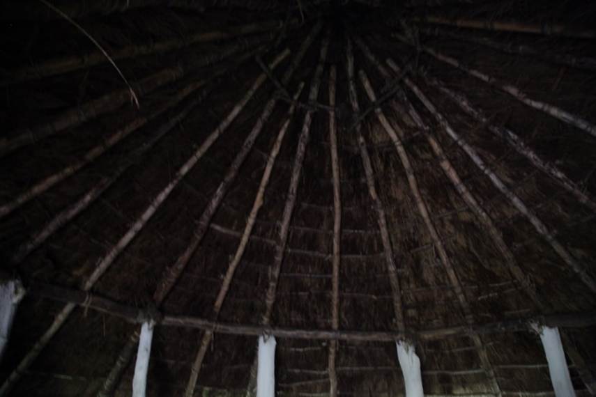
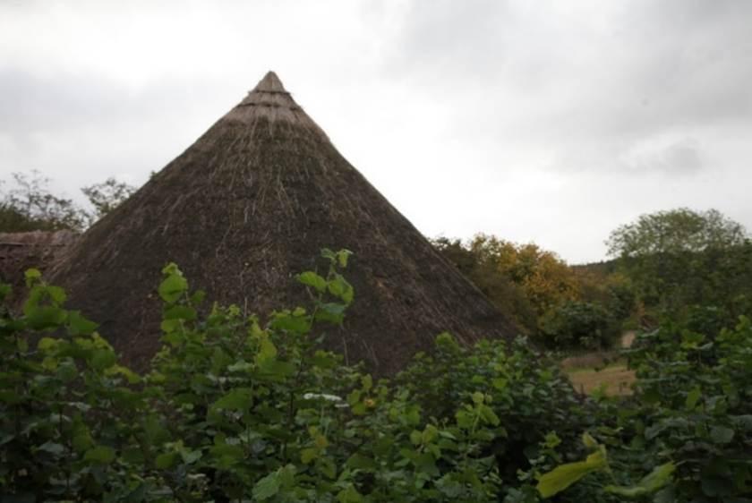
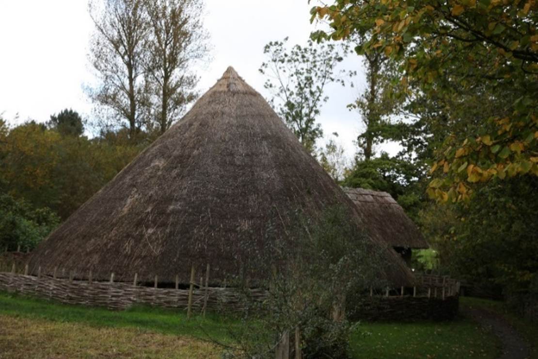
The reconstructed round house at the
Ryedale Folk Museum in Hutton le Hole
The
name Brigantes occurs in other places, and I cannot help thinking that when its
true history is found, it may prove to have been no tribal name, but rather a
nickname adopted and used by a local confederacy, that was taken up,
crystallised, and extended by the Romans. Indeed, various hints in the story of
Cartimanua
seemed to show that she and her husband Venutius
ruled over rather different branches of the same tribe and had by no means the
same interests. If this were so, it would explain the great size of the Brigantian territory. We know that the local confederacy
did not always act together, There was an anti Roman
party before the adventure of Caratacus. The inspiration of their patriotism
came not so much from that persistent agitator as from their own obstinate,
acquisitive temper. (Some Invasions of Yorkshire, Mary Kitson Clark, Yorkshire Archaeological Journal,
Volume 31, page 325).
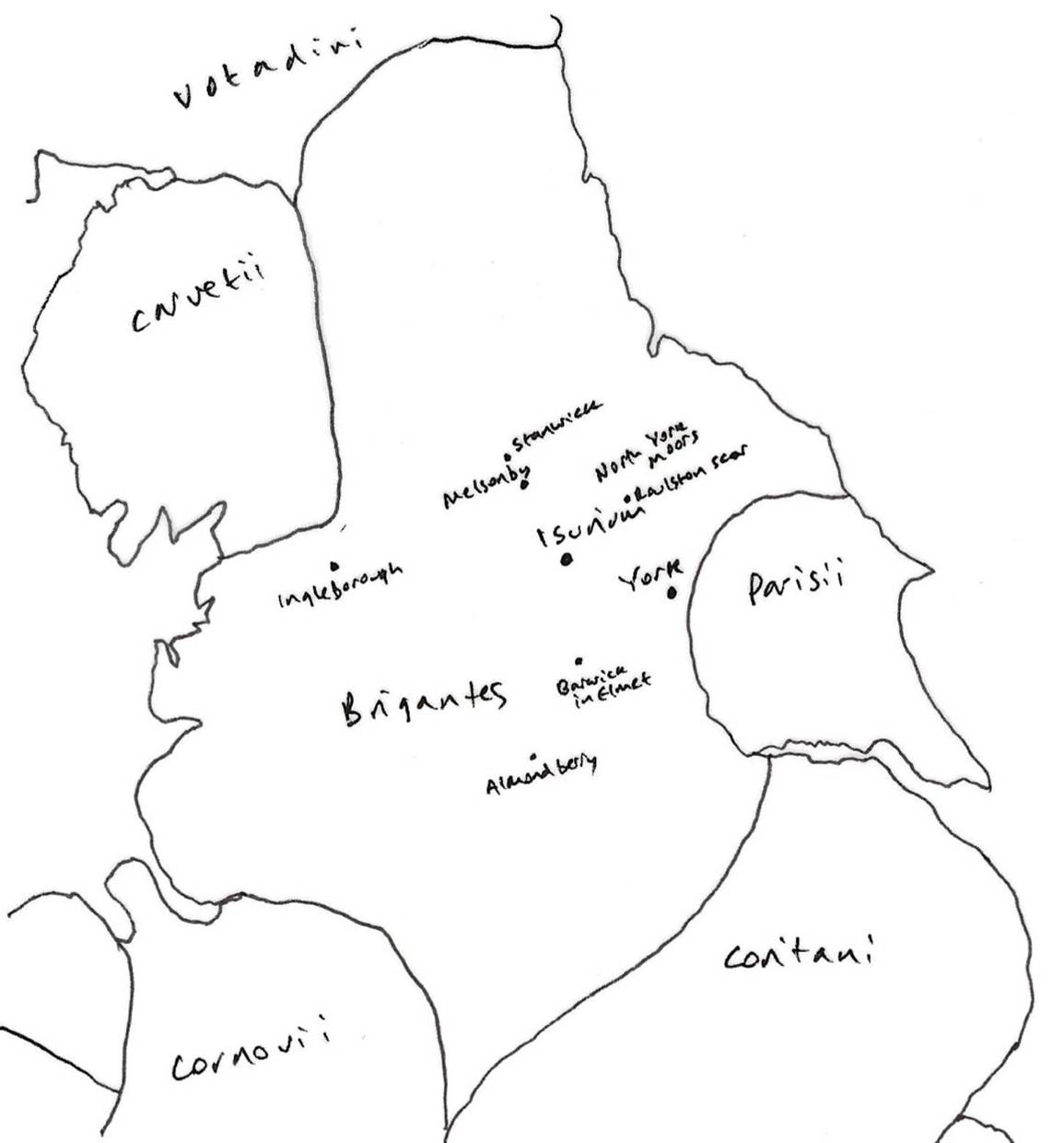
The Brigantes means something like The High Ones.
The Brigantes were not the only Celtic tribe
to occupy northeast Yorkshire. In Holderness and the Wolds area, were a folk
known as the Parisii who came from France and
Belgium.
The
last inhabitants of the area before the Romans were illiterate, but left their
mark in the place names of Yorkshire. Many Yorkshire rivers carry Celtic names
- Aire, Calder, Don, Nidd, Wharfe.
100 BCE
By
about 100 BCE, power had become concentrated in a narrow social elite. The Snettisham Treasure from
Norfolk (75 BCE) includes an impressive gold marriage torc from the late Iron
Age. Individual strands of gold were twisted to remarkable terminals which were
highly decorated. It evidences extreme wealth. This is an early form of royalty
and even early Celtic coins were issued, with abstract Celtic art. Olive oil
and other commodities were imported.
This
was also a time of slavery. The elite traded animal hides and wool, but also
humans for slavery to the expanding Roman empire. The Lyn Cerrig Bach
slave chain from Anglesey dates to c 90 BCE.
This
was also the time of the Druids, who may have had the highest status, whose
advice the kings listened to. They intervened in warfare and decided whether to
fight or not. They used such items as divination spoons to
make prophesies. In reality they were a means of manipulating power. The Deal Warrior (200
BCE) is an un-warriorlike skull with a crown of Bronze similar to later
religious headdresses of religious figures in Roman Britain. It has been
suggested that he may have been a Druid.
The
Iron Age tribes were competitive and warlike and internationally connected. The
Stirling Hoard (300
to 100 BCE) is an astonishing cache of Iron Age gold necklaces unearthed in a
field near Stirling in 2009. They evidence the wealth and power of some Iron
Age leaders and include Gaulish imports, made by
hands trained in the Classical world.
Costa Beck and
Thornton le Dale
Costa
Beck is a small river in Ryedale, North Yorkshire. Excavations from the 1920s
have revealed Iron Age lakeside settlements through the Vale of Pickering.
Animal bones, pottery sherds and a human skull have been excavated.
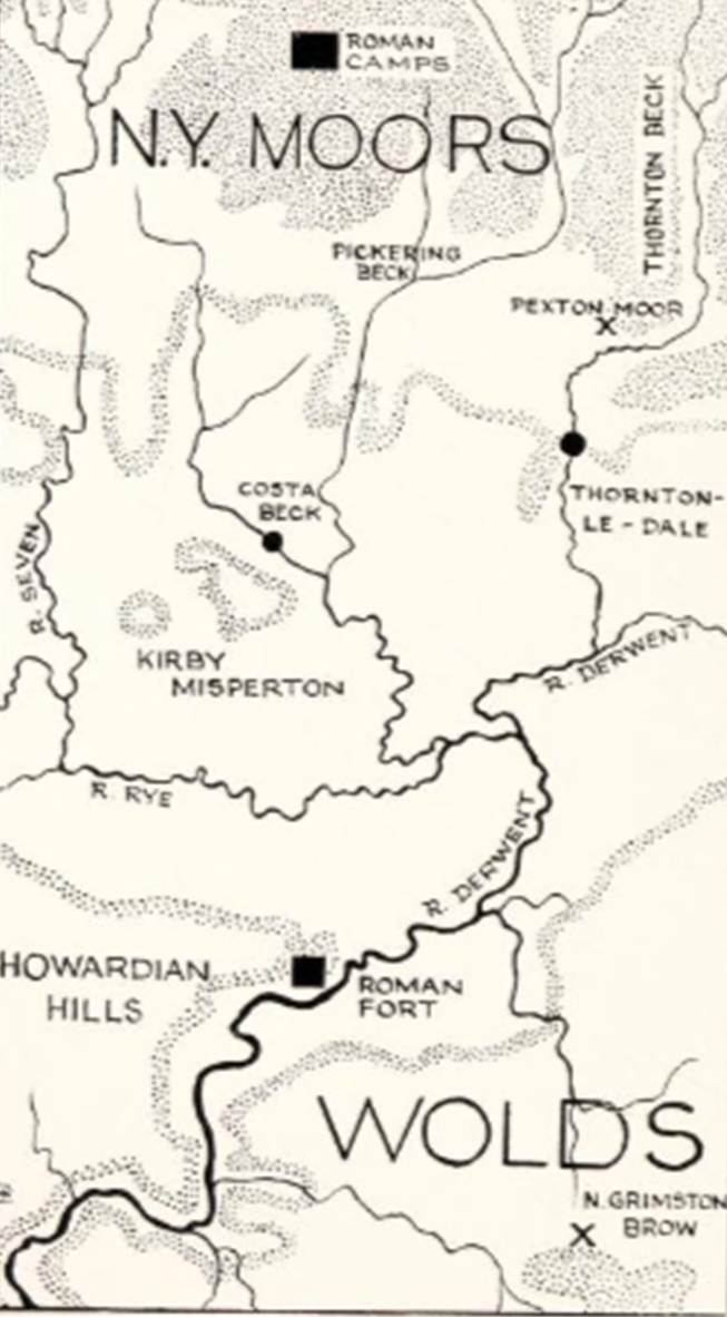
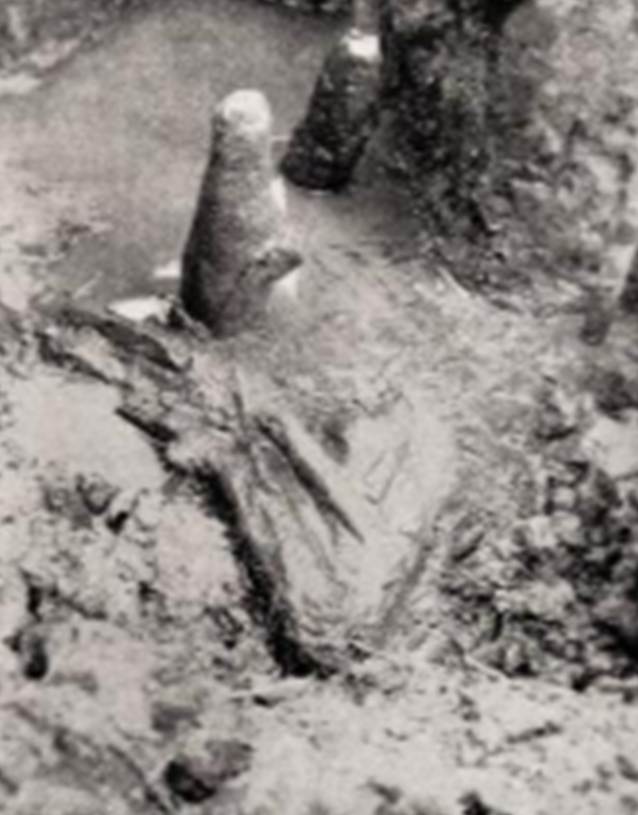
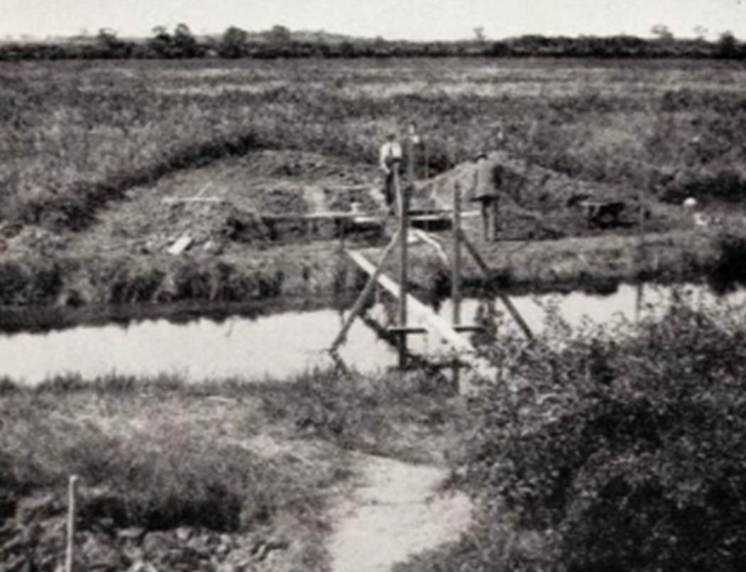
Piles and fragment of platform
Pumping operations, the site looking towards Barugh
The
Vale of Pickering is the site of an ancient lake, with a remarkable geological
history, in the eastern half of the North Riding. It is separated from the
other two low-lying areas of Yorkshire, the Vale of York, or central trough of
the country, and Holderness on the East Coast, by the Hambleton Hills and the
Wolds respectively. On the north it is bounded by the north Yorkshire moors, on
the west by the Hambleton Hills, and it drains in a southerly direction into
the Derwent, to the south-east of which lie the Wolds. It is about 24 by 10
miles in extent, and at present is drained meadows, but it is still
occasionally flooded, as in the very wet summer of 1927. The site excavated by
Dr. Kirk and Professor Ormerod on the banks of the Costa Beck lies nearly at
the centre of the old lake, and the site at Thornton-le-dale excavated by Mr.
Rowland is on the very brink of the north shores of the lake. Systematic
drainage is comparatively recent, but the channels of the various streams
crossing the vale were definite enough in the middle ages to be used as
boundaries.
In
Holderness a number of pile dwellings have been discovered, chiefly by the late
Thomas Boynton, who also investigated them. They comprise West Furze, Ulrome, Round Hill, Brunton Hill, and Barmston Outfall.
In
some ways the Costa Beck site seems a curious choice, for it is not more than a
mile away from two small hills or islands in the marsh (Barugh and Kirkby
Misperton), and commonsense suggests that either would have been a more
comfortable dwelling site, and no less secure, than a pile dwelling on peat in
the marsh itself.
The
pile dwellings were apparently established when the area was in marshy
condition, and a subsequent flood brought the stream waters over the previously
abandoned meander, re-excavating in part the old channel and rendering the
dwellings at this spot untenable.
Thornton-le-dale
lies on the north side of the Vale of Pickering where the Staindale
Beck flows out of the hills into the Vale. Miss Rowland's house, Low Mill
Garth, is built on the site of an old flax mill and the stream flows through
the garden. When the house was built in 1913 some pieces of vasicular
pottery were turned up in one of the trenches, but it was supposed that they
had been washed down the stream and no further search was made. In 1922 a small
pit was dug near the stream to make a water-lily pond. The surface of the
garden is about 4' above the stream. There is about 18" of soil, and under
that limestone gravel that has been washed down by the beck. In September,
1922, the sides of the pit were examined and some bands of sand and black earth
were found in the gravel. The black earth contained fragments of vasicular pottery. During the next six years trenches were
cut in the side of the stream and a few pits were sunk in the garden. No traces
of houses were found, but evidently layers of rubbish had been thrown down on
the banks of the stream at an early date. Some of the cooking-pots were nearly
whole and one or two appeared to have been in position for cooking. Most of the
ware is plain vasicular, but there are a few
fragments decorated with notches on the rim. There are a few scraps of bronze
and two Roman bronze brooches; one of the Aucissa
pattern; also several scraps of Terra Sigillata.
One
would like to postulate the occupation of both sites by related communities some time between 100 B.C. and 100 A.D. But as yet it
cannot be proved. Perhaps the red enamel in the foot of the Aucissa
brooch (which, according to Mr. Hull, is a feature so far unparalleled abroad)
means that it is a native copy of imported brooches. It will be remembered that
it is without the signature “Aucissa.” At the same
time, there are a few facts already known about the Iron Age occupation of
Yorkshire that may be relevant.
It
will be remembered that the La Tene period is comparatively well represented in
Yorkshire, and that the chain of finds leads north-west from the chariot
burials at Hessleskew on the Wolds to the huge camp
at North Stan wick near Richmond, at the base of the dales. The Pickering Vale
is not far off this line, and the famous burial at North Grimston Brow is
barely 10 miles S. of Thornton-le-dale.
The
only chariot burials known north of the Wolds lie within half a dozen miles of
Thornton-le-dale. A chariot burial was found at Cawthorn by the Mitchelsons and
is now in the York Museum. One identified and described by Dr. Kirk at Pexton
is only three miles from Thornton-le-dale. This was first discovered by Mr.
Hills gamekeeper when ferretting; he exposed an
upright iron tyre with remains of wood; a portion of it is now in the Memorial
Hall Museum, Pickering. The only pottery found in Yorkshire chariot burials
(from the Danes' Graves on the Wolds, now in the British Museum) bears a
superficial resemblance to our Costa-Thornton pottery; but one would be rash to
assume a real relationship without far more knowledge than we possess.
(Iron Age Sites in the Vale
of Pickering, M Kitson Clark, Yorkshire
Archaeological Journal, Volume 31, 1934, page
157)
75 BCE
By 75
BCE amphoras found in Britain contained wine from the Roman empire. The new
elite had access to the fine luxuries of the Roman world. The Romans were
already in Gaul. The elite of Britain were already well connected to the Roman
world.
Hengistbury Head in
Dorset was a significant Iron Age trading port, particularly in the Late Iron
Age, with strong connections to continental Europe, a boom town fuelled by
international trade. Novel items were traded that had not been seen before.
50 BCE
By
about 50 BCE, this trade was in decline as the Romans took over Celtic Gaul.
Iron Age Ryedale
A circular area six miles in radius with the centre at Helmsley was
chosen and it was decided to analyse the change in settlement patterns between
the Mesolithic (beginning 7600 B.C.) and the Domesday Book (1086). The
programme of investigation began with the mapping of settlement sites for each
of the six periods.
A change in the settlement pattern occurs at the end of the Bronze
Age, and this new pattern continues through until the Saxon invasions,
surprisingly unaffected by the Roman occupation and the siting of Roman villas
in the area. The evidence for settlements is again ambiguous: does the presence
of a quern, a collection of coins or a Romano-British burial necessarily mean a
settlement lies nearby?
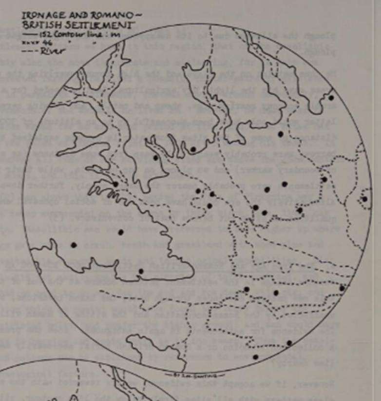
However, if we accept this evidence, we are rewarded with the
emergence of a clear pattern with all sites firmly below the 152m contour,
sited on dry islands of boulder or kimmeridge clay; springlines between the limestone and either the alluvial
bottom or the clays or in river valleys. All settlements still avoid the
alluvium itself and are all above or on the 46m contour which would now appear
to be the boundary between the wet and dry land.
What were the reasons for this clear move of settlement downhill?
Firstly, there is the joint factor of soil exhaustion on the uplands and the
clearing and drying out to the 46m contour of the previously heavily vegetated
and swampy Vale of Pickering. Developed on nutrient-poor parent rock, badly
farmed and cleared of protective tree cover, the upland soils appear to have
become leached and acidified by 600 BC, and pollen analysis has shown the area
to have finally turned to moorland.
However, the inhabitants still needed well-drained light soils or
clays and access to water for their pastoral economy, based on cattle ranching
and cereal cultivation, but did not have a heavy enough plough to cultivate the
alluvial bottoms. Therefore, they moved downhill to the newly-drained area
between the 152m and 46m contours, aided by the fact that the area seemed to be
enjoying an age of social stability, meaning that there was no need for a
defensive site. Again the settlement pattern is a result of the interaction of
economic, environmental, technological and socio-political factors.
(A look at Ryedale Settlement Patterns, Ryedale Historian, Volume 12, 1984, page 31)
Iron
Age sites include:
· Boltby Camp and promontory fort (SE 906857);
· Roulston
Scar (SE 535839) including remains of ancient dwellings near Casten Dyke and
First Century BCE pale blue glass with white chevron in Middlesbrough Museum;
· A
cist burial at Mount Pleasant Far, on Beadlam Rigg (SE 649863);
·
A beehive quern found at
Gillamoor (SE 688895);
· A
beehive quern found in Bransdale (SE 615987);
· Several
pieces of an incomplete beehive quern at Spaunton;
· A
quern reported by a mason, Joe Ford of Castleton before 1940 at Farndale Head;
· A
pottery sherd in Hodge Beck near Welburn (SE 685846).
(A History of Helmsley Rievaulx and
District, editor, J McDonnell, 1963,
page 406).
Ancient Routes
|
The ancient
routes across the moors
Exploring the ancient tracks
and roads across the moors around Farndale |
The vicinity of Farndale
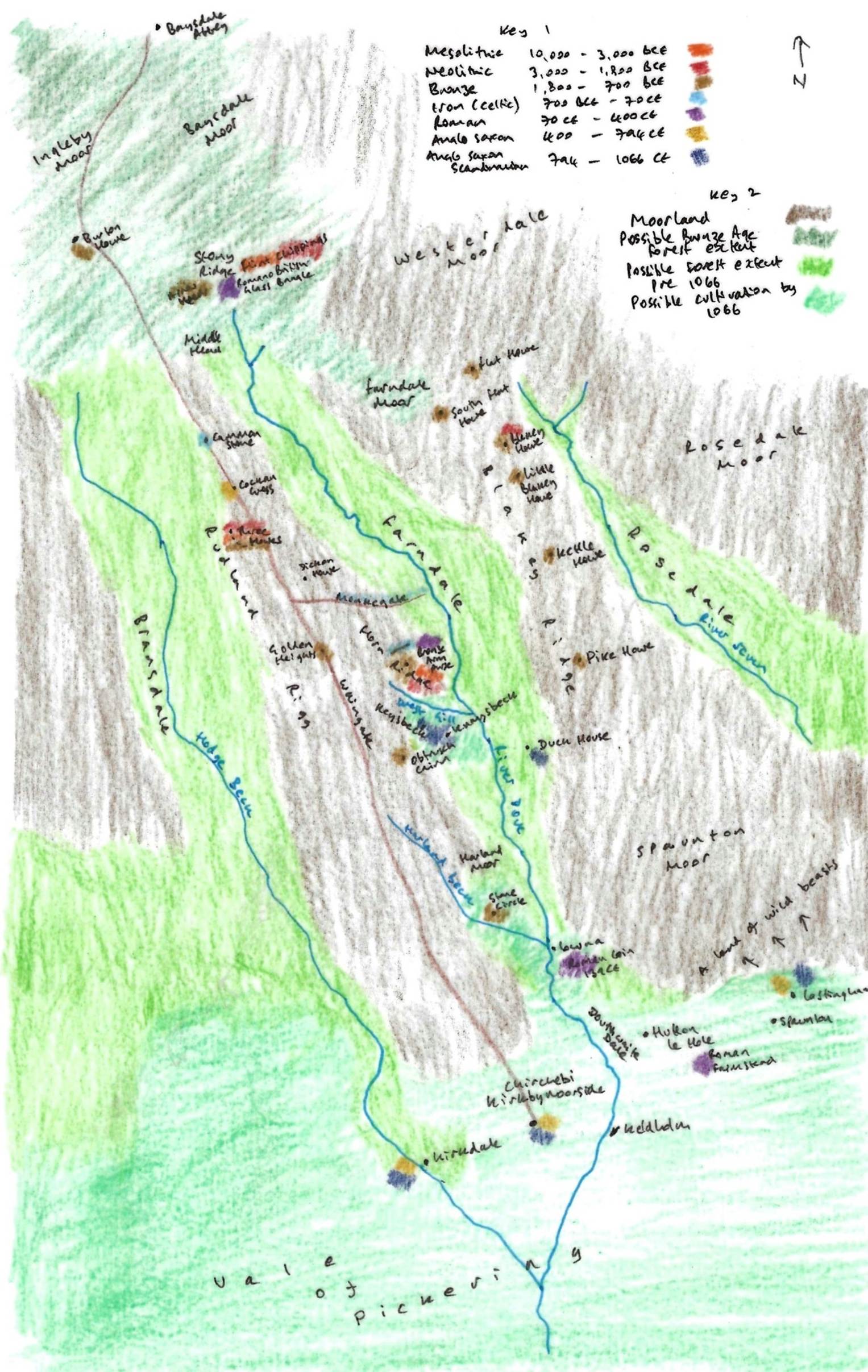
A
representation of Farndale and its vicinity prior to 1066
Key 1
is a colour code for archaeological finds around Farndale and the period of
time with which they are associated, giving an indication of settlement
patterns around Farndale through time. Key 2 shows the possible extent of
moorland, woodland up to the Bronze Age and woodland up to 1066 and beyond, and
the area of cultivation at the edge of the Vale of Pickering.
Historians are now generally agreed that a
fairly large-scale movement of population began in the far west of our islands.
Originating in Ireland and the Isle of Man, this movement crossed the narrow seas on to the mainland and via the Lake District and the
Pennines flowed into Yorkshire. The people who formed it were of mixed Celtic
and Scandinavian origin, the latter chiefly Norwegian, and the places where
they settled bear names which testify to this duality of race. Thus 'Farndale'
is compounded of a Celtic first syllable 'farn' = a
fern, and a Norwegian second syllable 'dal' = a valley. Similarly, A.H. Smith
derives 'Duvanesthuat' from an Old Irish personal
name 'Dubhan' and the Norwegian 'thweit'
= a clearing, thus giving 'Dubhan's clearing’ as the
meaning of the word. That Smith equates Duvanesthuat
with the old Douthwaite Hall is open to question, as will be seen later. The
river which runs through Farndale is the Dove, and this again is from a Celtic
word 'dubo' meaning 'black' or 'shady'. It seems very
possible then that Farndale was first settled by bands of mixed
Celtic/Scandinavian people moving in from the west, and that it was they who
first began the task of clearing certain areas of the dale of scrub and forest. (Notes on the History of
Farndale in the Middle Ages, Arthur H
Whitaker, Ryedale Historian, Volume 1, 1965, page 7). I am not sure that Farndale itself
was settled by Celtic people as Arthur Whitaker suggested, though it is
possible that it was named by Celtic-Scandinavian folk, and the name orally
passed down until it appeared in the written record in 1154.
There is an alternative theory, to which Frank Elgee, Early Man in North East Yorkshire, 1930,
page 223 to 224 is a proponent, that Farndale is indeed of Gaelic
origin, but derived from the Gaelic fearna,
alder (in Scotland farnoch means ‘the place of
the Alders’). Farndale would therefore be alder dale rather than fern dale. The
Alder is one of the commonest trees in Farndale. Elgee argued that the name of
the dale may have originated from the invasion of Gaelic or Goidelic speaking
people and he argues for the Gaelic origin of many local names.
It does appear that the Celtic people noticed the dale and may
have given it its name. They may have settled in areas on the periphery of the
dale, particularly around West Gill.
Whether the dale derives from the fern or the alder is open to
debate. Certainly alders continue to thrive in Farndale, relics of the ancient
woodland. The ferns and bracken which cover the edges of the dale and the
moorland today are not of ancient origin. On the other hand the fern is a
woodland plant and would have thrived in the forest of the dale through its
history. I tend to favour the derivation from the fern, which my family have
long adopted as a family emblem, along with the daffodil.
Celtic names
still linger in the dale. The river Dove derives from the Celtic du or dubo, the black of shady stream; Pennyhill in west
Farndale, from pen, a hill. Monket House contains the
words mon or maen, a stone, and kett or chett, a wood. It
has also been suggested that the name derived from monk-gate or monk’s way. (Raymond
Hayes, Farndale, 1961, unpublished, page 6 to 7).
Go forward to Roman
Yorkshire.
Bibliography
Yorkshire Archaeological and Historical Society – Iron Age Yorkshire.
There is an In Our Time podcast on the dawn of the European Iron Age, a period of
great upheaval when technology and societies were changed forever.
Frank Elgee, Early Man in North East Yorkshire, 1930, page
223 to 224
Iron Age Sites in
the Vale of Pickering, M Kitson Clark, Yorkshire Archaeological Journal, Volume 31,
1934, page
157.
A look at Ryedale Settlement Patterns,
Ryedale Historian, Volume 12, 1984, page 31.