London in the late seventeenth century
The
home of the Baker family for a few decades
|
Return to the Home Page of the Bakers Family part of the website |
The Bakers of Highfields Story
The Story of the Dods and Bakers and of Highfields,
Fenton House and Hasfield Court. A journey through the history of Cheshire and
Staffordshire, an Anglo-Saxon nobleman who retained his lands after the
Conquest, pottery at Stoke on Trent, an encounter with Elgar, and the history
of an Elizabethan manor house at Audlem |
The family tree of the Bakers of Highfields |
The Family Tree of the Dods, predecessors to the
Bakers of Highfields |
The Bakers of
Fenton House and Hasfield Court
The Family Tree of the pottery Bakers of Stoke on Trent |
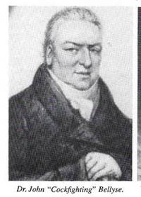
The Family Tree of the Bellyse Family |
The main part
of this website tells the story of the Farndale family from Yorkshire Descendants of Arthur Baker, the story of the
Farndale ancestry is told through the main part of this website You can also return to the Farndale
website home page |
The genealogy of the family of James Hall, linked to
the Baker family through marriage to Arthur Baker |

Headlines of are
in brown.
Dates are in red.
Hyperlinks to
other pages are in dark
blue.
References and
citations are in turquoise.
Context and local
history are in purple.
This page is work in progress
Fleet Street and the City
In the mid-seventeenth century,
life around Fleet Street and St Bride's parish was a bustling, chaotic, and
densely packed microcosm of London. Positioned just outside the City walls as a
critical artery connecting the commercial City with the political West End at
Westminster, the neighbourhood was undergoing a massive transition driven by
the explosive growth of the printing, legal, and literary trades.
Ever since Wynkyn de Worde set up
his press next to St Bride's Church in 1500, the area evolved into London's
typographic heartland. Workshops and offices expanded aggressively north into
what had been open fields. The neighbourhood
attracted some of the greatest minds and diarists of the era. John Milton, John
Dryden, and John Evelyn lived in the immediate vicinity. The diarist Samuel Pepys was born
in a house adjacent to St Bride's in 1633 and was baptised in the parish
church, where his family maintained a permanent pew.
Due to the proximity of the Inns
of Court, like Inner and Middle Temple, the population teemed with legal
professionals, clerks, and wealthy patrons who were eager consumers of the
printed word. Grand noble mansions lined the southern side of the street stretching
down to the River Thames, while tight alleys and courts behind the main
thoroughfare were packed with manual workers, shopkeepers, haberdashers, and
craftsmen. Fleet Street was legendary
for its density of alehouses and taverns. These served as vital newsrooms where
printers, writers, and lawyers mingled, gossiped, and gathered intelligence for
early newsletters and pamphlets. The street served as an early showplace for
eccentric street performers, exotic animals, fire-eaters, and oddity
exhibitions that drew rowdy crowds.
Before it was famously rebuilt by
Sir Christopher Wren after the Great Fire of 1666, the medieval St Bride's was a
massive, light-filled gothic building situated in a densely used, overcrowded
graveyard. Local diaries from the
1650s frequently complain about the relentless clatter of building works, as
residents desperately added storeys and extensions to handle the skyrocketing
rent and overcrowding.
A Maritime Economy at Stepney
In the late seventeenth century, Stepney was a massive, rapidly
transforming maritime and semi-rural parish located just east of the City of London.
It served as the heart of what would become London’s East End, acting as a
transition zone between the bustling, crowded docks of the River Thames and
open countryside.
The parish was anchored by St Dunstan's Church, the Seaman’s
church. It had such powerful ties to the British Merchant Navy that
children born at sea were traditionally registered as parishioners here.
The
area became a favoured residential retreat for sea captains, shipwrights, and merchants
making fortunes in foreign trade. They built high-quality, classical brick
residences, such as the surviving No. 37 Stepney Green (built in 1694), to stay
close to where their ships berthed.
Situated safely outside the jurisdiction of the City of London's
strict laws, Stepney became a major hub for Protestant dissenters,
Independents, and Puritans. In 1674, they erected the Stepney Meeting (Broad
Street Church), which grew into the largest dissenting congregation in London.
In the mid-seventeenth century, a wine cooper operating in the
maritime parish of Stepney, London, held a highly skilled, and multifaceted
position at the intersection of international trade, manufacturing, and
chemistry. Stepney was a rapidly expanding riverside hub just east of the
City of London. It encompassed docks like Ratcliff, making it a critical base
for merchants, mariners, and vintners who relied heavily on the wine trade.
The Great Plague 1665
The Great Plague of London was an outbreak of bubonic plague that
killed an estimated 100,000 people, nearly a quarter of the city's population,
between 1665 and 1666. Crowded housing, uncollected waste, and open
sewage in London's streets created ideal conditions for rats. It began in the
spring of 1665 in the parish of St Giles-in-the-Fields and peaked during the
hot summer months of August and September.
King Charles II, his court, and wealthy citizens fled London for
the countryside.
Homes with infected people were locked up for 40 days, marked with
a red cross and the words Lord have mercy upon us, with guards watching
the doors.
The death toll dropped sharply in the winter of 1665, and the
epidemic largely ended, though the Great Fire of London in 1666 later destroyed
many of the infected, rat-infested areas.
The Great Fire of London 1666
The Great Fire of London was a catastrophic blaze that swept
through the heart of England's capital from Sunday, 2 September to Wednesday, 5
September 1666. It destroyed the majority of the medieval city inside the old
Roman walls, permanently transforming London's architecture, safety
regulations, and urban layout.
The fire broke
out after midnight at a bakery owned by Thomas Farriner on Pudding Lane. A
long, hot summer had left the city dry. Strong easterly winds pushed the sparks
from house to house. Most homes were built of wood and thatch, built extremely
close together over narrow streets, allowing the fire to spread with terrifying
speed. London
had no formal fire brigade. The Lord Mayor, Sir Thomas Bludworth, hesitated to
order the demolition of houses to create
firebreaks, allowing the blaze to grow out of control.
The Great Fire of London
heavily impacted Fleet Street and St Bride's parish in September 1666. Over
four days, the inferno laid waste to this bustling area, turning its
timber-framed printing houses, crowded courts, and medieval landmarks into ash.
The fire raged westward from Pudding Lane, and by Tuesday, 4th September, it reached
the Fleet River. Although the river acted as a natural ditch, the intense
easterly winds and the dry, tightly packed wooden properties along the banks
allowed the flames to leap across the water. It aggressively pushed up Ludgate
Hill and into the heart of the Fleet Street commercial district.
St Bride's Church possessed its own manual fire engine. However,
because it had been poorly maintained, scoured, oyled and trimmed, it
failed completely when the flames engulfed the building. The medieval gothic
church was completely gutted, leaving only a shell of stone walls and piles of
rubble. The heat was so intense that the heavy church bells melted. Centuries
later, archaeologists digging in the crypt found clumps of this fused bell
metal from 1666.
The fire consumed thousands of households, tenements, and
businesses along the eastern half of Fleet Street. Coordinated firefighting
efforts, including blowing up houses with gunpowder to create firebreaks,
finally managed to stop the westward spread of the fire at Fetter Lane. Because
the fire was stopped here, the historic Inner and Middle Temple legal complexes
were only partially damaged, but the vast majority of St Bride’s parish was
entirely erased. Dozens of printing shops, bookbinders, and publishers lost
their heavy wooden presses, paper stocks, and life's work overnight.
Sir Christopher Wren was commissioned to rebuild the city's
churches. He spent seven years constructing a grand new, expensive baroque design
for St Bride's, which reopened in 1675. Between 1701 and 1703, he added its
iconic, tiered wedding cake spire, which permanently redefined the Fleet
Street skyline.
The King’s Road, London
In 1700, the area of the King's Road in Chelsea was very different
from the bustling, fashionable shopping district it is today. The road was a
private, restricted thoroughfare. Built just a few years earlier in 1694 by
King Charles II, its sole purpose was to provide a smooth, direct route for the
monarch and the royal court to travel between St James’s Palace and Hampton
Court or Kew. In 1700, the general public was strictly forbidden from using the
road. It was blocked off by a series of security gates. Only royalty,
high-ranking courtiers, and select aristocrats who had been granted special
permission or copper tokens bearing the King’s monogram could pass through
The surrounding area of Chelsea was largely rural, possessing a
population of only about 3,000 people. It was an area of farmland, nurseries,
and market gardens that grew produce to feed the city of London.
A gilder setup near the local manor houses or courthouse would
have been strategically positioned to cater directly to the wealthy
aristocracy, judges, and landed gentry who owned properties in these affluent
outskirts away from the dirty, overcrowded core of the City of London.
In 1700, a gilder living near Maiden Road and the King’s Road
Courthouse area in London practiced a delicate, highly toxic craft. He applied
ultra-thin gold leaf to wood, metal, or picture frames using dangerous mercury
amalgams or sizing glues. Working by candlelight in a rapidly growing capital,
he balanced modest artisanal independence with the constant threat of poverty
and occupational illness. Gilders handled paper-thin sheets of gold, using
squirrel-hair tips and specialised glues or wet gold techniques. They decorated
ornate furnishings, coach trimmings, mirrors, and architectural moulding for
affluent Londoners or merchant classes. They generally worked in small, poorly
ventilated domestic workshops with open charcoal fires or stoves used to dry
primed surfaces.
The area of King’s Court Road comprised tightly packed, volatile
urban parishes near Westminster. Gilders would have suffered frequent exposure
to harmful fumes and chemicals, particularly mercury if doing 'fire-gilding' on
metals. They earned a fluctuating income dependent on luxury trade demand,
leaving families vulnerable to seasonal slowdowns, high food prices, and crowd
diseases.
Bibliography
Early Stepney and Settlement and
Building to c.1700 in A History of the County of Middlesex: Volume
11, Stepney, Bethnal Green. Originally published by Victoria County History,
London, 1998.