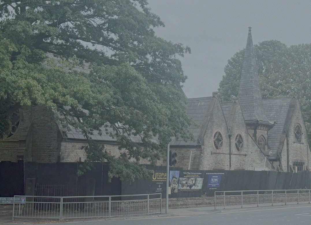
Huyton
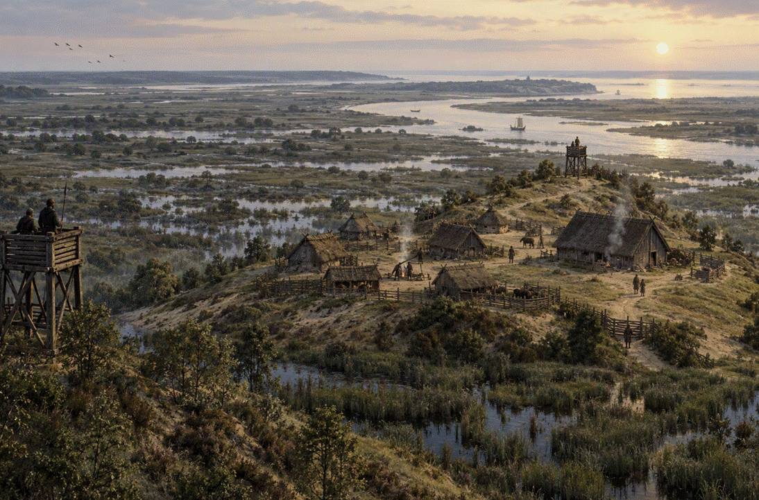
The
Anglo-Saxon lands of the Dods, now a suburb of Liverpool
|
Return to the Home Page of the Bakers Family part of the website |
The Bakers of Highfields Story
The Story of the Dods and Bakers and of Highfields,
Fenton House and Hasfield Court. A journey through the history of Cheshire and
Staffordshire, an Anglo-Saxon nobleman who retained his lands after the
Conquest, pottery at Stoke on Trent, an encounter with Elgar, and the history
of an Elizabethan manor house at Audlem |
The family tree of the Bakers of Highfields |
The Family Tree of the Dods, predecessors to the
Bakers of Highfields |
The Bakers of
Fenton House and Hasfield Court
The Family Tree of the pottery Bakers of Stoke on Trent |
The Family Tree of the Bellyse Family |
The main part
of this website tells the story of the Farndale family from Yorkshire Descendants of Arthur Baker, the story of the
Farndale ancestry is told through the main part of this website You can also return to the Farndale
website home page |
The genealogy of the family of James Hall, linked to
the Baker family through marriage to Arthur Baker |
Headlines of are
in brown.
Dates are in red.
Hyperlinks to
other pages are in dark
blue.
References and
citations are in turquoise.
Context and local
history are in purple.
For a detailed
chronology of the wider Mercian Kingdom, see Anglo Saxon Cheshire.
Huyton is now an eastern urban
suburb of Liverpool.
Anglo Saxon Huyton
During the Anglo-Saxon period, the
area of modern Liverpool was a sparsely populated, rural, and heavily wooded
landscape entirely disconnected from its later identity as a major maritime
port. No settlement at modern Liverpool existed. It was not chartered until 1207.
The region was a peripheral frontier zone integrated into the Kingdom of
Mercia, and occasionally contested by Northumbria, with the River Mersey acting
as a natural political boundary.
The site of modern Liverpool was a
natural, marshy creek or tidal inlet branching off from the River Mersey. It
provided a sheltered harbour but was surrounded by low-lying, swampy bogs, mosslands, and tidal mudflats. Rising above the marshes were prominent
red sandstone ridges, which provided elevated, dry ground suitable for
small-scale structures and lookout points.
Inland the landscape was agrarian
and wild, dominated by dense woodland and open meadows. Etymological clues from
surviving Anglo-Saxon place names offer some idea of the local environment.
Places like Speke derived from the Old English for "brushwood"
or "woodpecker," while Fazakerley referred to a "clearing
in the woodland". The area supported significant wildlife populations. The
name West Derby translates from Old English and Old Norse as the "place of
wild beasts" or "West Deer Park," suggesting a wild, forested
terrain later used for tracking game. Pockets
of marshy grasslands were used for livestock. Garston stems from gaerstun, meaning a "meadow or grazing
farm", and Everton translates to a "farmstead of the wild boar".
The settlement of Walton (Wealas-tun, meaning
"farmstead of the Britons") suggests that native, Romanised Celtic Britons
continued to live in their own pockets of farmland under Anglo-Saxon rule.
Walton may have also derived from weald (wood).
400 CE
Following the withdrawal of the
Romans, small rural farming communities farmed the land before the region fell
under the control of the Anglo-Saxon Kingdom of Mercia. The local population
lived in small, self-sufficient agricultural hamlets and farmsteads,
cultivating the land and fishing in the river. Initially the Romano Britains with
possessions to lose, fled westwards, but over the following centuries the
Germanic incomers followed them, and the indigenous Britains took refuse in the
mountainous regions of Wales.
600 CE
Over the sixth and seventh
centuries, Germanic invaders began expanding westward. Huyton was first settled
by Anglo-Saxons around 600 to 650 CE on a low hill surrounded by marshland,
reflected in its Old English name meaning High Town. The Anglian folk who
founded the site probably used a nearby landing place on the River Alt.
616 CE
Because Huton
sat at a crossroads, the area became heavily contested between the northern
kingdom of Northumbria and the emerging kingdom of Mercia. Initially, the
region fell under northern influence. The word Mersey translates from
Old English to Boundary River. For long stretches of history, it served
as a clearly defined boundary, Northumbria ruled the north bank, and Mercia
ruled the south (the Wirral).
In around 616 CE, King Æthelfrith
of Northumbria won a decisive victory at the Battle of Chester.
633 CE
Although Northumbrian dominance
continued until the Viking attack on Lindisfarne in 793 CE, the fortunes of the
competing kingdoms ebbed and flowed. The Northumbrian Edwin was killed at Hæthfelth,
the Battle of Hatfield Chase, near Doncaster, along with his son Osfrith, on 12
October 633 CE by the combined Mercian and Welsh forces under Cadwallon ap
Cadfan of Gwynedd and Penda of Mercia. Mercia
was coalescing in the early seventh century into a powerful kingdom in the
midlands.
642 CE
Mercia’s rise to dominance in the
mid-to-late seventh century under powerful pagan kings like Penda reshaped the
political landscape. Mercia relentlessly pushed its frontiers north and west.
Eventually, Mercian kings
successfully pushed across the River Mersey, claiming the strategic territory
between the River Mersey and the River Ribble. This definitive shift brought Huyton,
Walton, and the rest of the modern Liverpool area firmly into the Mercian
realm, converting it into an administrative frontier zone. Nevertheless, the
land between the Mersey and the Ribble rivers remained a disorganised border
region under Mercian control from the mid seventh century century.
758 CE
By the mid eighth century Mercia was growing in
ascendancy. There was an evolving English identity.
Between 758 to 770 CE, Offa consolidated his control
over Midland tribal groups such as the Hwicce and Magonsæte, and
exerted early influence over Sussex and Kent.
Scandinavian Huyton
877 CE
Scandinavians began to settle
lands in Mercia permanently.
The area around Huyton was settled
by Scandinavians in the tenth century. By the time the Vikings arrived in the
ninth and tenth centuries, the foundations of the area as a Mercian borderland
were firmly established, later solidifying into the historic county boundaries
of Lancashire.
893 CE
In 893 Vikings raided Chester, then
'a deserted city in Wirral'. (Early medieval Chester 400-1230, in A History of the County
of Chester: Volume 5 Part 1, the City of Chester: General History and
Topography, ed. C P Lewis, A T Thacker (London, 2003), British History
Online, pages 16 to
33).
902 CE
A Hiberno-Norse settlement on the
Wirral peninsula was established in 902 CE and extended across the Mersey into the
area of modern Liverpool. Driven out of Dublin, a group of Norwegian-descended
Vikings led by a commander named Ingimund negotiated a peaceful land
grant from Æthelflæd, the Queen of the Mercians and
daughter of Alfred the Great.
The territory granted to Ingimund
occupied the northern half of the Wirral peninsula. Over the following decades,
a massive influx of settlers from Ireland, the Isle of Man, and Scotland
transformed this enclave into a highly organized, practically independent mini-Viking
state.
The settlement established its own
system of governance at Thingwall (derived
from the Old Norse Þingvöllr, meaning
"Assembly Field"), which served as a central Scandinavian parliament.
The coastal settlement of Meols became a thriving international seaport and
trading hub, acting as the primary gateway for goods moving across the Irish
Sea. Excavations have uncovered
Hiberno-Norse pins, brooches, weapons, and the remains of characteristic
oval-shaped Viking longhouses at Irby. The landscape
adopted many Old Norse names. Settlements ending in -by (meaning farmstead or
village) like Irby ("settlement of the Irish Vikings"), Frankby, Greasby, and West Kirby map out the dense concentration of
Norse families.
The coastal settlement of Meols was located on the northernmost coast of the
Wirral Peninsula, fronting the Irish Sea. Today, it survives as a residential
suburb situated directly between Hoylake (to the west) and Moreton (to the
east). The settlement of Irby
is located in the central-western region of the Wirral
Peninsula, roughly two miles inland from the Dee Estuary.
Genetic studies led by the
University of Nottingham found that up to 50% of the DNA in local men from
long-standing Wirral and West Lancashire families carries distinct Norwegian
ancestry, proving that this early tenth-century migration left a permanent genetic
and cultural blueprint on both sides of the Mersey.
907 CE
Æthelflæd, the Lady of the Mercians,
fortified the strategic frontier town of Chester, extending English Mercia's
control northward and establishing a base against Northumbrian Danes.
The history of medieval Chester
can be said to begin only in 907 with the refortification of the site by the
ruler of Mercia, King Alfred's daughter Æthelflæd (Two Saxon Chrons. i. 94) The background to that event
was the establishment of a Hiberno-Norse community in Wirral after its
expulsion from Dublin in 902. It seems that the exiles, led by Hingamund, were granted land in Wirral by Æthelflæd and her husband Æthelred but soon afterwards cast
covetous eyes on the wealth of Chester, only to be repulsed by the great army
which she assembled in the city. The story, although preserved only in a late
source, has been shown to be reliable in essentials, and confirms that any
desertion of the city was temporary. (Early medieval Chester 400-1230, in A History of the County
of Chester: Volume 5 Part 1, the City of Chester: General History and
Topography, ed. C P Lewis, A T Thacker (London, 2003), British History
Online, pages 16 to
33).
1066
Recorded as Hitune
in the Domesday Book in 1086, the name combines Old English elements meaning
high (heah) and enclosure or settlement (tun).
Immediately before the Norman transition, the settlement was held by a local
lord named Dot, who owned both Huyton and the manor of Torboc
(Tarbock). These manor lands were a portion of the
area between the Ribble and the Mersey known collectively as the West Derby
Hundred.
1207
The name Liverpool stems
from Old English, lifer pol, meaning a muddy pool or creek, though no
settlement emerge at Liverpool until after the
Conquest.